
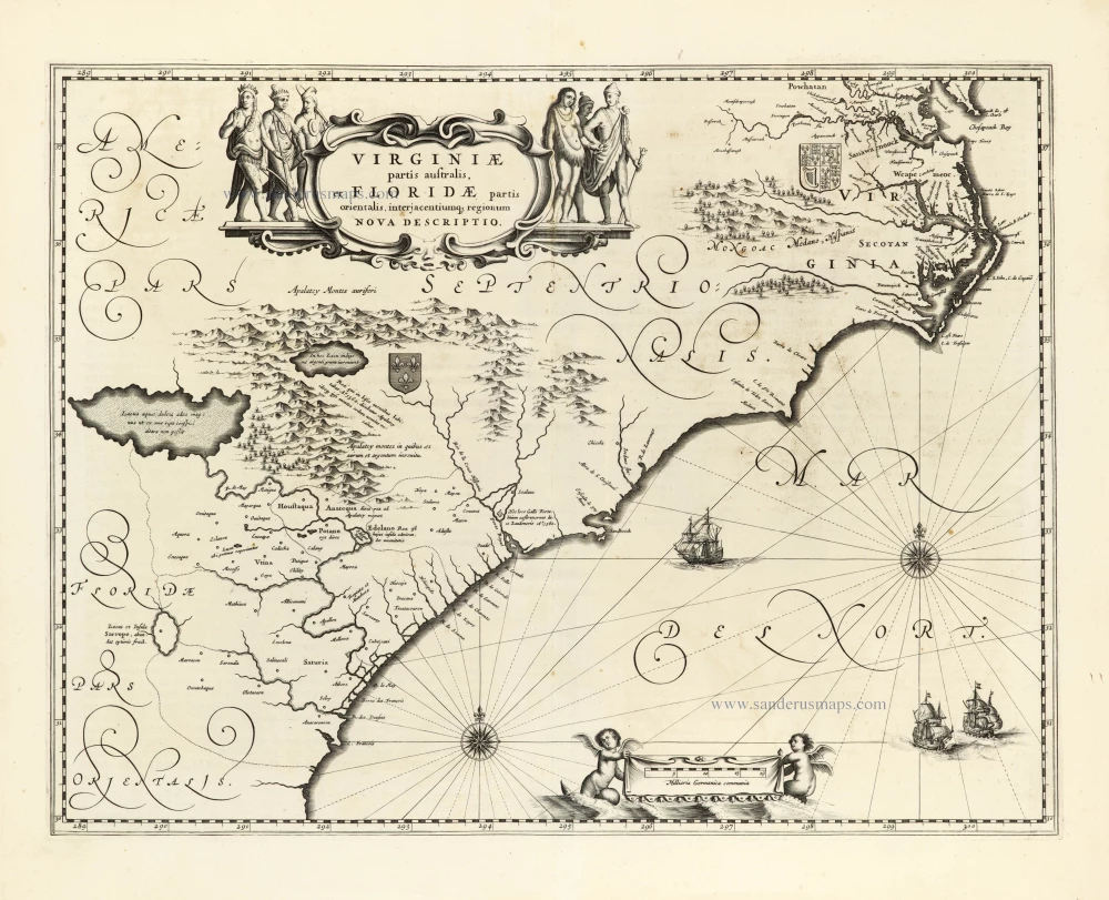
Carolinas and Georgia by Willem Blaeu. 1642-43
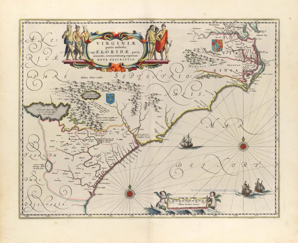


Cartographically, this map forms a marked improvement on the Jodocus Hondius map 1606, from which this was derived mainly. It also illustrates how engraving styles have moved, becoming more open and florid. The map depicts the two nations' interests, marked by their coat of arms. The French claim, being largely present-day Georgia, rests on the abortive colonial attempts of the 1560s. Blaeu makes no advance here in geography, following Hondius to the letter.
The most significant improvement occurs in the northern half of the map north of Porto Royal. Whereas on the Hondius, the coastline towards C. de Ste. Romano (present-day Cape Fear) veered directly east, Blaeu more correctly takes it northeast, placing the cape closer to its proper position of 34°. This span of coastline is approximately that of present-day South Carolina. This presents a more accurately proportioned Outer Banks Region, radically reduced in size but slightly too far north. For these improvements, Blaeu drew upon the extremely rare DE EYLANDEN ..., by Hessel Gerritsz, c. 1631. The Outer Banks combine the placenames of Gerritsz and Hondius, often using two different ones for the same area, such as C. de Trafalgar and C. ost Feare. This latter name was often applied to present-day Cape Lookout before being used for its present site to the southwest.
Chesapeake Bay was depicted as just a tiny bay on Hondius' map of 1606, as John Smith was yet to explore these waters. The Gerritsz terminated at this point, and only two placenames appeared. Blaeu draws mainly on the Smith map for much of the nomenclature but introduces some English ones from an unknown source. The most important is Newport Nesa, Newport News, founded in 1621 and shown here for the first time on a printed map. Also new are Bermouth, Stortingen and Arglas. The two Indian figures from Hondius' map form part of the cartouche on Blaeu's. The winged cherub to the left of the scale provides the only difference between the two known states:
State 1 c.1638: The cherub on the left is without a 'tail'.
State 2 1640: The left-hand cherub now has a 'tail'
(Burden)
The Blaeus: Willem Janszoon, Cornelis & Joan
Willem Jansz. Blaeu and his son Joan Blaeu are the seventeenth century's most widely known cartographic publishers.
Willem Jansz. (also written Guilielmus Janssonius) = Willem Janszoon Blaeu was born in Uitgeest (Netherlands), near Alkmaar, in 1571. He studied mathematics under Tycho Brahe and learned the theory and practice of astronomical observations and the art of instrument- and globe-making.
In 1596, he came to Amsterdam, where he settled down as a globe-, instrument- and mapmaker. He published his first cartographic work (a globe) in 1599 and probably published his first printed map (a map of the Netherlands) in 1604. He specialised in maritime cartography, published the first edition of the pilot guide Het Licht der Zeevaert in 1608, and was appointed Hydrographer of the V.O.C. (United East India Company) in 1633. After publishing books, wall maps, globes, charts and pilot guides for thirty years, he brought out his first atlas, Atlas Appendix (1630). This was the beginning of the great tradition of atlas-making by the Blaeus.
In 1618, another mapmaker, bookseller and publisher, Johannes Janssonius, established himself in Amsterdam next door to Blaeu's shop. No wonder these two neighbours began accusing each other of copying and stealing their information and became fierce competitors who did not have a good word to say about each other. In about 1621 Willem Jansz. decided to end the confusion between his name and his competitor's and assumed his grandfather's nickname, 'blauwe Willem' ('blue Willem'), as the family name; after that, he called himself Willem Jansz. Blaeu.
Willem Janszoon Blaeu died in 1638, leaving his prospering business to his sons, Cornelis and Joan. We only know that Cornelis's name occurs in the prefaces of books and atlases until c. 1645.
Joan Blaeu, born in Amsterdam in 1596, became a partner in his father's book trade and printing business. 1638, he was appointed his father's successor in the Hydrographic Office of the V.O.C. His efforts culminated in the magnificent Atlas Major and the town books of the Netherlands and Italy – works unsurpassed in history and modern times, giving eternal fame to the name of the Blaeu's.
A fire ruined the business on February 23, 1672, and one year later, Dr. Joan Blaeu died. The fire and the director's passing caused the complete sale of the Blaeu House's stock. Five public auctions dispersed the remaining books, atlases, copperplates, globes, etc., among many other map dealers and publishers in Amsterdam. The majority was acquired by several booksellers acting in partnership.
In the succeeding years, the remaining printing department remained in the hands of the Blaeu family until 1695, when the printing house's inventory was sold at a public auction. That meant the end of the Blaeu family as a printing house of world renown.
Virginiae Partis Australis, Et Floridae Partis Orientalis, interjacentiumq regionum Nova Descriptio.
Item Number: 25800 Authenticity Guarantee
Category: Antique maps > America > North America
Virginia by Willem Blaeu.
Title: Virginiae Partis Australis, Et Floridae Partis Orientalis, interjacentiumq regionum Nova Descriptio.
Date of the first edition: 1640.
Date of this map: 1642-43.
Copper engraving, printed on paper.
Image size: 385 x 507mm (15.16 x 19.96 inches).
Sheet size: 505 x 585mm (19.88 x 23.03 inches).
Verso: Dutch text.
Condition: Original coloured, excellent.
Condition Rating: A+.
From: Toonneel des Aerdriicx, Ofte Nieuwe Atlas, Dat is Beschryving van alle Landen. Amsterdam, 1642-43. (Van der Krogt 2, 221)
Cartographically, this map forms a marked improvement on the Jodocus Hondius map 1606, from which this was derived mainly. It also illustrates how engraving styles have moved, becoming more open and florid. The map depicts the two nations' interests, marked by their coat of arms. The French claim, being largely present-day Georgia, rests on the abortive colonial attempts of the 1560s. Blaeu makes no advance here in geography, following Hondius to the letter.
The most significant improvement occurs in the northern half of the map north of Porto Royal. Whereas on the Hondius, the coastline towards C. de Ste. Romano (present-day Cape Fear) veered directly east, Blaeu more correctly takes it northeast, placing the cape closer to its proper position of 34°. This span of coastline is approximately that of present-day South Carolina. This presents a more accurately proportioned Outer Banks Region, radically reduced in size but slightly too far north. For these improvements, Blaeu drew upon the extremely rare DE EYLANDEN ..., by Hessel Gerritsz, c. 1631. The Outer Banks combine the placenames of Gerritsz and Hondius, often using two different ones for the same area, such as C. de Trafalgar and C. ost Feare. This latter name was often applied to present-day Cape Lookout before being used for its present site to the southwest.
Chesapeake Bay was depicted as just a tiny bay on Hondius' map of 1606, as John Smith was yet to explore these waters. The Gerritsz terminated at this point, and only two placenames appeared. Blaeu draws mainly on the Smith map for much of the nomenclature but introduces some English ones from an unknown source. The most important is Newport Nesa, Newport News, founded in 1621 and shown here for the first time on a printed map. Also new are Bermouth, Stortingen and Arglas. The two Indian figures from Hondius' map form part of the cartouche on Blaeu's. The winged cherub to the left of the scale provides the only difference between the two known states:
State 1 c.1638: The cherub on the left is without a 'tail'.
State 2 1640: The left-hand cherub now has a 'tail'
(Burden)
The Blaeus: Willem Janszoon, Cornelis & Joan
Willem Jansz. Blaeu and his son Joan Blaeu are the seventeenth century's most widely known cartographic publishers.
Willem Jansz. (also written Guilielmus Janssonius) = Willem Janszoon Blaeu was born in Uitgeest (Netherlands), near Alkmaar, in 1571. He studied mathematics under Tycho Brahe and learned the theory and practice of astronomical observations and the art of instrument- and globe-making.
In 1596, he came to Amsterdam, where he settled down as a globe-, instrument- and mapmaker. He published his first cartographic work (a globe) in 1599 and probably published his first printed map (a map of the Netherlands) in 1604. He specialised in maritime cartography, published the first edition of the pilot guide Het Licht der Zeevaert in 1608, and was appointed Hydrographer of the V.O.C. (United East India Company) in 1633. After publishing books, wall maps, globes, charts and pilot guides for thirty years, he brought out his first atlas, Atlas Appendix (1630). This was the beginning of the great tradition of atlas-making by the Blaeus.
In 1618, another mapmaker, bookseller and publisher, Johannes Janssonius, established himself in Amsterdam next door to Blaeu's shop. No wonder these two neighbours began accusing each other of copying and stealing their information and became fierce competitors who did not have a good word to say about each other. In about 1621 Willem Jansz. decided to end the confusion between his name and his competitor's and assumed his grandfather's nickname, 'blauwe Willem' ('blue Willem'), as the family name; after that, he called himself Willem Jansz. Blaeu.
Willem Janszoon Blaeu died in 1638, leaving his prospering business to his sons, Cornelis and Joan. We only know that Cornelis's name occurs in the prefaces of books and atlases until c. 1645.
Joan Blaeu, born in Amsterdam in 1596, became a partner in his father's book trade and printing business. 1638, he was appointed his father's successor in the Hydrographic Office of the V.O.C. His efforts culminated in the magnificent Atlas Major and the town books of the Netherlands and Italy – works unsurpassed in history and modern times, giving eternal fame to the name of the Blaeu's.
A fire ruined the business on February 23, 1672, and one year later, Dr. Joan Blaeu died. The fire and the director's passing caused the complete sale of the Blaeu House's stock. Five public auctions dispersed the remaining books, atlases, copperplates, globes, etc., among many other map dealers and publishers in Amsterdam. The majority was acquired by several booksellers acting in partnership.
In the succeeding years, the remaining printing department remained in the hands of the Blaeu family until 1695, when the printing house's inventory was sold at a public auction. That meant the end of the Blaeu family as a printing house of world renown.
Related items
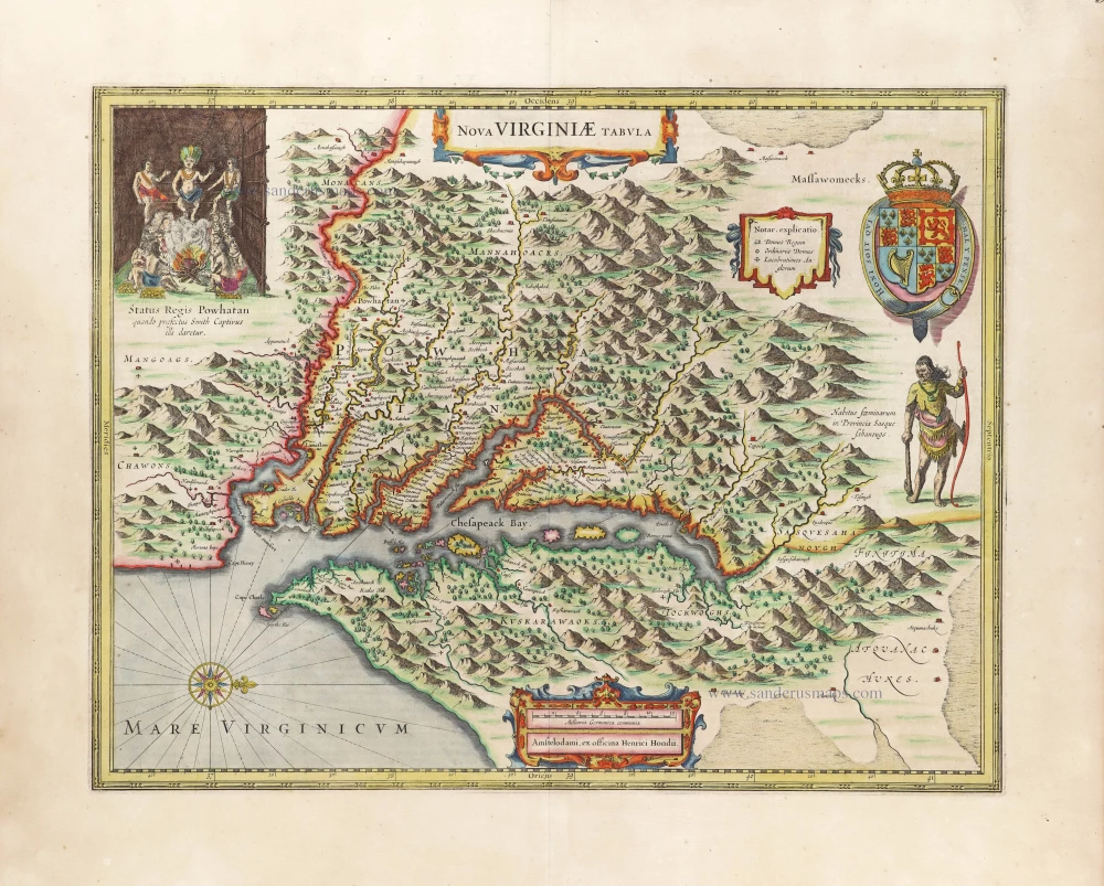
Nova Virginiae Tabula. 1666
Virginia by Henricus Hondius.
[Item number: 29956]
Luxury colouring
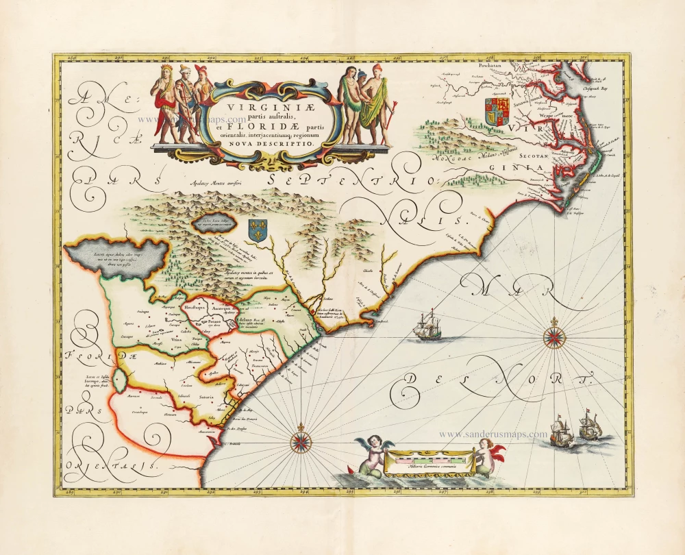
Virginiae partis australis et Floridae partis orientalis, interjacentiumq; regionum Nova Descriptio. 1666
Carolinas and Georgia by Johannes Janssonius
[Item number: 30020]
Virginiae Partis Australis, Et Floridae Partis Orientalis, interjacentiumq regionum Nova Descriptio. 1641
Carolinas and Georgia by Johannes Janssonius.
[Item number: 30319]