
Ottoman Empire by Ottens R. & J. 1756
The Ottens Family
Joachim Ottens (1663-1719), was a copper-engraver and the founder of the print- and mapsellers’ firm in Amsterdam. In 1710 he became a member of the art- and printsellers guild. After he died in 1719, his widow and the sons continued the business under the name “In de Wereldcaert” (In the world map). On the whole, the Ottens’s financial position was rather weak, and the stock was not very large.
In a notary contract dated 20 October 1726, the partnership between the two brothers, Reinier and Josua, was stipulated. Despite separate shops, the brothers’ partnership continued until the death of Renier in 1750.
After Joshua died in 1765, his widow continued the firm, together with her son, Renier II, until c. 1780.
The firm flourished mainly between 1719 and c. 1750. In that period, they advertised at various times the publication of new maps.
Ottens’s greatest fame comes from the voluminous atlases assembled to order. A small number of these so-called ‘Atlas factice’, splendid copies with gorgeous illumination, have survived. These collector’s copies are known to exist in 2, 6, 8, 11, and even 15 volumes. Ottens also published atlases in one volume, with a varying number of maps, pocket atlases, collections of military plans, and Renard’s atlas de la navigation.
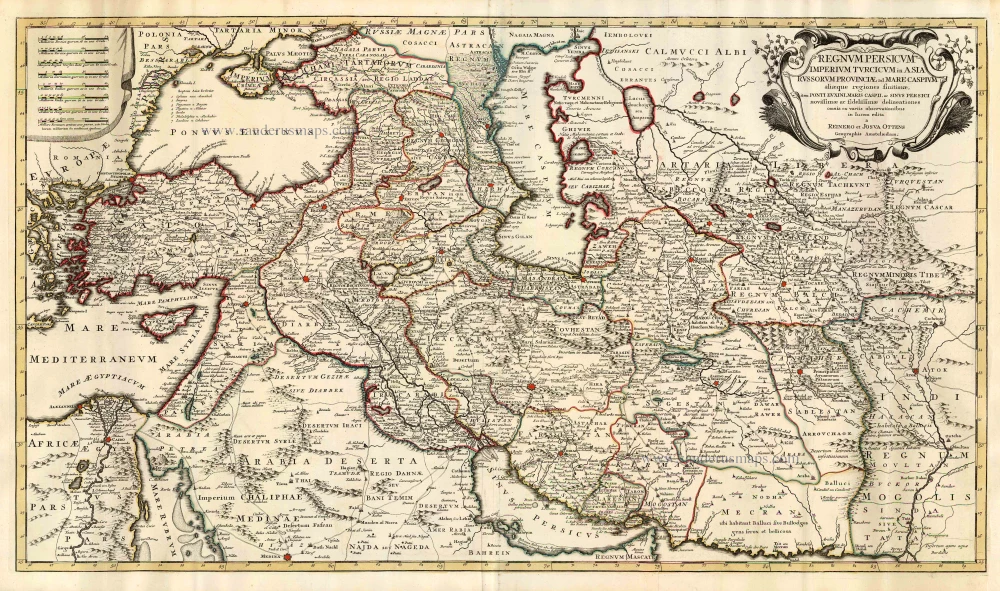
Regnum Persicum Imperium Turcicum in Asia, Russorum Provinciae ad Maris Caspium ...
Item Number: 25839 Authenticity Guarantee
Category: Antique maps > Asia > Turkey - Cyprus
Old, antique map of Ottoman Empire by Ottens R. & J.
Title: Regnum Persicum Imperium Turcicum in Asia, Russorum Provinciae ad Maris Caspium ...
Date: 1756.
Copper engraving, printed on paper.
Image size: 500 x 880mm (19.69 x 34.65 inches).
Sheet size: 535 x 935mm (21.06 x 36.81 inches).
Verso: Blank.
Condition: Original coloured in outline, excellent.
Condition Rating: A+.
From: Atlas minor sive geographia compendiosa in qua orbid terrarum paucis attamen novissimis tablulis ostenditur - Atlas nouveau contenant toutes les parties du monde où sont exactement remarquées les empires, monarchies, royaumes,états, républiques, &c. Amsterdam, R. & J. Ottens (1756). (Koeman, Ott3)
The Ottens Family
Joachim Ottens (1663-1719), was a copper-engraver and the founder of the print- and mapsellers’ firm in Amsterdam. In 1710 he became a member of the art- and printsellers guild. After he died in 1719, his widow and the sons continued the business under the name “In de Wereldcaert” (In the world map). On the whole, the Ottens’s financial position was rather weak, and the stock was not very large.
In a notary contract dated 20 October 1726, the partnership between the two brothers, Reinier and Josua, was stipulated. Despite separate shops, the brothers’ partnership continued until the death of Renier in 1750.
After Joshua died in 1765, his widow continued the firm, together with her son, Renier II, until c. 1780.
The firm flourished mainly between 1719 and c. 1750. In that period, they advertised at various times the publication of new maps.
Ottens’s greatest fame comes from the voluminous atlases assembled to order. A small number of these so-called ‘Atlas factice’, splendid copies with gorgeous illumination, have survived. These collector’s copies are known to exist in 2, 6, 8, 11, and even 15 volumes. Ottens also published atlases in one volume, with a varying number of maps, pocket atlases, collections of military plans, and Renard’s atlas de la navigation.
Related items
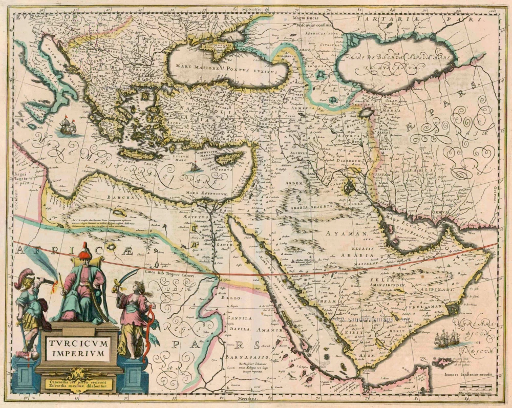
Turcicum Imperium 1638
Ottoman Empire by Henricus Hondius.
[Item number: 13028]
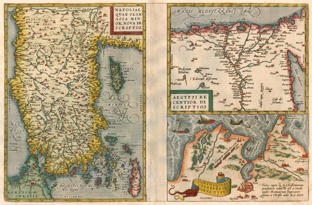
Natoliae quae olim Asia Minor [on sheet with] Argypti Recentioe Descriptio [and] Carthaginis Celeberrimi Sinus Typus 1612
Turkey - Egypt - Cartago by Ortelius A.
[Item number: 22800]
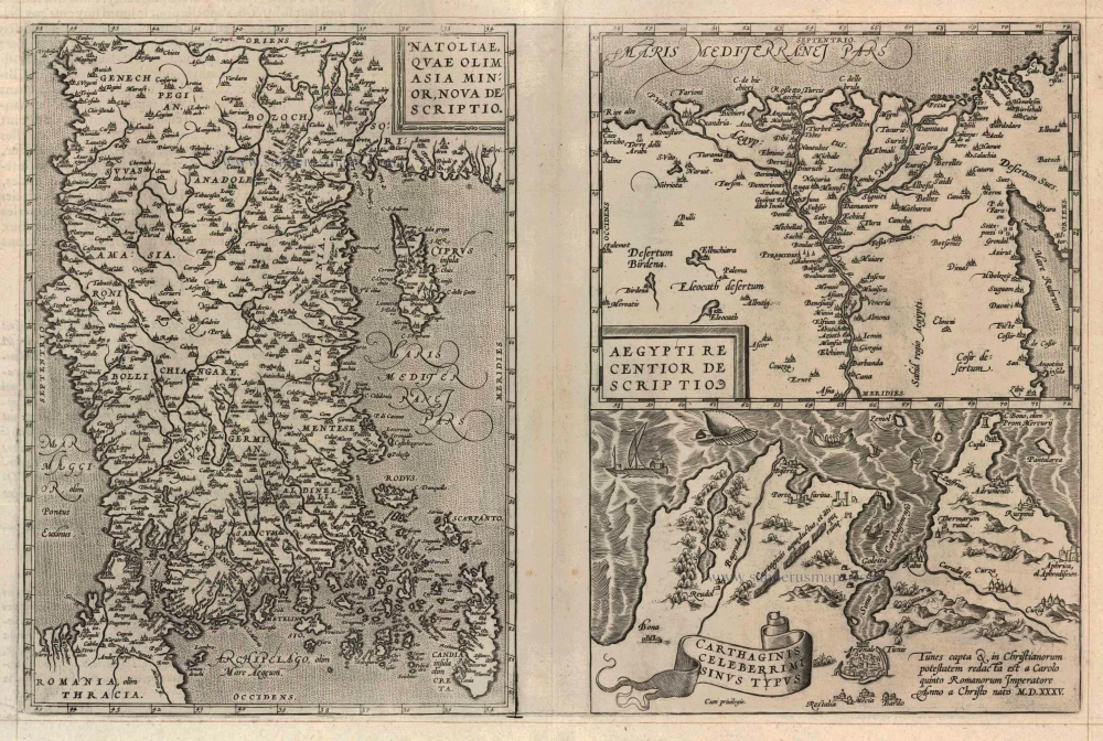
Natoliae quae olim Asia Minor [on sheet with] Argypti Recentioe Descriptio [and] Carthaginis Celeberrimi Sinus Typus 1598
Turkey - Egypt - Cartago, by A. Ortelius.
[Item number: 22865]
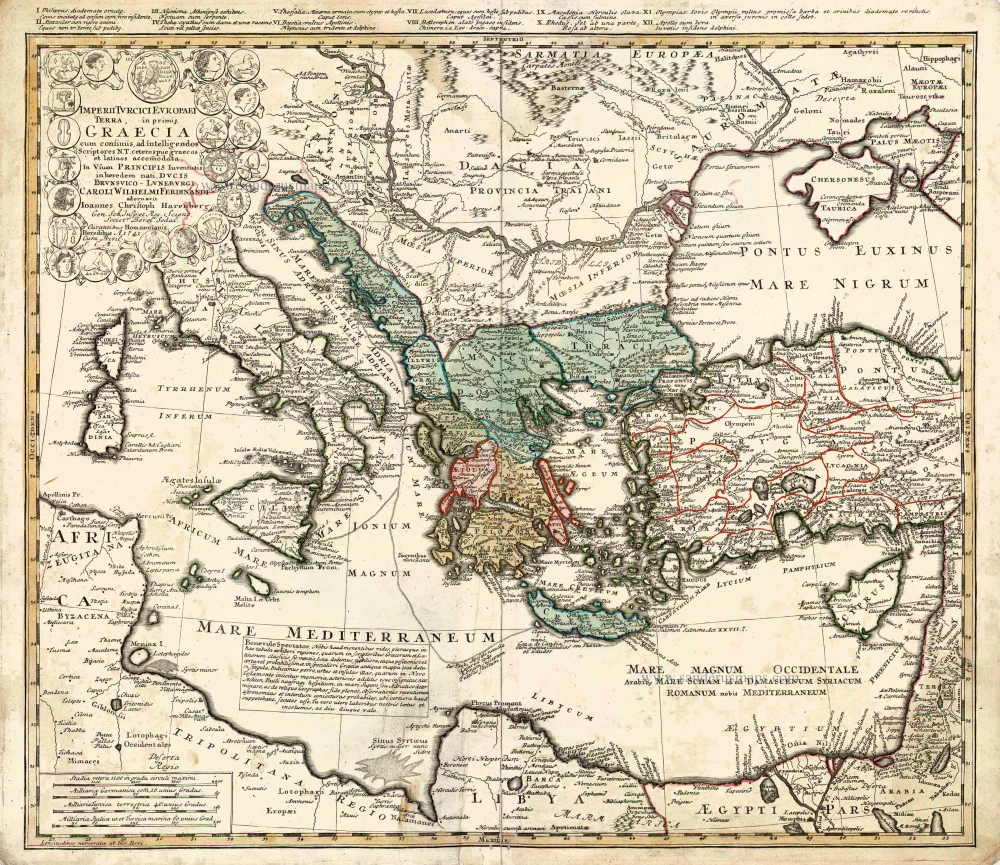
Imperii Turcici Europaei Terra in Primis Graecia. 1752-1775
Southeastern Europe - Turkey by Homann Heirs
[Item number: 26592]
Turcicum Imperium. ca. 1691-96
Ottoman Empire, by De Wit F.
[Item number: 28988]
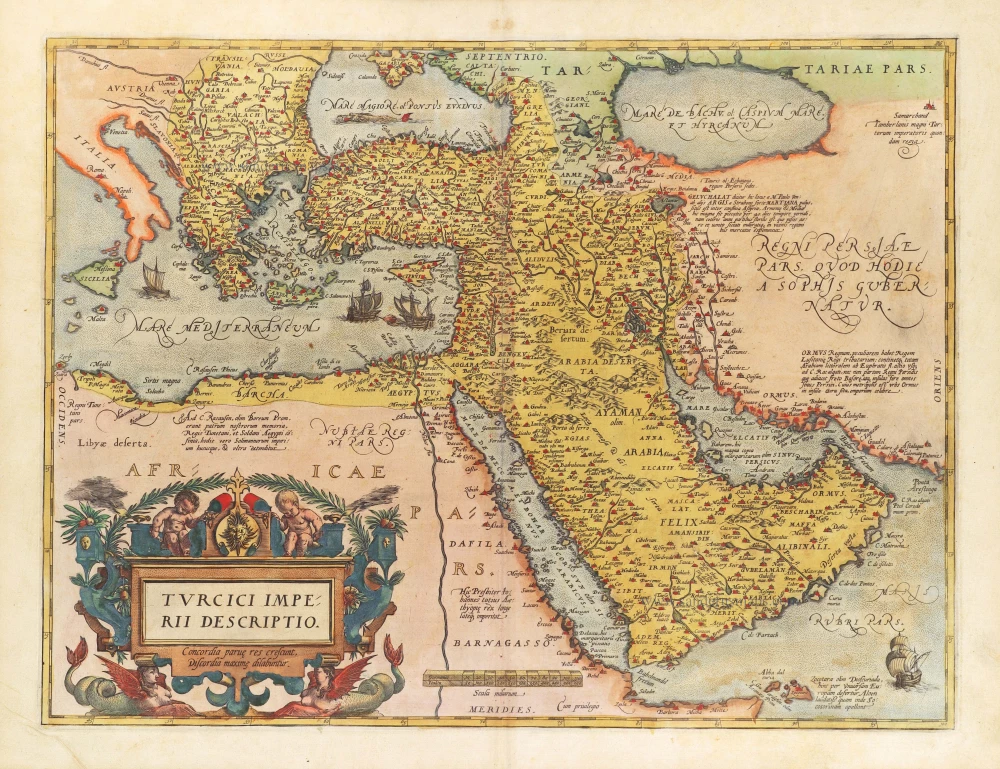
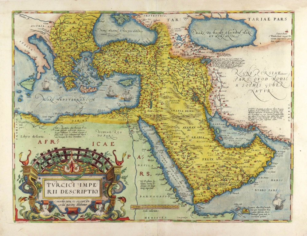
Turcici Imperii Descriptio. 1584
The Ottoman Empire by Abraham Ortelius.
[Item number: 29144]
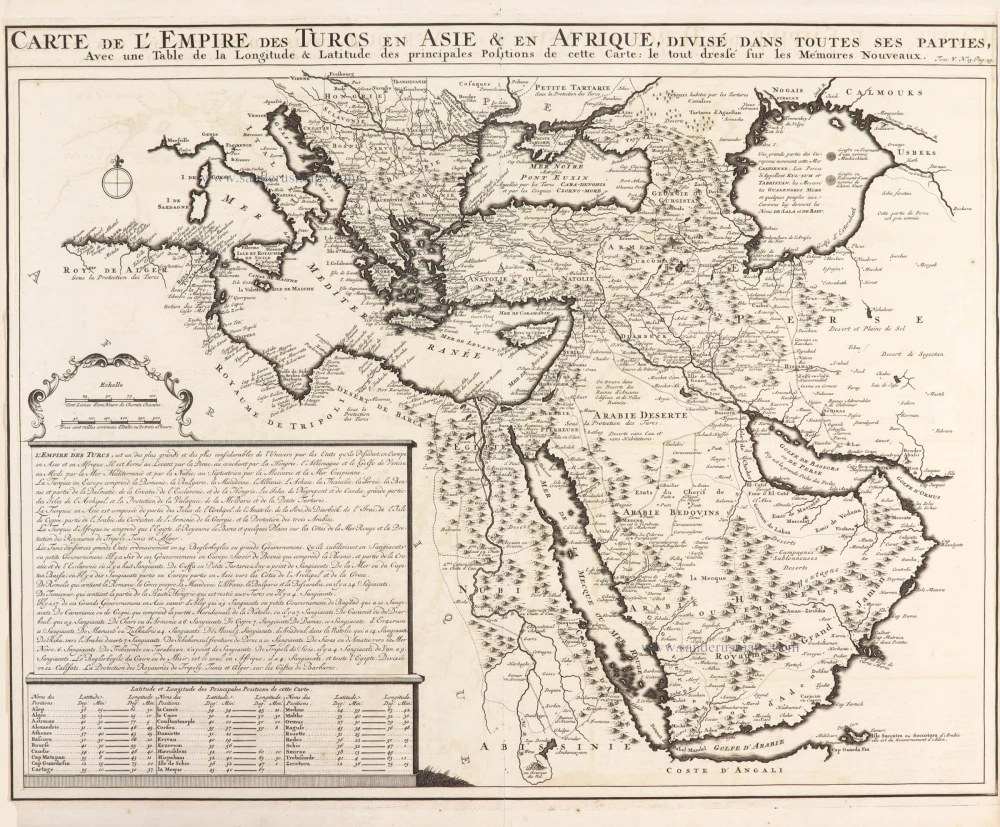
Carte de l'Empire des Turcs en Asie & en Afrique, divisé dans toutes ses parties, 1719
Ottoman Empire, by Zacharias Châtelain.
[Item number: 29384]
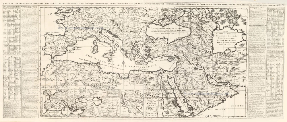
Carte de l'Empire Othoman considerée dans les Etats de cette Puissance, et des Etats qui l'avoisinent ou qui luy sont Tributaires, ainsi que deux petites Cartes pour conduire à l'Histoire Universelle, et en particulier à l'Histoire d'Alexandre le Grand, 1714
Ottoman Empire, by Zacharias Châtelain.
[Item number: 29399]
Turcici Imperii Descriptio. 1574
Ottoman Empire by Ortelius.
[Item number: 29584]
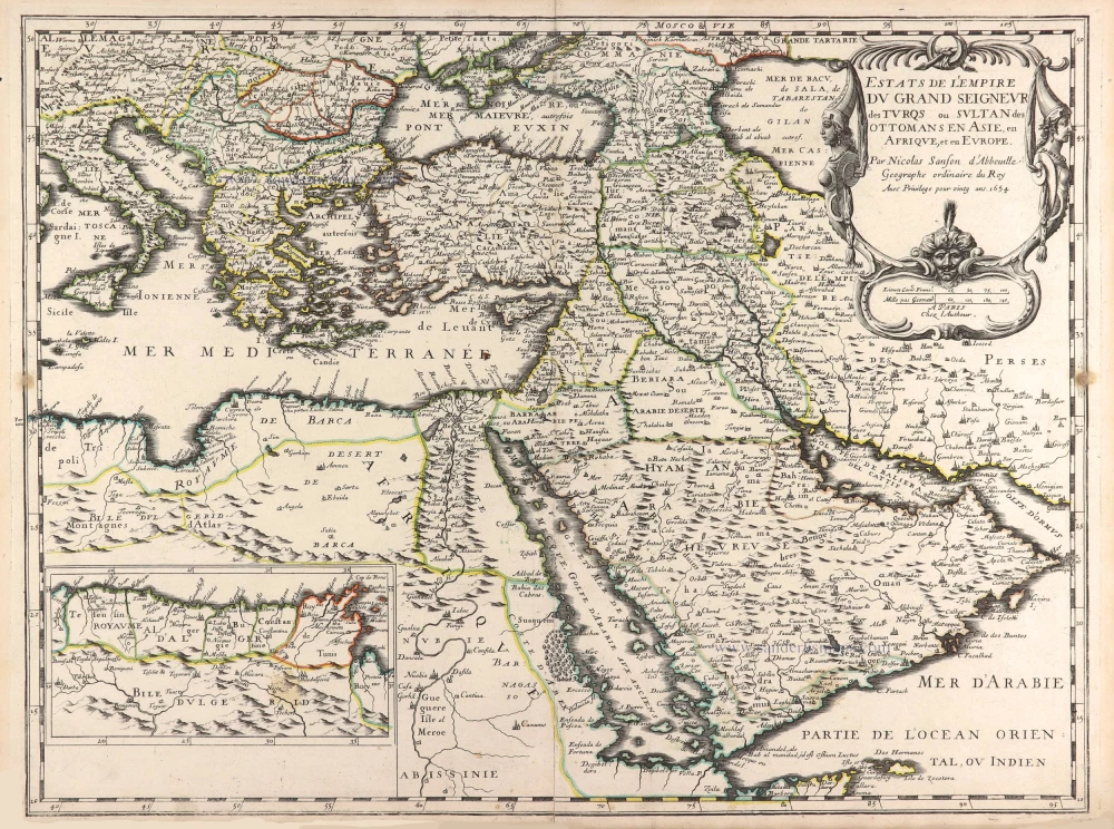
Estats de l'Empire du Grand Seigneur des Turqs ou Sultan des Ottomans en Asie, en Afrique, et en Europe. 1659
Ottoman Empire by Nicolas Sanson.
[Item number: 29713]