
Ottoman Empire, by Zacharias Châtelain. 1719
The Châtelain Family
Zacharias Châtelain (1684-1743) was a bookseller and publisher of Amsterdam. He was succeeded by his sons Zacharias jr and Henry Abraham. The Châtelain family was best known for the historical atlas Atlas Historique, ou nouvelle introduction à l’histoire…, a major work of its time. It was an encyclopaedia in seven volumes, including geography as one of its main subjects. The atlas was published in Amsterdam in seven volumes in various editions with different imprints from 1705 to 1739. An anonym person (Mr. C***) compiled the work with compositions of text, maps, plates and chronological and genealogical tables by Gueudeville, except volume 7, where H.P. Limiers took over this task. The maps were made mainly after the work of Guillaume de l'Isle.
The 1705 edition was published with the imprint “L’Honoré & Châtelain”. Later editions had the imprint: “les Frères Châtelain Libraires” or “L’Honoré & Châtelain Libraires”.
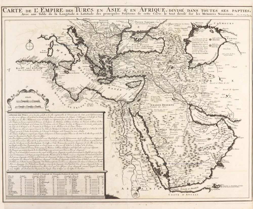
Carte de l'Empire des Turcs en Asie & en Afrique, divisé dans toutes ses parties,
Item Number: 29384 Authenticity Guarantee
Category: Antique maps > Asia > Middle East
Old, antique map of the Ottoman Empire, by Zacharias Châtelain.
Title: Carte de l'Empire des Turcs en Asie & en Afrique, divisé dans toutes ses parties,
Avec une Table de la Longitude & Latitude des principales positions de cette Carte: le tout dressé sur les Mémoires Nouveaux.
Tom: V. N° 13. Pag. 29.
Date of the first edition: 1719.
Date of this map: 1719.
Copper engraving, printed on paper.
Map size: 405 x 520mm (15.94 x 20.47 inches).
Sheet size: 440 x 520mm (17.32 x 20.47 inches).
Verso: Blank.
Condition: Short side margins.
Condition Rating: A
From: Châtelain Z. Atlas Historique, ou Nouvelle Introduction A l'Histoire, à la Chronologie & à la Geographie Ancienne & Moderne; ... Tome V. Qui comprend l'Asie en général et en particulier, l'Assyrie, l'Armenie, la Georgie, la Turquie Asiatique, la Terre-sainte, l'Arabie, la Perse, la Tartarie, les Etats Japon, et le Roïaume de Siam. A Amsterdam, Chez L'Honoré & Châtelain Libraires, M.DCC.XIX. (1719). (Koeman II, p. 37, Cha6)
The Châtelain Family
Zacharias Châtelain (1684-1743) was a bookseller and publisher of Amsterdam. He was succeeded by his sons Zacharias jr and Henry Abraham. The Châtelain family was best known for the historical atlas Atlas Historique, ou nouvelle introduction à l’histoire…, a major work of its time. It was an encyclopaedia in seven volumes, including geography as one of its main subjects. The atlas was published in Amsterdam in seven volumes in various editions with different imprints from 1705 to 1739. An anonym person (Mr. C***) compiled the work with compositions of text, maps, plates and chronological and genealogical tables by Gueudeville, except volume 7, where H.P. Limiers took over this task. The maps were made mainly after the work of Guillaume de l'Isle.
The 1705 edition was published with the imprint “L’Honoré & Châtelain”. Later editions had the imprint: “les Frères Châtelain Libraires” or “L’Honoré & Châtelain Libraires”.
Related items

Turquie d'Europe. 1776-79
The Ottoman Empire, by Francesco Santini.
[Item number: 26972]
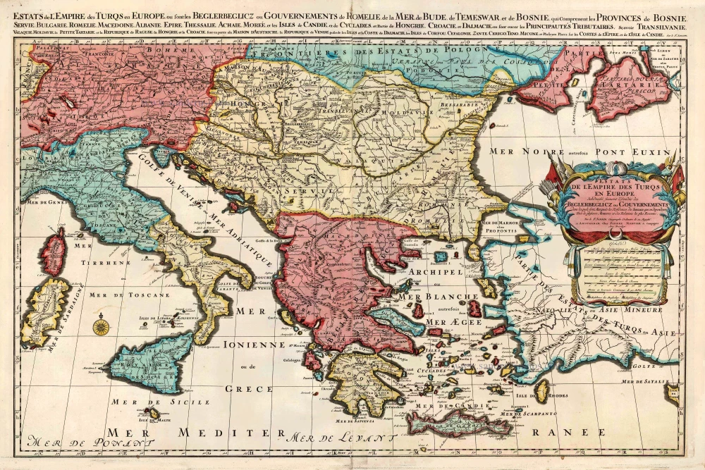
Estats de l'Empire des Turqs en Europe. c. 1705
European Ottoman Empire by Nicolas Sanson, published by Pieter Mortier.
[Item number: 27770]
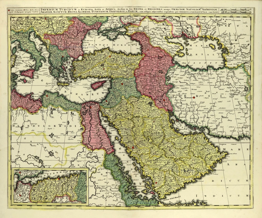
Imperium Turcicum in Europa, Asia et Africa, divisum in sua Regna et Regiones, nempe Graeciam, Natoliam, Armeniam, Arabiam, Aegyptum, Regna Algeriae, Tunetanum, Tripoleos et Barcae, cum reliquis adjacentibus regionibus. c. 1700
Ottoman Empire by Gerard and Leonard Valck.
[Item number: 28322]
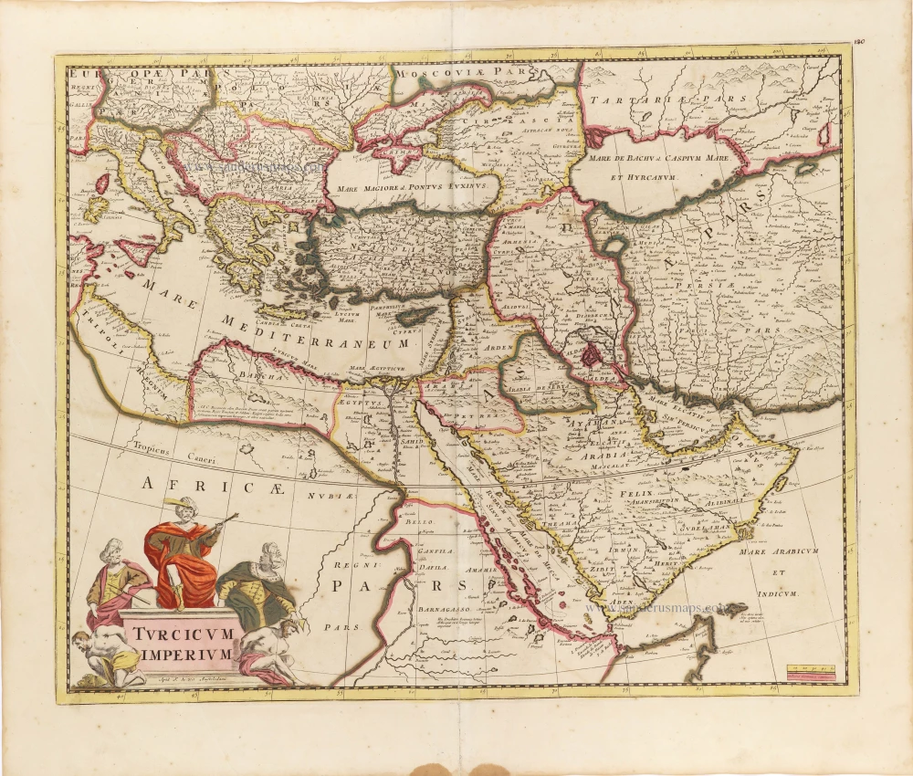
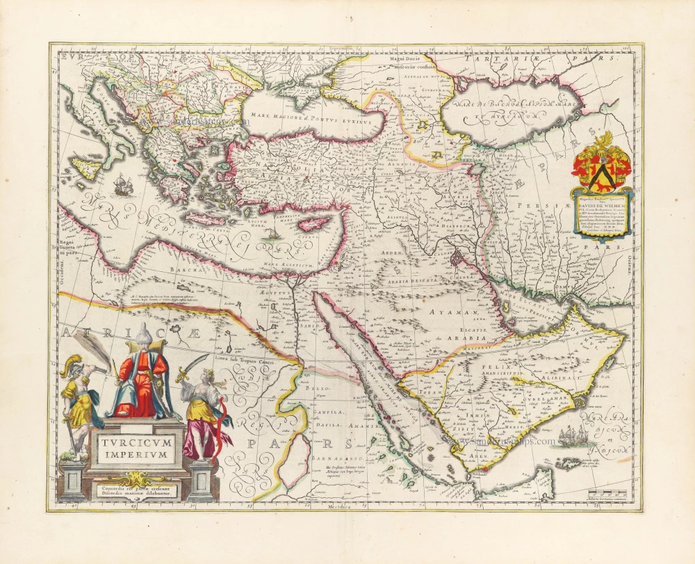
Turcicum Imperium. ca. 1691-96
Ottoman Empire, by De Wit F.
[Item number: 28988]
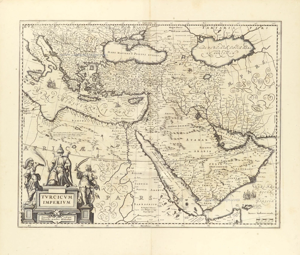
Turcicum Imperium. 1652-53
Ottoman Empire by Henricus Hondius.
[Item number: 29168]
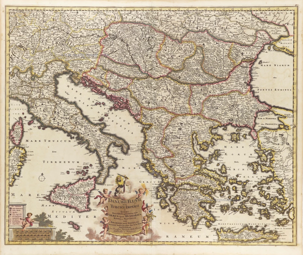
Danubii Fluvii Sive Turcici Imperii in Europa. c. 1705
Danube and European Ottoman Empire, by Frederick de Wit.
[Item number: 29279]
Turcicum Imperium. 1643
Ottoman Empire, by Willem & Joan Blaeu.
[Item number: 30196]

Estats de l'Empire du Grand Seigneur des Turcs en Europe, en Asie, et en Afrique ... 1692
Ottoman Empire by N. Sanson, so-called published by Hubert Jaillot. (Pirated edition by Pierre Mortier).
[Item number: 31198]
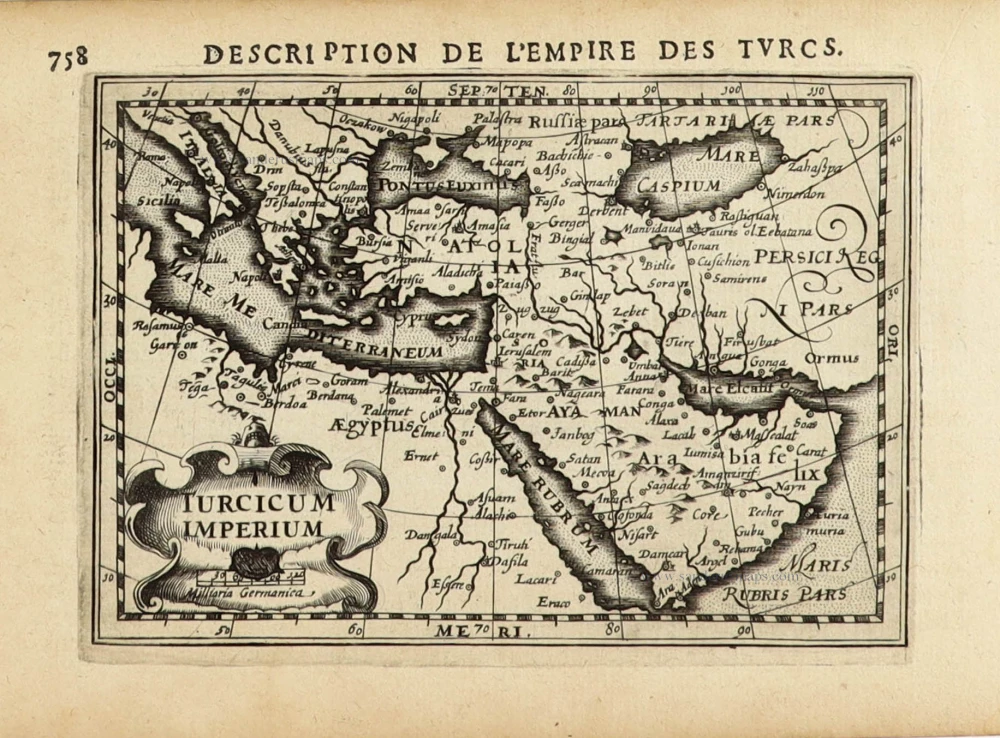
Turcicum Imperium. 1618
Ottoman Empire, by Petrus Bertius
[Item number: 32176]