
Rare and important map.
Scandinavia, by Michele Tramezini. 1558
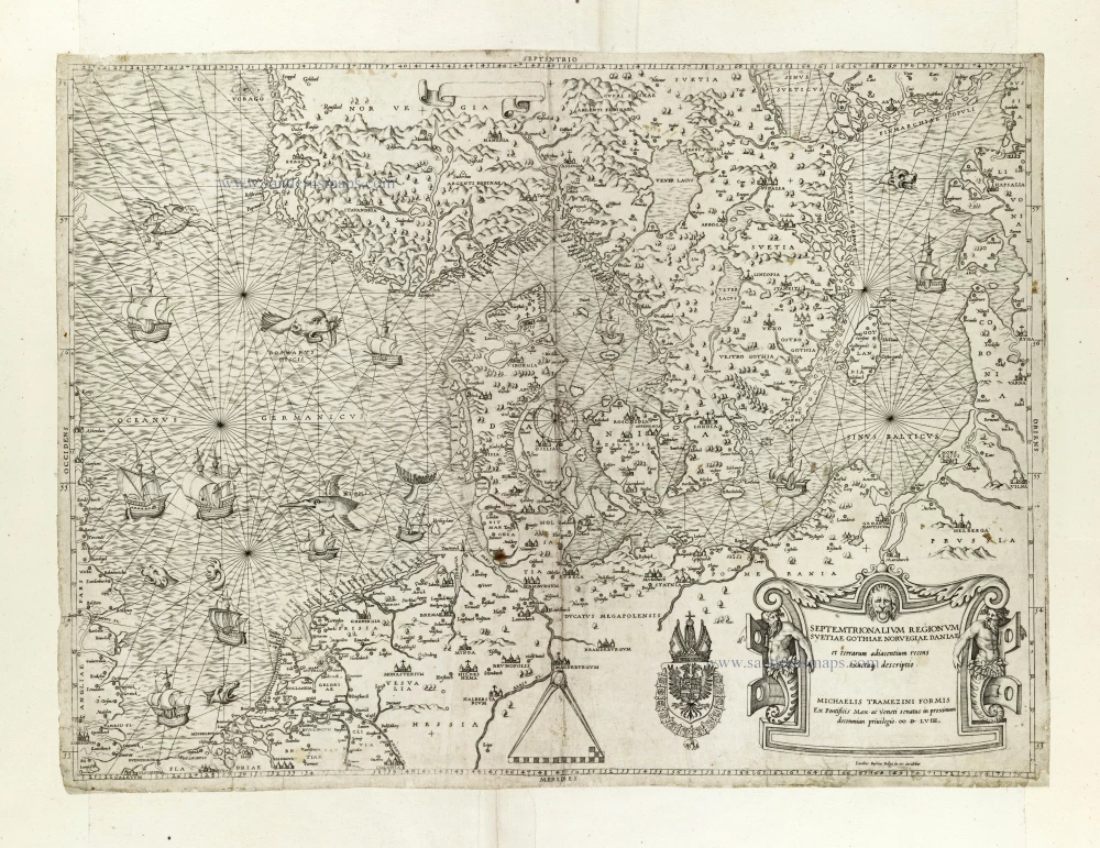


This rare map is a derivative from Cornelis Anthonisz' nine sheet wall map Caerte van Oostlant, published in Antwerp in 1543. The map of Anthonisz is known only through the reprint published around 1560 by Arnout Nicolai, whose only copy is now in the Herzog August Bibliothek of Wolfenbuttel. Tramezzino's work is a faithful reproduction of the original, also regarding the decorative elements such as marine animals and ships.
The first state is unknown to Ginsberg.
Michele Tramezzino (15?? – 1579)
Venetian printer and publisher with two workshops, one in Rome with his brother Francesco and one in Venice ‘all Insegna della Sibille’.
Both brothers, Michele and Francesco were born in Rome, although the family took refuge in Venice in 1527, fleeing the sack of Rome. Francesco returned to Rome, and Michele remained in Venice. The brothers have been printing maps, stamps and literary, historical and legal works since 1551. Their production was very copious and was always accompanied by a typographic mark that represented the figure of the Sibyl.
In 1554, Michele Tramezzino published a world map which stands on its own as a masterpiece of Renaissance cartography.
Septemtrionalium Regionum Svetiae Gothiae Norvegiae Daniae et terrarum adiacentium recens exactaq[ue] descriptio.
Item Number: 27045 Authenticity Guarantee
Category: Antique maps > Europe > Northern Europe
Old, antique map of Scandinavia, by Michele Tramezini.
Engraver: Jacob Bos.
Date of the first edition: 1556
Date of this map: 1558
Copper engraving, printed on paper.
Size (not including margins): 39.5 x 53cm (15.3 x 20.6 inches)
Verso: Blank
Condition: Small repairs at the original margins and centrefold with some small reinstatements to the centrefold, remargined.
Condition Rating: A
References: Bifolco-Ronca, Tav.246, State 2 (of 4); Ginsberg (Scandinavia), #16; Karrow, 6/8.2; Tooley (Lafreri School), #40 .
Separate publication. - Probably from a composite Lafreri Atlas.
This rare map is a derivative from Cornelis Anthonisz' nine sheet wall map Caerte van Oostlant, published in Antwerp in 1543. The map of Anthonisz is known only through the reprint published around 1560 by Arnout Nicolai, whose only copy is now in the Herzog August Bibliothek of Wolfenbuttel. Tramezzino's work is a faithful reproduction of the original, also regarding the decorative elements such as marine animals and ships.
The first state is unknown to Ginsberg.
Michele Tramezzino (15?? – 1579)
Venetian printer and publisher with two workshops, one in Rome with his brother Francesco and one in Venice ‘all Insegna della Sibille’.
Both brothers, Michele and Francesco were born in Rome, although the family took refuge in Venice in 1527, fleeing the sack of Rome. Francesco returned to Rome, and Michele remained in Venice. The brothers have been printing maps, stamps and literary, historical and legal works since 1551. Their production was very copious and was always accompanied by a typographic mark that represented the figure of the Sibyl.
In 1554, Michele Tramezzino published a world map which stands on its own as a masterpiece of Renaissance cartography.
Related items
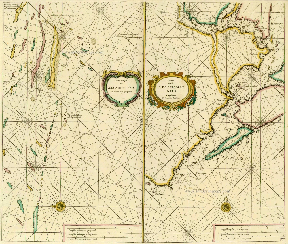
Caarte van 't gat van Abbo, ofte Uttoy. [on sheet with] Caarte van 't Stochomse Liet. 1686
Sea chart of Finland - Sweden, by Doncker H.
[Item number: 14593]
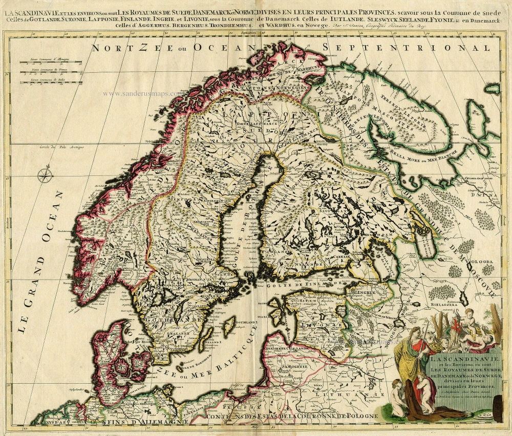
La Scandinavie, et les Environs, ou sont les Royaumes de Suede, de Danemark et de Norwege, divises en leurs principales Provinces. c. 1700
SCANDINAVIA by Schenk P.
[Item number: 19145]
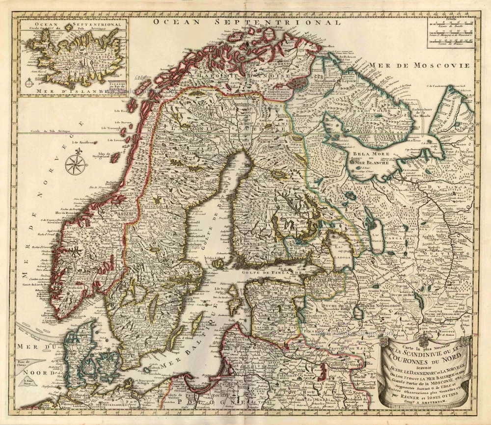
Carte la Plus Nouvelle de la Scandinivie ou les Couronnes du Nord Scavoir La Suede le Dannemarc et La Norvege Ou Lon Trouve La Mer Baltique et une Grande Partie de la Moscovie etc. 1730-45
Scandinavia par R. & I. Ottens.
[Item number: 25858]
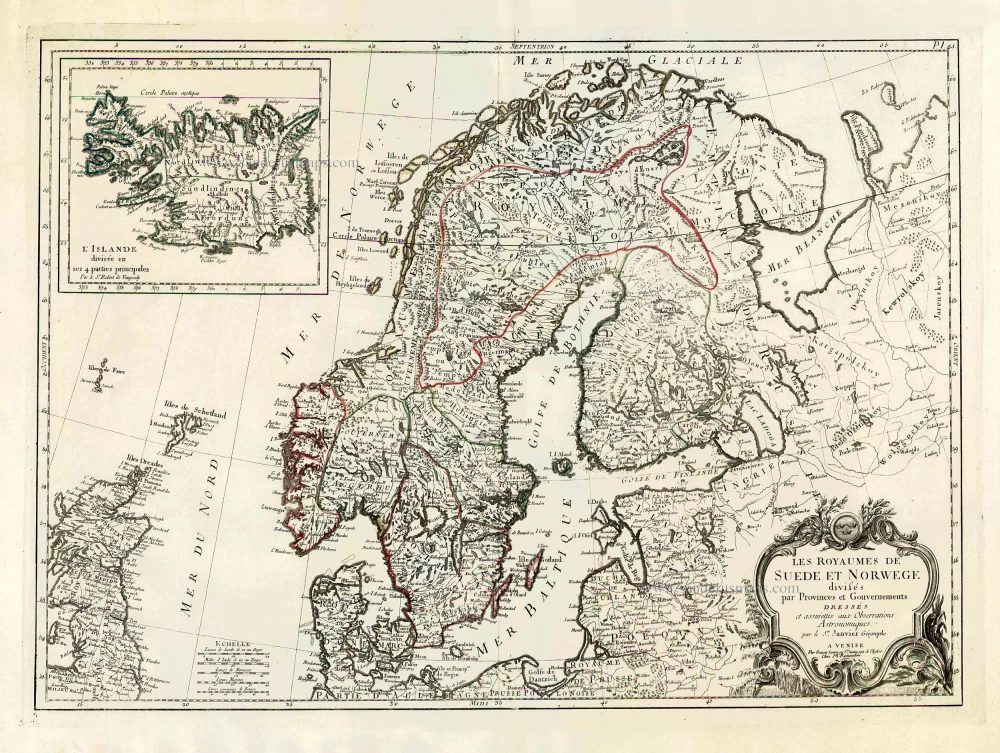
Les Royaumes de Suede et Norwege Divisés par Provinces et Gouvernements. 1776-79
Scandinavia, by Francesco Santini.
[Item number: 26964]
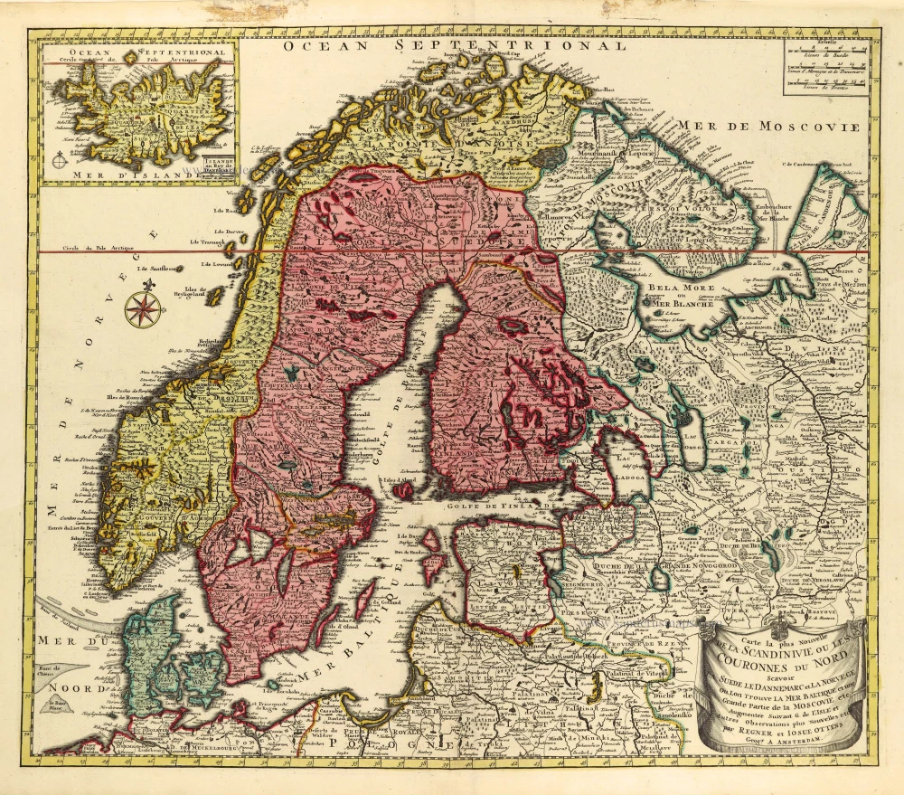
Carte la Plus Nouvelle de la Scandinivie ou les Couronnes du Nord Scavoir La Suede le Dannemarc et La Norvege Ou Lon Trouve La Mer Baltique et une Grande Partie de la Moscovie etc. 1730-45
Scandinavia par R. & I. Ottens.
[Item number: 28269]
Tabula exactissima Regnorum Sueciae et Norvegiae, nec non Maris Universi Orientalis, 1656-80
Scandinavia by Nicolaas Visscher.
[Item number: 28742]
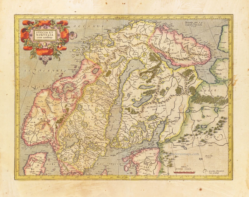
Svecia et Norvegia cum confinijs. 1628
Scandinavia, by Gerard Mercator.
[Item number: 28815]

Finmarchiae et Laplandiae Maritima. = Nieuwe Pascaert vande kusten Finmarcken en Lapland Streckende van Dronten tot Archangel. ca. 1680
The Coast of Lapland, by Frederick de Wit.
[Item number: 29219]
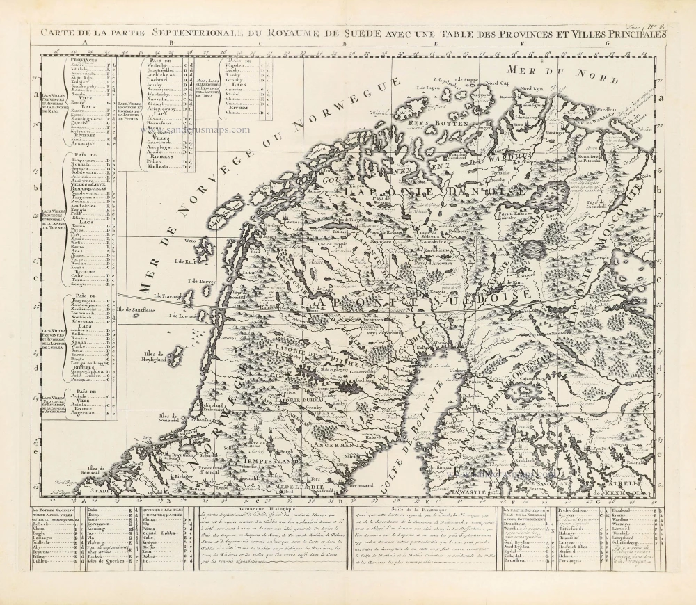
Carte de la Partie Septentrionale du Royaume de Suède avec une Table des Provinces et Villes Principales. 1714
Northern Scandinavia by Zacharias Châtelain.
[Item number: 29412]
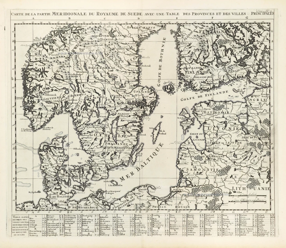
Carte de la Partie Meridionale du Royaume de Suède avec une Table des Provinces et Villes Principales. 1714
Southern Scandinavia by Zacharias Châtelain.
[Item number: 29413]
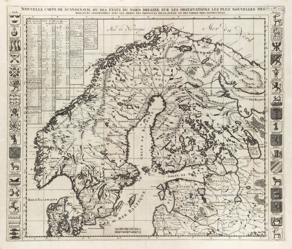
Nouvelle Carte de Scandinavie ou des Etats du Nord Dressée sur les observations les plus nouvelles des meilleurs Géographes avec les Armes des Provinces de la Suède et des Tables tres instructives. 1714
Scandinavia, by Zacharias Châtelain.
[Item number: 29499]

La Scandinavie et les environs ou sont les Estats et Royaumes de Danemarck Norwegue et Suede. 1652
Scandinavia by Nicolas Sanson.
[Item number: 29607]
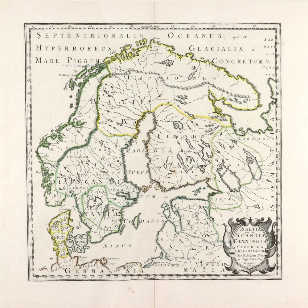
Baltia, quae et Scandia, Cimbrica Chersonesus &c. 1654-58
Scandinavia by Nicolas Sanson.
[Item number: 29608]
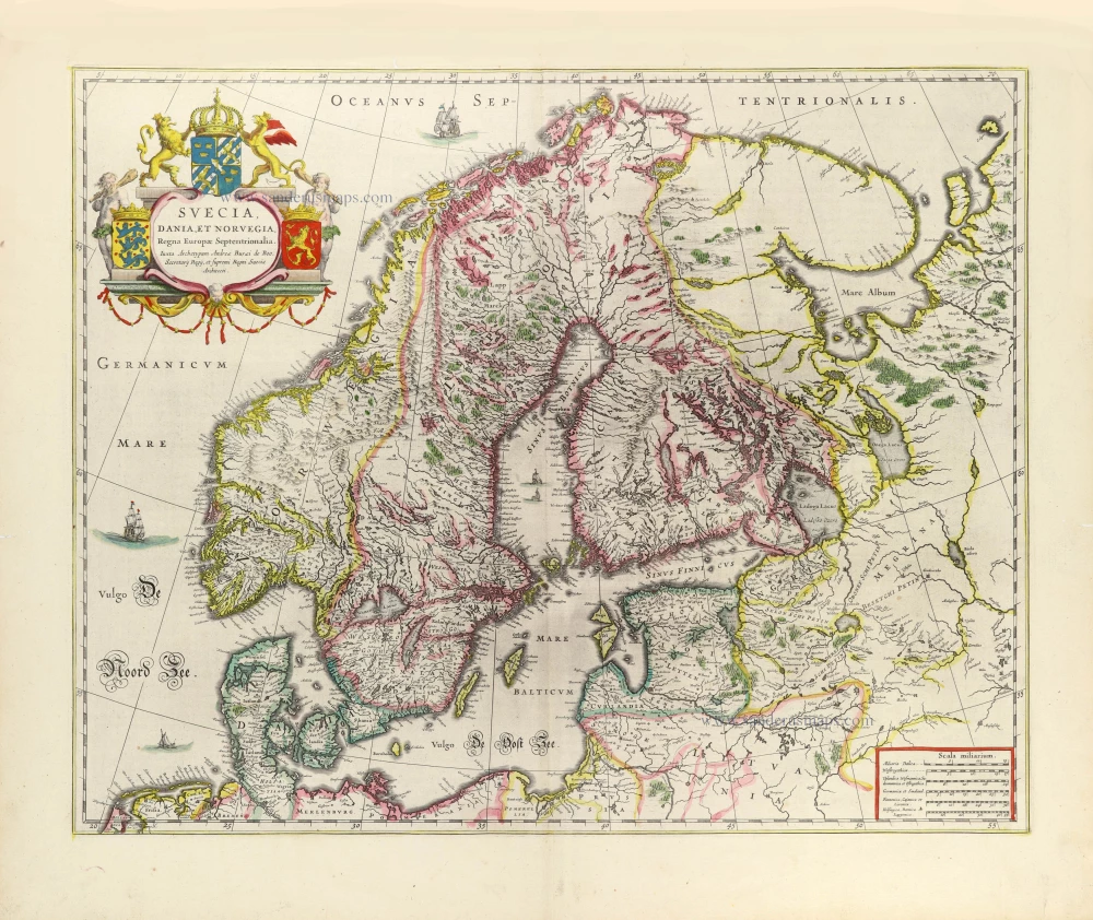
Suecia, Dania et Norvegia, Regna Europae Septentrionalia. 1643
Scandinavia by Joan Blaeu.
[Item number: 29998]
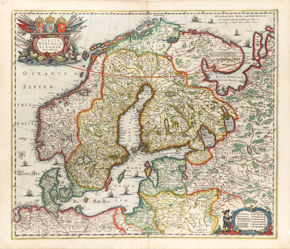
Sueciae, Norvegiae, et Daniae, Nova Tabula. 1666
Scandinavia, by Johannes Janssonius.
[Item number: 30290]