
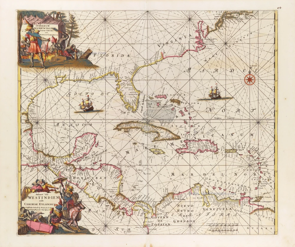
West Indies, by Frederick de Wit. c. 1680


This map is derived from the very rare Hessel Gerrtisz map, c. 1631. This version is, however, more closely related to the Johannes van loon of 1661.
Frederick de Wit (1630-1706)
The engraver and map-seller, Frederick de Wit, was born in Gouda (Netherlands) in 1630 as a son of Hendrick Fredericksz de Wit. Through his marriage with Maria van der Waag of Amsterdam in 1661, he obtained citizenship of the city where he had been working since 1648 and where he became one of the most famous engravers of maps of the second half of the 17th century. Although De Wit was a Catholic, which meant that he was not favoured at the time by the city council, he was awarded the honour of being listed as one of the "excellent citizens" on the roll of the city council in the years 1694-1704. However, his name was not written in the Guild of St. Luke book before 1664. At that time, he lived on the Kalverstraat "in de Witte Pascaert", where he stayed until his death in 1706. His earliest dates on maps engraved are 1659 (Regni Daniae) and 1660 (World map).
Frederick de Wit published several world atlases, a sea atlas, and an atlas of the Netherlands.
The dating of the maps is difficult. However, as a privilege was granted in 1689, the annotation 'cum privilegio' marks an edition after 1688.
Around 1700, Frederick de Wit entered the market with a town atlas. He produced two volumes with a total of 260 plans and views. Most were printed from plates used for Janssonius and Blaeu town atlases.
After he died in 1706, his widow continued the shop until 1709. The plates and stock of De Wit's atlas were sold to Covens & Mortier in 1710, who sold the atlas for an extended period.
Indiarum Occidentalium Tractus Littoralis cum Insulis Caribicis. - Pascaert van Westindien ende Caribise Eylanden.
Item Number: 29176 Authenticity Guarantee
Category: Antique maps > America > West Indies
Old, antique sea chart of the West Indies, by Frederick de Wit.
Title: Indiarum Occidentalium Tractus Littoralis cum Insulis Caribicis. - Pascaert van Westindien ende Caribise Eylanden.
t'Amsterdam Gedruckt by Frederick de Wit inde Kalverstraet inde Witte Pascaert
Engraver: Romeyn de Hooghe.
Date of the first edition: ca. 1671-76.
Date of this map: c. 1680.
Copper engraving, printed on paper.
Map size: 485 x 560mm (19.09 x 22.05 inches).
Sheet size: 540 x 640mm (21.26 x 25.2 inches).
Verso: Blank.
Condition: Original coloured, reinforcements with archival paper at the back.
Condition Rating: A+.
From: Orbis Maritimus ofte Zee Atlas. Amsterdam, F. de Wit, c. 1680.
This map is derived from the very rare Hessel Gerrtisz map, c. 1631. This version is, however, more closely related to the Johannes van loon of 1661.
Frederick de Wit (1630-1706)
The engraver and map-seller, Frederick de Wit, was born in Gouda (Netherlands) in 1630 as a son of Hendrick Fredericksz de Wit. Through his marriage with Maria van der Waag of Amsterdam in 1661, he obtained citizenship of the city where he had been working since 1648 and where he became one of the most famous engravers of maps of the second half of the 17th century. Although De Wit was a Catholic, which meant that he was not favoured at the time by the city council, he was awarded the honour of being listed as one of the "excellent citizens" on the roll of the city council in the years 1694-1704. However, his name was not written in the Guild of St. Luke book before 1664. At that time, he lived on the Kalverstraat "in de Witte Pascaert", where he stayed until his death in 1706. His earliest dates on maps engraved are 1659 (Regni Daniae) and 1660 (World map).
Frederick de Wit published several world atlases, a sea atlas, and an atlas of the Netherlands.
The dating of the maps is difficult. However, as a privilege was granted in 1689, the annotation 'cum privilegio' marks an edition after 1688.
Around 1700, Frederick de Wit entered the market with a town atlas. He produced two volumes with a total of 260 plans and views. Most were printed from plates used for Janssonius and Blaeu town atlases.
After he died in 1706, his widow continued the shop until 1709. The plates and stock of De Wit's atlas were sold to Covens & Mortier in 1710, who sold the atlas for an extended period.
Related items
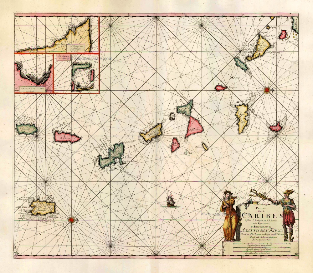
Pas Kaart van de Caribes tusschen I. Barbados en I.S. Martin. 1684
The Lesser Antilles, by J. Van Keulen.
[Item number: 2377]
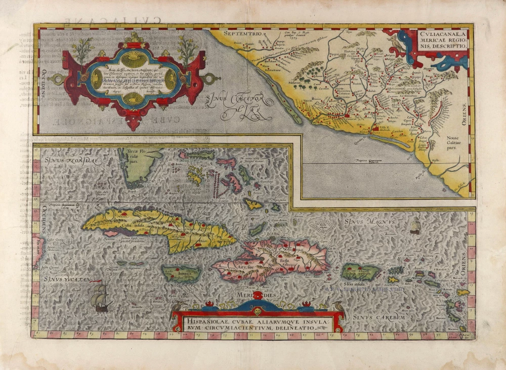
Culiacanae Americae Regionis Descriptio. - Hispaniolae, Cubae, Aliarumquae Insularum Circumiacentium, delineatio. 1581
Antilles - Mexico by Ortelius A.
[Item number: 6245]
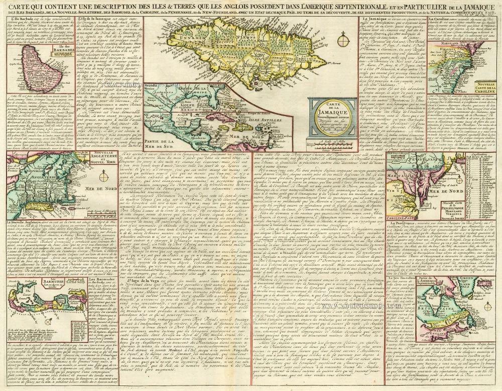
Carte qui Contient une Description des Iles & Terres que les Anglois Possèdent dans l'Amerique Septentrionale, et en Particulier de la Jamaique, .. 1713-1719
West Indies, Bermuda, New England, Virginia by Châtelain.
[Item number: 16834]

Heightened in gold
Pascaert vande Caribes Eylanden. 1667
Sea chart of the Lesser Antilles, by Pieter Goos.
[Item number: 25708]

Cuba Insula et Iamaica. 1607
Antilles: Cuba - Jamaica, by Cornelis van Wytfliet.
[Item number: 26502]
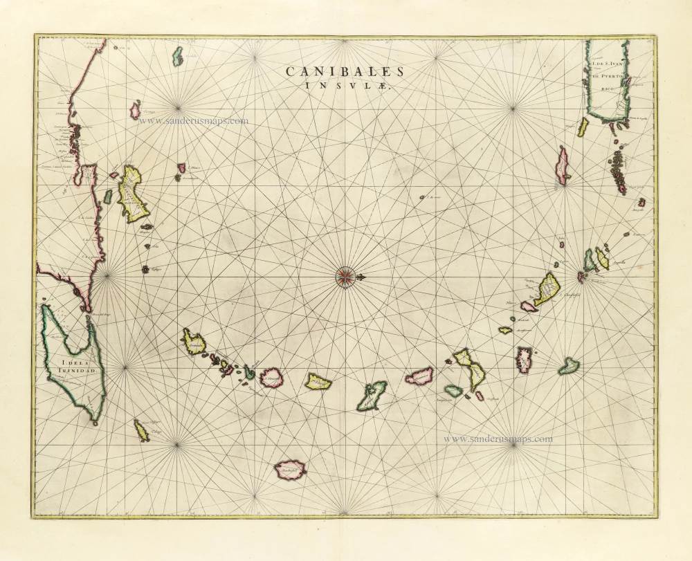
Canibales Insulae. 1662
Sea chart of the Lesser Antilles, by Joan Blaeu.
[Item number: 26737]
In excellent condition
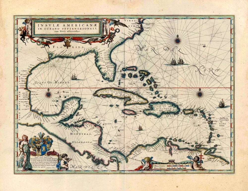
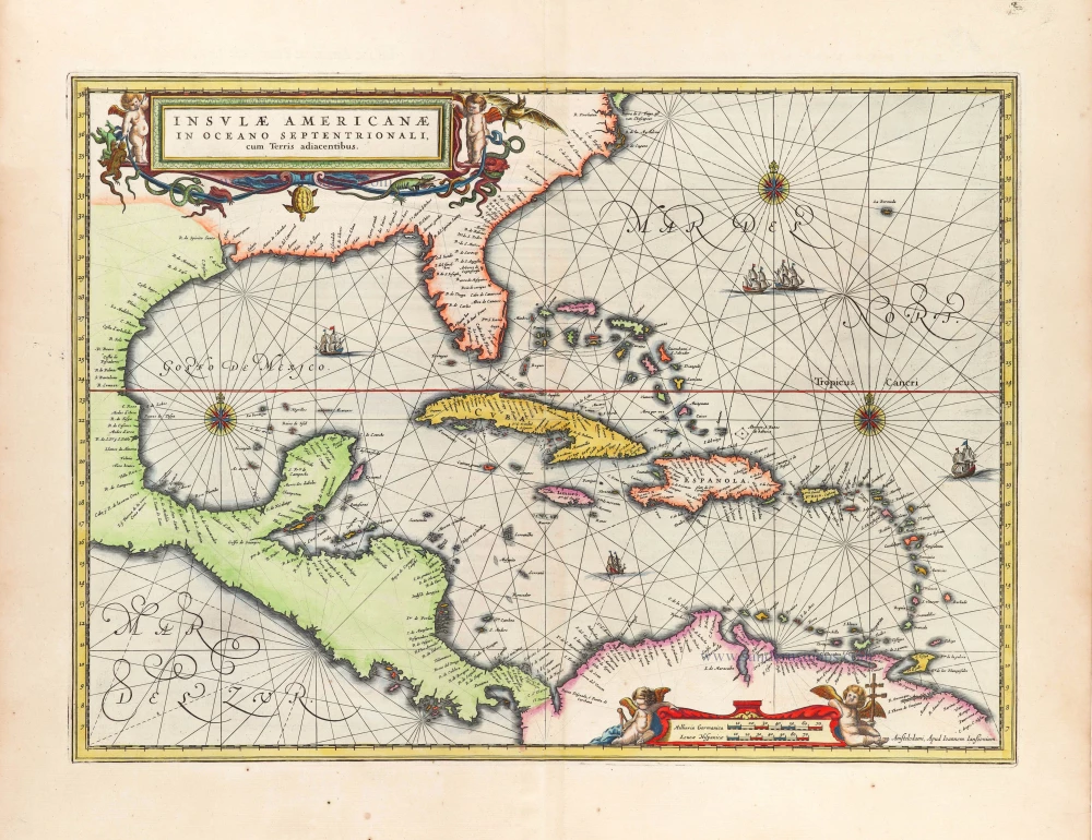
Insulae Americanae in Oceano Septentrionali, cum Terris Adiacentibus. 1643-50
West Indies by Willem Blaeu.
[Item number: 26985]
Big and spectacular map in excellent condition
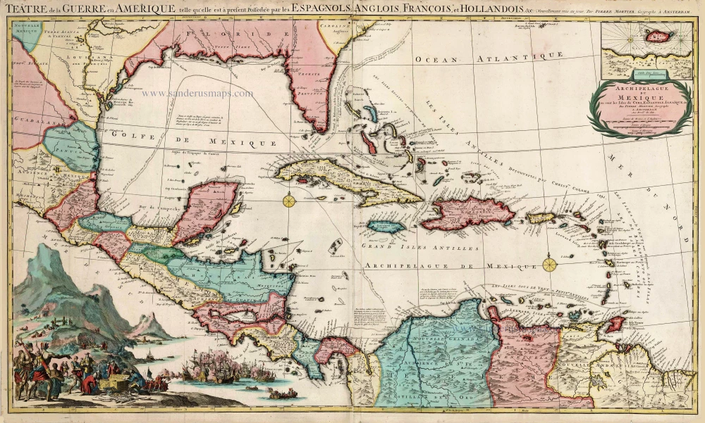
Teatre de la Guerre en Amerique, telle qu'elle est a Present Possedee par les Espagnols, Anglois, Francois, et Hollandois &c. c. 1705
Central America by Pieter Mortier (Pierre).
[Item number: 27766]
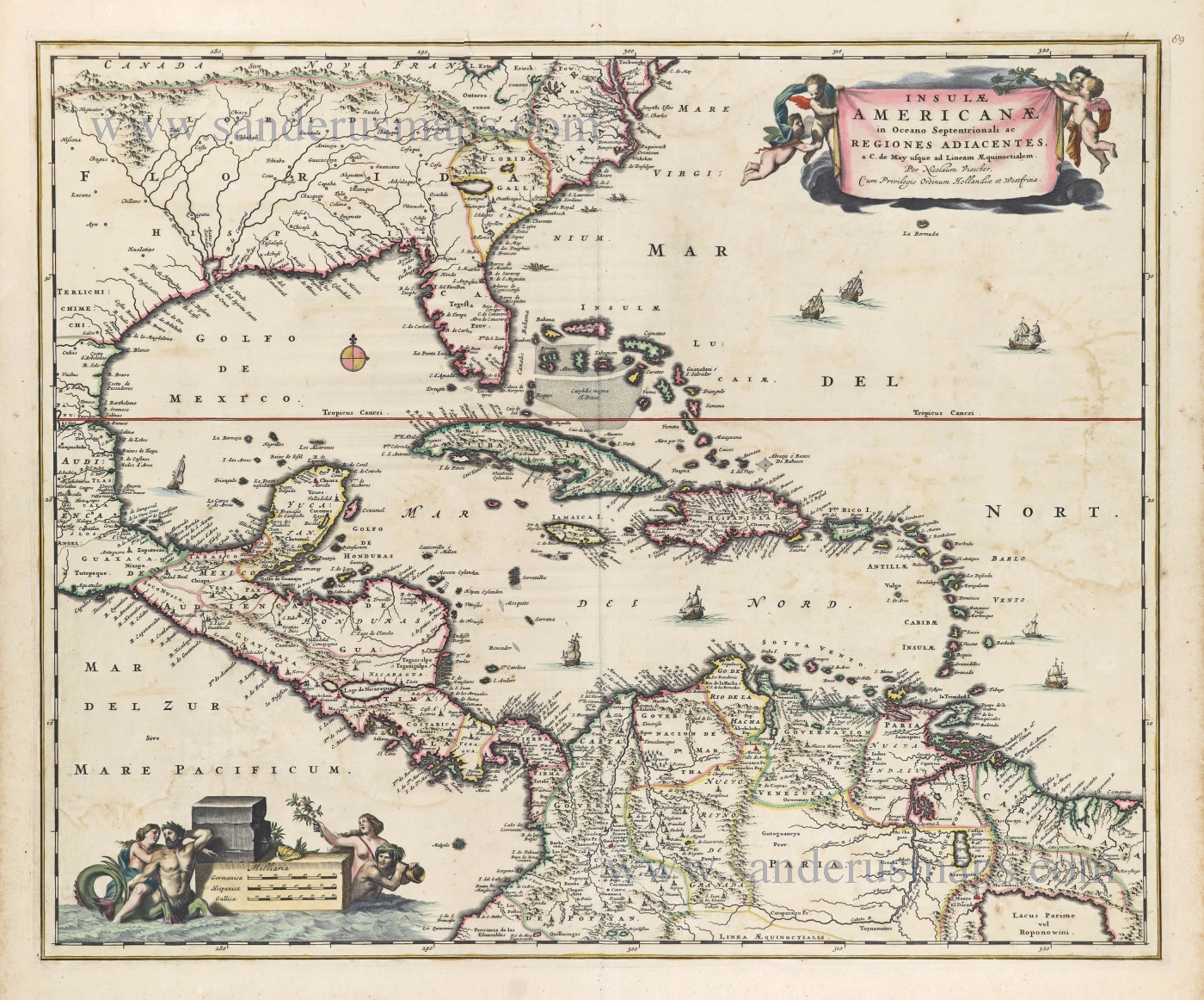
Insulae Americanae in Oceano Septentrionali ac Regiones Adiacentes, a. C. de May usque ad Lineam AEquinoctialem. c. 1682
The Antilles by Nicolaes Visscher II.
[Item number: 28553]
With luxury colour
Insulae Americanae in Oceano Septentrionali, cum Terris adiacentibus. 1666
West Indies, by Johannes Janssonius.
[Item number: 29806]
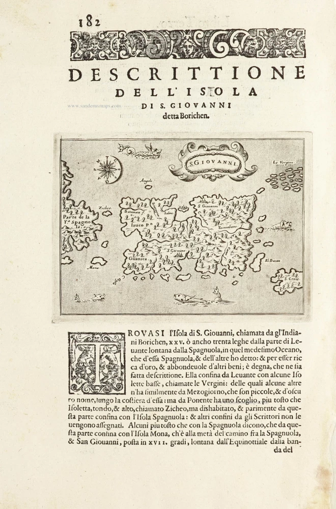
S.Giovanni. - [Above map :] Descrittione del l'Isola di S. Giovanni detta Borichen. 1590
Puerto Rico by Tommaso Porcacchi.
[Item number: 29810]