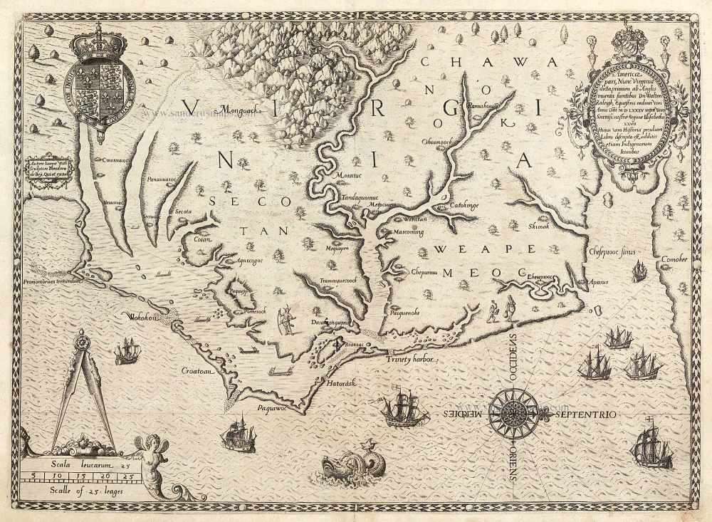
Antique map of North Carolina - Virginia by de Bry Th. - White 1590
Americae pars, Nunc Virginia dicta primum ab Anglis inventa sumtibus.
Item Number: 2958 Authenticity Guarantee
Category: Antique maps > America > North America
Antique map of North Carolina - Virginia by de Bry Th. - White
Copper engraving
Size: 30.5 x 31.5cm (11.9 x 12.3 inches)
Verso: Blank
Condition: Wide margins, a few small stains, nice copy.
References: Burden 76 State 2; Cumming, 12; Stephenson & McKee p.26 I-2.
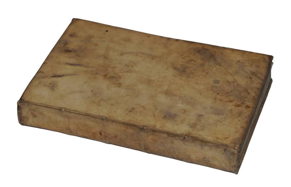
From: Harriot, Thomas. Admiranda Narratio fida tamen, de Commodis et Incolarum Ritibus Virginiae. Frankfurt, 1590.
Harriot's work is Part 1 of Theodorus De Bry's Collectiones Peregrinationum in Indiam Occidentalem. (25 parts) Frankfurt, 1590-1634.
Burden: "Theodore de Bry's map of Virginia, after John White, is one of the most significant cartographical milestones in colonial North American history. It was the most accurate map drawn in the sixteenth century of any part of that continent. It became the prototype of the area long after James Moxon's map in 1671. The region of Chesapeake Bay was, however, improved by the surveying of John Smiths around 1607. This is the first map to focus on Virginia (now largely North Carolina), and records the first English attempts at colonisation in the New World.
After the failed attempts of Martin Frobisher in finding a North West Passage through to Asia, the attention of the English turned towards America itself and forming their own settlement. Both Spain and for some time France, its two main rivals for power, had developed some considerable knowledge of American waters. England did not want to be left out. The publication of Michael Lok's map in 1582 had tantalisingly depicted at the rough latitude of Carolina a large inland sea that connected with the Pacific Ocean. This was derived from Giovanni di Verazzano's mistaken understanding of the Carolina Sounds when he passed by the Outer Banks in 1524. It was also positioned conveniently between the French centred around the Gulf of St. Lawrence and the Spanish in Florida.
A reconnoitre was sent out by Walter Raleigh in 1584 under the command of Captains Philip Amadas and Arthur Barlow to select a suitable landing site. They chose Roanoke Island and after six weeks returned to England. Immediately Raleigh started preparations for a permanent settlement, and in January 1585 he was knighted by Queen Elizabeth I. The new colony was to be named in her honour Virginia. In April Sir Richard Grenville left Plymouth and in late June started some initial explorations of the Caroline Sounds. Landing at Roanoke they built a fort and prepared for the winter; Grenville returned home leaving a number of men behind. Small parties were sent out which included the scientist and surveyor Thomas Harriot and the artist John White. Between them they recorded and mapped the areas they visited. White sketched some beautifully finished drawings, a number of which reside today at the British Library. In the meantime the colony suffered from bad provisions and poor relations, both with the indians and between themselves. When Sir Francis Drake passed by in June 1586 at the end of his West Indian voyage, and saw the state they were in, he carried all of the survivors with him back to England. For a brief period the colony was abandoned. Later in the summer Grenville arrived and finding nobody there promptly left only fifteen men and returned. These men disappeared, probably lost to Indian attacks.
The fourth voyage to the area arrived in July 1587 and White, who was now Governor, set about restoring the remains of the settlement. He was, however, persuaded to sail back for England to obtain more supplies. He was never to see his daughter again, or his grand-daughter Virginia Dare who was the first English person born in America. By the time he arrived back in England, it was under serious threat of attack from the Spanish Armada, so no ships could be spared. On his eventual return to the area during the summer of 1590 he found no survivors. To this day nobody knows the fate of the colonists.
With the understandable distractions of the Spanish Armada interest in the Roanoke colony in England was fading. To keep this up, in 1588 Thomas Harriot published his A briefe and true report of the new found land of Virginia. At this time Theodore de Bry was in London trying to acquire Jacques le Moyne's original drawings of the French colonial attempt in Florida during the 1560s. He had in mind to publish an illustrated account of the venture. However, Raleigh and the other persuaded him to publish Harriot's account and illustrate it with White's drawings. It was published in Frankfurt, 1590, in four languages: Latin, German, French and English. They were published within ten days of each other. The English and French editions are by far the rarest. There was a further latin one in c.1608 containing the map. The German edition appeared again in 1600 and 1620, both with the map.
The map concerned depicts the area from Chesapeake Bay to Cape Lookout. It exhibits greater knowledge than on any of the surviving manuscripts. Possibly this is from knowledge gained during White's brief visit in 1587 and signifies some lost manuscripts. Here we find the first printed use of the name Chesapeake, Chesepiooc Sinus, and the second of Roanoke (the first being Mazza). It depicts the positions of the Indian villages in the area and is adorned with the Royal Arms of England. The Latter's ships are shown at sea with Indian canoes traversing the inland waters. The two native scenes shown are taken from illustrations in the book. It influenced many maps, most notably those of de Jode 1593, Wytfliet 1597 and Metellus 1598. There are three states of the map, this is the second one with a 'C' superimposed on the first letter of the village called Ehesepiooc ." (Burden)
"... Although this map lacks the authenticity of White's manuscript map of approximately the same area, the addition of some names and an improvement in coastal delineation may show increased knowledge gaines in 1587-88, after the manuscript map was made.
De Bry's engraving of White's watercolor map is one of the most important type maps in Carolina cartography. ..." (Cumming)
"The new geographical information imparted by the White-de Bry engraving swept through Europe and was incorporated into maps by other publishers for at least eighty years. Roanoke Island, neighboring Indian villages, and other features are identified. In addition, the entrance to the Chesapeake Bay, Chesepiooc Sinus, is named for the first time on a published map. De Bry oriented White's map to show west at the top rather than north. This became the preferred orientation for published maps of Virginia and other eastern seaboard colonies until the eighteenth century." (Stephenson & McKee).


