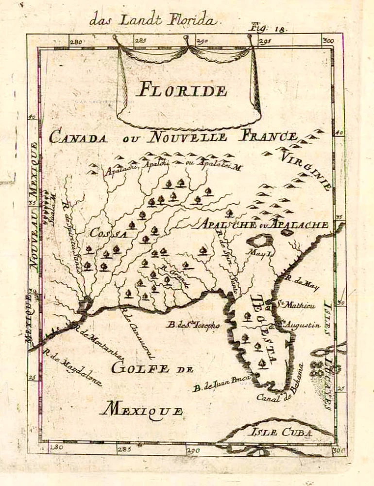
Florida - Louisiana by Rigobert Bonne. 1780

In detail, it shows Florida, Georgia, and South Carolina westward to the Mississippi and the mountainous western parts of North Carolina and Virginia.
Rigobert Bonne (1729-1795)
Rigobert Bonne was a French cartographer considered one of the most important cartographers of the late 18th century.
He applied himself to physics, mathematics, geography, and for fifteen years, he was one of the most sought-after masters in Paris. Finally, in 1775, he succeeded Giovanni Rizzi-Zannoni as cartographer to the King of France in the Hydrographic Service of the Navy.
He produced maps for Father Raynal's works and the Methodical Encyclopedia of Nicolas Desmarest.
The work of Bonne is highly regarded for its detail, historical importance, and overall aesthetic appeal.
Carte de la Louisiane et de la Floride.
Item Number: 28303 Authenticity Guarantee
Category: Antique maps > America > North America
Old, antique map of Florida - Louisiana, by Bonne Rigobert.
Inset: Portion of the Missouri River.
Title: Carte de la Louisiane et de la Floride.
Par M. Bonne, Ingénieur-Hydrogph de la Marine.
Gravé par André.
Date of the first edition: 1780.
Date of this map: 1780.
Copper engraving, printed on paper.
Size (not including margins): 325 x 215mm (12.8 x 8.46 inches).
Verso: Blank.
Condition: Small stain at bottom centre, else good.
Condition Rating: A.
References: Cumming, #326
From: Raynal G.Th. Atlas de toutes les parties connues du Globe Terrestre, dressé pour l'Histoire Philosophique et Politique des Établissemens et du Commerce des Européens dans les Deux Indes. Genève, J.-L. Pellet, 1780.
In detail, it shows Florida, Georgia, and South Carolina westward to the Mississippi and the mountainous western parts of North Carolina and Virginia.
Rigobert Bonne (1729-1795)
Rigobert Bonne was a French cartographer considered one of the most important cartographers of the late 18th century.
He applied himself to physics, mathematics, geography, and for fifteen years, he was one of the most sought-after masters in Paris. Finally, in 1775, he succeeded Giovanni Rizzi-Zannoni as cartographer to the King of France in the Hydrographic Service of the Navy.
He produced maps for Father Raynal's works and the Methodical Encyclopedia of Nicolas Desmarest.
The work of Bonne is highly regarded for its detail, historical importance, and overall aesthetic appeal.