
In luxury colouring
New England by Joannes Janssonius. 1666

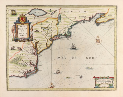

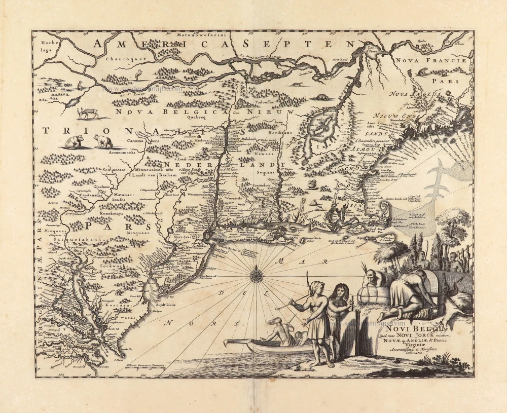
"This influential map is derived from the less well-circulated Johannes de Laet of 1630. Enlarged and expanded to the north and east slightly, it carries de Laet's narrative on the reverse. De Laet's map is crucial, being the first printed to use the names Manbattes (Manhattan) and N.Amsterdam. The nomenclature is also virtually identical, with a few minor differences, most likely owing to the engraver's error. C. of Feare is still depicted over 2° too far south. This is not Cape Fear we know of today but Cape Lookout. During the fiercely competitive decade of the 1630s, the families of Blaeu and Hondius-Janssonius often produced maps drawn directly from one another. However, Janssonius produced one that was not followed by Blaeu, the latter relying upon the more restricted map of NOVA BELGICA to represent the land north of Chesapeake Bay. A sign of the Dutch influence here is that both atlas producers largely declined to include the advanced cartography of Champlain, thereby relegating it together. In his delineation of the Great Lakes area, Janssonius differs from Hondius' AMERICA SEPTENTRIONALIS. The extension northwards enables him to encapsulate Grand Lac, something de Laet did not do. Although Karpinski claims this to be the first map to show a complete Lake Superior, there is no evidence to suggest that this lake was meant; it more likely represents Lake Huron. There are three known states of the map. In 1647 Janssonius altered the title to match that of the Blaeu to give greater prominence to the Dutch colonies. He also draws on Blaeu for the cartouche design, the Indian village scene and much of the wildlife depicted. The nomenclature is unchanged. A third state appeared following the auction of the copperplates in 1694, acquired by Petrus Schenk from the heirs of Jansson van Waesberge." (Burden)
The Janssonius Family
Joannes Janssonius (Arnhem, 1588-1664), son of the Arnhem publisher Jan Janssen, married Elisabeth Hondius, daughter of Jodocus Hondius, in Amsterdam in 1612. After his marriage, he settled down in this town as a bookseller and publisher of cartographic material. In 1618, he established himself in Amsterdam next door to Blaeu’s bookshop. He entered into serious competition with Willem Jansz. Blaeu when copying Blaeu’s Licht der Zeevaert after the expiration of the privilege in 1620. His activities concerned the publication of atlases, books, single maps, and an extensive book trade with branches in Frankfurt, Danzig, Stockholm, Copenhagen, Berlin, Koningsbergen, Geneva, and Lyon. In 1631, he began publishing atlases together with Henricus Hondius.
In the early 1640s, Henricus Hondius left the atlas publishing business to Janssonius. Competition with Joan Blaeu, Willem’s son and successor, in atlas production, prompted Janssonius to enlarge his Atlas Novus finally into a work of six volumes, into which a sea atlas and an atlas of the Old World were inserted. Other atlases published by Janssonius are Mercator’s Atlas Minor, Hornius’s historical atlas (1652), the townbooks in eight volumes (1657), Cellarius’s Atlas Coelestis and several sea atlases and pilot guides.
After the death of Joannes Janssonius, the shop and publishing firm were continued by the heirs under the direction of Johannes van Waesbergen (c. 1616-1681), son-in-law of Joannes Janssonius. Van Waesbergen added Janssonius's name to his own.
In 1676, Joannes Janssonius’s heirs sold by auction “all the remaining Atlases in Latin, French, High and Low German, as well as the Stedeboecken in Latin, in 8 volumes, bound and unbound, maps, plates belonging to the Atlas and Stedeboecken.” The copperplates from Janssonius’s atlases were afterwards sold to Schenk and Valck.
Nova Belgica et Anglia Nova.
Item Number: 29954 Authenticity Guarantee
Category: Antique maps > America > North America
Old, antique map of New England by Joannes Janssonius.
Title: Nova Belgica et Anglia Nova.
Amstelodami Johannes Janßonius Excudit.
Date of the first edition: 1644.
Date of this map: 1666.
Copper engraving, printed on paper.
Image size: 390 x 505mm (15.35 x 19.88 inches).
Sheet size: 520 x 600mm (20.47 x 23.62 inches).
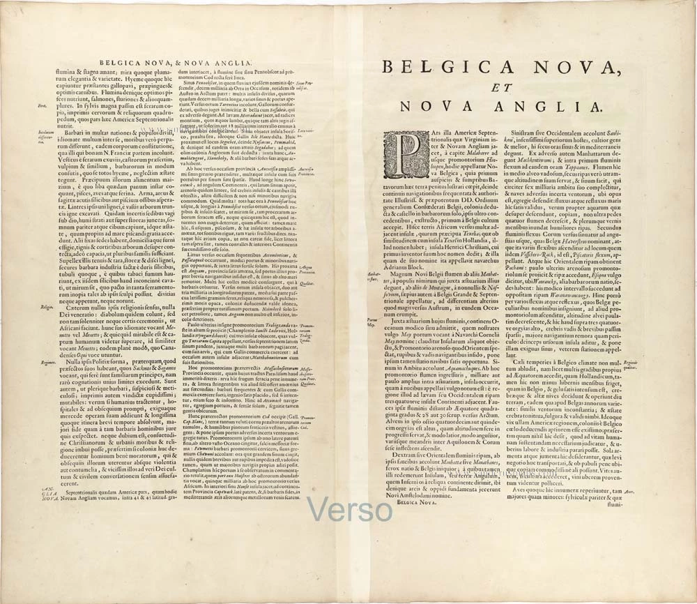
Verso: Latin text.
Condition: Superb original coloured, heightened with gold.
Condition Rating: A+.
From: Joannis Janssonii Atlas Contractus, sive Atlantis Majoris Compendium, . . . Amsterdam, Janssonius Heirs, 1666. (Van der Krogt, 1:407)
"This influential map is derived from the less well-circulated Johannes de Laet of 1630. Enlarged and expanded to the north and east slightly, it carries de Laet's narrative on the reverse. De Laet's map is crucial, being the first printed to use the names Manbattes (Manhattan) and N.Amsterdam. The nomenclature is also virtually identical, with a few minor differences, most likely owing to the engraver's error. C. of Feare is still depicted over 2° too far south. This is not Cape Fear we know of today but Cape Lookout. During the fiercely competitive decade of the 1630s, the families of Blaeu and Hondius-Janssonius often produced maps drawn directly from one another. However, Janssonius produced one that was not followed by Blaeu, the latter relying upon the more restricted map of NOVA BELGICA to represent the land north of Chesapeake Bay. A sign of the Dutch influence here is that both atlas producers largely declined to include the advanced cartography of Champlain, thereby relegating it together. In his delineation of the Great Lakes area, Janssonius differs from Hondius' AMERICA SEPTENTRIONALIS. The extension northwards enables him to encapsulate Grand Lac, something de Laet did not do. Although Karpinski claims this to be the first map to show a complete Lake Superior, there is no evidence to suggest that this lake was meant; it more likely represents Lake Huron. There are three known states of the map. In 1647 Janssonius altered the title to match that of the Blaeu to give greater prominence to the Dutch colonies. He also draws on Blaeu for the cartouche design, the Indian village scene and much of the wildlife depicted. The nomenclature is unchanged. A third state appeared following the auction of the copperplates in 1694, acquired by Petrus Schenk from the heirs of Jansson van Waesberge." (Burden)
The Janssonius Family
Joannes Janssonius (Arnhem, 1588-1664), son of the Arnhem publisher Jan Janssen, married Elisabeth Hondius, daughter of Jodocus Hondius, in Amsterdam in 1612. After his marriage, he settled down in this town as a bookseller and publisher of cartographic material. In 1618, he established himself in Amsterdam next door to Blaeu’s bookshop. He entered into serious competition with Willem Jansz. Blaeu when copying Blaeu’s Licht der Zeevaert after the expiration of the privilege in 1620. His activities concerned the publication of atlases, books, single maps, and an extensive book trade with branches in Frankfurt, Danzig, Stockholm, Copenhagen, Berlin, Koningsbergen, Geneva, and Lyon. In 1631, he began publishing atlases together with Henricus Hondius.
In the early 1640s, Henricus Hondius left the atlas publishing business to Janssonius. Competition with Joan Blaeu, Willem’s son and successor, in atlas production, prompted Janssonius to enlarge his Atlas Novus finally into a work of six volumes, into which a sea atlas and an atlas of the Old World were inserted. Other atlases published by Janssonius are Mercator’s Atlas Minor, Hornius’s historical atlas (1652), the townbooks in eight volumes (1657), Cellarius’s Atlas Coelestis and several sea atlases and pilot guides.
After the death of Joannes Janssonius, the shop and publishing firm were continued by the heirs under the direction of Johannes van Waesbergen (c. 1616-1681), son-in-law of Joannes Janssonius. Van Waesbergen added Janssonius's name to his own.
In 1676, Joannes Janssonius’s heirs sold by auction “all the remaining Atlases in Latin, French, High and Low German, as well as the Stedeboecken in Latin, in 8 volumes, bound and unbound, maps, plates belonging to the Atlas and Stedeboecken.” The copperplates from Janssonius’s atlases were afterwards sold to Schenk and Valck.
Related items
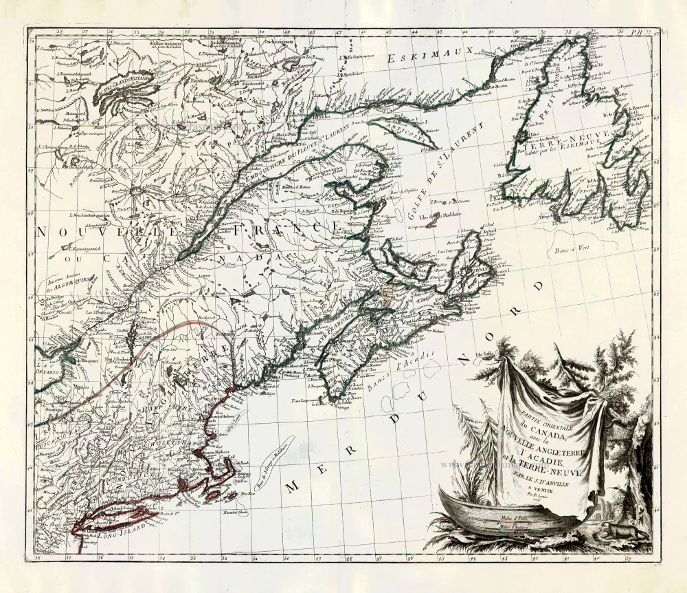
Partie Orientale du Canada, avec la Nouvelle Angleterre, l'Acadie, et la Terre-Neuve. 1776-79
New England and Northeastern Canada, by Paolo Santini.
[Item number: 26982]
Extremely important map with a view of New York
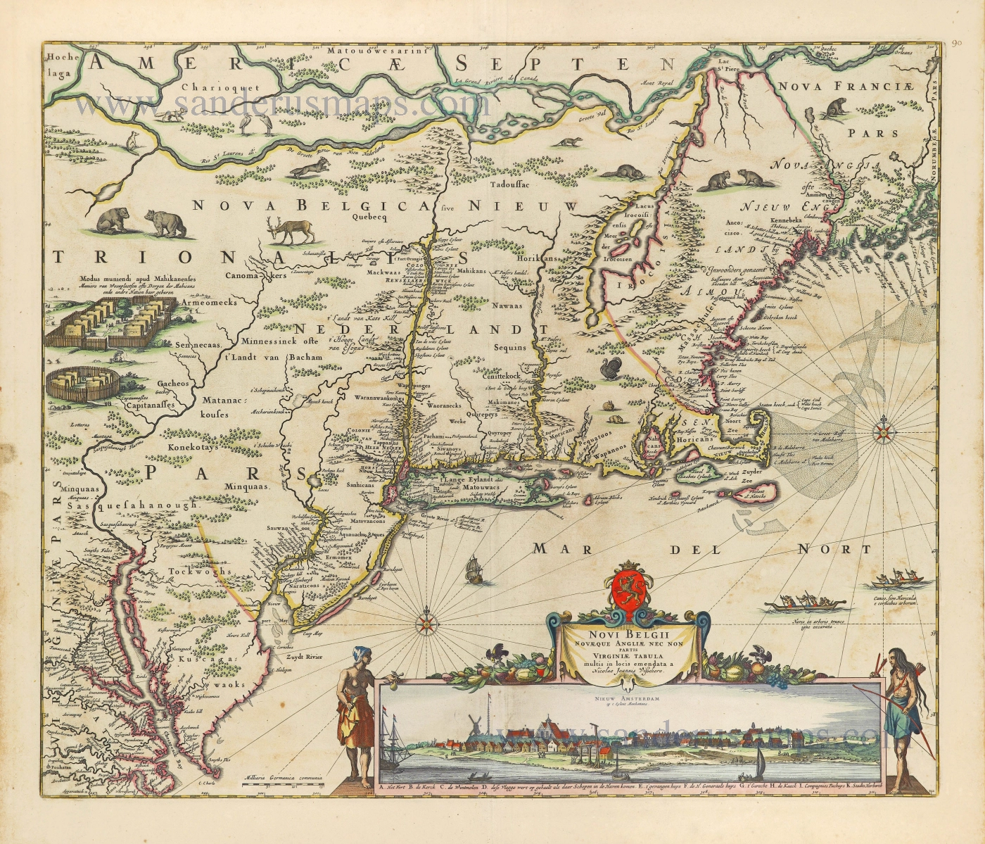
Novi Belgii novaeque Angliae nec non partis Virginiae Tabula. 1656-77
New England by Nicolaes Visscher I.
[Item number: 28549]
Novi Belgii quod nunc Novi Jorck vocatur, Novae q. Angliae, & Partis Virginiae. 1671
New York - New England by Arnoldus Montanus.
[Item number: 28880]

Important map in excellent condition
Nova Belgica et Anglia Nova. 1640
New England - Nova Belgica, by Willem Blaeu.
[Item number: 28953]