
New England and Northeastern Canada, by Paolo Santini. 1776-79

Francesco and Paolo Santini (c.1729-1793)
Francesco Santini, a Venetian publisher, acquired the printing plates of Vaugondy’s Atlas Universel …, a commercial and cartographic success, with widespread influence on mapmakers throughout Europe. Together with his brother Paolo, he commissioned a new set of plates and reissued the atlas in 1776. The following year, Paolo Santini assigned all his publication rights to M. Remondini, who in 1777 reissued the same atlas but with his name.
Jean-Baptiste Bourguignon d'Anville (1697 -1782)
French geographer and cartographer to the king. He made more than 200 maps during his life. His maps remained the reference point in cartography throughout the 19th century.
Partie Orientale du Canada, avec la Nouvelle Angleterre, l'Acadie, et la Terre-Neuve.
Item Number: 26982 Authenticity Guarantee
Category: Antique maps > America > North America
Old, antique map of New England and Northeastern Canada, by Paolo Santini.
First state with the imprint of Remondini: with engraved page numbers in the top right corner: "P.II.47".
Cartographer: Jean Baptiste Bourguignon d'Anville
Date of the first edition: 1776
Date of this map: 1776
Copper engraving, printed on paper.
Size (not including margins): 48.5 x 57.5cm (18.9 x 22.4 inches)
Verso: Blank
Condition: Original coloured in outline, excellent.
Condition Rating: A+
References: Kershaw, #713.
From: Atlas Universel dressé sur les meilleures cartes modernes. Venice, Remondini, 1776-79.
Francesco and Paolo Santini (c.1729-1793)
Francesco Santini, a Venetian publisher, acquired the printing plates of Vaugondy’s Atlas Universel …, a commercial and cartographic success, with widespread influence on mapmakers throughout Europe. Together with his brother Paolo, he commissioned a new set of plates and reissued the atlas in 1776. The following year, Paolo Santini assigned all his publication rights to M. Remondini, who in 1777 reissued the same atlas but with his name.
Jean-Baptiste Bourguignon d'Anville (1697 -1782)
French geographer and cartographer to the king. He made more than 200 maps during his life. His maps remained the reference point in cartography throughout the 19th century.
Related items

Estotilandia et Laboratoris Terra. 1607
Greenland and Northeast Canada, by C. van Wytfliet.
[Item number: 26499]
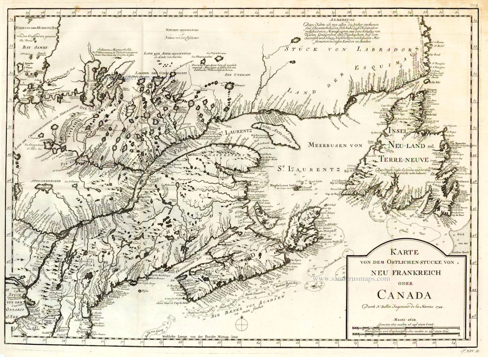
Karte von dem Ostlichen-Stucke von Neu Frankreich oder Canada. 1747-74
Eastern Canada, by Jacques Nicolas Bellin.
[Item number: 26796]

Suite de la Carte Reduite du Golphe de St. Laurent Contenant les Costes de Labrador depuis Mecatina jusqu'a la Baye des Esquimaux le Detroit de Belle-Isle Et partie des Costes de l'Isle de Terre Neuve Connues sous le Nom du Petit Nord 1753
St. Lawrence River, by J.N. Bellin.
[Item number: 27914]

Carte Réduite du Golphe de St. Laurent Contenant l'Isle de Terre-Neuve et Partie de la Coste des Esquimaux l'Isle Royale, l'Isle St. Jean et celle d'Anticosti &ca. 1754
St. Lawrence Gulf, by Jacques Nicholas Bellin.
[Item number: 27915]

Septemtrionaliora Americae à Groenlandia, per Freta Davidis et Hudson, ad Terram Novam = De Noordelyckste Zee kusten van America van Goenland door de Straet Davis ende Straet Hudson tot Terra Neuf. c. 1690
North-Eastern Coasts of North America (Canada), by Frederick de Wit.
[Item number: 29242]
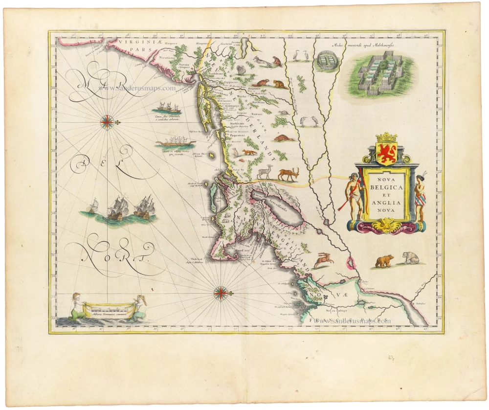
Nova Belgica et Anglia Nova. 1645
New England by Willem Blaeu
[Item number: 33023]
new