
Northern Europe, North Atlantic Ocean by Abraham Ortelius. 1609
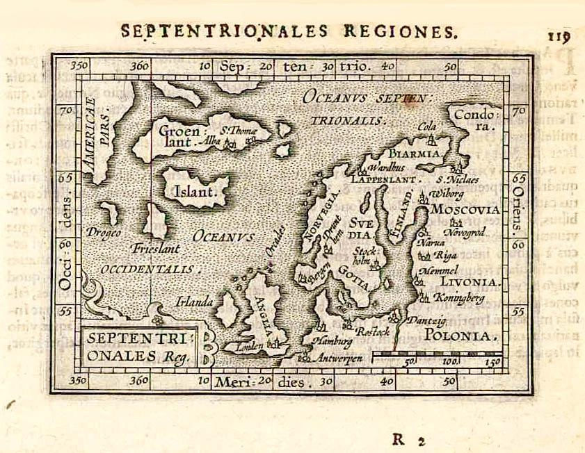
In 1601 Johannes Keerbergen produced a competitive version of the successful miniature Ortelius atlas. Michel Coignet provided the text, and Ambrosius and Ferdinand Arsenius cut a new series of copperplates. These new maps had latitude and longitude markings. This map shows Scandinavia and the North Atlantic with parts of North America. Well engraved, its most exciting feature is Russia's easterly inclined north coast, indicating a North-East Passage.
Abraham Ortelius (1527-1598)
The maker of the 'first atlas', the Theatrum Orbis Terrarum (1570), was born on 4 April 1527 into an old Antwerp family. He learned Latin and studied Greek and mathematics.
Abraham and his sisters Anne and Elizabeth took up map colouring. Ortelius was admitted to the Guild of St. Luke as an "illuminator of maps." In addition to colouring maps, Ortelius was a dealer in antiques, coins, maps, and books, and the book and map trade gradually became his primary occupation.
Business went well because his means permitted him to start an extensive collection of medals, coins, antiques, and a library of many volumes. In addition, he travelled a lot, visited Italy and France, made contacts everywhere with scholars and editors, and maintained extensive correspondence with them.
In 1564, he published his first map, a large and ambitious world wall map. The inspiration for this map may well have been Gastaldi's large world map. In 1565, he published a map of Egypt and a map of the Holy Land; a large map of Asia followed.
In 1568, the production of individual maps for his atlas Theatrum Orbis Terrarum was already in full swing. He completed the atlas in 1569, and in May 1570, it was available for sale. It was one of the most expensive books ever published.
This first edition contained seventy maps on fifty-three sheets. Franciscus Hogenberg engraved the maps.
Later editions included Additamenta (additions), resulting in Ortelius' historical atlas, the Parergon, which is mainly bound together with the atlas. The Parergon can be considered a truly original work by Ortelius, who drew the maps based on his research.
The importance of the Theatrum Orbis Terrarum for geographical knowledge in the last quarter of the sixteenth century is difficult to overemphasize. Nothing was like it until Mercator's atlas appeared twenty-five years later. Demand for the Theatrum was remarkable. Some 24 editions appeared during Ortelius's lifetime and another 10 after he died in 1598. Editions were published in Dutch, German, French, Spanish, English, and Italian. The number of map sheets grew from 53 in 1570 to 167 in 1612 in the last edition.
In 1577, engraver Philip Galle and poet-translator Pieter Heyns published the first pocket-sized edition of the Theatrum, the Epitome. The work was trendy. Over thirty editions of this Epitome were published in different languages.
Septentrionales Reg.
Item Number: 27695 Authenticity Guarantee
Category: Antique maps > America > North America
Old, antique map of Northern Europe, by Abraham Ortelius.
Date of the first edition: 1601
Date of this map: 1609
Copper engraving, printed on paper.
Size (not including margins): 8.5 x 12cm (3.3 x 4.7 inches)
Verso text: Latin
Condition: Excellent.
Condition Rating: A+
References: Van der Krogt 3, 1200:333; Burden, #144, Ginsberg (Scandinavia), #50; Ginsberg (Septentrionalium), #35
From: Epitome Theatri Orbis Terrarum Abrahami Ortelij. Antwerpen, Jan Baptist Vrients, 1609. (Van der Krogt 333:02A)
In 1601 Johannes Keerbergen produced a competitive version of the successful miniature Ortelius atlas. Michel Coignet provided the text, and Ambrosius and Ferdinand Arsenius cut a new series of copperplates. These new maps had latitude and longitude markings. This map shows Scandinavia and the North Atlantic with parts of North America. Well engraved, its most exciting feature is Russia's easterly inclined north coast, indicating a North-East Passage.
Abraham Ortelius (1527-1598)
The maker of the 'first atlas', the Theatrum Orbis Terrarum (1570), was born on 4 April 1527 into an old Antwerp family. He learned Latin and studied Greek and mathematics.
Abraham and his sisters Anne and Elizabeth took up map colouring. Ortelius was admitted to the Guild of St. Luke as an "illuminator of maps." In addition to colouring maps, Ortelius was a dealer in antiques, coins, maps, and books, and the book and map trade gradually became his primary occupation.
Business went well because his means permitted him to start an extensive collection of medals, coins, antiques, and a library of many volumes. In addition, he travelled a lot, visited Italy and France, made contacts everywhere with scholars and editors, and maintained extensive correspondence with them.
In 1564, he published his first map, a large and ambitious world wall map. The inspiration for this map may well have been Gastaldi's large world map. In 1565, he published a map of Egypt and a map of the Holy Land; a large map of Asia followed.
In 1568, the production of individual maps for his atlas Theatrum Orbis Terrarum was already in full swing. He completed the atlas in 1569, and in May 1570, it was available for sale. It was one of the most expensive books ever published.
This first edition contained seventy maps on fifty-three sheets. Franciscus Hogenberg engraved the maps.
Later editions included Additamenta (additions), resulting in Ortelius' historical atlas, the Parergon, which is mainly bound together with the atlas. The Parergon can be considered a truly original work by Ortelius, who drew the maps based on his research.
The importance of the Theatrum Orbis Terrarum for geographical knowledge in the last quarter of the sixteenth century is difficult to overemphasize. Nothing was like it until Mercator's atlas appeared twenty-five years later. Demand for the Theatrum was remarkable. Some 24 editions appeared during Ortelius's lifetime and another 10 after he died in 1598. Editions were published in Dutch, German, French, Spanish, English, and Italian. The number of map sheets grew from 53 in 1570 to 167 in 1612 in the last edition.
In 1577, engraver Philip Galle and poet-translator Pieter Heyns published the first pocket-sized edition of the Theatrum, the Epitome. The work was trendy. Over thirty editions of this Epitome were published in different languages.
Related items
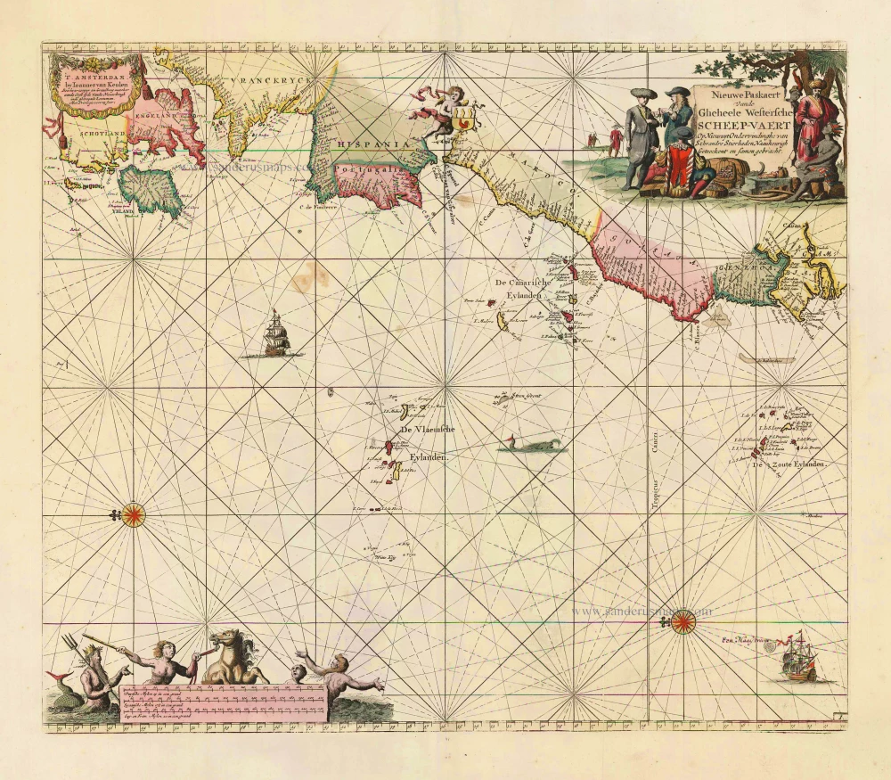
Nieuwe Paskaert vande Gheheele Westersche Scheep-Vaert, op Nieus uyt Ondervindinghe van Schrandre Stierlieden Naaukeurigh Geteeckent en Samen Gebracht. 1697-1709
The Atlantic Ocean, by J. Van Keulen.
[Item number: 11218]

Ocean Atlantique et Mers Adjacentes en Quatre Feuilles Contenant les Cotes de l'Europe, de l'Afrique et de l'Amerique ... 1778
The Atlantic Ocean, by G.L. Le Rouge.
[Item number: 14086]
Rare.
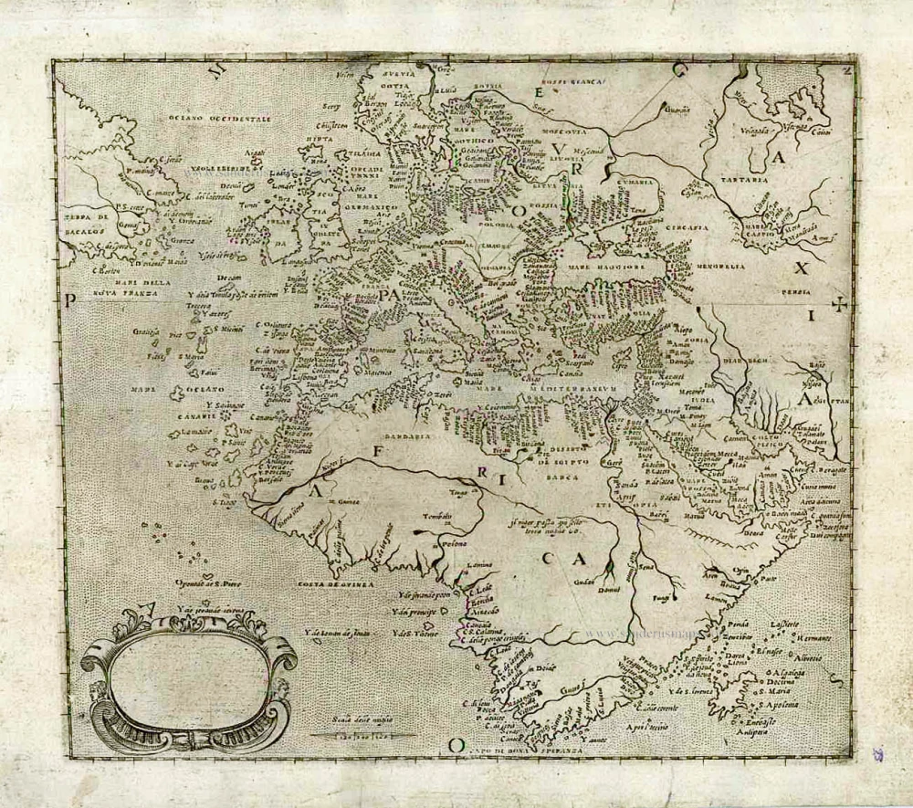
[No title] c. 1575
Atlantic Ocean - Europe, Africa & Eastern Canada by Giovanni Francesco Camocio
[Item number: 27086]
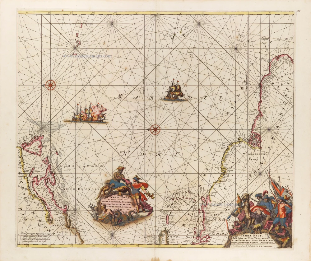
Terra Nova ac Maris Tractus circa Novam Franciam, Angliam, Belgium, Venezuelam Novam, Andalusiam, Guianam, et Brasiliam. - Terra Neuf, en de Custen van Nieu Vranckryck, Nieu Engeland, Nieu Nederland, Nieu Andalusia, Guiana en Venezuela. c. 1680
The Western Atlantic Ocean, by Frederick de Wit.
[Item number: 29175]