
United States (Northeast), by Girolamo Ruscelli. 1598
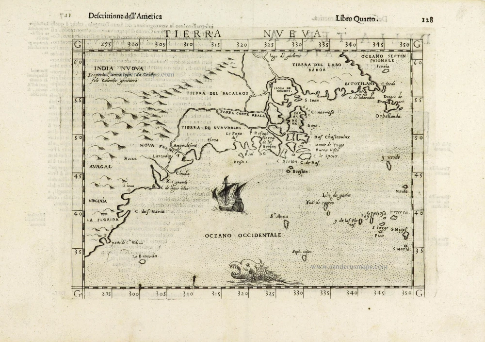
This map of the east coast is an enlarged version of Giacomo Gastaldi's published in 1548. The nomenclature and cartography are unchanged, with the exception of the depiction of the rivers. Here he borrowed the assumption of Ramusio that the Hudson and St. Lawrence Rivers, as we know them today, were connected upriver.
Here in this third state, additional names have been added, notably "Virginia" and "Estotilandia". The blank sea has been decorated with a ship and sea monster, and there are additional mountains engraved to fill the blank area in the west.
Girolamo Ruscelli (1504 (1518?) -1566)
Girolamo Ruscelli was an Italian mathematician and cartographer who worked in Venice in the early 16th century. He was also an alchemist who wrote pseudonymously as Alessio Piemontese.
He published a translation of the Geografia of Ptolemy, printed in Venice by Vincenzo Valgrisi in 1561. It was a quarto edition with Ptolemaic and modern maps. The engravers may have been the brothers Giulio and Livio Sanuto. Among the 69 copperplate maps were 40 based on maps by Giacomo Gastaldi. The maps were re-issued in 1562, 1564, 1574 and 1598.
Tierra Nueva.
Item Number: 28429 Authenticity Guarantee
Category: Antique maps > America > North America
Old, antique map of the Northeast of the United States, by Girolamo Ruscelli.
Title: Tierra Nueva.
Cartographer: Giacomo Gastaldi.
Engraver: Giulio & Livio Sanuto.
Date of the first edition: 1561.
Date of this map: 1598.
Copper engraving, printed on paper.
Size (not including margins): 190 x 250mm (7.48 x 9.84 inches).
Verso: Italian text.
Condition: Sharp impression, excellent.
Condition Rating: A+.
References: Burden, #30, 3rd state; Kershaw I, p. 23 Plate 13
From: La Geografia di Claudio Tolomeo Alessandrino, Tradotta di Greco nell'Idioma Volgare Italiano da M. Girolamo Ruscelli, et hora nouvamente ampliata da Gioseffo Rosaccio ... In Venetia, MDXCVIII [1598]. (Shirley (Brit. Lib.), T.PTOL-10f)
This map of the east coast is an enlarged version of Giacomo Gastaldi's published in 1548. The nomenclature and cartography are unchanged, with the exception of the depiction of the rivers. Here he borrowed the assumption of Ramusio that the Hudson and St. Lawrence Rivers, as we know them today, were connected upriver.
Here in this third state, additional names have been added, notably "Virginia" and "Estotilandia". The blank sea has been decorated with a ship and sea monster, and there are additional mountains engraved to fill the blank area in the west.
Girolamo Ruscelli (1504 (1518?) -1566)
Girolamo Ruscelli was an Italian mathematician and cartographer who worked in Venice in the early 16th century. He was also an alchemist who wrote pseudonymously as Alessio Piemontese.
He published a translation of the Geografia of Ptolemy, printed in Venice by Vincenzo Valgrisi in 1561. It was a quarto edition with Ptolemaic and modern maps. The engravers may have been the brothers Giulio and Livio Sanuto. Among the 69 copperplate maps were 40 based on maps by Giacomo Gastaldi. The maps were re-issued in 1562, 1564, 1574 and 1598.
Related items
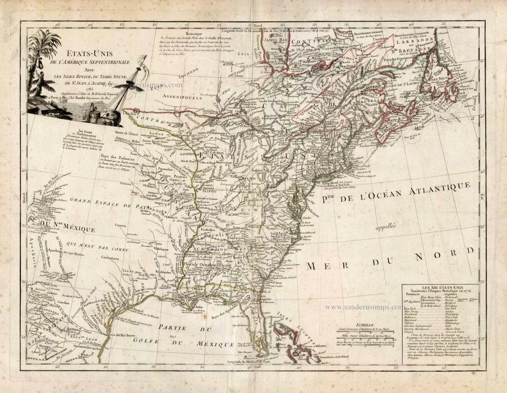
Etats-Unis de l'Amerique Septentrionale avec les Isles Royale, de Terre Neuve de St. Jean, l'Acadie &c. 1786
United States (East) by Boudet A. - de Vaugondy R.
[Item number: 25265]
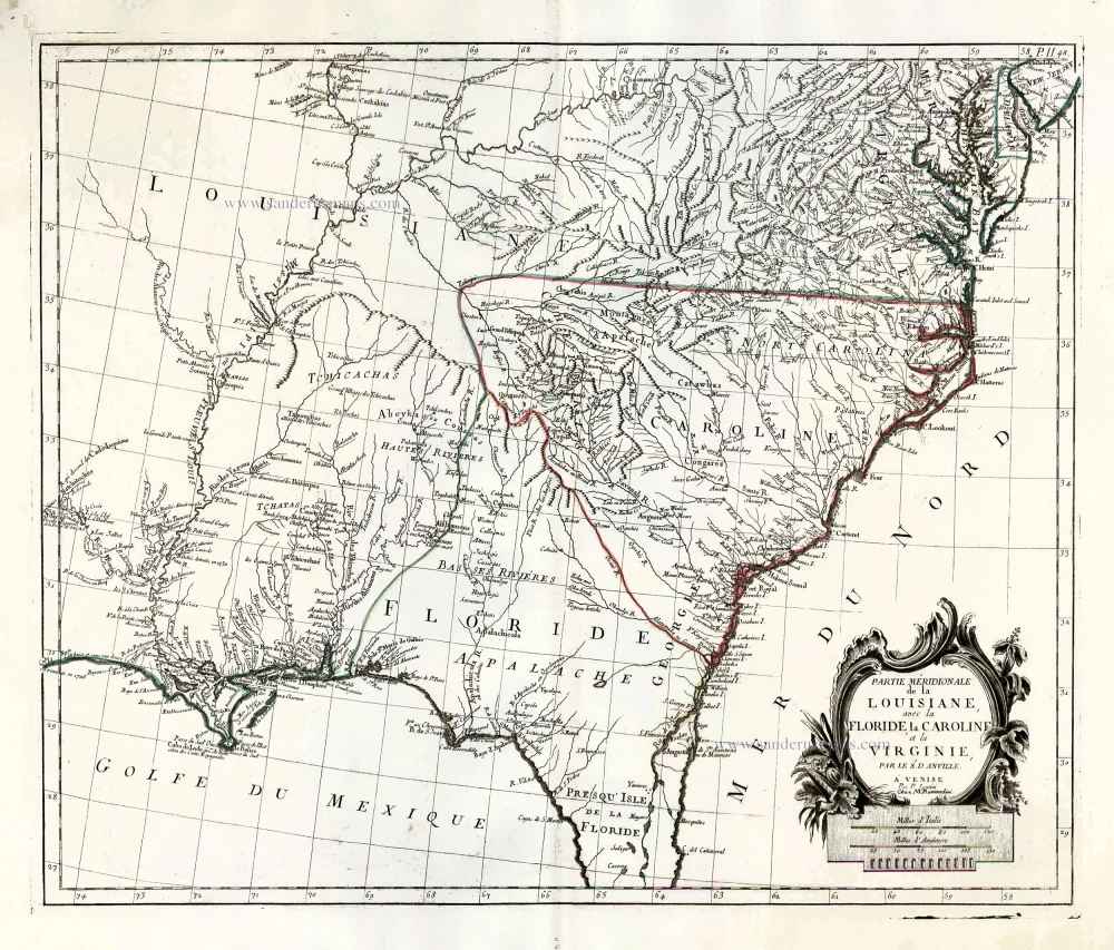
Partie Méridionale de la Louisiane, avec la Floride, la Caroline et la Virginie. 1776-79
The United States (Southeast), by Francesco Santini.
[Item number: 26983]