
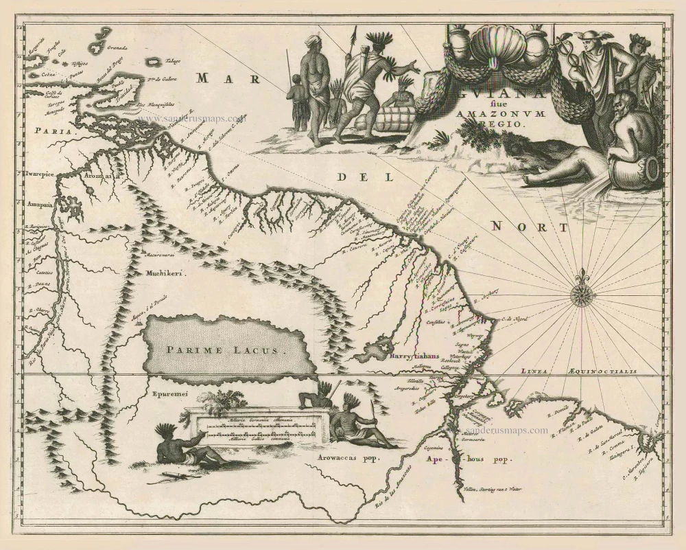
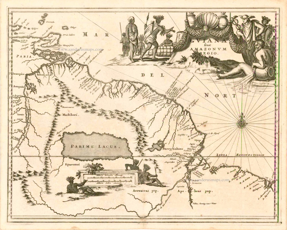
Guiana by Arias Montanus 1673
Arnoldus Montanus (c. 1625-1683)
Arnoldus Montanus was a Dutch teacher and author. He published books on theology, history, and geography. His most famous book is De Nieuwe en Onbekende weereld, of beschryving van America en 't Zuid-Land. (The New and Unknown World: or Description of America and the Southland). It was initially intended for publication in 1670. However, delays in acquiring the information he needed deferred publication until the following year. It was printed by Jacob de Meurs, who had an agreement with John Ogilby to produce an English edition which appeared later in the same year. Jacob de Meurs published a German edition translated by Dr Olfert Dapper in 1673.
The work included several engraved maps of the regions.
Guiana sive Amazonum Regio.
Currently not available
Item Number: 26729 Authenticity Guarantee
Category: Antique maps > America > South America
Guiana by Arias Montanus.
Title: Guiana sive Amazonum Regio.
Date of the first edition: 1671.
Date of this map: 1673.
Copper engraving, printed on paper.
Image size: 290 x 365mm (11½ x 14¼ inches).
Sheet size: 295 x 375mm (11½ x 14¾ inches).
Verso: Blank.
Condition: Short right margin.
Condition Rating: A+.
From: Montanus A. Die Unbekante Neue Welt, oder Beschreibung des Welt-teils Amerika. Amsterdam, 1673.
Arnoldus Montanus (c. 1625-1683)
Arnoldus Montanus was a Dutch teacher and author. He published books on theology, history, and geography. His most famous book is De Nieuwe en Onbekende weereld, of beschryving van America en 't Zuid-Land. (The New and Unknown World: or Description of America and the Southland). It was initially intended for publication in 1670. However, delays in acquiring the information he needed deferred publication until the following year. It was printed by Jacob de Meurs, who had an agreement with John Ogilby to produce an English edition which appeared later in the same year. Jacob de Meurs published a German edition translated by Dr Olfert Dapper in 1673.
The work included several engraved maps of the regions.
Related items
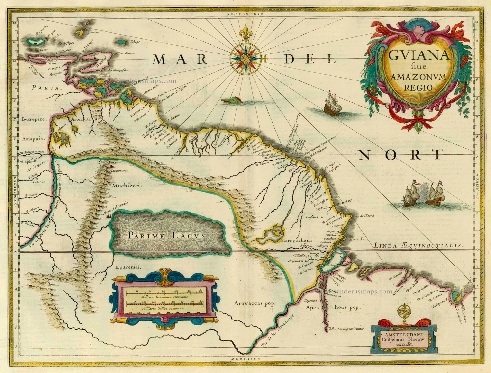
Guiana Sive Amazonum Regio. 1633
Guiana by H. Hondius.
[Item number: 7558]
Guiana sive Amazonum Regio. 1673
Guiana, by A. Montanus.
[Item number: 12480]
Guiana Sive Amazonum Regio 1654-1662
Guiana, by J. Blaeu.
[Item number: 14719]
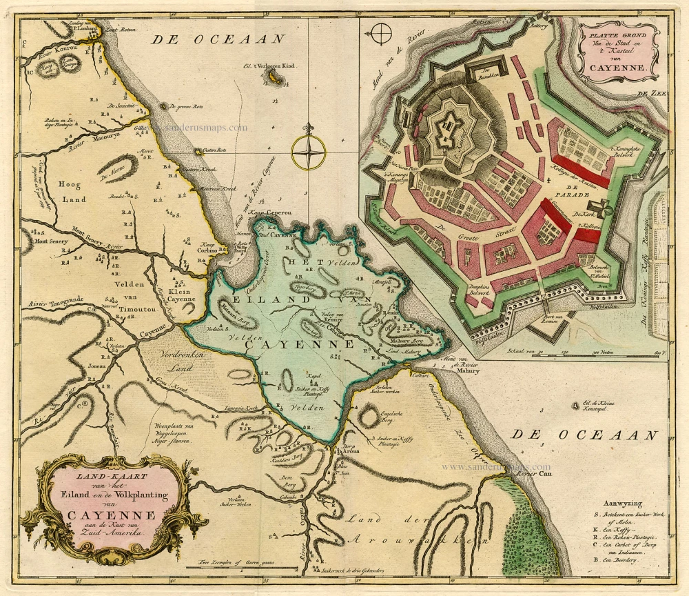
Landkaart van het Eiland en de Volkplanting van Cayenne aan de Kust van Zuid-Amerika c. 1770
Guiana - Cayenne, by Tirion I.
[Item number: 19192]
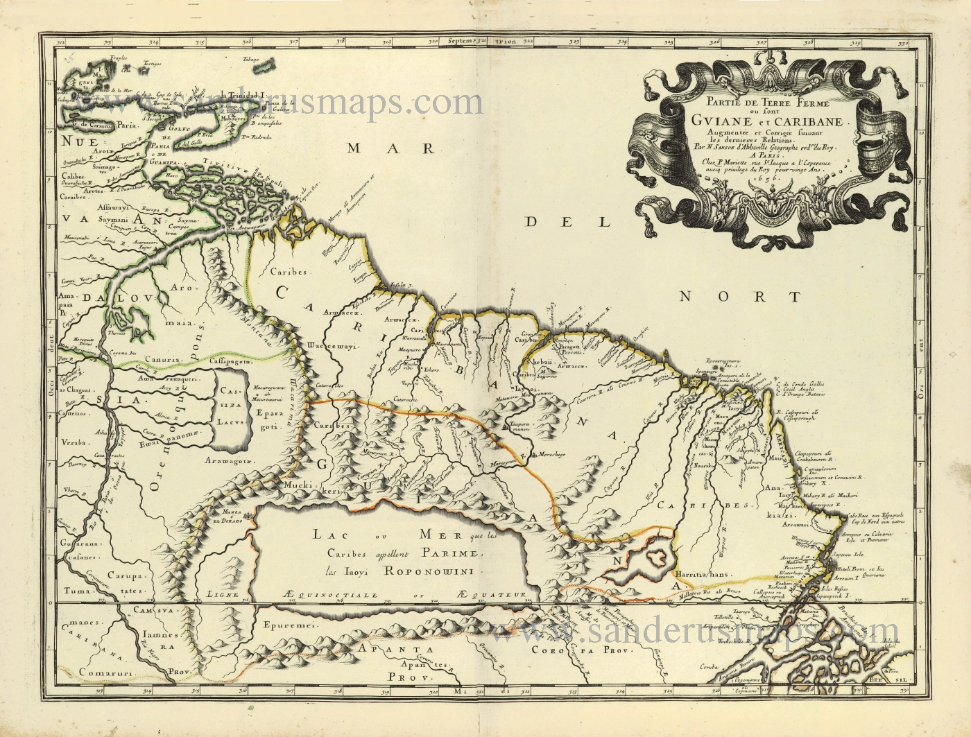
Partie de Terre Ferme ou sont Guiane et Caribane. 1658
Guiana by Nicolas Sanson.
[Item number: 28504]