
America, by Gerard Mercator. 1623

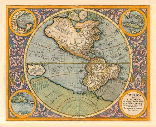
After the death of the great Gerard Mercator in 1594, it was left to his son Rumold to publish the last of three parts that formed his famous atlas, the Atlantis Pars Altera. The atlas was finished with several maps engraved by various descendants of Gerard. The task of the American map was given to his grandson, Michael. The only printed map known to be by him is beautifully engraved. It is a hemispherical map with an attractive floral design, surrounded by four roundels, one of which contains the title. The other three have maps of the Gulf of Mexico, Cuba and Hispaniola, all spheres of Spanish influence. The general outline is largely based on Rumold Mercator's world map of 1587, with a little more detail added. A few famous theories are still present: a large inland lake in Canada, two of the four islands of the North Pole, a bulge to the west coast of South America and the large southern continent. It does not show any knowledge of English in Virginia, possibly reflecting their failure by then. A large St. Lawrence River is shown, originating halfway across the continent. (Burden)
Gerard Mercator (1512 – 1594)
Gerard Mercator was born Gerard de Cremere in Rupelmonde (near Antwerp) on 5 March 1512.
Young Gerard learned what Latin he could in Rupelmonde, and when he was about fifteen, his uncle sent him to s'Hertogenbosch to study at a school run by the Brothers of the Common Life. One of Mercator’s teachers was the celebrated humanist Macropedius. After three and a half years with the brothers, Gerard went to Louvain, where he enrolled in the university in 1530 as one of the poor students at Castle College.
By this time, he had Latinized his name to Mercator. He studied philosophy and took his master’s degree in 1532. The problems of the creation of the Universe and the Earth interested him in particular, and this is reflected in his works written in later years.
After spending a few years in Antwerp, he returned to Louvain in c. 1535, where he took courses in mathematics under Gemma Frisius. Soon, he was recognised as an expert on the construction of mathematical instruments, as a land surveyor and, after 1537, as a cartographer. He drew his income from these activities after his marriage on August 3, 1536. He also qualified himself as a copper engraver, the first to introduce italic handwriting to this trade. The first maps, drawn and engraved by Gerard Mercator, are Palestine, 1537; the World in double heart-shaped projection, 1538; and Flanders, 1540.
In 1544, Mercator came into great danger: he was arrested on the accusation of heresy and put into jail. Thanks to the intervention of the University of Louvain, he was released after four months. In 1552, he moved with his family to Duisburg (Germany). In 1560, Mercator became a cosmographer in service of the Duke of Jülich-Cleve-Berge, and in 1563, he became a lecturer at the Grammar School of the new University in Duisburg. During this period, he made wall maps of Europe, 1554; of Loraine, 1564; the British Isles, 1564; and the famous world map with increasing latitudes, 1569. About this time, Mercator was also working on the project for a complete description of the creation, the Heavens, Earth, Sea and world history. This resulted in his Atlas, sive cosmographicae meditationes de fabrica mundi et fabricati figura. He also worked on an edition of Ptolemy’s Geographia in 1578. The first part of his book, which contains modern maps (France, Germany, and the Netherlands), appeared in 1585.
Shortly after the publication of the second part of his map book (not yet called Atlas) with the maps of Italy (1589), he had a stroke that ended his highly significant productivity. The great man passed away on 2 December 1594, leaving the responsibility of finishing the map book to his son Rumold. The final part of it appeared in 1595. Its title is Pars Altera, and it constitutes an essential part of what was then called Mercator’s Atlas.
The map of Europe and the world map in the Atlas are by Rumold Mercator. After Rumold died in 1599, the Atlas was reissued in 1602.
The plates of the maps, both of the Ptolemy edition and the Atlas, were sold in 1604 to Jodocus Hondius of Amsterdam. The following year, Hondius managed to bring out Ptolemy’s Geographia. In 1606, the first Amsterdam edition of the Mercator Atlas appeared in the next year. From then to 1638, the Atlas saw many enlarged editions in various languages.
America sive India Nova, ad magnae Gerardi Mercatoris avu Universalis imitationem, in compendium redacta.
Item Number: 27752 Authenticity Guarantee
Category: Antique maps > America > The Americas
America (Western Hemisphere), by Gerard Mercator.
Title: America sive India Nova, ad magnae Gerardi Mercatoris avu Universalis imitationem, in compendium redacta.
Per Michaelem Mercatorem Duysburgensem.
In the corners, inset maps of the Gulf of Mexico, Cuba and Hispaniola.
Date of the first edition: 1595.
Date of this map: 1623.
Copper engraving, printed on paper.
Size (not including margins): 370 x 460mm (14.57 x 18.11 inches).
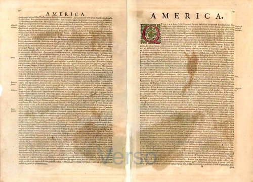
Verso: Latin text.
Condition: Original coloured, lower centrefold split reinforced at the back.
Condition Rating: A+.
From: Gerardi Mercatoris - Atlas sive Cosmographicae Meditationes de Fabrica Mundi et Fabricati Figura. Denuo auctus Editio Quinta. Henricus Hondius. 1623. (Van der Krogt 1, 105)
After the death of the great Gerard Mercator in 1594, it was left to his son Rumold to publish the last of three parts that formed his famous atlas, the Atlantis Pars Altera. The atlas was finished with several maps engraved by various descendants of Gerard. The task of the American map was given to his grandson, Michael. The only printed map known to be by him is beautifully engraved. It is a hemispherical map with an attractive floral design, surrounded by four roundels, one of which contains the title. The other three have maps of the Gulf of Mexico, Cuba and Hispaniola, all spheres of Spanish influence. The general outline is largely based on Rumold Mercator's world map of 1587, with a little more detail added. A few famous theories are still present: a large inland lake in Canada, two of the four islands of the North Pole, a bulge to the west coast of South America and the large southern continent. It does not show any knowledge of English in Virginia, possibly reflecting their failure by then. A large St. Lawrence River is shown, originating halfway across the continent. (Burden)
Gerard Mercator (1512 – 1594)
Gerard Mercator was born Gerard de Cremere in Rupelmonde (near Antwerp) on 5 March 1512.
Young Gerard learned what Latin he could in Rupelmonde, and when he was about fifteen, his uncle sent him to s'Hertogenbosch to study at a school run by the Brothers of the Common Life. One of Mercator’s teachers was the celebrated humanist Macropedius. After three and a half years with the brothers, Gerard went to Louvain, where he enrolled in the university in 1530 as one of the poor students at Castle College.
By this time, he had Latinized his name to Mercator. He studied philosophy and took his master’s degree in 1532. The problems of the creation of the Universe and the Earth interested him in particular, and this is reflected in his works written in later years.
After spending a few years in Antwerp, he returned to Louvain in c. 1535, where he took courses in mathematics under Gemma Frisius. Soon, he was recognised as an expert on the construction of mathematical instruments, as a land surveyor and, after 1537, as a cartographer. He drew his income from these activities after his marriage on August 3, 1536. He also qualified himself as a copper engraver, the first to introduce italic handwriting to this trade. The first maps, drawn and engraved by Gerard Mercator, are Palestine, 1537; the World in double heart-shaped projection, 1538; and Flanders, 1540.
In 1544, Mercator came into great danger: he was arrested on the accusation of heresy and put into jail. Thanks to the intervention of the University of Louvain, he was released after four months. In 1552, he moved with his family to Duisburg (Germany). In 1560, Mercator became a cosmographer in service of the Duke of Jülich-Cleve-Berge, and in 1563, he became a lecturer at the Grammar School of the new University in Duisburg. During this period, he made wall maps of Europe, 1554; of Loraine, 1564; the British Isles, 1564; and the famous world map with increasing latitudes, 1569. About this time, Mercator was also working on the project for a complete description of the creation, the Heavens, Earth, Sea and world history. This resulted in his Atlas, sive cosmographicae meditationes de fabrica mundi et fabricati figura. He also worked on an edition of Ptolemy’s Geographia in 1578. The first part of his book, which contains modern maps (France, Germany, and the Netherlands), appeared in 1585.
Shortly after the publication of the second part of his map book (not yet called Atlas) with the maps of Italy (1589), he had a stroke that ended his highly significant productivity. The great man passed away on 2 December 1594, leaving the responsibility of finishing the map book to his son Rumold. The final part of it appeared in 1595. Its title is Pars Altera, and it constitutes an essential part of what was then called Mercator’s Atlas.
The map of Europe and the world map in the Atlas are by Rumold Mercator. After Rumold died in 1599, the Atlas was reissued in 1602.
The plates of the maps, both of the Ptolemy edition and the Atlas, were sold in 1604 to Jodocus Hondius of Amsterdam. The following year, Hondius managed to bring out Ptolemy’s Geographia. In 1606, the first Amsterdam edition of the Mercator Atlas appeared in the next year. From then to 1638, the Atlas saw many enlarged editions in various languages.
Related items
The most important collection of voyages to the New World
Newe Welt und Americanische Historien. ...
GOTTFRIED J.L. (Abelin)
[Item number: 2653]

Nieuwe Kaart van America c. 1770
Antique map of America by Tirion I.
[Item number: 19194]
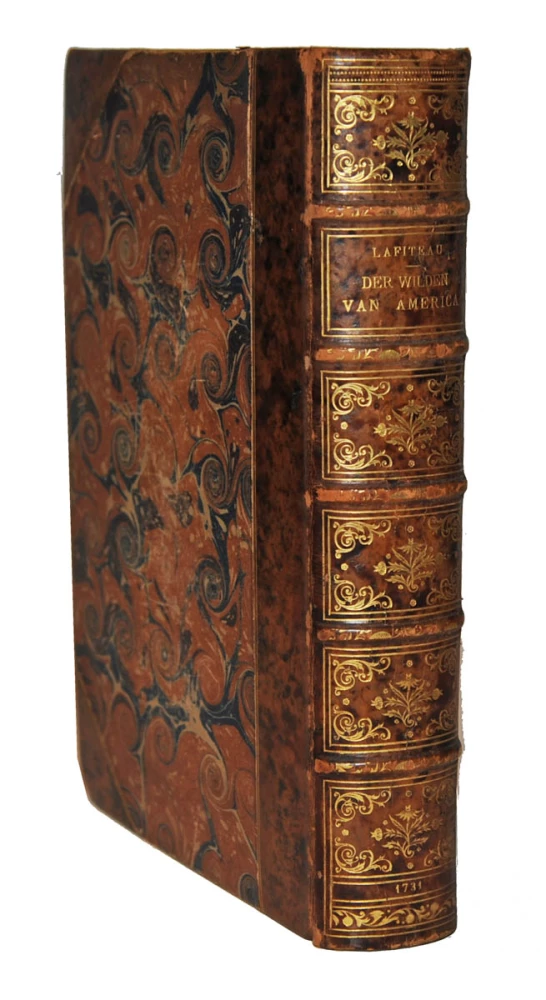
De zeden der wilden van Amerika . . . 1713-1719
America, by J.F. Lafitau. 1731.
[Item number: 21501]

America. 1597
AMERICA by Giovanni Magini
[Item number: 22492]

Typus Orbis Terrarum, [in set with:] Europa, [and] Asia, [and] Americae Descrip., [and] Africae Descriptio. 1607
World + Continents, by Jodocus Hondius.
[Item number: 27088]

Original Halma edition.
L'Amerique selon les Nouvelles Observations de Messrs. de l'Academie des Sciences, etc. Before 1713
America, by François Halma.
[Item number: 28017]

Novissima et Accuratissima Septentrionalis ac Meridionalis Americae. c. 1715
America by Covens & Mortier.
[Item number: 28295]

California as an island
Atlantis Insula. 1692
The Americas by Guillaume Sanson.
[Item number: 28376]

America. 1598
America, by Giovanni Lorenzo d'Anania, published by Girolamo Ruscelli.
[Item number: 28432]

Novissima et Accuratissima Totius Americae Descriptio. 1656-77
America by Nicolaes Visscher I.
[Item number: 28554]

One of the most elaborately engraved maps ever published.
Carte tres Curieuse de la Mer du Sud, Contenant des Remarques Nouvelles et tres Utiles non Seulement sur les Ports et Iles de cette Mer, 1719
Pacific by Zacharias Châtelain after Nicolas de Fer.
[Item number: 29466]

Early edition, 1613.
America sive India Nova, ad magnae Gerardi Mercatoris avu Universalis imitationem, in compendium redacta. 1613
America (Western Hemisphere), by Gerard Mercator.
[Item number: 30733]

L'Amerique Divisée en ses Principaux Etats Assujettie aux Observations Astronomiq. 1769
America by Sr Janvier, published by Lattré.
[Item number: 31125]

California as an island
Totius Americae Septentrionalis et Meridionalis Novissima Repraesentatio quam ex singulis recentium Geographorum Tabulis collecta c. 1720
America by J.B. Homann.
[Item number: 32191]

America. 1618
America, by Petrus Bertius.
[Item number: 32329]

Recentissima Novi Orbis Sive Americae Septentrionalis et Meridionalis Tabula. 1696
America by Justus Danckerts - California as an island
[Item number: 32460]

America 1630
America by Jodocus Hondius.
[Item number: 32577]