
Allegorical title page by Joan Blaeu, published by Reinier & Josua Ottens. 1725-50.
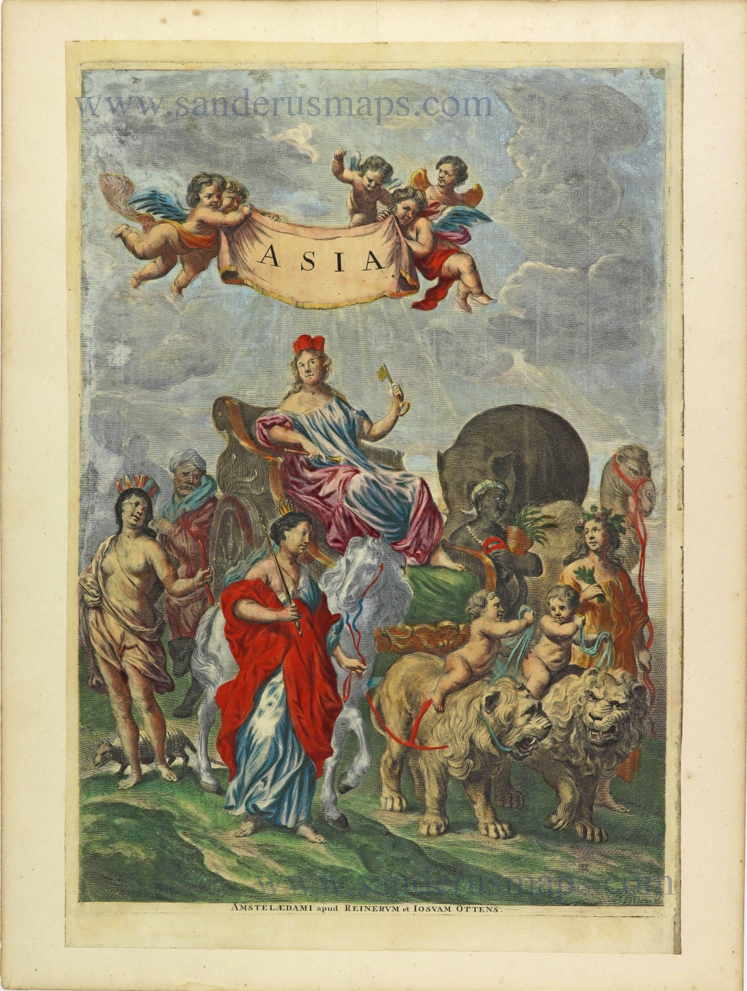
Allegorical representation shows Cybele, the Earth-goddess with her mural crown and holding a key, seated in her chariot drawn by a pair of lions. Accompanying attendants in the form of female figures and animals represent the continents: Europe has a horse; America has an armadillo at her foot; Asia has a camel, and Africa has an elephant.
The origin of the composition can be traced to a painting by Peter Paul Rubens, which is in the Louvre.
Initially, Joan Blaeu used this frontispiece as the main general frontispiece of his Geographia Blaviana (Atlas Major).
The Blaeus: Willem Janszoon, Cornelis & Joan
Willem Jansz. Blaeu and his son Joan Blaeu are the seventeenth century's most widely known cartographic publishers.
Willem Jansz. (also written Guilielmus Janssonius) = Willem Janszoon Blaeu was born in Uitgeest (Netherlands), near Alkmaar, in 1571. He studied mathematics under Tycho Brahe and learned the theory and practice of astronomical observations and the art of instrument- and globe-making.
In 1596, he came to Amsterdam, where he settled down as a globe-, instrument- and map-maker. He published his first cartographic work (a globe) in 1599 and probably published his first printed map (a map of the Netherlands) in 1604. He specialised in maritime cartography, published the first edition of the pilot guide Het Licht der Zeevaert in 1608, and was appointed Hydrographer of the V.O.C. (United East India Company) in 1633. After publishing books, wall maps, globes, charts and pilot guides for thirty years, he brought out his first atlas, Atlas Appendix (1630). This was the beginning of the great tradition of atlas-making by the Blaeus.
In 1618, another mapmaker, bookseller and publisher, Johannes Janssonius, established himself in Amsterdam next door to Blaeu's shop. No wonder these two neighbours began accusing each other of copying and stealing their information and became fierce competitors who did not have a good word to say about each other. In about 1621 Willem Jansz. decided to end the confusion between his name and his competitor's and assumed his grandfather's nickname, 'blauwe Willem' ('blue Willem'), as the family name; after that, he called himself Willem Jansz. Blaeu.
Willem Janszoon Blaeu died in 1638, leaving his prospering business to his sons, Cornelis and Joan. We only know that Cornelis's name occurs in the prefaces of books and atlases until c. 1645.
Joan Blaeu, born in Amsterdam in 1596, became a partner in his father’s book trade and printing business. 1638, he was appointed his father’s successor in the Hydrographic Office of the V.O.C. His efforts culminated in the magnificent Atlas Major and the town books of the Netherlands and Italy – works unsurpassed in history and modern times, giving eternal fame to the name of the Blaeu's.
On February 23, 1672, a fire ruined the business. One year later, Dr Joan Blaeu died. The fire of 1672 and the passing away of the director gave rise to a complete sale of the stock of the Blaeu House. Five public auctions dispersed the remaining books, atlases, copperplates, globes, etc., among many other map dealers and publishers in Amsterdam. The majority was acquired by several booksellers acting in partnership.
In the succeeding years, the remaining printing department was left in the hands of the Blaeu family until 1695, when the printing house's inventory was sold at a public auction. That meant the end of the Blaeu's as a printing house of world renown.
The Ottens Family
Joachim Ottens (1663-1719), was a copper-engraver and the founder of the print- and mapsellers’ firm in Amsterdam. In 1710 he became a member of the art- and printsellers guild. After he died in 1719, his widow and the sons continued the business under the name “In de Wereldcaert” (In the world map). On the whole, the Ottens’s financial position was rather weak, and the stock was not very large.
In a notary contract dated 20 October 1726, the partnership between the two brothers, Reinier and Josua, was stipulated. Despite separate shops, the brothers’ partnership continued until the death of Renier in 1750.
After Joshua died in 1765, his widow continued the firm, together with her son, Renier II, until c. 1780.
The firm flourished mainly between 1719 and c. 1750. In that period, they advertised at various times the publication of new maps.
Ottens’s greatest fame comes from the voluminous atlases assembled to order. A small number of these so-called ‘Atlas factice’, splendid copies with gorgeous illumination, have survived. These collector’s copies are known to exist in 2, 6, 8, 11, and even 15 volumes. Ottens also published atlases in one volume, with a varying number of maps, pocket atlases, collections of military plans, and Renard’s atlas de la navigation.
Asia.
Item Number: 28508 Authenticity Guarantee
Category: Antique maps > Asia > Asia
Allegorical title page by Joan Blaeu, published by Reinier & Josua Ottens.
Title: Asia.
Amstelaedami apud Reinerum et Josuam Ottens.
Date of the first edition: 1662.
Date of this map: 1725-50.
Copper engraving, printed on paper.
Map size: 430 x 295mm (16.93 x 11.61 inches).
Sheet size: 500 x 375mm (19.69 x 14.76 inches).
Verso: Blank.
Condition: Original coloured, remargined.
Condition Rating: A.
References: Van der Krogt 2, 2:35; Shirley (Titlepages), p. 146 #52
From: Atlas Major, cum generales omnium Totius Orbis regnorum, ... Amstelodami, Apud Regnerum & Josuam Ottens. [1725-1750]
Allegorical representation shows Cybele, the Earth-goddess with her mural crown and holding a key, seated in her chariot drawn by a pair of lions. Accompanying attendants in the form of female figures and animals represent the continents: Europe has a horse; America has an armadillo at her foot; Asia has a camel, and Africa has an elephant.
The origin of the composition can be traced to a painting by Peter Paul Rubens, which is in the Louvre.
Initially, Joan Blaeu used this frontispiece as the main general frontispiece of his Geographia Blaviana (Atlas Major).
The Blaeus: Willem Janszoon, Cornelis & Joan
Willem Jansz. Blaeu and his son Joan Blaeu are the seventeenth century's most widely known cartographic publishers.
Willem Jansz. (also written Guilielmus Janssonius) = Willem Janszoon Blaeu was born in Uitgeest (Netherlands), near Alkmaar, in 1571. He studied mathematics under Tycho Brahe and learned the theory and practice of astronomical observations and the art of instrument- and globe-making.
In 1596, he came to Amsterdam, where he settled down as a globe-, instrument- and map-maker. He published his first cartographic work (a globe) in 1599 and probably published his first printed map (a map of the Netherlands) in 1604. He specialised in maritime cartography, published the first edition of the pilot guide Het Licht der Zeevaert in 1608, and was appointed Hydrographer of the V.O.C. (United East India Company) in 1633. After publishing books, wall maps, globes, charts and pilot guides for thirty years, he brought out his first atlas, Atlas Appendix (1630). This was the beginning of the great tradition of atlas-making by the Blaeus.
In 1618, another mapmaker, bookseller and publisher, Johannes Janssonius, established himself in Amsterdam next door to Blaeu's shop. No wonder these two neighbours began accusing each other of copying and stealing their information and became fierce competitors who did not have a good word to say about each other. In about 1621 Willem Jansz. decided to end the confusion between his name and his competitor's and assumed his grandfather's nickname, 'blauwe Willem' ('blue Willem'), as the family name; after that, he called himself Willem Jansz. Blaeu.
Willem Janszoon Blaeu died in 1638, leaving his prospering business to his sons, Cornelis and Joan. We only know that Cornelis's name occurs in the prefaces of books and atlases until c. 1645.
Joan Blaeu, born in Amsterdam in 1596, became a partner in his father’s book trade and printing business. 1638, he was appointed his father’s successor in the Hydrographic Office of the V.O.C. His efforts culminated in the magnificent Atlas Major and the town books of the Netherlands and Italy – works unsurpassed in history and modern times, giving eternal fame to the name of the Blaeu's.
On February 23, 1672, a fire ruined the business. One year later, Dr Joan Blaeu died. The fire of 1672 and the passing away of the director gave rise to a complete sale of the stock of the Blaeu House. Five public auctions dispersed the remaining books, atlases, copperplates, globes, etc., among many other map dealers and publishers in Amsterdam. The majority was acquired by several booksellers acting in partnership.
In the succeeding years, the remaining printing department was left in the hands of the Blaeu family until 1695, when the printing house's inventory was sold at a public auction. That meant the end of the Blaeu's as a printing house of world renown.
The Ottens Family
Joachim Ottens (1663-1719), was a copper-engraver and the founder of the print- and mapsellers’ firm in Amsterdam. In 1710 he became a member of the art- and printsellers guild. After he died in 1719, his widow and the sons continued the business under the name “In de Wereldcaert” (In the world map). On the whole, the Ottens’s financial position was rather weak, and the stock was not very large.
In a notary contract dated 20 October 1726, the partnership between the two brothers, Reinier and Josua, was stipulated. Despite separate shops, the brothers’ partnership continued until the death of Renier in 1750.
After Joshua died in 1765, his widow continued the firm, together with her son, Renier II, until c. 1780.
The firm flourished mainly between 1719 and c. 1750. In that period, they advertised at various times the publication of new maps.
Ottens’s greatest fame comes from the voluminous atlases assembled to order. A small number of these so-called ‘Atlas factice’, splendid copies with gorgeous illumination, have survived. These collector’s copies are known to exist in 2, 6, 8, 11, and even 15 volumes. Ottens also published atlases in one volume, with a varying number of maps, pocket atlases, collections of military plans, and Renard’s atlas de la navigation.
Related items
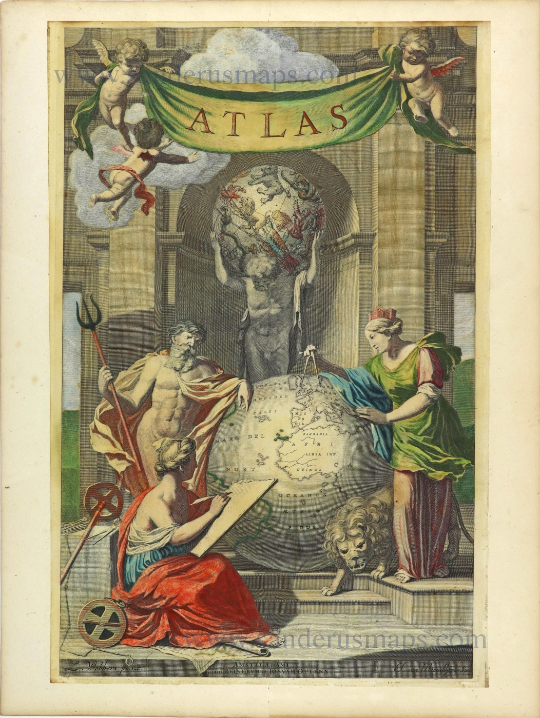
Atlas. 1725-50.
Allegorical title page by Joan Blaeu, published by Reinier & Josua Ottens.
[Item number: 28509]
Heightened in gold
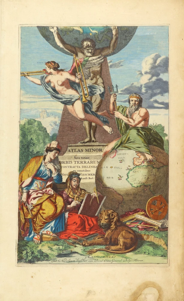
Atlas Minor Sive totius Orbis Terrarum contracta delinea... 1683-1716
Allegorical atlas title page by Nicolaas Visscher II.
[Item number: 28787]
Exceptional nice old colour. Heightened in gold.
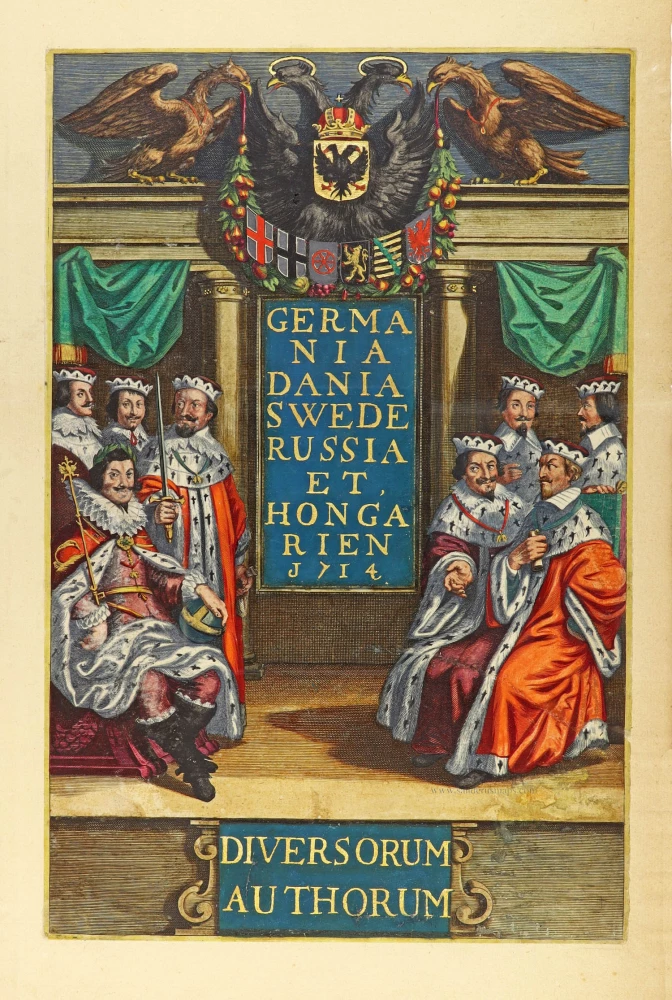
Germania Dania Swede Russia et Hongarien 1714. - Diversorum Authorum. 1714
Joannes Janssonius, title page
[Item number: 30095]

De Praecipuis, Totius Universi Urbibus Liber Secundus. 1575-1612
Georg Braun & Frans Hogenberg, allegorical atlas title page of the second part.
[Item number: 30096]
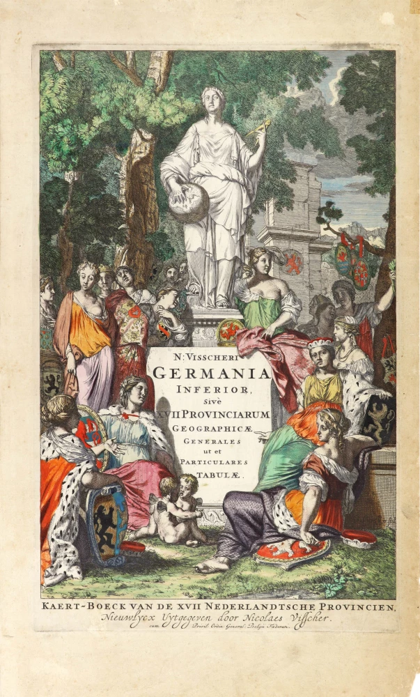
N: Visscheri Germania Inferior Sive XVII Provinciarum Geographicae Generales ut et Particulares Tabulae. - Kaert-Boeck van de XVII Nederlandtsche Provincien, Nieuwlycx uytgegeven door Nicolaes Visscher. After 1677 (privilege)
Atlas title page by Nicolas Visscher II.
[Item number: 30417]