
Rare first edition of Ortelius' pocket edition
Japan by Abraham Ortelius. 1598
Abraham Ortelius (1527-1598)
The maker of the 'first atlas', the Theatrum Orbis Terrarum (1570), was born on 4 April 1527 into an old Antwerp family. He learned Latin and studied Greek and mathematics.
Abraham and his sisters Anne and Elizabeth took up map colouring. Ortelius was admitted to the Guild of St. Luke as an "illuminator of maps." In addition to colouring maps, Ortelius was a dealer in antiques, coins, maps, and books, and the book and map trade gradually became his primary occupation.
Business went well because his means permitted him to start an extensive collection of medals, coins, antiques, and a library of many volumes. In addition, he travelled a lot, visited Italy and France, made contacts everywhere with scholars and editors, and maintained extensive correspondence with them.
In 1564, he published his first map, a large and ambitious world wall map. The inspiration for this map may well have been Gastaldi's large world map. In 1565, he published a map of Egypt and a map of the Holy Land; a large map of Asia followed.
In 1568, the production of individual maps for his atlas Theatrum Orbis Terrarum was already in full swing. He completed the atlas in 1569, and in May 1570, it was available for sale. It was one of the most expensive books ever published.
This first edition contained seventy maps on fifty-three sheets. Franciscus Hogenberg engraved the maps.
Later editions included Additamenta (additions), resulting in Ortelius' historical atlas, the Parergon, which is mainly bound together with the atlas. The Parergon can be considered a truly original work by Ortelius, who drew the maps based on his research.
The importance of the Theatrum Orbis Terrarum for geographical knowledge in the last quarter of the sixteenth century is difficult to overemphasize. Nothing was like it until Mercator's atlas appeared twenty-five years later. Demand for the Theatrum was remarkable. Some 24 editions appeared during Ortelius's lifetime and another 10 after he died in 1598. Editions were published in Dutch, German, French, Spanish, English, and Italian. The number of map sheets grew from 53 in 1570 to 167 in 1612 in the last edition.
In 1577, engraver Philip Galle and poet-translator Pieter Heyns published the first pocket-sized edition of the Theatrum, the Epitome. The work was trendy. Over thirty editions of this Epitome were published in different languages.
Filips Galle (1537-1612)
The Galle family were engravers, publishers, and printsellers of Antwerp.
Filips Galle, born in Haarlem and active in Antwerp, was a friend and collaborator of A. Ortelius. He was also co-publisher of G. Braun and F. Hogenberg's Civitates Orbis Terrarum, 1572. In 1577, he suggested producing a small-format pocket-book edition of the Theatrum, the Epitome, which he also helped finance. This pocket-book edition also became very popular and was reprinted again and again. Galle executed the portrait of Ortelius for the 1579 edition of the Theatrum.
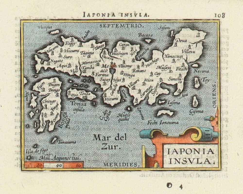
Iaponia Insula.
Item Number: 30987 Authenticity Guarantee
Category: Antique maps > Asia > Japan
Japan by Abraham Ortelius.
Title: Iaponia Insula.
Above map: Iapponia Insula. 108
Date of the first edition: 1598.
Date of this map: 1598.
Copper engraving, printed on paper.
Image size: 80 x 105mm (3.15 x 4.13 inches).
Sheet size: 115 x 155mm (4.53 x 6.1 inches).
Verso: French text.
Condition: Hand coloured, excellent.
Condition Rating: A+.
From: Epitome du Théâtre du monde. Auquel se represente, tant par figures que characteres, la vraye situation, nature, & proprieté de la terre universelle. Revueu, corrigé, & augmenté de plusieurs Cartes, pour la derniere fois. A Anvers, de l'imprimerie Plantinienne. Pour Philippe Galle. M.D.XCVIII. [1598] (Van der Krogt 3, p. 298, 332:03).
Abraham Ortelius (1527-1598)
The maker of the 'first atlas', the Theatrum Orbis Terrarum (1570), was born on 4 April 1527 into an old Antwerp family. He learned Latin and studied Greek and mathematics.
Abraham and his sisters Anne and Elizabeth took up map colouring. Ortelius was admitted to the Guild of St. Luke as an "illuminator of maps." In addition to colouring maps, Ortelius was a dealer in antiques, coins, maps, and books, and the book and map trade gradually became his primary occupation.
Business went well because his means permitted him to start an extensive collection of medals, coins, antiques, and a library of many volumes. In addition, he travelled a lot, visited Italy and France, made contacts everywhere with scholars and editors, and maintained extensive correspondence with them.
In 1564, he published his first map, a large and ambitious world wall map. The inspiration for this map may well have been Gastaldi's large world map. In 1565, he published a map of Egypt and a map of the Holy Land; a large map of Asia followed.
In 1568, the production of individual maps for his atlas Theatrum Orbis Terrarum was already in full swing. He completed the atlas in 1569, and in May 1570, it was available for sale. It was one of the most expensive books ever published.
This first edition contained seventy maps on fifty-three sheets. Franciscus Hogenberg engraved the maps.
Later editions included Additamenta (additions), resulting in Ortelius' historical atlas, the Parergon, which is mainly bound together with the atlas. The Parergon can be considered a truly original work by Ortelius, who drew the maps based on his research.
The importance of the Theatrum Orbis Terrarum for geographical knowledge in the last quarter of the sixteenth century is difficult to overemphasize. Nothing was like it until Mercator's atlas appeared twenty-five years later. Demand for the Theatrum was remarkable. Some 24 editions appeared during Ortelius's lifetime and another 10 after he died in 1598. Editions were published in Dutch, German, French, Spanish, English, and Italian. The number of map sheets grew from 53 in 1570 to 167 in 1612 in the last edition.
In 1577, engraver Philip Galle and poet-translator Pieter Heyns published the first pocket-sized edition of the Theatrum, the Epitome. The work was trendy. Over thirty editions of this Epitome were published in different languages.
Filips Galle (1537-1612)
The Galle family were engravers, publishers, and printsellers of Antwerp.
Filips Galle, born in Haarlem and active in Antwerp, was a friend and collaborator of A. Ortelius. He was also co-publisher of G. Braun and F. Hogenberg's Civitates Orbis Terrarum, 1572. In 1577, he suggested producing a small-format pocket-book edition of the Theatrum, the Epitome, which he also helped finance. This pocket-book edition also became very popular and was reprinted again and again. Galle executed the portrait of Ortelius for the 1579 edition of the Theatrum.
Related items
Iapan. 1602
Japan by Langenes, published by Bertius P.
[Item number: 12487]
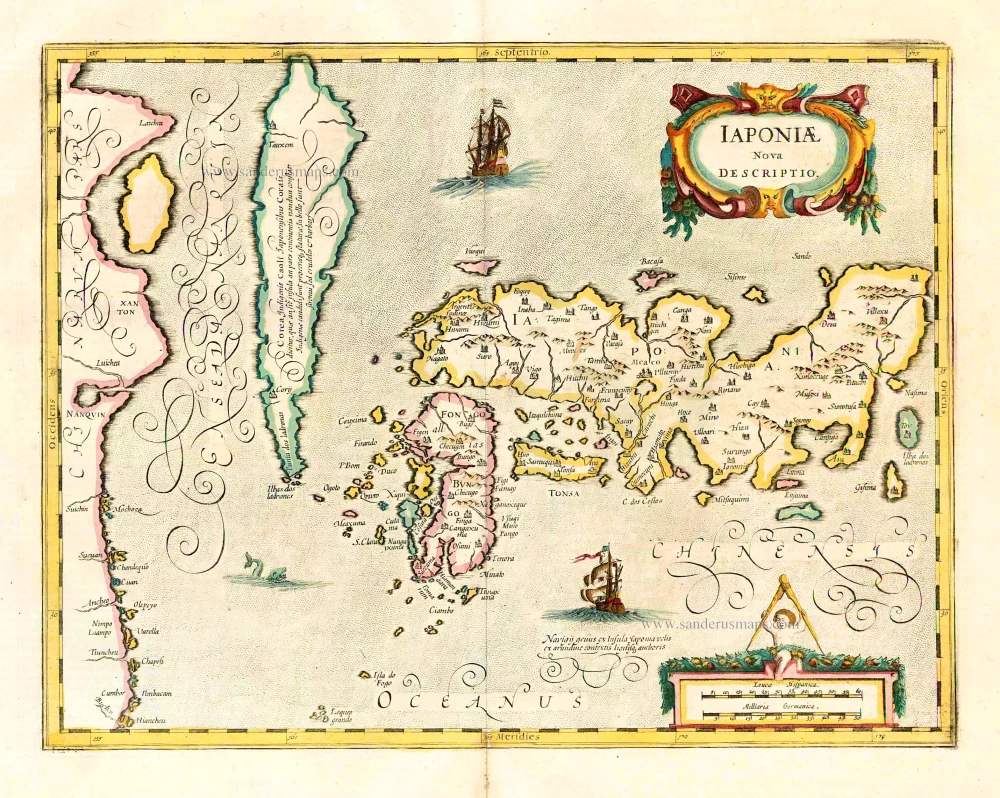
Iaponiae Nova Desciptio. 1641
Japan & Korea by Johannes Janssonius
[Item number: 26441]
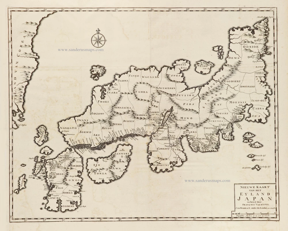
Nieuwe kaart van het Eyland Japan. 1726
Japan by François Valentyn (Valentijn).
[Item number: 26876]
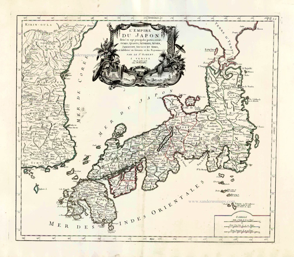
L'Empire du Japon Divisé en sept principales parties, savoir, Ochio, Quanto, Jetsegen, Jetsen, Jamaisoit, Xicoco et Ximo, et subdivisé en soixante et six Royaumes. 1776-79
Japan, by Francesco Santini.
[Item number: 26975]
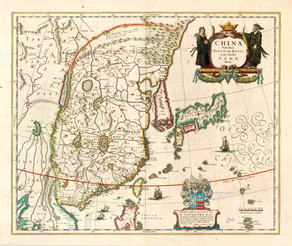
China Veteribus Sinarum Regio Nunc Incolis Tame Dicta. 1649-55
China - Japan - Korea, by Willem & Joan Blaeu.
[Item number: 27043]
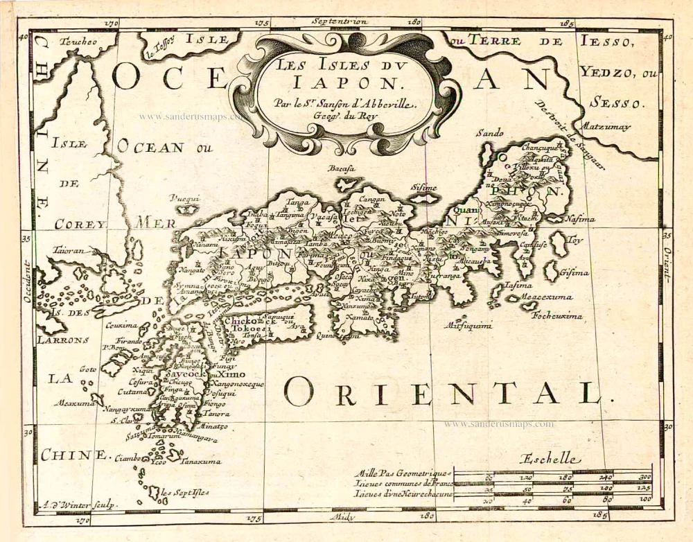
Les Isles du Iapon. 1683
Japan, by Nicolas Sanson.
[Item number: 27081]
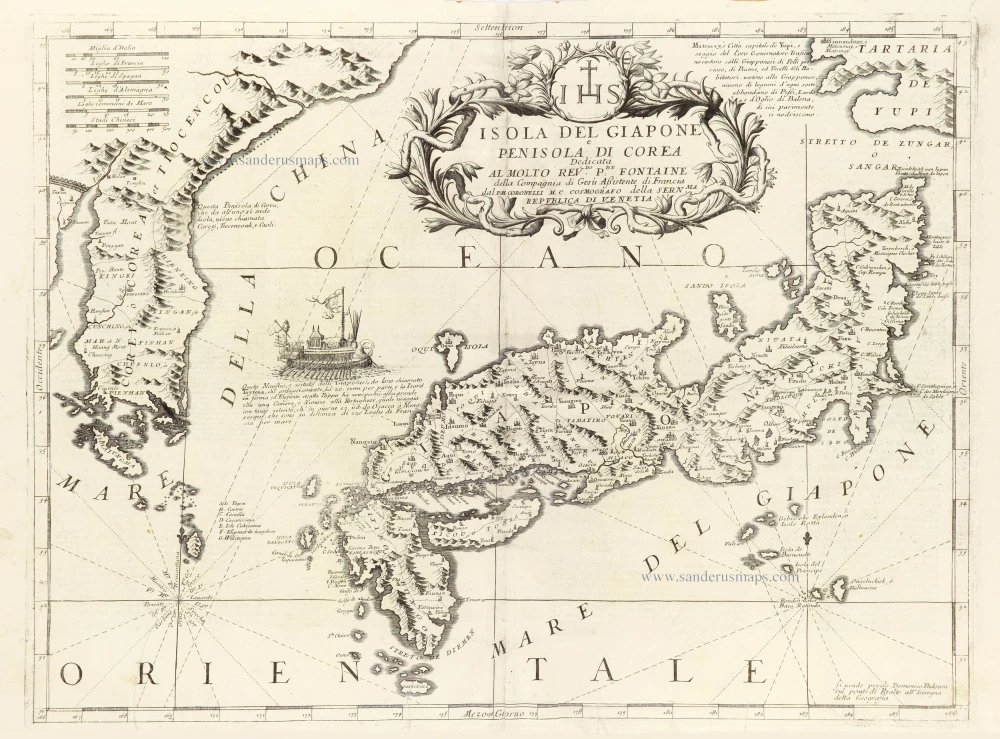
Isola del Giapone e Penisola di Corea. 1696
Japan - Korea by Vincenzo Coronelli.
[Item number: 28757]
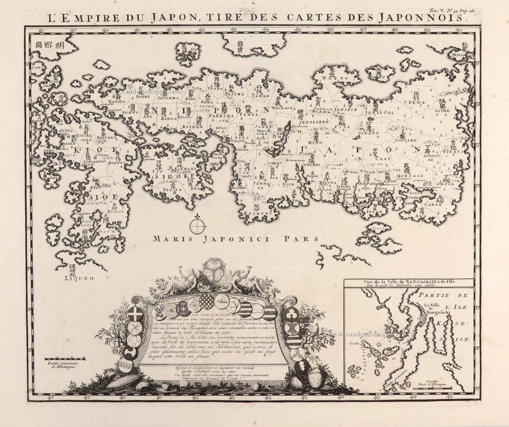
L'Empire du Japon, tiré des Cartes des Japonnois. 1719
Japan, by Z. Châtelain.
[Item number: 29379]
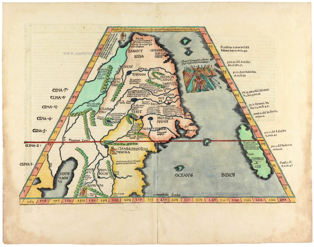
Rare 1525 edition in nice old colour.
No title - on verso: Ta. Superioris Indiae et Tartariae Maioris. 1525
China - Japan by Lorenz Fries, after Martin Waldseemüller.
[Item number: 30659]

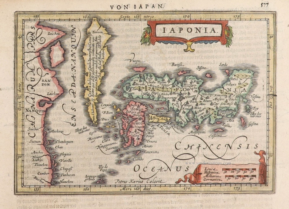
Iaponia. c. 1630-1650
Japan by Jodocus Hondius.
[Item number: 30857]
Rare!
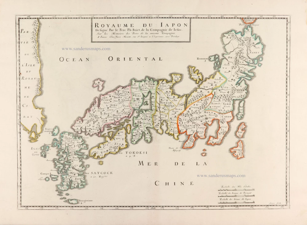
Royaume du Iapon. c. 1658
Japan by Philippe Briet, published by Pierre Mariette.
[Item number: 30911]
Iaponia. 1631
Japan by G. Mercator, published by J. Janssonius.
[Item number: 30988]
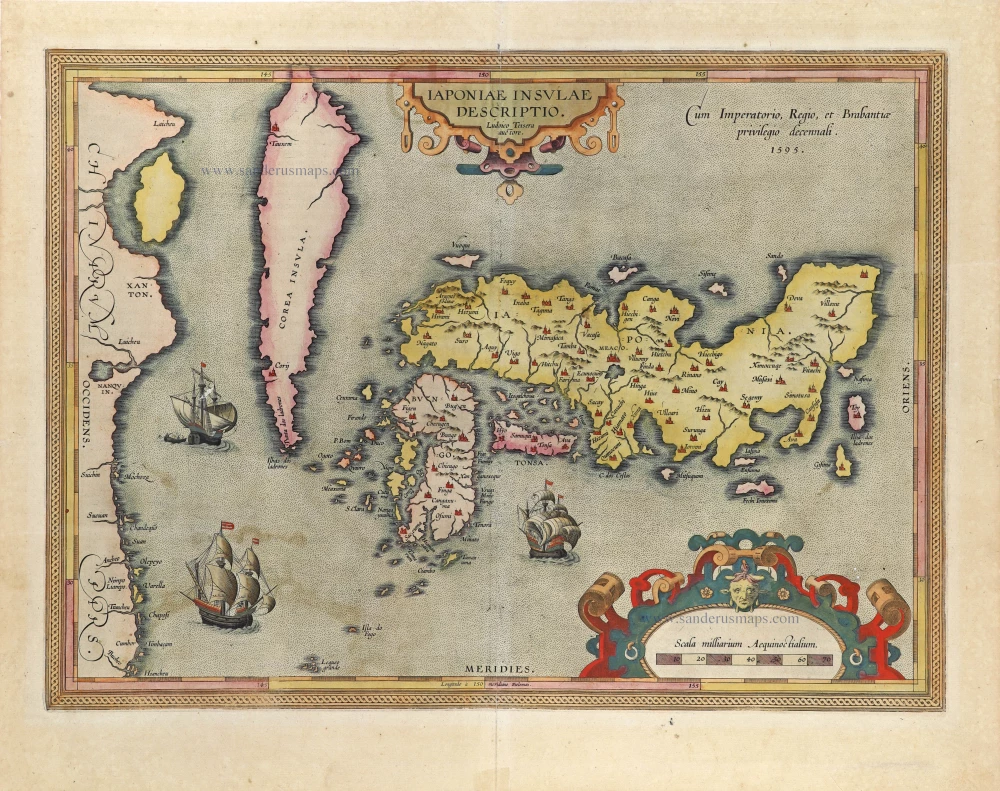
The first accurate European map of Japan.
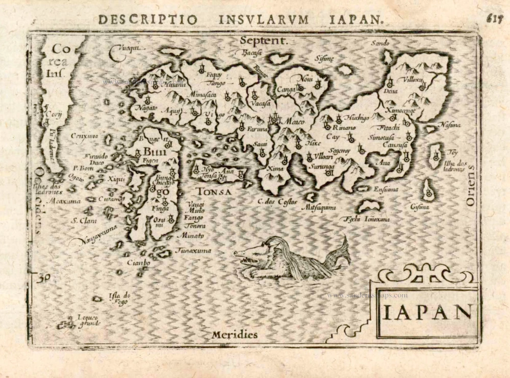
Iaponiae Insulae Descriptio. 1612
Japan by Abraham Ortelius.
[Item number: 31043]