
Rare!
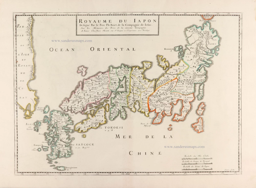
Japan by Philippe Briet, published by Pierre Mariette. c. 1658
Philippe Briet (1601-1668)
Jesuit priest of Abbeville, historian and cartographer. Author of historical maps; worked for Pierre Mariette and Michael van Lochom, Parisian publishers.
He published his Paralella Geographica in 1648, which contained 144 maps of Europe. He had intended to continue with the other continents but only produced a manuscript of the Asia tome, which was never published. Briet published two other atlases in 1653: the Theatre Geographique de l'Europe, with 79 maps, and the Theatrum Geographicum Europa Veteris, with 57 maps of ancient geography.
Pierre Mariette (1602-1658)
Bookseller, printseller, printer, and publisher, located in the Rue Saint-Jacques in Paris. On February 12, 1644, Pierre Mariette acquired most of Melchior Tavernier's fund. In 1646, he had a series of maps by Blaeu copied and asked Abraham Peyrounin to engrave them. In the meantime, he published the works of Nicolas Sanson. In 1650, he published the atlas Théâtre Géographique de France. A second edition followed in 1653. He later contributed to Sanson's atlas, the Cartes générales de toutes les parties du monde. Many maps of Mariette's Théatre appeared in later editions of Sanson's Cartes générales.
Royaume du Iapon.
Item Number: 30911 Authenticity Guarantee
Category: Antique maps > Asia > Japan
Japan by Philippe Briet, published by Pierre Mariette.
Title: Royaume du Iapon.
Designé Par le Pere Ph: Briet, de la Compagnie de Iesus. | Sur les Memoires des Peres de la mesme Compagnie
A Paris Chez Pierre Mariette, rue St. Iacques a l'Esperance, avec Privilege
Somer sculp.
Engraver: Jean Somer.
Date of the first edition: c. 1658.
Date of this map: c. 1658.
Copper engraving, printed on paper.
Image size: 370 x 520mm (14.57 x 20.47 inches).
Sheet size: 450 x 600mm (17.72 x 23.62 inches).
Verso: Blank.
Condition: Original coloured in outline, excellent.
Condition Rating: A+.
Separate publication.
This rare map is sometimes added in Sanson atlases.
Philippe Briet (1601-1668)
Jesuit priest of Abbeville, historian and cartographer. Author of historical maps; worked for Pierre Mariette and Michael van Lochom, Parisian publishers.
He published his Paralella Geographica in 1648, which contained 144 maps of Europe. He had intended to continue with the other continents but only produced a manuscript of the Asia tome, which was never published. Briet published two other atlases in 1653: the Theatre Geographique de l'Europe, with 79 maps, and the Theatrum Geographicum Europa Veteris, with 57 maps of ancient geography.
Pierre Mariette (1602-1658)
Bookseller, printseller, printer, and publisher, located in the Rue Saint-Jacques in Paris. On February 12, 1644, Pierre Mariette acquired most of Melchior Tavernier's fund. In 1646, he had a series of maps by Blaeu copied and asked Abraham Peyrounin to engrave them. In the meantime, he published the works of Nicolas Sanson. In 1650, he published the atlas Théâtre Géographique de France. A second edition followed in 1653. He later contributed to Sanson's atlas, the Cartes générales de toutes les parties du monde. Many maps of Mariette's Théatre appeared in later editions of Sanson's Cartes générales.
Related items
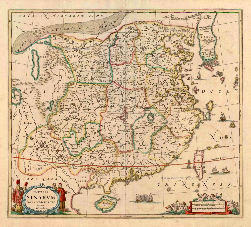
Imperii Sinarum Nova Descriptio. c. 1680.
China with Japan, Korea and Taiwan, by J. Janssonius.
[Item number: 2618]

With Korea as an island.
China 1619
China, Korea and Japan by J. Hondius.
[Item number: 6494]
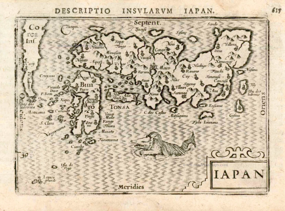
Iapan. 1602
Japan by Langenes, published by Bertius P.
[Item number: 12487]
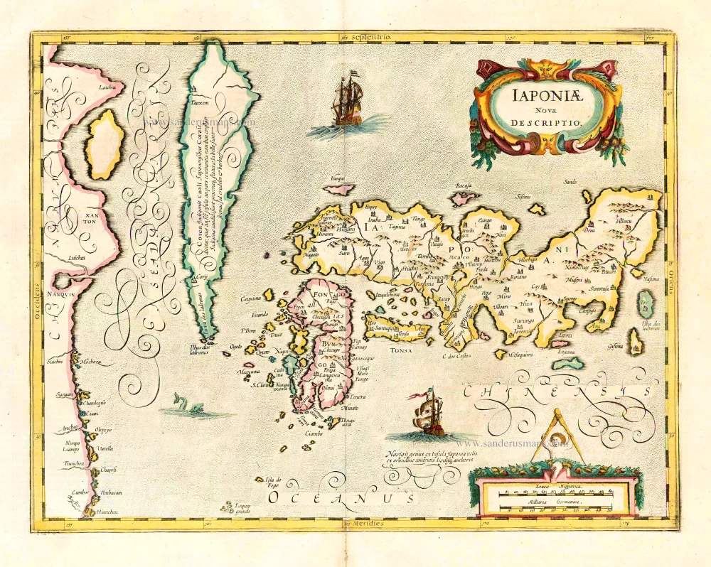
Iaponiae Nova Desciptio. 1641
Japan & Korea by Johannes Janssonius
[Item number: 26441]
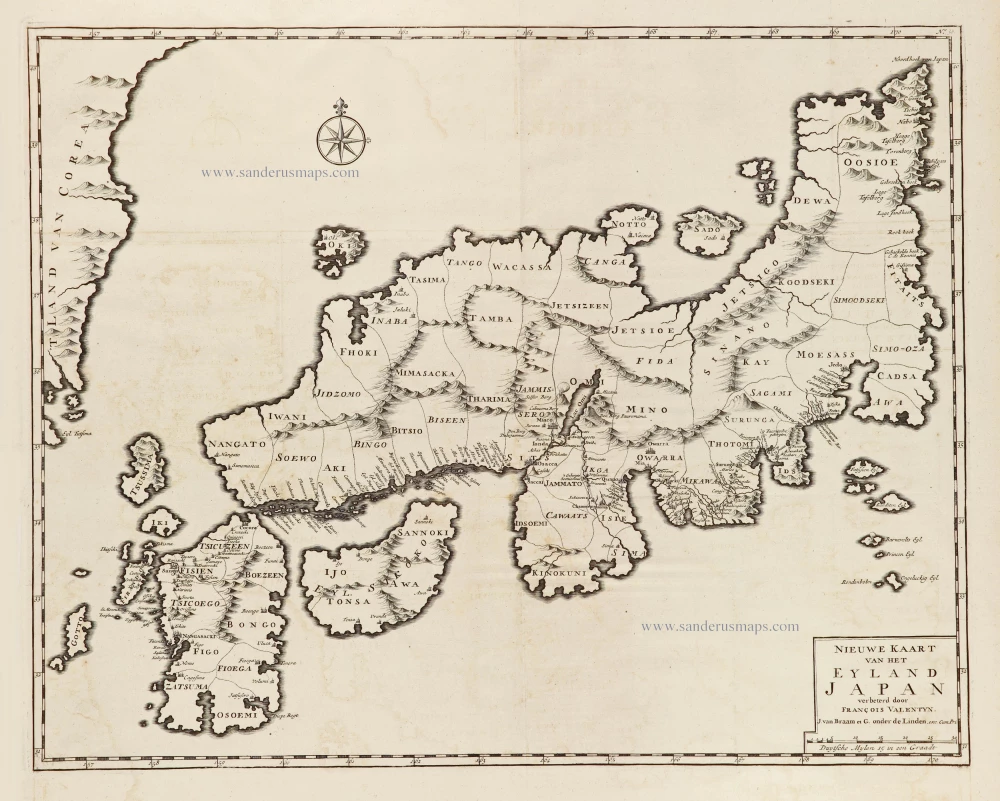
Nieuwe kaart van het Eyland Japan. 1726
Japan by François Valentyn (Valentijn).
[Item number: 26876]
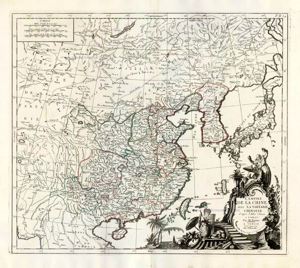
L'Empire de la Chine, avec la Tartarie Chinoise d'après l'Atlas Chinois. 1776-79
China with Korea and Japan, by Paolo Santini.
[Item number: 26974]
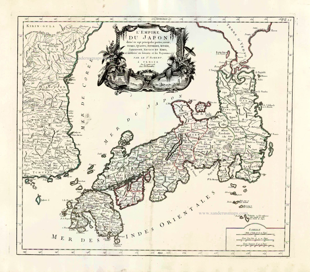
L'Empire du Japon Divisé en sept principales parties, savoir, Ochio, Quanto, Jetsegen, Jetsen, Jamaisoit, Xicoco et Ximo, et subdivisé en soixante et six Royaumes. 1776-79
Japan, by Francesco Santini.
[Item number: 26975]
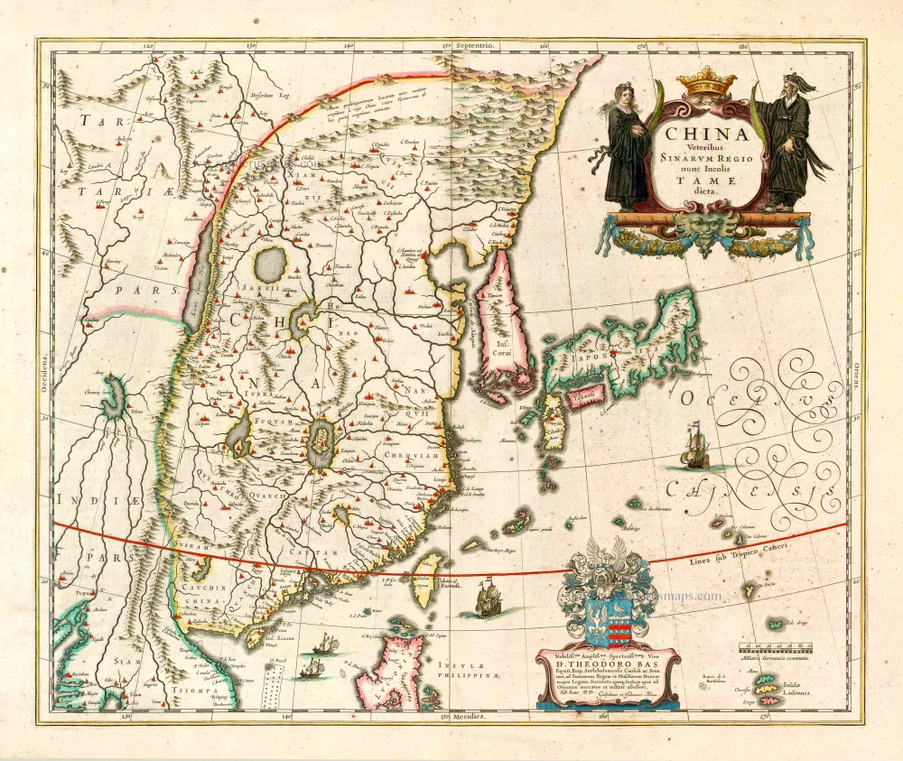
China Veteribus Sinarum Regio Nunc Incolis Tame Dicta. 1649-55
China - Japan - Korea, by Willem & Joan Blaeu.
[Item number: 27043]
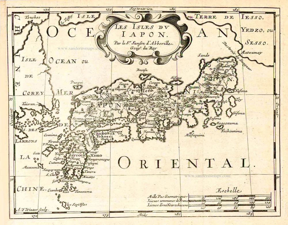
Les Isles du Iapon. 1683
Japan, by Nicolas Sanson.
[Item number: 27081]

Candia [on sheet with:] Corphu. 1638
Crete - Corfu, by Matthäus Merian.
[Item number: 27982]
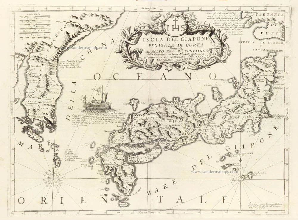
Isola del Giapone e Penisola di Corea. 1696
Japan - Korea by Vincenzo Coronelli.
[Item number: 28757]
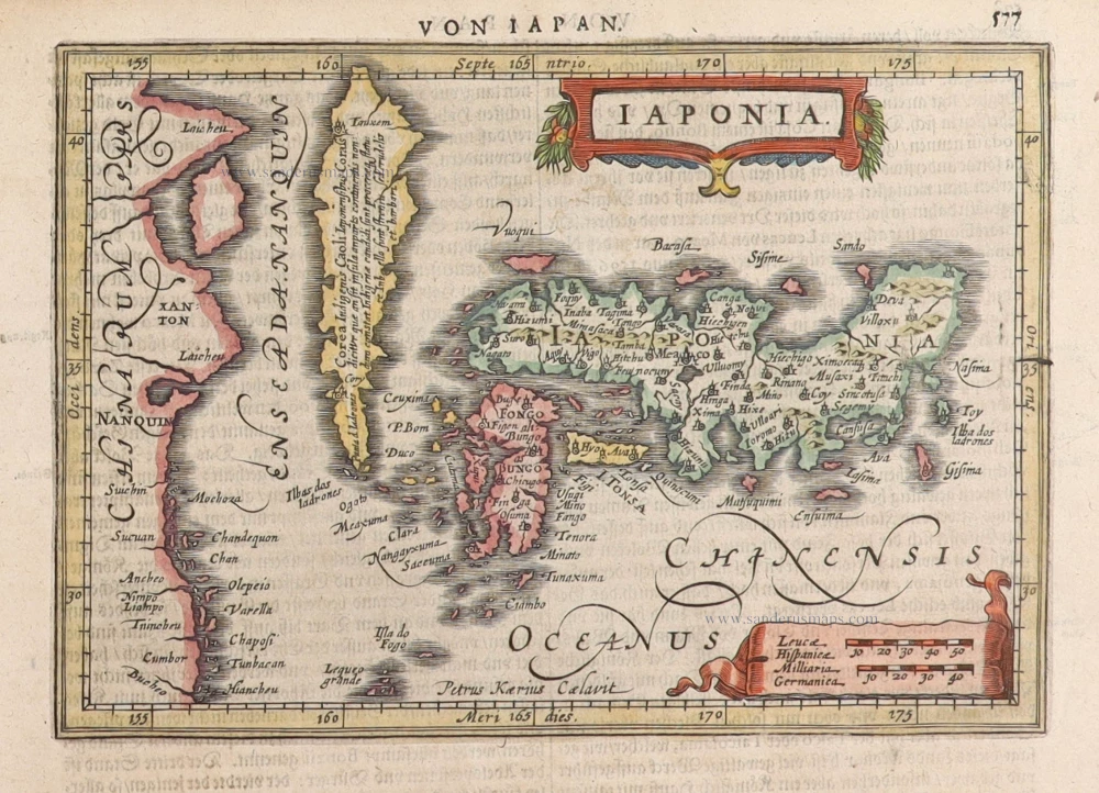
Iaponia. 1631
Japan by G. Mercator, published by J. Janssonius.
[Item number: 30988]
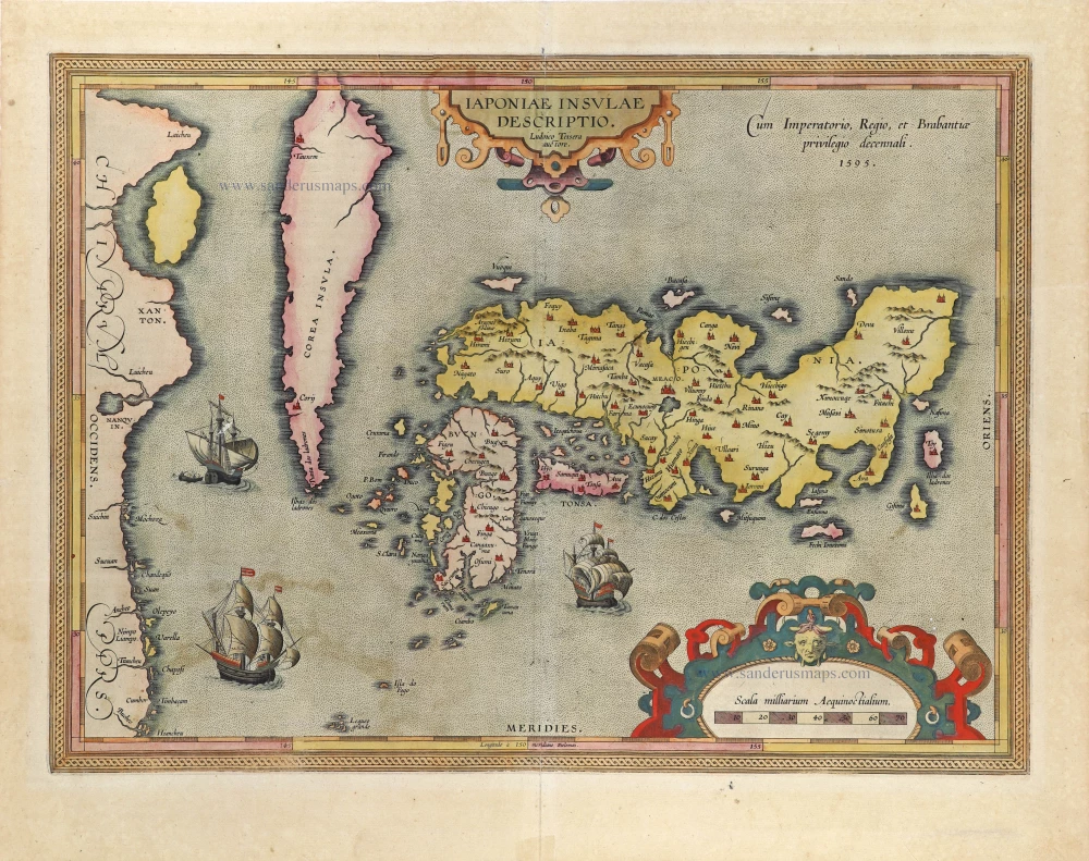
The first accurate European map of Japan.
Iaponiae Insulae Descriptio. 1612
Japan by Abraham Ortelius.
[Item number: 31043]

In rare original colour
Vue et Description de la Ville de Meaco, Capitale du Japon avec d'autres Particularitez du Pays. 1719
Kyoto - Decima (Japan), by Z. Châtelain.
[Item number: 31431]

Original coloured
Iapan. 1618
Japan by Petrus Bertius.
[Item number: 31455]

Iaponia Insula. 1604
Japan by Abraham Ortelius, published by Johannes van Keerbergen.
[Item number: 31739]
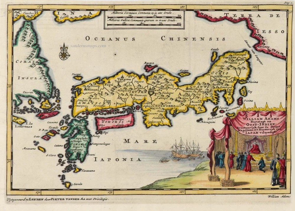
Rare first state of Van der Aa's Japan map with Korea as an island.
William Adams Reystogt na Oost-Indien; Avontuurlyk door de Straat van Magellaan, in't Keyzerryk van Iapan voleyndigd. 1706
Japan by Pieter Van der Aa.
[Item number: 31841]
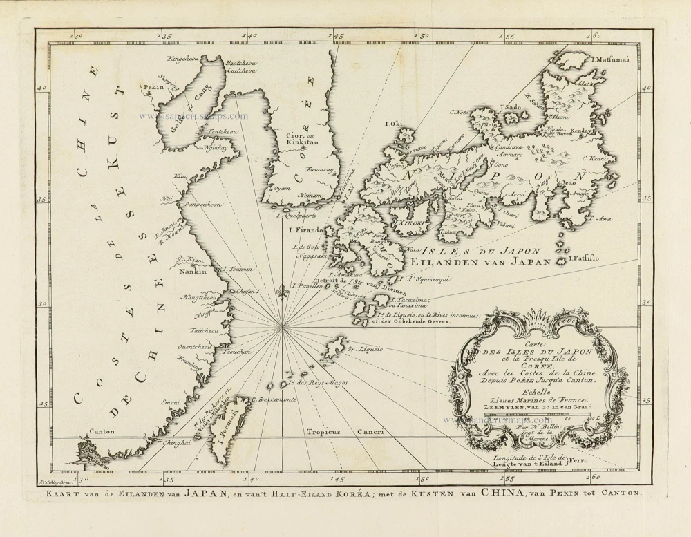
Carte des Isles du Japon et la Presqu’ Isle de Corée, avec les Costes de la Chine, depuis Pékin jusqu’à Canton. 1747
Japan - Korea by Jacques-Nicolas Bellin, published by A.F. Prévost.
[Item number: 31880]

Iapan. 1618
Japan, by Petrus Bertius
[Item number: 32175]