
In rare original colour
Kyoto - Decima (Japan), by Z. Châtelain. 1719

The Châtelain Family
Zacharias Châtelain (1684-1743) was a bookseller and publisher of Amsterdam. He was succeeded by his sons Zacharias jr and Henry Abraham. The Châtelain family was best known for the historical atlas Atlas Historique, ou nouvelle introduction à l’histoire…, a major work of its time. It was an encyclopaedia in seven volumes, including geography as one of its main subjects. The atlas was published in Amsterdam in seven volumes in various editions with different imprints from 1705 to 1739. An anonym person (Mr. C***) compiled the work with compositions of text, maps, plates and chronological and genealogical tables by Gueudeville, except volume 7, where H.P. Limiers took over this task. The maps were made mainly after the work of Guillaume de l'Isle.
The 1705 edition was published with the imprint “L’Honoré & Châtelain”. Later editions had the imprint: “les Frères Châtelain Libraires” or “L’Honoré & Châtelain Libraires”.
Vue et Description de la Ville de Meaco, Capitale du Japon avec d'autres Particularitez du Pays.
Item Number: 31431 Authenticity Guarantee
Category: Antique maps > Asia > Japan
Meaco (Kyoto - Japan), by Z. Châtelain.
Title: Vue et Description de la Ville de Meaco, Capitale du Japon avec d'autres Particularitez du Pays.
Tom: V. N° 36. Pag: 172.
Date of the first edition: 1719.
Date of this map: 1719.
Copper engraving, printed on paper.
Image size: 380 x 490mm (15 x 19¼ inches).
Sheet size: 445 x 530mm (17½ x 20¾ inches).
Verso: Blank.
Condition: Original coloured.
Condition Rating: A+.
From: Châtelain Z. Atlas Historique, ou Nouvelle Introduction A l'Histoire, à la Chronologie & à la Geographie Ancienne & Moderne; ... Tome V. Qui comprend l'Asie en général et en particulier, l'Assyrie, l'Armenie, la Georgie, la Turquie Asiatique, la Terre-sainte, l'Arabie, la Perse, la Tartarie, les Etats Japon, et le Roïaume de Siam. A Amsterdam, Chez L'Honoré & Châtelain Libraires, M.DCC.XIX. (1719). (Koeman II, p. 37, Cha6)
Châtelain maps are rarely found in original colouring.
The Châtelain Family
Zacharias Châtelain (1684-1743) was a bookseller and publisher of Amsterdam. He was succeeded by his sons Zacharias jr and Henry Abraham. The Châtelain family was best known for the historical atlas Atlas Historique, ou nouvelle introduction à l’histoire…, a major work of its time. It was an encyclopaedia in seven volumes, including geography as one of its main subjects. The atlas was published in Amsterdam in seven volumes in various editions with different imprints from 1705 to 1739. An anonym person (Mr. C***) compiled the work with compositions of text, maps, plates and chronological and genealogical tables by Gueudeville, except volume 7, where H.P. Limiers took over this task. The maps were made mainly after the work of Guillaume de l'Isle.
The 1705 edition was published with the imprint “L’Honoré & Châtelain”. Later editions had the imprint: “les Frères Châtelain Libraires” or “L’Honoré & Châtelain Libraires”.
Related items

Iapan. 1602
Japan by Langenes, published by Bertius P.
[Item number: 12487]

Iaponiae Nova Desciptio. 1641
Japan & Korea by Johannes Janssonius
[Item number: 26441]

Nieuwe kaart van het Eyland Japan. 1726
Japan by François Valentyn (Valentijn).
[Item number: 26876]

L'Empire du Japon Divisé en sept principales parties, savoir, Ochio, Quanto, Jetsegen, Jetsen, Jamaisoit, Xicoco et Ximo, et subdivisé en soixante et six Royaumes. 1776-79
Japan, by Francesco Santini.
[Item number: 26975]
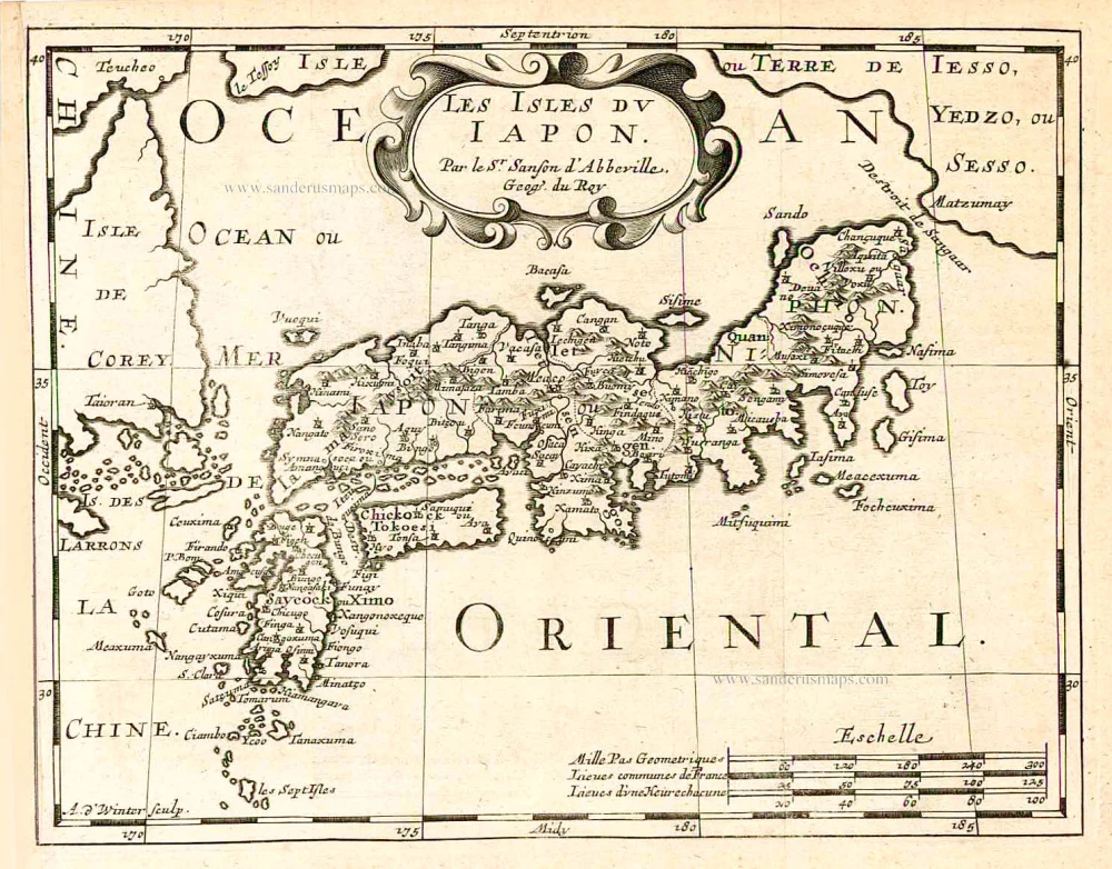
Les Isles du Iapon. 1683
Japan, by Nicolas Sanson.
[Item number: 27081]

Isola del Giapone e Penisola di Corea. 1696
Japan - Korea by Vincenzo Coronelli.
[Item number: 28757]

L'Empire du Japon, tiré des Cartes des Japonnois. 1719
Japan, by Z. Châtelain.
[Item number: 29379]

First map to show Korea as a peninsula. Excellent condition.
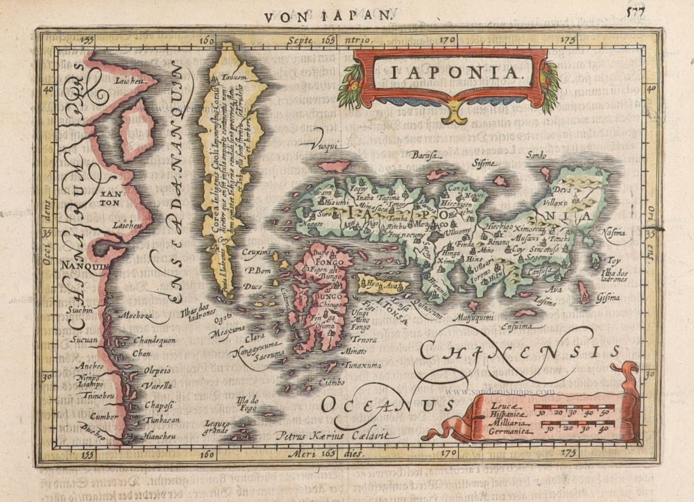
Iaponia Regnum. 1655-1659
Japan & Korea by Joan Blaeu.
[Item number: 29853]

Rare 1525 edition in nice old colour.
No title - on verso: Ta. Superioris Indiae et Tartariae Maioris. 1525
China - Japan by Lorenz Fries, after Martin Waldseemüller.
[Item number: 30659]

Iaponia. c. 1630-1650
Japan by Jodocus Hondius.
[Item number: 30857]

Rare!
Royaume du Iapon. c. 1658
Japan by Philippe Briet, published by Pierre Mariette.
[Item number: 30911]
Iaponia. 1631
Japan by G. Mercator, published by J. Janssonius.
[Item number: 30988]

The first accurate European map of Japan.
Iaponiae Insulae Descriptio. 1612
Japan by Abraham Ortelius.
[Item number: 31043]

Rare first state of Van der Aa's Japan map with Korea as an island.
William Adams Reystogt na Oost-Indien; Avontuurlyk door de Straat van Magellaan, in't Keyzerryk van Iapan voleyndigd. 1706
Japan by Pieter Van der Aa.
[Item number: 31841]

Carte des Isles du Japon et la Presqu’ Isle de Corée, avec les Costes de la Chine, depuis Pékin jusqu’à Canton. 1747
Japan - Korea by Jacques-Nicolas Bellin, published by A.F. Prévost.
[Item number: 31880]