
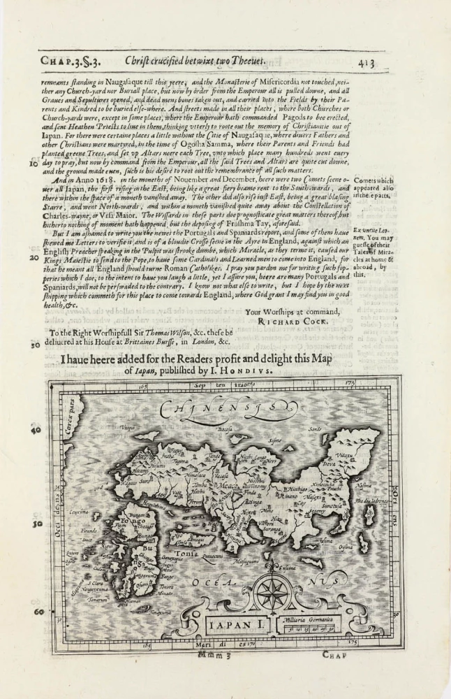
Japan by Jodocus Hondius, published by Samuel Purchas 1625
The Hondius Family
Jodocus Hondius the Elder (1563-1612)
Joost d’Hondt was born at Wakken (Flanders) in 1563. Two years later, his family settled in Ghent, where young Joost displayed an excellent gift for drawing and calligraphy. Through study and lessons, he developed his talents and became an engraver with a good reputation.
Due to the circumstances of the war, he moved to London in 1584, where he settled down as an engraver, instrument-maker, and map-maker. In 1587, he married Coletta van den Keere, sister of the well-known engraver Pieter van den Keere (Petrus Kaerius); some years earlier, his sister, Jacomina, had married Pieter van den Berghe (Petrus Montanus). Joost, who had Latinized his name to Jodocus Hondius, closely co-operated with his two brothers-in-law.
The political situation in the Northern Netherlands in 1593 was such that Jodocus seemed justified in establishing himself in Amsterdam, where many Antwerp printers, publishers, and engravers had gone. In this new centre of cartography, Jodocus Hondius set up his business “In de Wackere Hondt” (in the vigilant dog), this name being an allusion to his birthplace and name. He engraved many maps and published atlases and many other works, such as his continuation of Gerard Mercator’s Atlas.
He suddenly passed away in February 1612. The publishing firm of Jodocus Hondius was continued by his widow, later on, by his two sons, Jodocus Jr. and Henricus, and by his son-in-law, J. Janssonius.
Jodocus Hondius II (1594-1629) & Henricus Hondius (1597-1651)
After the father’s death, the widow and her seven children continued publishing the atlases under the name of Jodocus Hondius till 1620. The firm was reinforced by the very welcome help of Joannes Janssonius (1588-1664), who married 24-year-old Elisabeth Hondius in 1612. After 1619, Mercator’s Atlas was published under the name of Henricus Hondius.
One of the most dramatic events in the early history of commercial cartography in Amsterdam was the sale of Jodocus Hondius Jr.’s copper plates to Willem Jansz. Blaeu in 1629, the year of his death. At least 34 plates, from which Jodocus II had printed single-sheet maps for his benefit, passed into the hands of his great competitor. Immediately after that, his brother, Henricus, and Joannes Janssonius ordered the engraving of identical plates.
Henricus devoted all his energy to publishing the Atlas for an extended period. He saw its growth up to and including the fourth part in 1646; after that, his name no longer figures on the title pages. After 1638, the title of the Atlas was changed to Atlas Novus; Joannes Janssonius mainly carried it on.
The competition with the Blaeu's dates from 1630. In 1630, Willem Janszoon (=Blaeu) first attacked with his Atlantis Appendix. In 1635, Blaeu completed his Theatrum Orbis Terrarum in two volumes with French, Latin, Dutch, and German texts, prompting Henricus Hondius to speed up the enlargement of his Atlas.
Samuel Purchas (c. 1577-1626)
Samuel Purchas was born around 1577 in Thaxted, Essex, England. Little is known about his childhood, but records indicate he studied at St. John’s College, Cambridge, where he earned a Bachelor of Arts degree and later entered the Anglican clergy. His clerical career eventually led him to a comfortable living as rector of St. Martin's in Ludgate, London. This fortunate position provided him with access to books, travellers, merchants, and manuscripts, which became the foundation of his life's work.
Purchas lived during a period of intense global exploration. England’s growing maritime presence created demand for knowledge about geography, foreign cultures, and distant lands. While not an explorer himself, Purchas played a crucial role in collecting, organising, and publishing geographical and travel information, making him a vital figure for mapmakers, navigators, and scholars.
In 1625, he published his monumental work, Hakluytus Posthumus, or Purchas His Pilgrimes, a massive four-volume compilation (five volumes if you include the new, expanded edition of Purchas His Pilgrimage) of over a thousand travel narratives, maritime logs, ethnographic descriptions, and geographic reports. While this was not itself a map collection, its cartographic impact was enormous: It recorded sailors’ latitudes, longitudes, bearings, and coastal features; It preserved eyewitness descriptions of lands visited by English, Dutch, Portuguese, and Spanish voyagers; It provided raw geographic data used by mapmakers such as John Speed, Henry Briggs, Jodocus Hondius, and other early modern cartographers; It helped shape English understanding of North America, especially New England and Virginia; It supported developing concepts of global geography, including the shape of continents and newly discovered routes.
Samuel Purchas died in 1626, shortly after completing Pilgrimes. Today, Purchas is recognised not as a mapmaker but as a major curator of geographic knowledge, whose compilation efforts significantly shaped cartographic development during a pivotal era.
Iapan I.
Item Number: 32418 Authenticity Guarantee
Category: Antique maps > Asia > Japan
Japan by Jodocus Hondius, published by Samuel Purchas.
Title: Iapan I.
Cartographer: Jodocus Hondius.
Date of the first edition: 1607.
Date of this map: 1625.
Copper engraving, printed on paper.
Image size: 130 x 165mm (5 x 6½ inches).
Sheet size: 335 x 210mm (13¼ x 8¼ inches).
Verso: Blank.
Condition: Excellent.
Condition Rating: A+
From: Purchas S. Hakluytus Posthumus or Purchas His Pilgrimes. Contayning a History of the World, in Sea Voyages, & lande - Travels, by Englishmen & other. ... Imprinted at London for Henry Fetherston at ye signe of the rose in Pauls Churchyard 1625.
The Hondius Family
Jodocus Hondius the Elder (1563-1612)
Joost d’Hondt was born at Wakken (Flanders) in 1563. Two years later, his family settled in Ghent, where young Joost displayed an excellent gift for drawing and calligraphy. Through study and lessons, he developed his talents and became an engraver with a good reputation.
Due to the circumstances of the war, he moved to London in 1584, where he settled down as an engraver, instrument-maker, and map-maker. In 1587, he married Coletta van den Keere, sister of the well-known engraver Pieter van den Keere (Petrus Kaerius); some years earlier, his sister, Jacomina, had married Pieter van den Berghe (Petrus Montanus). Joost, who had Latinized his name to Jodocus Hondius, closely co-operated with his two brothers-in-law.
The political situation in the Northern Netherlands in 1593 was such that Jodocus seemed justified in establishing himself in Amsterdam, where many Antwerp printers, publishers, and engravers had gone. In this new centre of cartography, Jodocus Hondius set up his business “In de Wackere Hondt” (in the vigilant dog), this name being an allusion to his birthplace and name. He engraved many maps and published atlases and many other works, such as his continuation of Gerard Mercator’s Atlas.
He suddenly passed away in February 1612. The publishing firm of Jodocus Hondius was continued by his widow, later on, by his two sons, Jodocus Jr. and Henricus, and by his son-in-law, J. Janssonius.
Jodocus Hondius II (1594-1629) & Henricus Hondius (1597-1651)
After the father’s death, the widow and her seven children continued publishing the atlases under the name of Jodocus Hondius till 1620. The firm was reinforced by the very welcome help of Joannes Janssonius (1588-1664), who married 24-year-old Elisabeth Hondius in 1612. After 1619, Mercator’s Atlas was published under the name of Henricus Hondius.
One of the most dramatic events in the early history of commercial cartography in Amsterdam was the sale of Jodocus Hondius Jr.’s copper plates to Willem Jansz. Blaeu in 1629, the year of his death. At least 34 plates, from which Jodocus II had printed single-sheet maps for his benefit, passed into the hands of his great competitor. Immediately after that, his brother, Henricus, and Joannes Janssonius ordered the engraving of identical plates.
Henricus devoted all his energy to publishing the Atlas for an extended period. He saw its growth up to and including the fourth part in 1646; after that, his name no longer figures on the title pages. After 1638, the title of the Atlas was changed to Atlas Novus; Joannes Janssonius mainly carried it on.
The competition with the Blaeu's dates from 1630. In 1630, Willem Janszoon (=Blaeu) first attacked with his Atlantis Appendix. In 1635, Blaeu completed his Theatrum Orbis Terrarum in two volumes with French, Latin, Dutch, and German texts, prompting Henricus Hondius to speed up the enlargement of his Atlas.
Samuel Purchas (c. 1577-1626)
Samuel Purchas was born around 1577 in Thaxted, Essex, England. Little is known about his childhood, but records indicate he studied at St. John’s College, Cambridge, where he earned a Bachelor of Arts degree and later entered the Anglican clergy. His clerical career eventually led him to a comfortable living as rector of St. Martin's in Ludgate, London. This fortunate position provided him with access to books, travellers, merchants, and manuscripts, which became the foundation of his life's work.
Purchas lived during a period of intense global exploration. England’s growing maritime presence created demand for knowledge about geography, foreign cultures, and distant lands. While not an explorer himself, Purchas played a crucial role in collecting, organising, and publishing geographical and travel information, making him a vital figure for mapmakers, navigators, and scholars.
In 1625, he published his monumental work, Hakluytus Posthumus, or Purchas His Pilgrimes, a massive four-volume compilation (five volumes if you include the new, expanded edition of Purchas His Pilgrimage) of over a thousand travel narratives, maritime logs, ethnographic descriptions, and geographic reports. While this was not itself a map collection, its cartographic impact was enormous: It recorded sailors’ latitudes, longitudes, bearings, and coastal features; It preserved eyewitness descriptions of lands visited by English, Dutch, Portuguese, and Spanish voyagers; It provided raw geographic data used by mapmakers such as John Speed, Henry Briggs, Jodocus Hondius, and other early modern cartographers; It helped shape English understanding of North America, especially New England and Virginia; It supported developing concepts of global geography, including the shape of continents and newly discovered routes.
Samuel Purchas died in 1626, shortly after completing Pilgrimes. Today, Purchas is recognised not as a mapmaker but as a major curator of geographic knowledge, whose compilation efforts significantly shaped cartographic development during a pivotal era.
Related items
With Korea as an island.
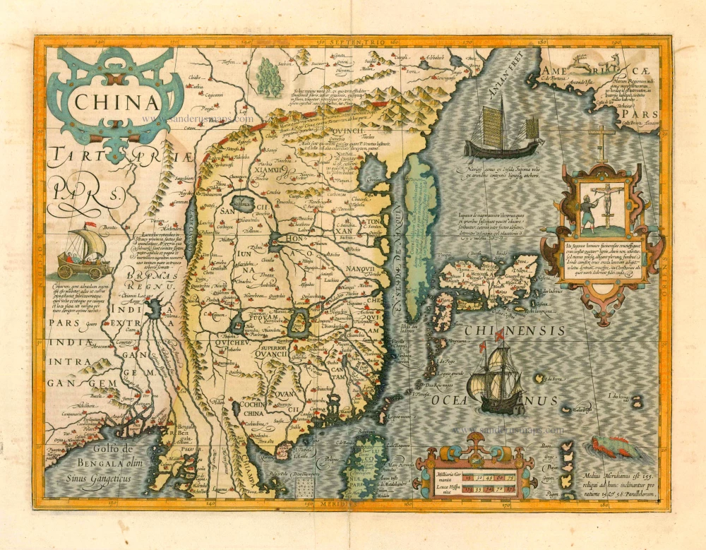
China 1619
China, Korea and Japan by J. Hondius.
[Item number: 6494]

Iapan. 1602
Japan by Langenes, published by Bertius P.
[Item number: 12487]

Iaponiae Nova Desciptio. 1641
Japan & Korea by Johannes Janssonius
[Item number: 26441]

L'Empire du Japon Divisé en sept principales parties, savoir, Ochio, Quanto, Jetsegen, Jetsen, Jamaisoit, Xicoco et Ximo, et subdivisé en soixante et six Royaumes. 1776-79
Japan, by Francesco Santini.
[Item number: 26975]

China Veteribus Sinarum Regio Nunc Incolis Tame Dicta. 1649-55
China - Japan - Korea, by Willem & Joan Blaeu.
[Item number: 27043]
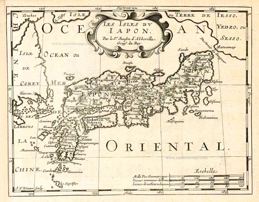
Les Isles du Iapon. 1683
Japan, by Nicolas Sanson.
[Item number: 27081]

Isola del Giapone e Penisola di Corea. 1696
Japan - Korea by Vincenzo Coronelli.
[Item number: 28757]

First map to show Korea as a peninsula. Excellent condition.
Iaponia Regnum. 1655-1659
Japan & Korea by Joan Blaeu.
[Item number: 29853]