
Rare first state of Van der Aa's Japan map with Korea as an island.
Japan, by Pieter van der Aa. 1707
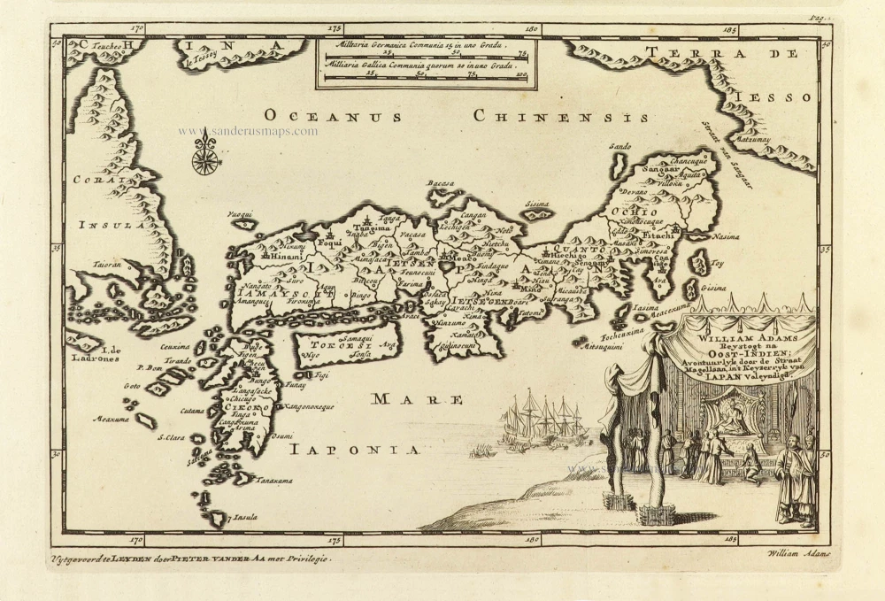
In 1598, Adams, in the capacity of pilot, joined a Dutch fleet of five vessels bound for the Moluccas through the straits of Magellan. He arrived with one ship, De Liefde (The Charity), in Japan in April 1600, with only a couple of dozen of the crew barely alive, of the original 110. He was taken into the service of the Shogun and died in Hirado in 1620 without returning to Europe.
Although he also took geographical measurements, no map of Japan was known to have been produced by him. Van der Aa, however, provided him with a monument in European cartography. In a collection of travel descriptions, he included two of Adams's letters that Adams had given to Dutch East India Company employees to bring back to Europe. The map's cartouche, included as an illustration, depicts Adams during an audience with the shogun, who sits under a baldachin on a fancifully portrayed throne. The depiction of Japan follows the Dudley/Janssonius type in the manner of Sanson. However, Sanson's southwestern tip of Ezo with "Le Tessoy" here belongs to "China" because Van der Aa could not make sense of the arrangement based on Dudley. The mountains along the coasts of Ezo and Korea are depicted in two later variations of Sanson's map, which are not shown here. The place names are also taken from Sanson, though Van der Aa understandably thought it necessary to add the audience's location with the shogun shown in the cartouche. "Eddo" is found in the interior, equidistant from the coasts of the Pacific ("Mare Iaponia") and the Sea of Japan ("Oceanus Chinensis"), roughly where it is shown on Janssonius's map of 1658.
Pieter van der Aa (Leiden, 1659-1733)
Pieter van der Aa was already in 1682 owner of a bookshop and auction house. During his life, he has published an enormous amount of printed material.
After 1700, van der Aa increasingly specialised in books on geography and travel.
He published composite atlases, a series of geographical descriptions of European countries, and some very spectacular works. Between 1706 and 1708 he published the Naauweurige versameling der gedenkwaardigste zee- en land-reysen, in 28 volumes.
Many of Van der Aa’s publications are richly illustrated with maps and plates. He took over many copperplates and prints from other publishers such as Carel Allard and Frederik De Wit. The composite atlases that appeared from his workshop contain a curious mixture of his own material, copies of maps from other publishers, and reprints made from old copper plates, now with his own imprint.
The Galérie agréable du monde, was completed in 1729, and comprised 66 parts, bound in 27 volumes. Van der Aa presented it as a good investment; after publication, the antiquarian value of the work would double, the more so since it was printed in a limited edition of only one hundred copies.
William Adams Reystogt na Oost-Indien; Avontuurlyk door de Straat Magellaan, in't Keyzerryk van Iapan voleyndigd.
Item Number: 32404 Authenticity Guarantee
Category: Antique maps > Asia > Japan
Japan, by Pieter van der Aa.
Title: William Adams Reystogt na Oost-Indien; Avontuurlyk door de Straat Magellaan, in't Keyzerryk van Iapan voleyndigd.
Date of the first edition: 1706.
Date of this map: 1707.
Copper engraving, printed on paper.
Image size: 160 x 230mm (6¼ x 9 inches).
Sheet size: 170 x 280mm (6¾ x 11 inches).
Verso: Blank.
Condition: Excellent.
Condition Rating: A+.
From: Naaukeurige Versameling der gedenk-waardigste Zee- en landreysen na Oost en West-Indien. Leiden, Pieter Van der Aa, 1706.
In 1598, Adams, in the capacity of pilot, joined a Dutch fleet of five vessels bound for the Moluccas through the straits of Magellan. He arrived with one ship, De Liefde (The Charity), in Japan in April 1600, with only a couple of dozen of the crew barely alive, of the original 110. He was taken into the service of the Shogun and died in Hirado in 1620 without returning to Europe.
Although he also took geographical measurements, no map of Japan was known to have been produced by him. Van der Aa, however, provided him with a monument in European cartography. In a collection of travel descriptions, he included two of Adams's letters that Adams had given to Dutch East India Company employees to bring back to Europe. The map's cartouche, included as an illustration, depicts Adams during an audience with the shogun, who sits under a baldachin on a fancifully portrayed throne. The depiction of Japan follows the Dudley/Janssonius type in the manner of Sanson. However, Sanson's southwestern tip of Ezo with "Le Tessoy" here belongs to "China" because Van der Aa could not make sense of the arrangement based on Dudley. The mountains along the coasts of Ezo and Korea are depicted in two later variations of Sanson's map, which are not shown here. The place names are also taken from Sanson, though Van der Aa understandably thought it necessary to add the audience's location with the shogun shown in the cartouche. "Eddo" is found in the interior, equidistant from the coasts of the Pacific ("Mare Iaponia") and the Sea of Japan ("Oceanus Chinensis"), roughly where it is shown on Janssonius's map of 1658.
Pieter van der Aa (Leiden, 1659-1733)
Pieter van der Aa was already in 1682 owner of a bookshop and auction house. During his life, he has published an enormous amount of printed material.
After 1700, van der Aa increasingly specialised in books on geography and travel.
He published composite atlases, a series of geographical descriptions of European countries, and some very spectacular works. Between 1706 and 1708 he published the Naauweurige versameling der gedenkwaardigste zee- en land-reysen, in 28 volumes.
Many of Van der Aa’s publications are richly illustrated with maps and plates. He took over many copperplates and prints from other publishers such as Carel Allard and Frederik De Wit. The composite atlases that appeared from his workshop contain a curious mixture of his own material, copies of maps from other publishers, and reprints made from old copper plates, now with his own imprint.
The Galérie agréable du monde, was completed in 1729, and comprised 66 parts, bound in 27 volumes. Van der Aa presented it as a good investment; after publication, the antiquarian value of the work would double, the more so since it was printed in a limited edition of only one hundred copies.
Related items
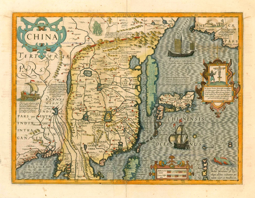
With Korea as an island.
China 1619
China, Korea and Japan by J. Hondius.
[Item number: 6494]

Iapan. 1602
Japan by Langenes, published by Bertius P.
[Item number: 12487]

Iaponiae Nova Desciptio. 1641
Japan & Korea by Johannes Janssonius
[Item number: 26441]

L'Empire du Japon Divisé en sept principales parties, savoir, Ochio, Quanto, Jetsegen, Jetsen, Jamaisoit, Xicoco et Ximo, et subdivisé en soixante et six Royaumes. 1776-79
Japan, by Francesco Santini.
[Item number: 26975]

China Veteribus Sinarum Regio Nunc Incolis Tame Dicta. 1649-55
China - Japan - Korea, by Willem & Joan Blaeu.
[Item number: 27043]
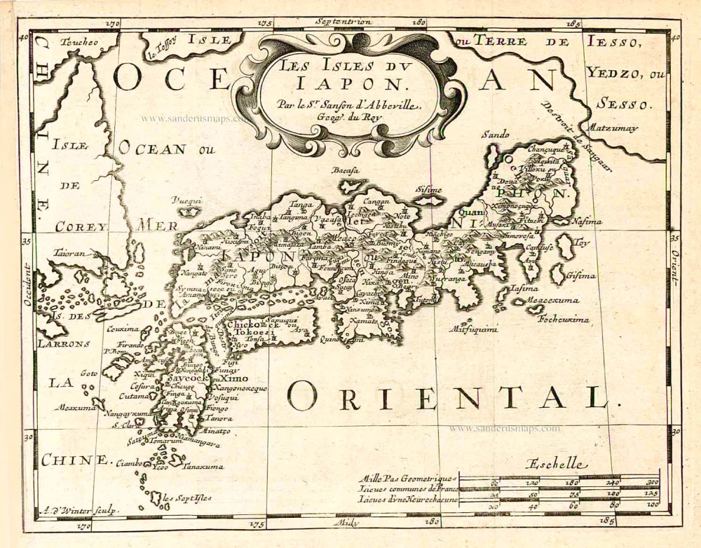
Les Isles du Iapon. 1683
Japan, by Nicolas Sanson.
[Item number: 27081]

Isola del Giapone e Penisola di Corea. 1696
Japan - Korea by Vincenzo Coronelli.
[Item number: 28757]

First map to show Korea as a peninsula. Excellent condition.
Iaponia Regnum. 1655-1659
Japan & Korea by Joan Blaeu.
[Item number: 29853]
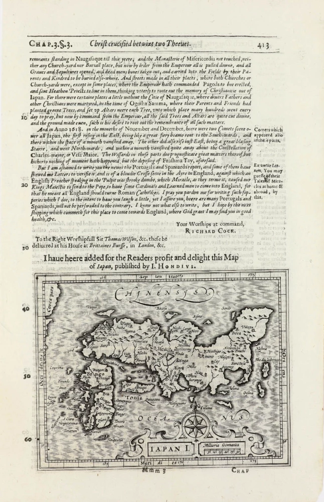
Iapan I. 1625
Japan by Jodocus Hondius, published by Samuel Purchas
[Item number: 32418]