
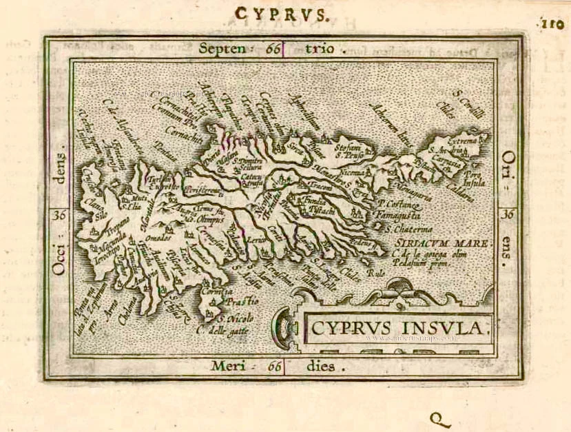
Cyprus & other Greek Islands, by Abraham Ortelius. 1601

Abraham Ortelius (1527-1598)
The maker of the 'first atlas', the Theatrum Orbis Terrarum (1570), was born on 4 April 1527 into an old Antwerp family. He learned Latin and studied Greek and mathematics.
Abraham and his sisters, Anne and Elizabeth, took up map colouring. Ortelius was admitted to the Guild of St. Luke as an "illuminator of maps." In addition to colouring maps, Ortelius was a dealer in antiques, coins, maps, and books, and the book and map trade gradually became his primary occupation.
Business went well because his means allowed him to amass an extensive collection of medals, coins, and antiques, as well as a library of many volumes. In addition, he travelled extensively, visited Italy and France, made contacts with scholars and editors everywhere, and maintained extensive correspondence with them.
In 1564, he published his first map, a large and ambitious world wall map. The inspiration for this map may well have been Gastaldi's large world map. In 1565, he published a map of Egypt and a map of the Holy Land; a large map of Asia followed.
In 1568, the production of individual maps for his atlas Theatrum Orbis Terrarum was already in full swing. He completed the atlas in 1569, and in May 1570, it was available for sale. It was one of the most expensive books ever published.
This first edition contained seventy maps on fifty-three sheets. Franciscus Hogenberg engraved the maps.
Later editions included Additamenta (additions), resulting in Ortelius' historical atlas, the Parergon, which is mainly bound together with the atlas. The Parergon can be considered a truly original work by Ortelius, who drew the maps based on his research.
The importance of the Theatrum Orbis Terrarum for geographical knowledge in the last quarter of the sixteenth century is difficult to overemphasise. Nothing was like it until Mercator's atlas appeared twenty-five years later. Demand for the Theatrum was remarkable. Some 24 editions appeared during Ortelius's lifetime, and another 10 after he died in 1598. Editions were published in Dutch, German, French, Spanish, English, and Italian. The number of map sheets grew from 53 in 1570 to 167 in the last edition in 1612.
In 1577, engraver Philip Galle and poet-translator Pieter Heyns published the first pocket-sized edition of the Theatrum, the Epitome. The work was trendy. Over thirty editions of this Epitome were published in different languages.
Ortelius is also remembered for an early idea resembling continental drift: he suggested that the Americas, Europe, and Africa may once have been joined together before separating over time. His work helped shape the development of modern geography and mapmaking.
Insular. aliquot Aegaei Maris Antiqua Descrip.
Item Number: 28639 Authenticity Guarantee
Category: Antique maps > Asia > Turkey - Cyprus
Cyprus & other Greek Islands, by Abraham Ortelius.
Title: Insular. aliquot Aegaei Maris Antiqua Descrip.
Ex Conatibus geographicis Abrahami Ortelij Antverpiani.
Cum privilegio decennali.
1584.
Date of the first edition: 1584.
Date of this map: 1601.
Date on map: 1584.
Copper engraving, printed on paper.
Image size: 365 x 475mm (14.37 x 18.7 inches).
Sheet size: 475 x 580mm (18.7 x 22.83 inches).
Verso: Latin text.
Condition: Hand coloured, margins age-toned.
Condition Rating: B.
From: Theatrum Orbis Terrarum Abrahami Ortelii Antverp. Geographi Regii. Antwerpen, Plantin Press, 1601. (Van der Krogt 3, 1:052)
Abraham Ortelius (1527-1598)
The maker of the 'first atlas', the Theatrum Orbis Terrarum (1570), was born on 4 April 1527 into an old Antwerp family. He learned Latin and studied Greek and mathematics.
Abraham and his sisters, Anne and Elizabeth, took up map colouring. Ortelius was admitted to the Guild of St. Luke as an "illuminator of maps." In addition to colouring maps, Ortelius was a dealer in antiques, coins, maps, and books, and the book and map trade gradually became his primary occupation.
Business went well because his means allowed him to amass an extensive collection of medals, coins, and antiques, as well as a library of many volumes. In addition, he travelled extensively, visited Italy and France, made contacts with scholars and editors everywhere, and maintained extensive correspondence with them.
In 1564, he published his first map, a large and ambitious world wall map. The inspiration for this map may well have been Gastaldi's large world map. In 1565, he published a map of Egypt and a map of the Holy Land; a large map of Asia followed.
In 1568, the production of individual maps for his atlas Theatrum Orbis Terrarum was already in full swing. He completed the atlas in 1569, and in May 1570, it was available for sale. It was one of the most expensive books ever published.
This first edition contained seventy maps on fifty-three sheets. Franciscus Hogenberg engraved the maps.
Later editions included Additamenta (additions), resulting in Ortelius' historical atlas, the Parergon, which is mainly bound together with the atlas. The Parergon can be considered a truly original work by Ortelius, who drew the maps based on his research.
The importance of the Theatrum Orbis Terrarum for geographical knowledge in the last quarter of the sixteenth century is difficult to overemphasise. Nothing was like it until Mercator's atlas appeared twenty-five years later. Demand for the Theatrum was remarkable. Some 24 editions appeared during Ortelius's lifetime, and another 10 after he died in 1598. Editions were published in Dutch, German, French, Spanish, English, and Italian. The number of map sheets grew from 53 in 1570 to 167 in the last edition in 1612.
In 1577, engraver Philip Galle and poet-translator Pieter Heyns published the first pocket-sized edition of the Theatrum, the Epitome. The work was trendy. Over thirty editions of this Epitome were published in different languages.
Ortelius is also remembered for an early idea resembling continental drift: he suggested that the Americas, Europe, and Africa may once have been joined together before separating over time. His work helped shape the development of modern geography and mapmaking.
Related items

Parergon map
Insular. aliquot Aegaei Maris Antiqua Descrip. 1601
Cyprus & other Greek Islands by Abraham Ortelius.
[Item number: 12452]

Cyprus Insula - Candia, olim Creta. 1572
Cyprus - Crete, by A. Ortelius.
[Item number: 16585]
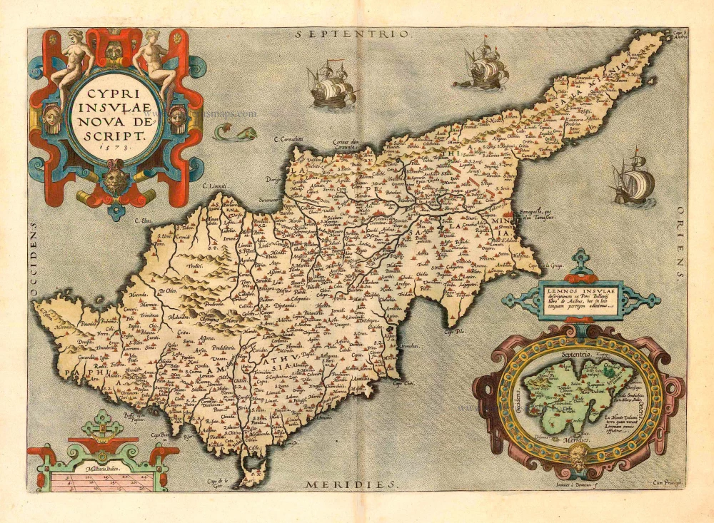
Cypri Insulae Nova Descript. 1573 1592
Cyprus, by Ortelius A.
[Item number: 22955]

Cyprus Ins: 1633
Cyprus, by Jodocus Hondius.
[Item number: 24436]
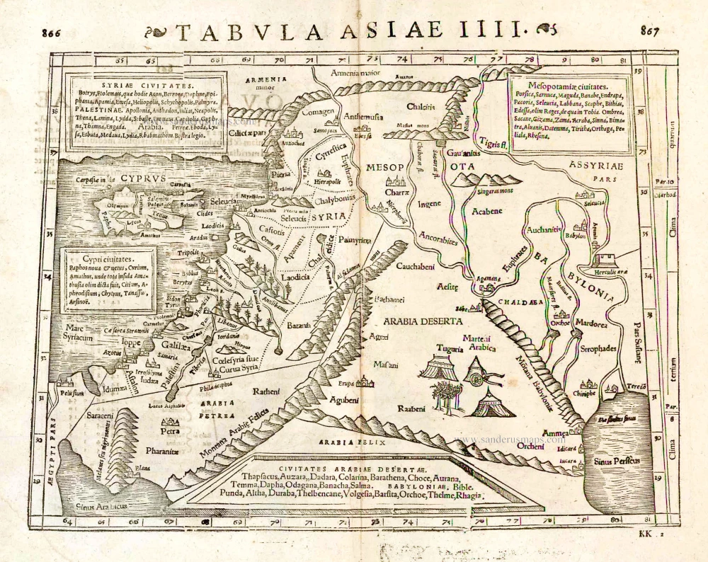
Tabula Asiae IIII. 1571
Middle East - Cyprus - Holy Land by Strabo - Sebastian Münster
[Item number: 25653]

Cyprus Insula. 1552
Cyprus, by S. Münster.
[Item number: 25723]
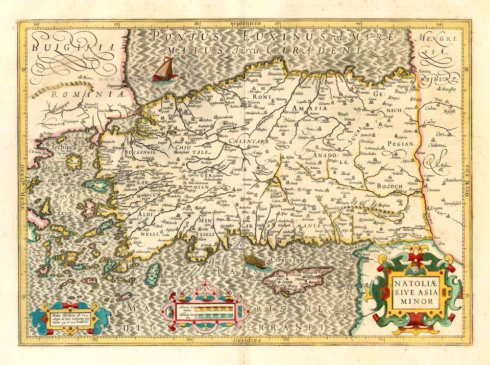
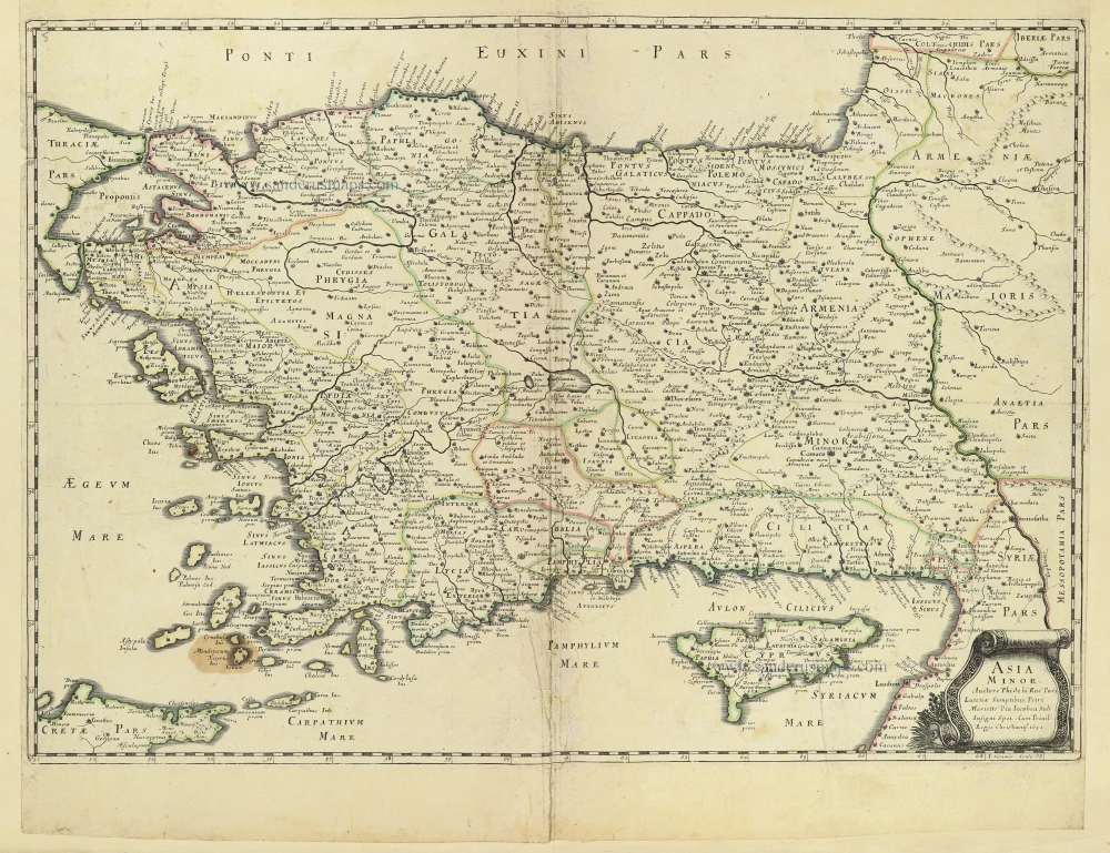
Natoliae sive Asia Minor. 1641
Turkey & Cyprus, by Jodocus Hondius.
[Item number: 26435]

Cyprus Ins: 1641
Cyprus, by Henricus Hondius.
[Item number: 26436]
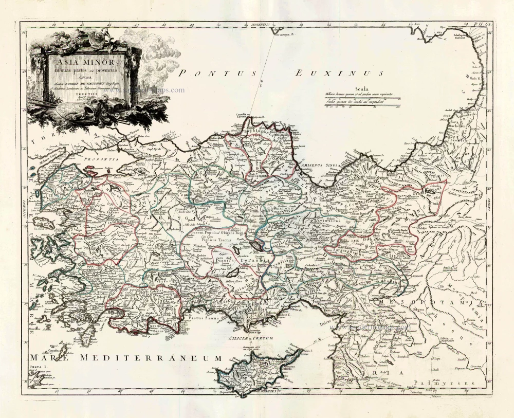
Asia Minor in suas partes seu provincias divisa. 1776-79
Turkey and Cyprus, by Paolo Santini.
[Item number: 27014]
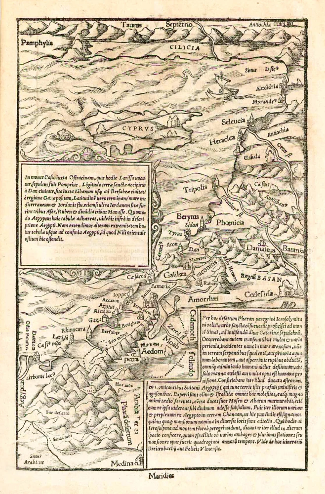
In monte Casio iuxta Ostracinam, ... 1550
Cyprus and the Holy Land, by Sebastian Münster.
[Item number: 27073]

Natolia quae olim Asia Minor. 1640
Turkey and Cyprus, by Willem Blaeu.
[Item number: 27148]

Scarce
Cyprus Insula. - De L'Isle de Chipre. 1575
Cyprus, by François Belleforest.
[Item number: 27300]
Cyprus Insula. 1609
Cyprus by Abraham Ortelius.
[Item number: 27509]

Very rare.
Cipro insula nobiliss. ... c. 1575
Cyprus by Giovanni Francesco Camocio
[Item number: 27577]
Asia Minor. 1665
Turkey - Cyprus by Philippe de la Rue.
[Item number: 28470]

Asia Minor In Epitomen contracta, Magnas Regiones seu Provincias Representans In Quibus Populi, Primariae Urbes Locaque Praecipua Notantur. 1700-1710
Turkey & Cyprus by Pierre Moullart-Sanson.
[Item number: 28532]
Rare!
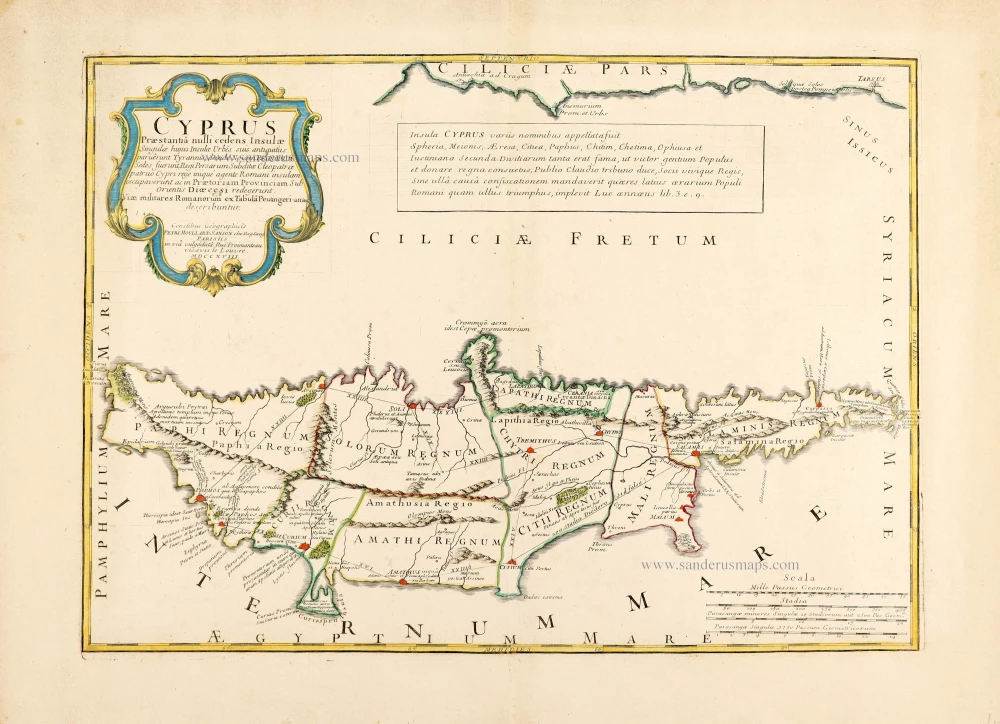
Cyprus Praestantia nulli cedens Insulae. 1718
Cyprus by Pierre Moullart-Sanson.
[Item number: 28632]

Cipro. - [Above map :] Descrittione dell'Isola di Cipro. 1590
Cyprus by Thomasso Porcacchi.
[Item number: 29827]

Rare.
Cyprus Insula. ca. 1658-1663
Cyprus by Nicolas Sanson, published by Pierre Mariette.
[Item number: 30045]

Cypri Insulae Nova Descript. 1573 1575
Cyprus by Abraham Ortelius.
[Item number: 30103]

Cyprus Insula. 1640
Cyprus, by W. & J. Blaeu.
[Item number: 32828]