
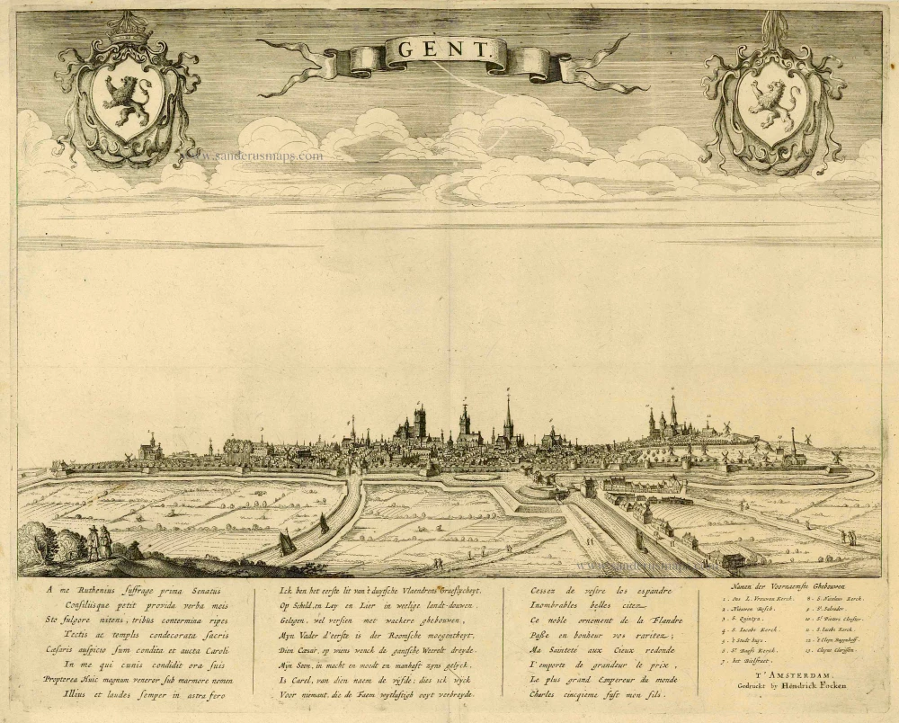
Gent by Joan Blaeu. 1652

Antonius Sanderus (Antwerpen, 1586 – Affligem, 1664)
Antoon Sanders (in Latin Antonius Sanderus) came from a distinguished Ghent family who briefly stayed in Antwerp after temporarily fleeing the Ghent Republic.
Antonius Sanderus, a man of exceptional intellectual prowess, began his Latin studies at the renowned Jesuit college of Oudenaarde and further honed his knowledge in Ghent. His thirst for knowledge led him to pursue philosophy at the Jesuit College of Douai, where he earned a Master's Artium in 1609, a testament to his scholarly dedication.
In 1611, Sanderus was ordained a priest in Ghent and became a pastor in a few hamlets near Eeklo. However, despite the relative calm of the Twelve Years' Truce, the region was not without its tensions. Sanderus found himself in a precarious position due to his controversial writings, which included critiques of Anabaptism in Flanders. These critiques sparked heated debates and raised eyebrows among his peers.
In 1615, he became Baccalaureus in theology at the University of Leuven, and in 1619, he returned to Douai, where he obtained a degree in theology at the University of Douai.
In 1621, he returned to Ghent, where Bishop Antonius Triest protected him. In 1623, he was made chaplain and secretary to Cardinal Alfonso de la Cueva, the governor of Philip IV of Spain in the Southern Netherlands.
1625, he became a canon at St. Martins' Church in Ypres.
In the meantime, he conducted extensive research for a prestigious history work on the county of Flanders, the Flandria Illustrata. For these searches, he visited monasteries and castles to consult the archives, a testament to his dedication and thoroughness as a historian. However, this meticulous approach to research was not always appreciated by the other canons of Ypres, who felt he was neglecting his other duties.
That is why he resigned from his religious functions in 1654 and received the post of Censor Librorum in Brussels, a position of significant influence in controlling and regulating printed materials. In this role, he played a crucial part in shaping the intellectual and cultural life of the city.
In 1668, he resigned as a canon of the Ypres chapter. The reasons for this decision are not entirely clear. Still, it is believed that his increasing focus on his historical research and the offer of a more suitable environment for his work at the Affligem Abbey were contributing factors. Finally, he left the city to settle at the Affligem Abbey, where he was warmly received by the abbot Benedictus van Haeften.
He died there on January 16, 1664, and was buried in the abbey church.
Antonius Sanderus published historical works from 1610, but his magnum opus is the richly illustrated Flandria Illustrata, sive Descriptio Comitatus Istius per Totum Terrarum Orbis Terrarum. The publication was begun by Henricus Hondius, who had a publication contract with Sanderus as early as 1634. It was a landmark in studying Flanders' history, featuring numerous portraits, plans, views, and maps. In 1641, Hondius printed the first volume in Leiden as Theatrum Flandriae but immediately sold the rights to Joan Blaeu. They published two volumes of the work in 1641 and 1644, respectively, with a fake publisher's address in Cologne. The work's influence extended beyond its initial publication, with Blaeu using fifteen maps of the Flandria Illustrata for his Atlas Maior and most of the plans being used in the town book of the Royal Netherlands.
In 1659, he published a history of Brabant abbeys and monasteries: the Chorographia sacra Brabantiae.
The Blaeus: Willem Janszoon, Cornelis & Joan
Willem Jansz. Blaeu and his son Joan Blaeu are the seventeenth century's most widely known cartographic publishers.
Willem Jansz. (also written Guilielmus Janssonius) = Willem Janszoon Blaeu was born in Uitgeest (Netherlands), near Alkmaar, in 1571. He studied mathematics under Tycho Brahe and learned the theory and practice of astronomical observations and the art of instrument- and globe-making.
In 1596, he came to Amsterdam, where he settled down as a globe-, instrument- and mapmaker. He published his first cartographic work (a globe) in 1599 and probably published his first printed map (a map of the Netherlands) in 1604. He specialised in maritime cartography, published the first edition of the pilot guide Het Licht der Zeevaert in 1608, and was appointed Hydrographer of the V.O.C. (United East India Company) in 1633. After publishing books, wall maps, globes, charts and pilot guides for thirty years, he brought out his first atlas, Atlas Appendix (1630). This was the beginning of the great tradition of atlas-making by the Blaeus.
In 1618, another mapmaker, bookseller and publisher, Johannes Janssonius, established himself in Amsterdam next door to Blaeu's shop. No wonder these two neighbours began accusing each other of copying and stealing their information and became fierce competitors who did not have a good word to say about each other. In about 1621 Willem Jansz. decided to end the confusion between his name and his competitor's and assumed his grandfather's nickname, 'blauwe Willem' ('blue Willem'), as the family name; after that, he called himself Willem Jansz. Blaeu.
Willem Janszoon Blaeu died in 1638, leaving his prospering business to his sons, Cornelis and Joan. We only know that Cornelis's name occurs in the prefaces of books and atlases until c. 1645.
Joan Blaeu, born in Amsterdam in 1596, became a partner in his father's book trade and printing business. 1638, he was appointed his father's successor in the Hydrographic Office of the V.O.C. His efforts culminated in the magnificent Atlas Major and the town books of the Netherlands and Italy – works unsurpassed in history and modern times, giving eternal fame to the name of the Blaeu's.
A fire ruined the business on February 23, 1672, and one year later, Dr. Joan Blaeu died. The fire and the director's passing caused the complete sale of the Blaeu House's stock. Five public auctions dispersed the remaining books, atlases, copperplates, globes, etc., among many other map dealers and publishers in Amsterdam. The majority was acquired by several booksellers acting in partnership.
In the succeeding years, the remaining printing department remained in the hands of the Blaeu family until 1695, when the printing house's inventory was sold at a public auction. That meant the end of the Blaeu family as a printing house of world renown.
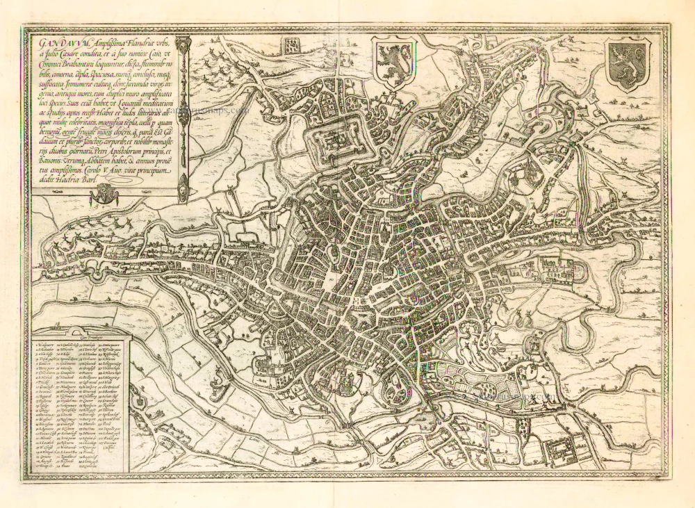
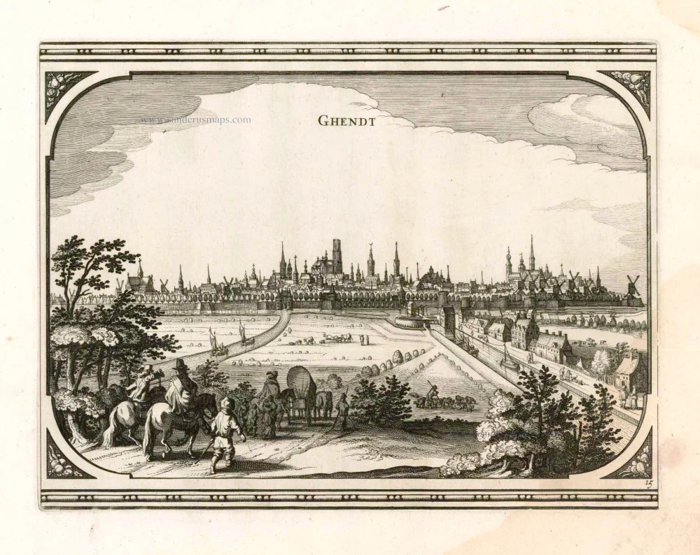
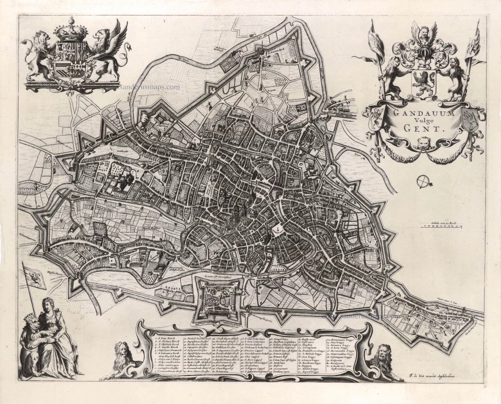
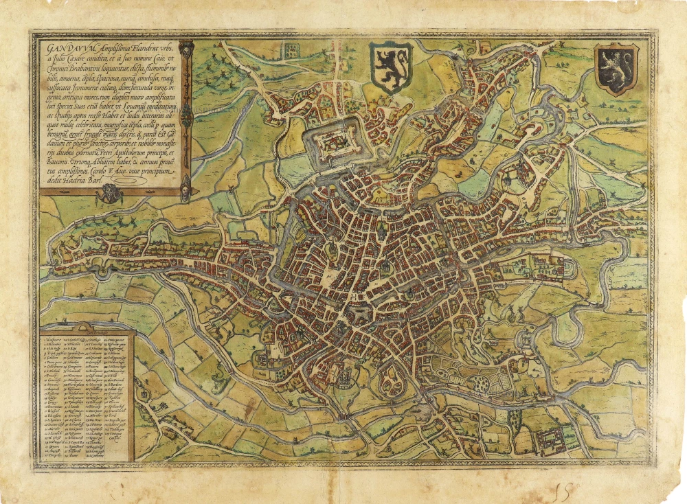
Gandavum vulgo Gent.
Item Number: 27500 Authenticity Guarantee
Category: Antique maps > Europe > Belgium - Cities
Antique bird’s-eye view plan of Gent, by Antonius Sanderus, published by Joan Blaeu.
Title: Gandavum vulgo Gent.
Oriented to the southwest.
Date of the first edition: 1641.
Date of this map: 1652.
Copper engraving, printed on paper.
Size (not including margins): 430 x 540mm (16.93 x 21.26 inches).
Verso: Latin text.
Condition: Original coloured, excellent.
Condition Rating: A+.
From: Novum Ac Magnum Theatrum Urbium Belgicae Regiae. Amsterdam, J. Blaeu, 1652. (Van der Krogt 4, 43:113.2)
Antonius Sanderus (Antwerpen, 1586 – Affligem, 1664)
Antoon Sanders (in Latin Antonius Sanderus) came from a distinguished Ghent family who briefly stayed in Antwerp after temporarily fleeing the Ghent Republic.
Antonius Sanderus, a man of exceptional intellectual prowess, began his Latin studies at the renowned Jesuit college of Oudenaarde and further honed his knowledge in Ghent. His thirst for knowledge led him to pursue philosophy at the Jesuit College of Douai, where he earned a Master's Artium in 1609, a testament to his scholarly dedication.
In 1611, Sanderus was ordained a priest in Ghent and became a pastor in a few hamlets near Eeklo. However, despite the relative calm of the Twelve Years' Truce, the region was not without its tensions. Sanderus found himself in a precarious position due to his controversial writings, which included critiques of Anabaptism in Flanders. These critiques sparked heated debates and raised eyebrows among his peers.
In 1615, he became Baccalaureus in theology at the University of Leuven, and in 1619, he returned to Douai, where he obtained a degree in theology at the University of Douai.
In 1621, he returned to Ghent, where Bishop Antonius Triest protected him. In 1623, he was made chaplain and secretary to Cardinal Alfonso de la Cueva, the governor of Philip IV of Spain in the Southern Netherlands.
1625, he became a canon at St. Martins' Church in Ypres.
In the meantime, he conducted extensive research for a prestigious history work on the county of Flanders, the Flandria Illustrata. For these searches, he visited monasteries and castles to consult the archives, a testament to his dedication and thoroughness as a historian. However, this meticulous approach to research was not always appreciated by the other canons of Ypres, who felt he was neglecting his other duties.
That is why he resigned from his religious functions in 1654 and received the post of Censor Librorum in Brussels, a position of significant influence in controlling and regulating printed materials. In this role, he played a crucial part in shaping the intellectual and cultural life of the city.
In 1668, he resigned as a canon of the Ypres chapter. The reasons for this decision are not entirely clear. Still, it is believed that his increasing focus on his historical research and the offer of a more suitable environment for his work at the Affligem Abbey were contributing factors. Finally, he left the city to settle at the Affligem Abbey, where he was warmly received by the abbot Benedictus van Haeften.
He died there on January 16, 1664, and was buried in the abbey church.
Antonius Sanderus published historical works from 1610, but his magnum opus is the richly illustrated Flandria Illustrata, sive Descriptio Comitatus Istius per Totum Terrarum Orbis Terrarum. The publication was begun by Henricus Hondius, who had a publication contract with Sanderus as early as 1634. It was a landmark in studying Flanders' history, featuring numerous portraits, plans, views, and maps. In 1641, Hondius printed the first volume in Leiden as Theatrum Flandriae but immediately sold the rights to Joan Blaeu. They published two volumes of the work in 1641 and 1644, respectively, with a fake publisher's address in Cologne. The work's influence extended beyond its initial publication, with Blaeu using fifteen maps of the Flandria Illustrata for his Atlas Maior and most of the plans being used in the town book of the Royal Netherlands.
In 1659, he published a history of Brabant abbeys and monasteries: the Chorographia sacra Brabantiae.
The Blaeus: Willem Janszoon, Cornelis & Joan
Willem Jansz. Blaeu and his son Joan Blaeu are the seventeenth century's most widely known cartographic publishers.
Willem Jansz. (also written Guilielmus Janssonius) = Willem Janszoon Blaeu was born in Uitgeest (Netherlands), near Alkmaar, in 1571. He studied mathematics under Tycho Brahe and learned the theory and practice of astronomical observations and the art of instrument- and globe-making.
In 1596, he came to Amsterdam, where he settled down as a globe-, instrument- and mapmaker. He published his first cartographic work (a globe) in 1599 and probably published his first printed map (a map of the Netherlands) in 1604. He specialised in maritime cartography, published the first edition of the pilot guide Het Licht der Zeevaert in 1608, and was appointed Hydrographer of the V.O.C. (United East India Company) in 1633. After publishing books, wall maps, globes, charts and pilot guides for thirty years, he brought out his first atlas, Atlas Appendix (1630). This was the beginning of the great tradition of atlas-making by the Blaeus.
In 1618, another mapmaker, bookseller and publisher, Johannes Janssonius, established himself in Amsterdam next door to Blaeu's shop. No wonder these two neighbours began accusing each other of copying and stealing their information and became fierce competitors who did not have a good word to say about each other. In about 1621 Willem Jansz. decided to end the confusion between his name and his competitor's and assumed his grandfather's nickname, 'blauwe Willem' ('blue Willem'), as the family name; after that, he called himself Willem Jansz. Blaeu.
Willem Janszoon Blaeu died in 1638, leaving his prospering business to his sons, Cornelis and Joan. We only know that Cornelis's name occurs in the prefaces of books and atlases until c. 1645.
Joan Blaeu, born in Amsterdam in 1596, became a partner in his father's book trade and printing business. 1638, he was appointed his father's successor in the Hydrographic Office of the V.O.C. His efforts culminated in the magnificent Atlas Major and the town books of the Netherlands and Italy – works unsurpassed in history and modern times, giving eternal fame to the name of the Blaeu's.
A fire ruined the business on February 23, 1672, and one year later, Dr. Joan Blaeu died. The fire and the director's passing caused the complete sale of the Blaeu House's stock. Five public auctions dispersed the remaining books, atlases, copperplates, globes, etc., among many other map dealers and publishers in Amsterdam. The majority was acquired by several booksellers acting in partnership.
In the succeeding years, the remaining printing department remained in the hands of the Blaeu family until 1695, when the printing house's inventory was sold at a public auction. That meant the end of the Blaeu family as a printing house of world renown.
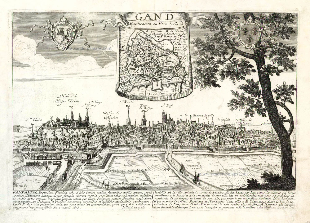
Related items
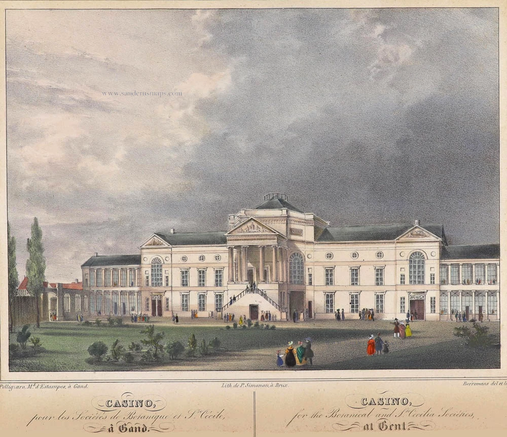
Casino, pour les Sociétés de Botanique et Ste. Cécile, à Gand. - Casono, for the Botanical and Ste Cecilia Sociétes, at Gent. ca. 1840
Gent - Casino by Henri Borremans.
[Item number: 359]
Gandavum, Amplißima Flandria Urbs ... 1657
Ghent (Gent) by Georg Braun & Frans Hogenberg, published by Johannes Janssonius.
[Item number: 2687]
With 'Gravensteen'.
No title. 1641-1644
Ghent (Gent), by A. Sanderus.
[Item number: 5533]
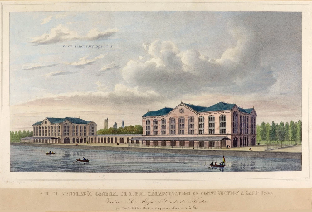
Vue de l'Entrépôt Général de Libre Réexportation en Construction à Gand 1844. c. 1850
Ghent by Charles Le Clerc, after Louis Roelandt.
[Item number: 5604]
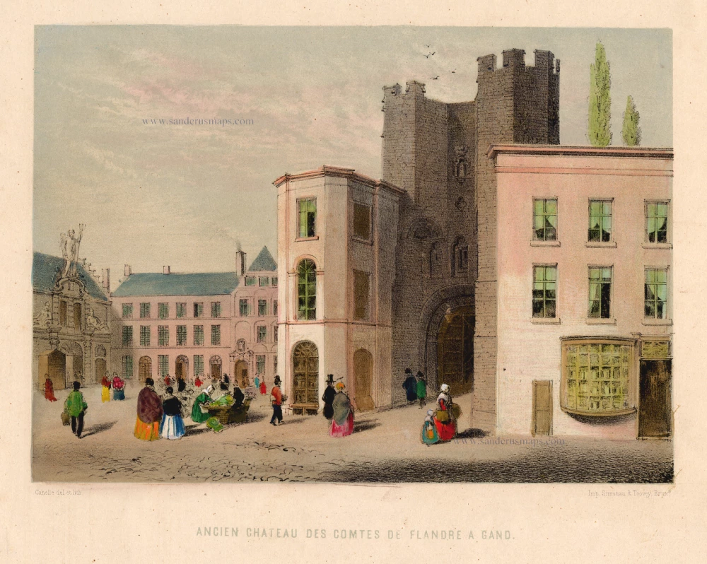
Ancien Château des Comtes de Flandre à Gand. c. 1850
Castle in Ghent (Gravenkasteel) by Canelle.
[Item number: 13180]
Rare.
Gent. c. 1660
Gent, by Focken Hendrick
[Item number: 21312]

Rare.
Gent ca. 1650
Gent by Schnitzer Lucas
[Item number: 21998]
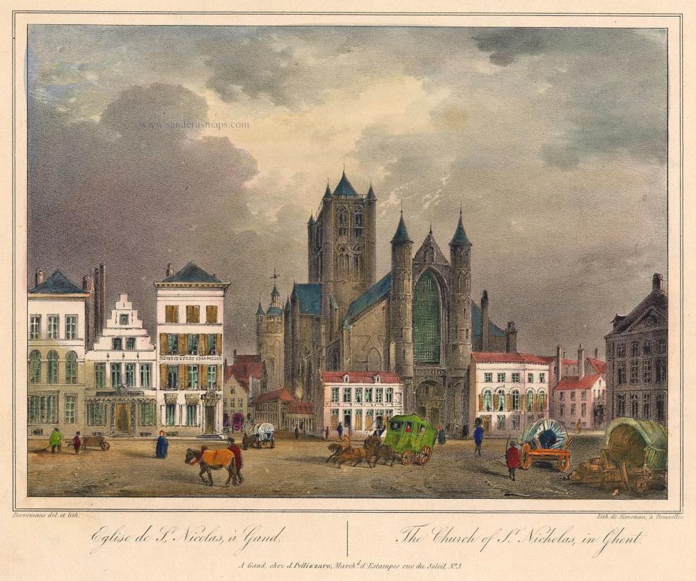
Eglise de St. Nicolas à Gand. - The Church of S. Nicholas, in Ghent. c. 1840
Ghent - Church of St. Nicholas by Henri Borremans.
[Item number: 22002]
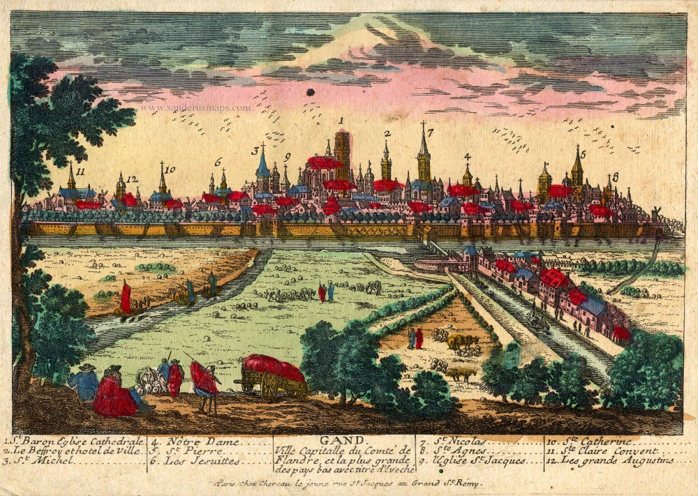
Gand. Ville Capitalle du Comté de Flandre, et la plus grande des pays bas avec titre d'Eveché c. 1720
Gent, by Chéreau.
[Item number: 22537]
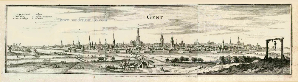
Ghendt 1656
Gent, by Visscher N. - Schut P.H.
[Item number: 25397]
Rare!
Gand. c. 1678
Ghent (Gent) by Gerard Jollain.
[Item number: 26705]
Gent. 1659
Gent, by Matthäus Merian.
[Item number: 27411]
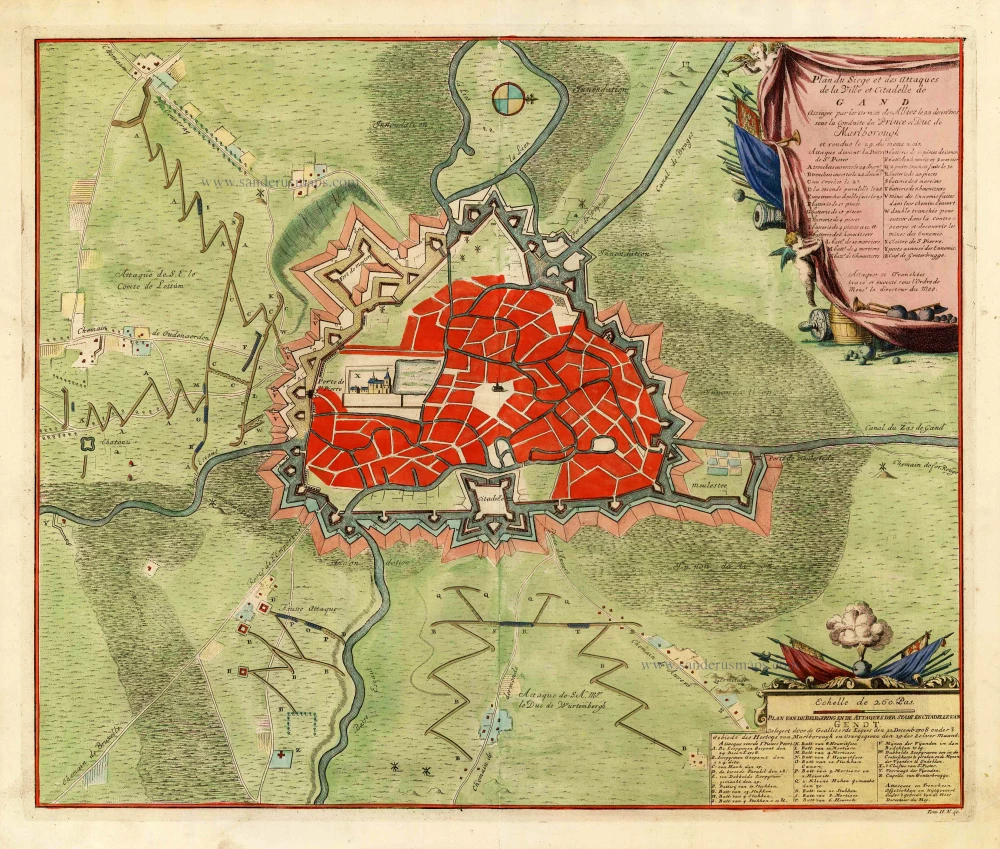
Plan du siège et des attaques de la ville et citadelle de Gand assiégée par les armées des alliez le 22 décembre 1708. ... 1729
Gent, by Jean Dumont.
[Item number: 27430]
Gandavum vulgo Gent. c. 1700
Gent by Frederick de Wit.
[Item number: 29517]
Plan de la Ville et Citadelle de Gand . . . 1712
Gent by Eugène Fricx.
[Item number: 29542]
Ghendt. 1613
Gent by Ludovico Guicciardini.
[Item number: 29558]
Ghent. 1833
Ghent (Gent) Three towers - Drie torens, by S. Prout.
[Item number: 30027]
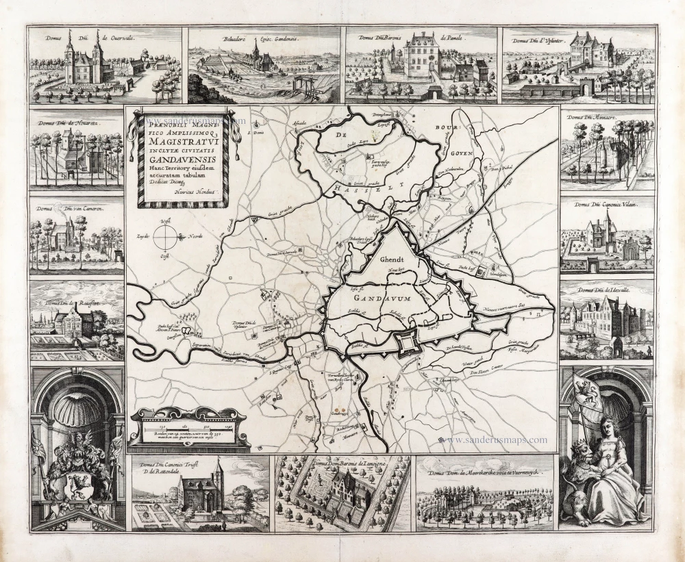
Extremely rare map of Ghent and surroundings.
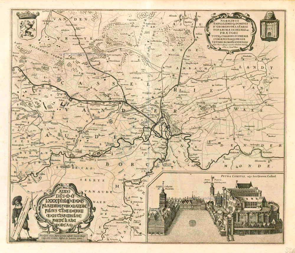
Praenobili Magnifico Amplissimoq[ue] Magistratui inclytae civitatis Gandavensis
Ghent (Gent), by Henricus Hondius.
[Item number: 30121]
Gandavum, Amplissima Flandriae urbs, ... 1599
Gent by Georg Braun & Frans Hogenberg.
[Item number: 31325]

Gandavum. 1612
Gent by Lodovico Guicciardini.
[Item number: 31373]
new