
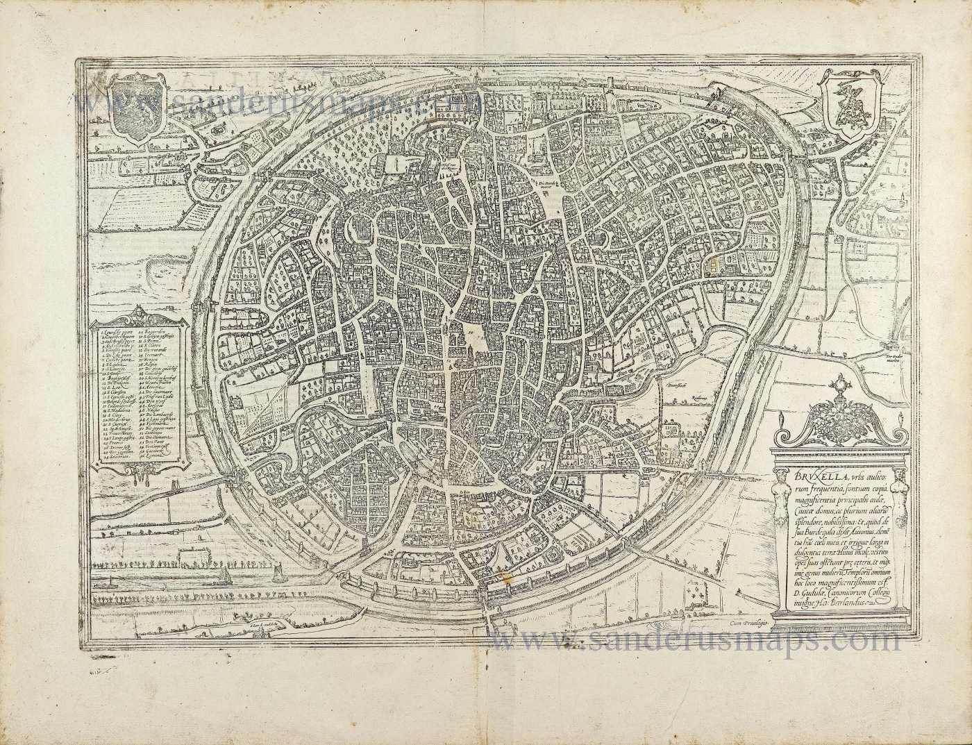
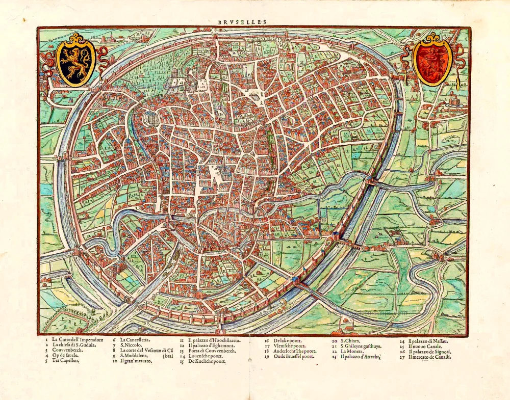
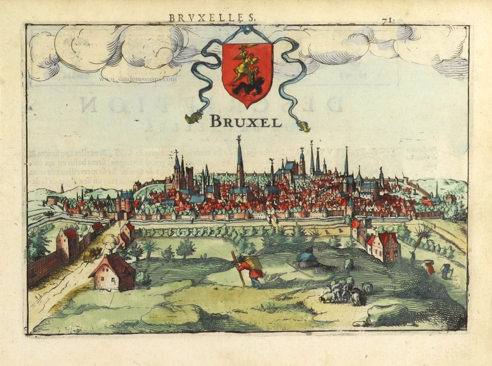
Brussels, by Georg Braun and Frans Hogenberg. 1599
The item displayed on this page has been sold. However, we have a similar map in stock:
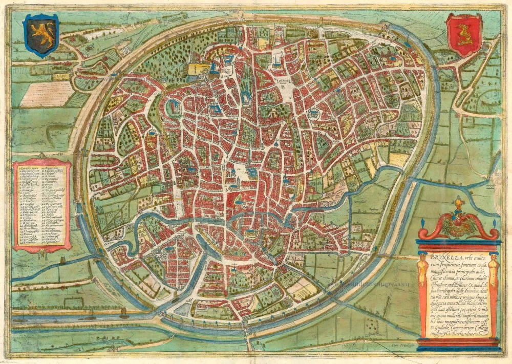
Brussels, by Georg Braun and Frans Hogenberg. 1612
Bruxella, Urbs Aulicorum Frequentia, Fontium...
[Item number: 32428]
new
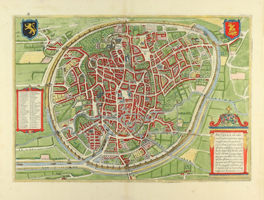

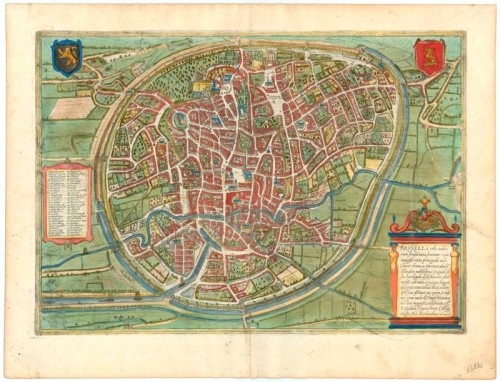

TRANSLATION OF CARTOUCHE TEXT: Brussels is a very well-known city due to its large number of courtiers, its copious springs, the magnificence of its princely court and its town hall and many other things. And as Ausonius says of his Burdegala: rich with a mild climate and well-irrigated soil. The inhabitants, particularly the women, display their riches through their dress. The most magnificent church is St Gudula's, still distinguished by its college of canons (according to Ha. Barlandus).
COMMENTARY BY BRAUN (on verso): "Brussels, the noblest city in all Brabant, was chosen by the kings as their seat because it has springs that always flow, uplifting hills and healthy air and is very splendid to behold. [...] The royal palace, which lies on a hill with a chapel, was built by Emperor Charles V and is no small embellishment for the city because there, the lords of the Golden Fleece and the councillors meet for joint deliberations with the Governor. [...] A waterway was miraculously dug from Brussels, at great expense and with a great deal of work, for the benefit of locals and strangers. [...] The canal is over five German miles long. It was begun in 1550 and completed in 1561 to the great admiration of all."
From a bird-eye perspective, this plan view shows an idealized, almost circular view of the city. The picture is dominated on the one hand by the wide streets and the city wall ringed by a moat and on the other by the navigable River Senne, which enabled ships to dock inside the city using the canal network. Brussels received its charter in 1312 and, as early as 1357, built an extensive city wall, enclosing fields and tracts of land within it. When the Dukes of Brabant chose Brussels as their seat of government in 1383, the population had already reached 50,000. At the start of the 15th century, the dukes constructed their palaces (17). Brussels experienced its greatest flowering from 1430 under Philip the Good: the Hôtel de Ville (51) was built on the Grande Place, and artists and craftsmen, manuscript illuminators, sculptors and goldsmiths settled in the city. Pieter Breughel the Elder lived and worked here and, in 1569, was buried in Notre-Dame-de-la-Chapelle.
The engraving is made after a plan from Guicciardini (1567); some topographical details may derive from a sketch by Jacob van Deventer (c. 1550). (Taschen)
Braun G. & Hogenberg F. and the Civitates Orbis Terrarum.
The Civitates Orbis Terrarum, also known as the 'Braun & Hogenberg', is a six-volume town atlas and the most excellent book of town views and plans ever published: 363 engravings, sometimes beautifully coloured. It was one of the best-selling works in the last quarter of the 16th century. Georg Braun, a skilled writer, wrote the text accompanying the plans and views on the verso. Many plates were engraved after the original drawings of a professional artist, Joris Hoefnagel (1542-1600). The first volume was published in Latin in 1572 and the sixth in 1617. Frans Hogenberg, a talented engraver, created the tables for volumes I through IV, and Simon van den Neuwel made those for volumes V and VI. Other contributors were cartographers Daniel Freese and Heinrich Rantzau, who provided valuable geographical information. Works by Jacob van Deventer, Sebastian Münster, and Johannes Stumpf were also used as references. Translations appeared in German and French, making the atlas accessible to a broader audience.
Since its original publication of volume 1 in 1572, the Civitates Orbis Terrarum has left an indelible mark on the history of cartography. Seven more editions followed the first volume in 1575, 1577, 1582, 1588, 1593, 1599, and 1612. Vol.2, initially released in 1575, saw subsequent editions in 1597 and 1612. The subsequent volumes, each a treasure trove of historical insights, graced the world in 1581, 1588, 1593, 1599, and 1606. The German translation of the first volume, a testament to its widespread appeal, debuted in 1574, followed by the French edition in 1575.
Several printers were involved: Theodor Graminaeus, Heinrich von Aich, Gottfried von Kempen, Johannis Sinniger, Bertram Buchholtz, and Peter von Brachel, all of whom worked in Cologne.
Georg Braun (1541-1622)
Georg Braun, the author of the text accompanying the plans and views in the Civitates Orbis Terrarum, was born in Cologne in 1541. After his studies in Cologne, he entered the Jesuit Order as a novice, indicating his commitment to learning and intellectual pursuits. In 1561, he obtained his bachelor's degree; in 1562, he received his Magister Artium, further demonstrating his academic achievements. Although he left the Jesuit Order, he continued his studies in theology, gaining a licentiate in theology. His theological background likely influenced the content and tone of the text in the Civitates Orbis Terrarum, adding a unique perspective to the work.
Frans Hogenberg (1535-1590)
Frans Hogenberg was a Flemish and German painter, engraver, and mapmaker. He was born in Mechelen as the son of Nicolaas Hogenberg.
By the end of the 1560s, Frans Hogenberg was employed upon Abraham Ortelius's Theatrum Orbis Terrarum, published in 1570; he is named an engraver of numerous maps. In 1568, he was banned from Antwerp by the Duke of Alva and travelled to London, where he stayed a few years before emigrating to Cologne. He immediately embarked on his two most important works, the Civitates, published in 1572 and the Geschichtsblätter, which appeared in several series from 1569 until about 1587.
Thanks to large-scale projects like the Geschichtsblätter and the Civitates, Hogenberg's social circumstances improved with each passing year. He died as a wealthy man in Cologne in 1590.
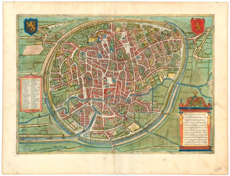
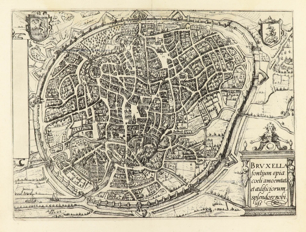
Bruxella, Urbs Aulicorum Frequentia, Fontium Copia, Magnificentia Principalis Aulae ...
Item Number: 23220 Authenticity Guarantee
Category: Antique maps > Europe > Belgium - Cities
Old, antique bird’s-eye view plan of Brussels, by Georg Braun and Frans Hogenberg.
Title: Bruxella, Urbs Aulicorum Frequentia, Fontium Copia, Magnificentia Principalis Aulae ...
Date of the first edition: 1572.
Date of this map: 1599.
Copper engraving, printed on paper.
Size (not including margins): 330 x 470mm (12.99 x 18.5 inches).
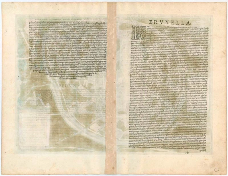
Verso: Latin text.
Condition: Original coloured, excellent.
Condition Rating: A+.
From: Civitates Orbis Terrarum, Liber Primus. Köln, Bertram Buchholtz, 1599. (Van der Krogt 4, 41:1.1)
TRANSLATION OF CARTOUCHE TEXT: Brussels is a very well-known city due to its large number of courtiers, its copious springs, the magnificence of its princely court and its town hall and many other things. And as Ausonius says of his Burdegala: rich with a mild climate and well-irrigated soil. The inhabitants, particularly the women, display their riches through their dress. The most magnificent church is St Gudula's, still distinguished by its college of canons (according to Ha. Barlandus).
COMMENTARY BY BRAUN (on verso): "Brussels, the noblest city in all Brabant, was chosen by the kings as their seat because it has springs that always flow, uplifting hills and healthy air and is very splendid to behold. [...] The royal palace, which lies on a hill with a chapel, was built by Emperor Charles V and is no small embellishment for the city because there, the lords of the Golden Fleece and the councillors meet for joint deliberations with the Governor. [...] A waterway was miraculously dug from Brussels, at great expense and with a great deal of work, for the benefit of locals and strangers. [...] The canal is over five German miles long. It was begun in 1550 and completed in 1561 to the great admiration of all."
From a bird-eye perspective, this plan view shows an idealized, almost circular view of the city. The picture is dominated on the one hand by the wide streets and the city wall ringed by a moat and on the other by the navigable River Senne, which enabled ships to dock inside the city using the canal network. Brussels received its charter in 1312 and, as early as 1357, built an extensive city wall, enclosing fields and tracts of land within it. When the Dukes of Brabant chose Brussels as their seat of government in 1383, the population had already reached 50,000. At the start of the 15th century, the dukes constructed their palaces (17). Brussels experienced its greatest flowering from 1430 under Philip the Good: the Hôtel de Ville (51) was built on the Grande Place, and artists and craftsmen, manuscript illuminators, sculptors and goldsmiths settled in the city. Pieter Breughel the Elder lived and worked here and, in 1569, was buried in Notre-Dame-de-la-Chapelle.
The engraving is made after a plan from Guicciardini (1567); some topographical details may derive from a sketch by Jacob van Deventer (c. 1550). (Taschen)
Braun G. & Hogenberg F. and the Civitates Orbis Terrarum.
The Civitates Orbis Terrarum, also known as the 'Braun & Hogenberg', is a six-volume town atlas and the most excellent book of town views and plans ever published: 363 engravings, sometimes beautifully coloured. It was one of the best-selling works in the last quarter of the 16th century. Georg Braun, a skilled writer, wrote the text accompanying the plans and views on the verso. Many plates were engraved after the original drawings of a professional artist, Joris Hoefnagel (1542-1600). The first volume was published in Latin in 1572 and the sixth in 1617. Frans Hogenberg, a talented engraver, created the tables for volumes I through IV, and Simon van den Neuwel made those for volumes V and VI. Other contributors were cartographers Daniel Freese and Heinrich Rantzau, who provided valuable geographical information. Works by Jacob van Deventer, Sebastian Münster, and Johannes Stumpf were also used as references. Translations appeared in German and French, making the atlas accessible to a broader audience.
Since its original publication of volume 1 in 1572, the Civitates Orbis Terrarum has left an indelible mark on the history of cartography. Seven more editions followed the first volume in 1575, 1577, 1582, 1588, 1593, 1599, and 1612. Vol.2, initially released in 1575, saw subsequent editions in 1597 and 1612. The subsequent volumes, each a treasure trove of historical insights, graced the world in 1581, 1588, 1593, 1599, and 1606. The German translation of the first volume, a testament to its widespread appeal, debuted in 1574, followed by the French edition in 1575.
Several printers were involved: Theodor Graminaeus, Heinrich von Aich, Gottfried von Kempen, Johannis Sinniger, Bertram Buchholtz, and Peter von Brachel, all of whom worked in Cologne.
Georg Braun (1541-1622)
Georg Braun, the author of the text accompanying the plans and views in the Civitates Orbis Terrarum, was born in Cologne in 1541. After his studies in Cologne, he entered the Jesuit Order as a novice, indicating his commitment to learning and intellectual pursuits. In 1561, he obtained his bachelor's degree; in 1562, he received his Magister Artium, further demonstrating his academic achievements. Although he left the Jesuit Order, he continued his studies in theology, gaining a licentiate in theology. His theological background likely influenced the content and tone of the text in the Civitates Orbis Terrarum, adding a unique perspective to the work.
Frans Hogenberg (1535-1590)
Frans Hogenberg was a Flemish and German painter, engraver, and mapmaker. He was born in Mechelen as the son of Nicolaas Hogenberg.
By the end of the 1560s, Frans Hogenberg was employed upon Abraham Ortelius's Theatrum Orbis Terrarum, published in 1570; he is named an engraver of numerous maps. In 1568, he was banned from Antwerp by the Duke of Alva and travelled to London, where he stayed a few years before emigrating to Cologne. He immediately embarked on his two most important works, the Civitates, published in 1572 and the Geschichtsblätter, which appeared in several series from 1569 until about 1587.
Thanks to large-scale projects like the Geschichtsblätter and the Civitates, Hogenberg's social circumstances improved with each passing year. He died as a wealthy man in Cologne in 1590.
Related items
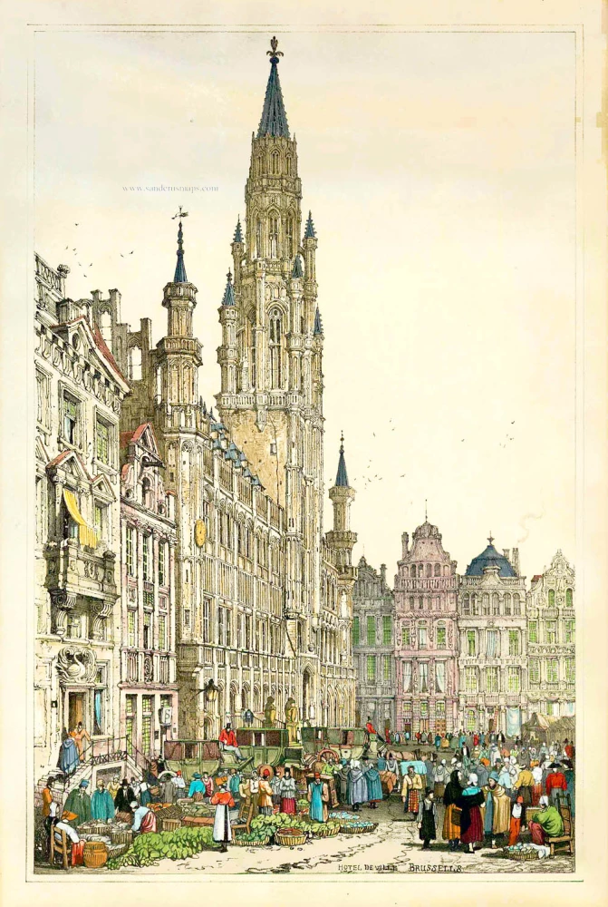
Hotel de Ville - Brussels. 1833
View of Brussels - (Brussel - Bruxelles) by S. Prout.
[Item number: 1829]
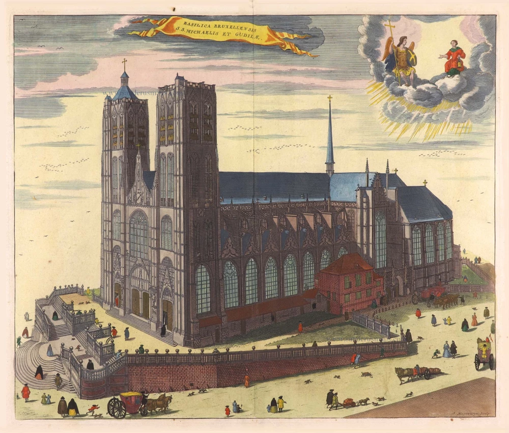
Basilica Bruxellensis S.S. Michaelis ey Gudilae. 1726
Brussels - St Michael and St Gudula Cathedral, by Antonius Sanderus.
[Item number: 4737]
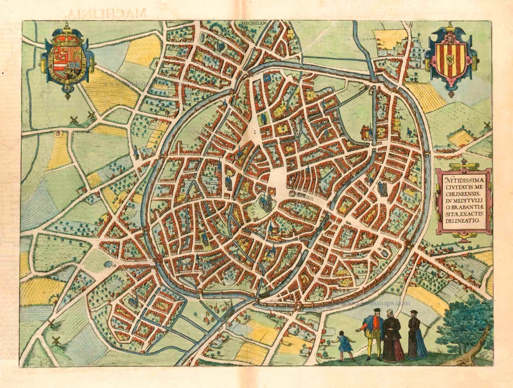
Mechelen - Nitidissimae Civitatis Mechlineensis in meditullio Brabantiae sitae, exactis: delineatio 1581-88
Mechelen, by Braun & Hogenberg.
[Item number: 18002]
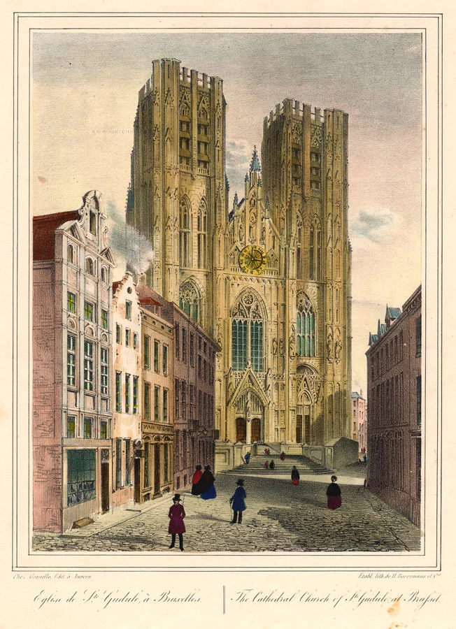
Eglise de Ste Gudule à Bruxelles - The Cathedral Church of Ste Gudule at Brussel. c. 1846
Brussel - Bruxelles - Ste Gudule, by Granello L.
[Item number: 21815]
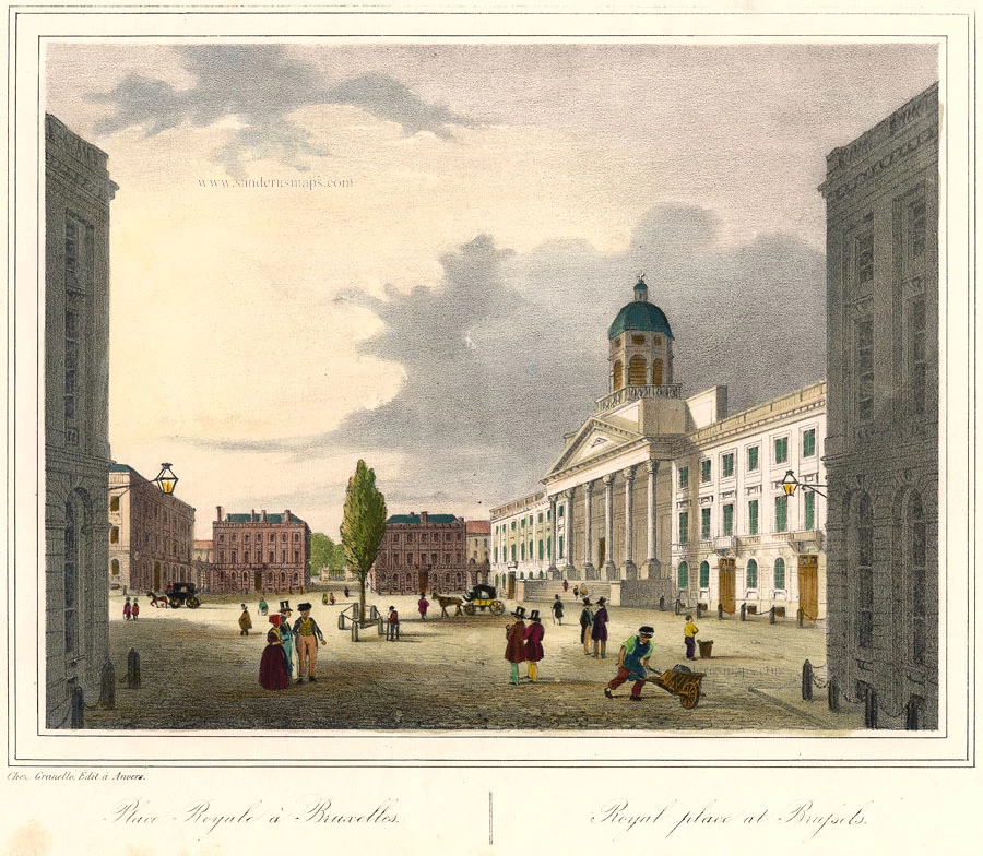
Place Royale à Bruxelles. - Royal Place at Brussels. c. 1846
Brussel Koningsplein - Bruxelles Place Royale, by Granello L.
[Item number: 21823]
Bruxella, Urbs Aulicorum Frequentia, Fontium Copia, Magnificentia Principalis Aulae ... 1612
Brussels, by Braun and Hogenberg.
[Item number: 22311]
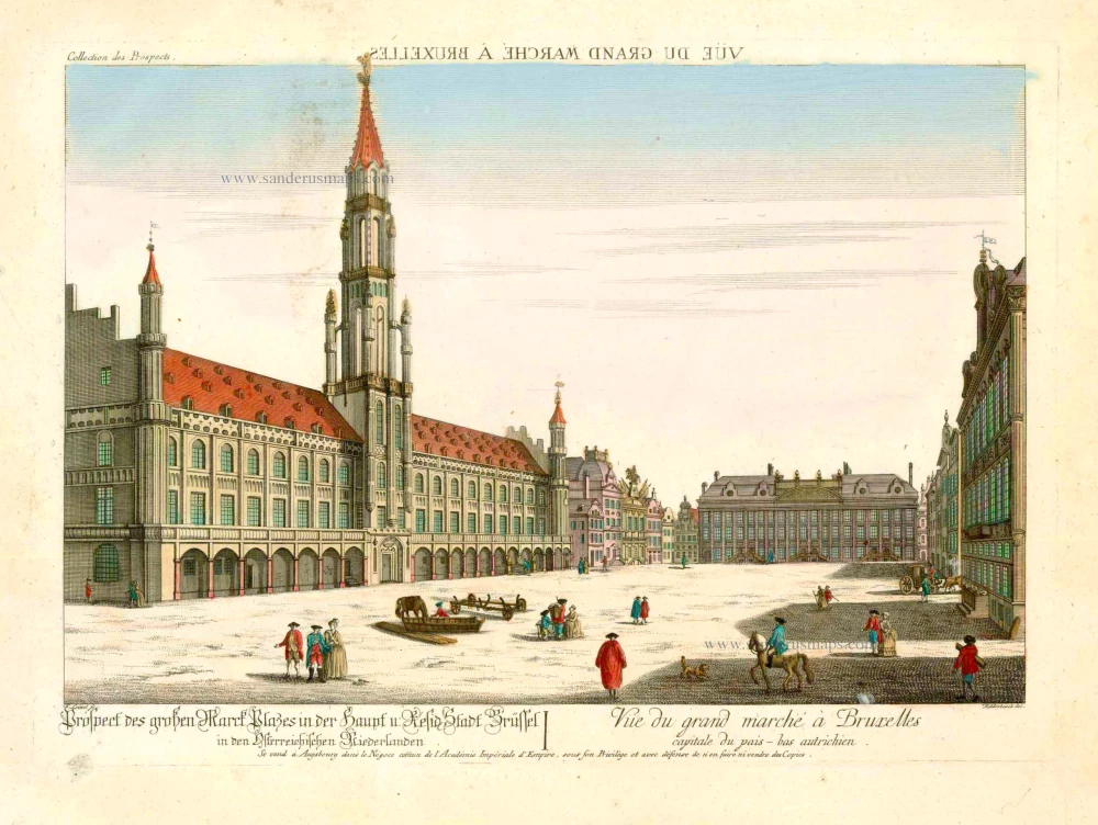
Prospect des grossen Marck Plasses in der Haupf u: Reside Stadt Brüssel ... - Vue du Grand Marché à Bruxelles, capitale du Pais-Bas Autrichien. 18e eeuw
Bruxelles - Brussel, optica
[Item number: 25325]
Rare!
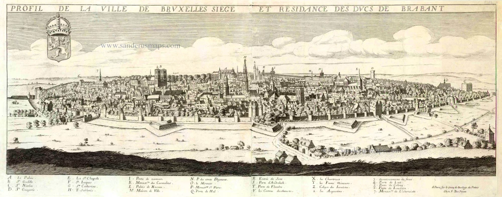
Profil de la ville de Bruxelles Siege et Residance des Ducs de Brabant. c. 1668
View of Brussels by Jean Boisseau.
[Item number: 25574]
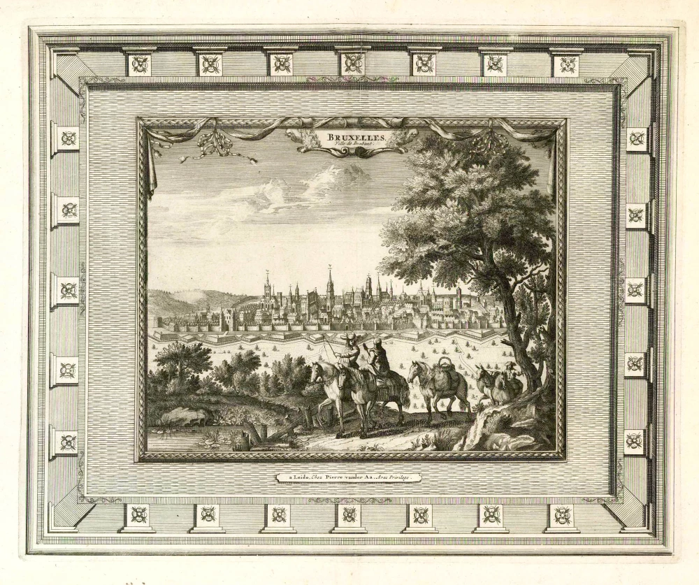
Bruxelles, Ville de Brabant. 1702
Brussels (Brussel - Bruxelles), by Pieter van der Aa.
[Item number: 25767]
Heightened in gold and silver.
Bruselles. 1567
Brussel - Bruxelles by Lodovico Guicciardini
[Item number: 27585]
Rare!
Brussel. 1675
Brussel - Bruxelles, by Clement de Jonghe.
[Item number: 28120]
Bruxel. 1613
Brussels (Brussel - Bruxelles) by Ludovico Guicciardini.
[Item number: 29557]
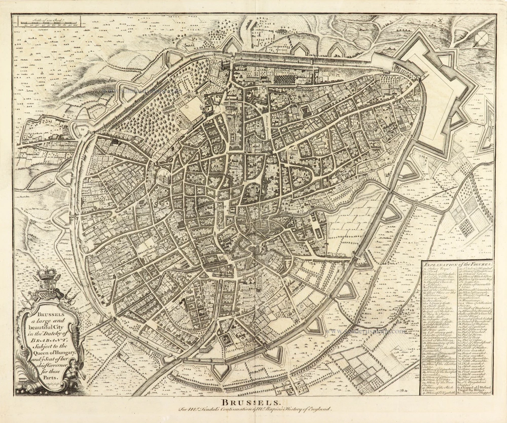
Brussels. 1744-47
Brussels - Bruxelles by Rapin de Thoyras
[Item number: 30611]
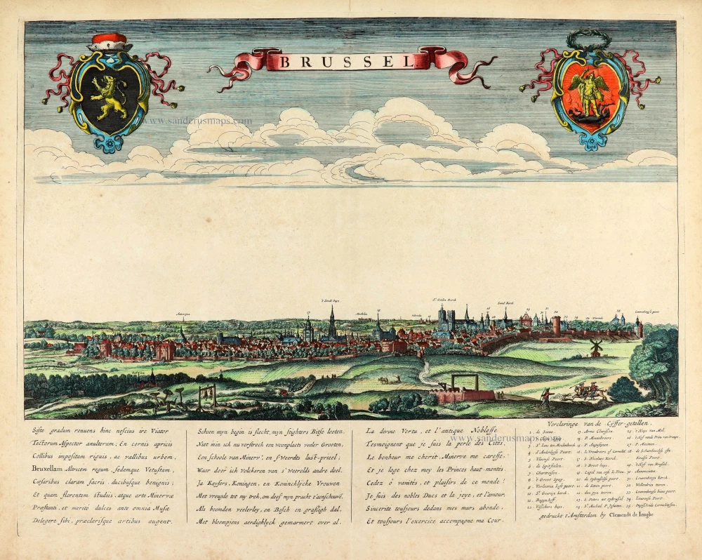
Bruxella fontium copia coelu amoemtate et aedificiorum, splendore nobiliss. 1609
Brussel - Bruxelles by Ludovico Guicciardini.
[Item number: 30814]