
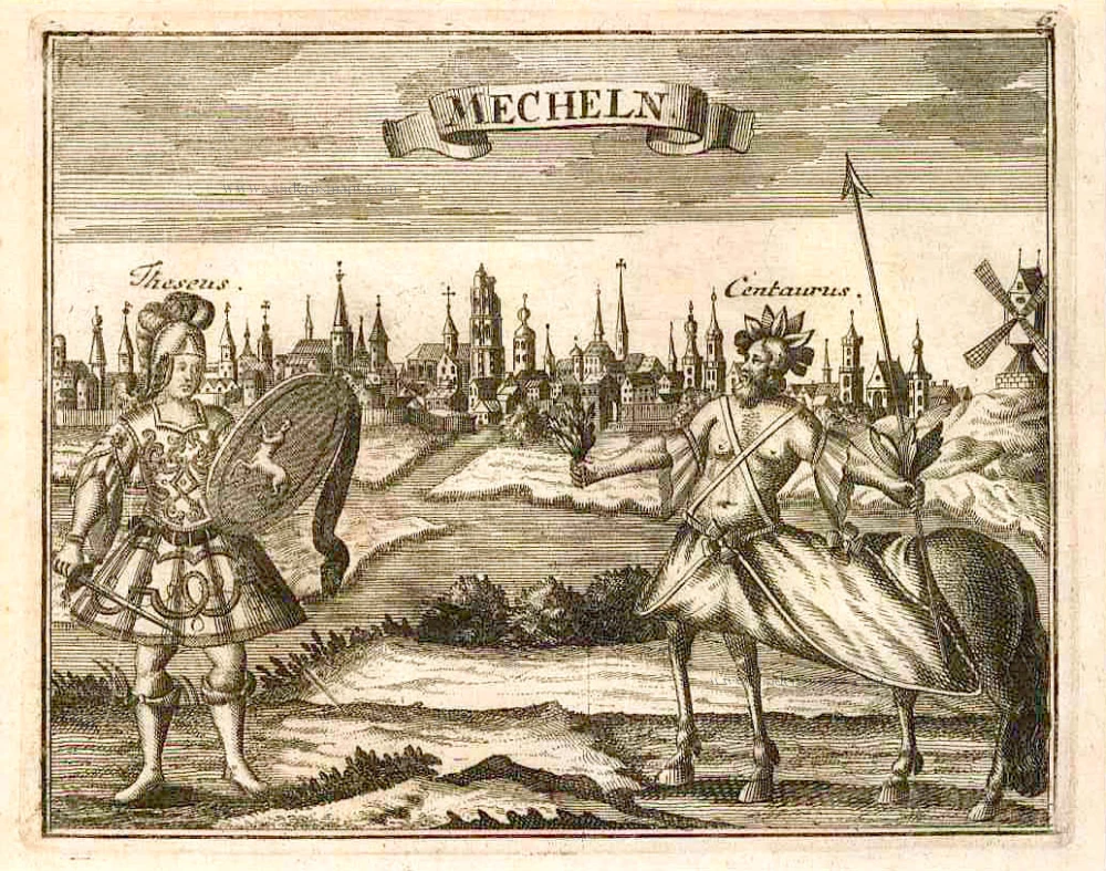
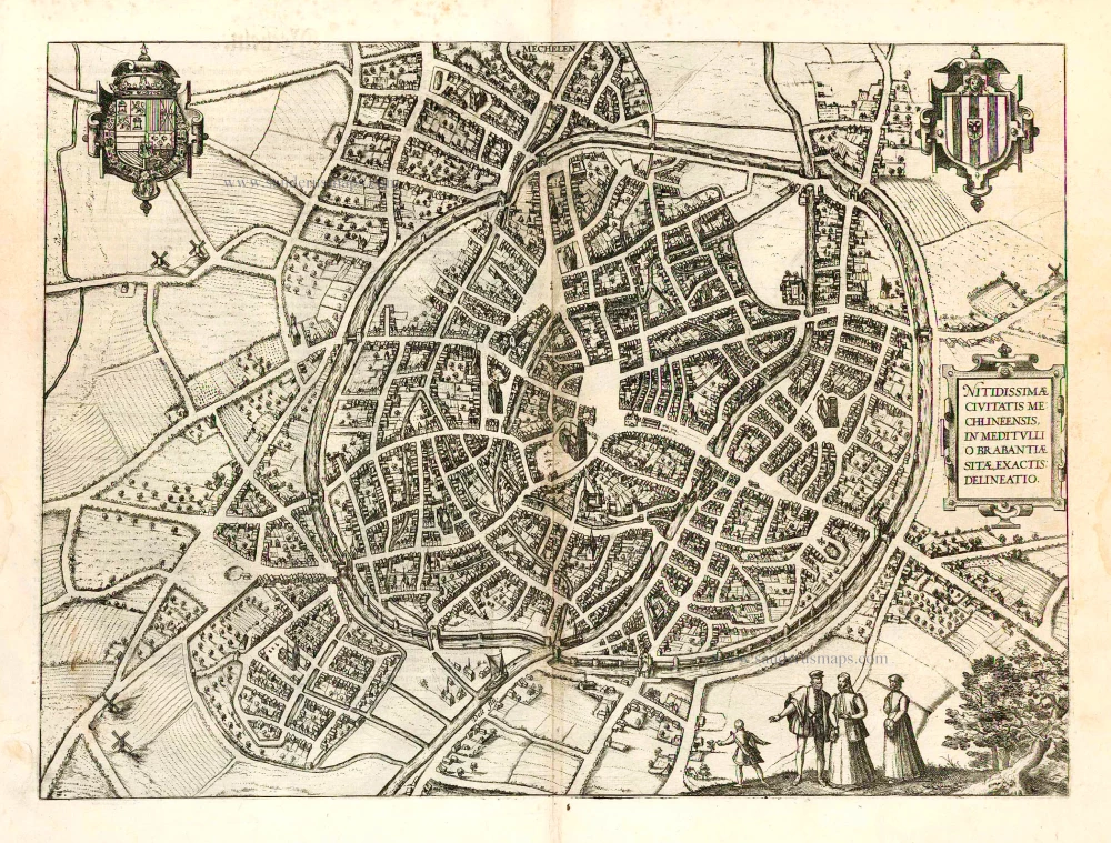
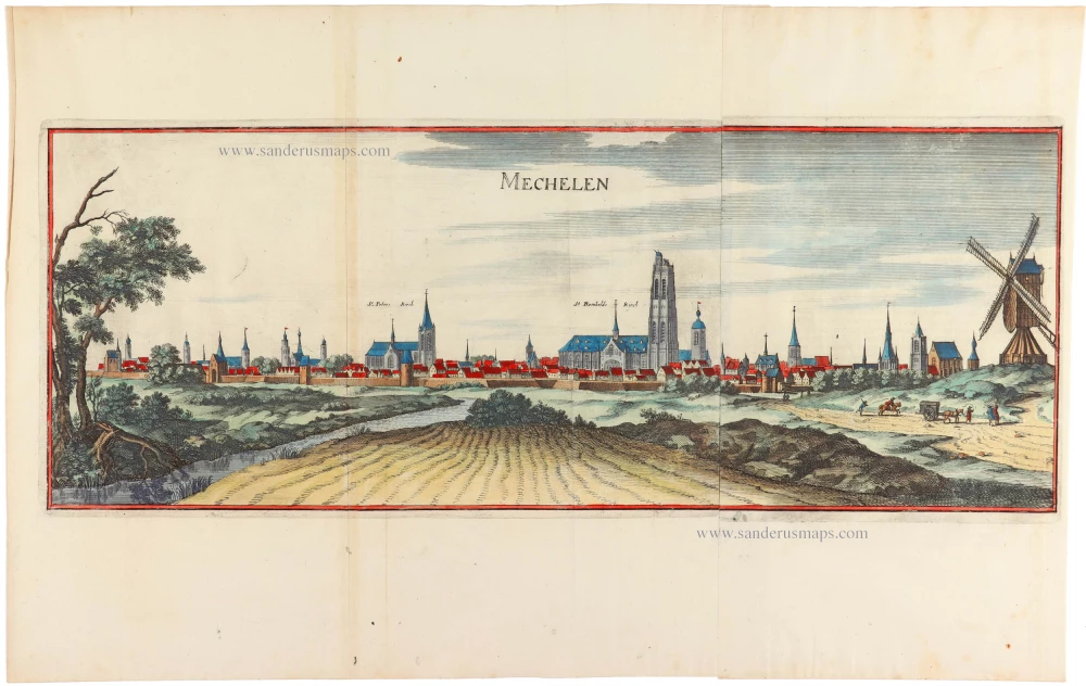
Mechelen, by Braun & Hogenberg. 1581-88

TRANSLATION OF CARTOUCHE TEXT: Faithful view of the illustrious town of Mechelen, in the middle of Brabant.
COMMENTARY BY BRAUN: "In the year 1473, Charles the Bold moved the Supreme Court, also called the Royal Council or Assembly, to Mechelen: he himself is the supreme judge in the company of 34 other lords. Initially, this council accompanied his Lordship at all times and followed him wherever he went; in the absence of the sovereign, the Chancellor presided over all others in his place. One could appeal to it from almost all the courts in Belgium."
Franz Hogenberg's birthplace is illustrated twice. In the view presented in Volume I, the cityscape is dominated by the massive tower belonging to the cathedral of Sint-Rombout, which measures almost 100 m in height. Behind the cathedral to the right lies the Onze-Lieve-Vrouwe church built in the Brabantine late Gothic style. Mechelen is seen in a bird's-eye view from the northwest in the present plate. Clearly apparent is the almost circular shape of the inner city, which has already spread beyond the bounds of the canal, ringing the old city wall. In the Middle Ages, staple rights and the cloth trade brought Mechelen great prosperity. In 1336 the city passed to the Duchy of Brabant, later to Burgundy, and developed into a highly regarded centre of commerce. The collapse of the cloth industry prompted the development of new manufacturing areas, such as the cannon and bell founding. In 1477 Mechelen passed to the Habsburgs, and from 1507 to 1530, under the regency of Margaret of Austria, was the capital of the Habsburg Netherlands. In 1559 Mechelen became an archbishopric and grew into a centre of the Counter-Reformation during the Wars of Religion. For some time, it was also the seat of the highest tribunal of the Habsburg Netherlands. (Taschen)
Braun G. & Hogenberg F. and the Civitates Orbis Terrarum.
The Civitates Orbis Terrarum, also known as the 'Braun & Hogenberg', is a six-volume town atlas and the most excellent book of town views and plans ever published: 363 engravings, sometimes beautifully coloured. It was one of the best-selling works in the last quarter of the 16th century. Georg Braun, a skilled writer, wrote the text accompanying the plans and views on the verso. Many plates were engraved after the original drawings of a professional artist, Joris Hoefnagel (1542-1600). The first volume was published in Latin in 1572 and the sixth in 1617. Frans Hogenberg, a talented engraver, created the tables for volumes I through IV, and Simon van den Neuwel made those for volumes V and VI. Other contributors were cartographers Daniel Freese and Heinrich Rantzau, who provided valuable geographical information. Works by Jacob van Deventer, Sebastian Münster, and Johannes Stumpf were also used as references. Translations appeared in German and French, making the atlas accessible to a broader audience.
Since its original publication of volume 1 in 1572, the Civitates Orbis Terrarum has left an indelible mark on the history of cartography. Seven more editions followed the first volume in 1575, 1577, 1582, 1588, 1593, 1599, and 1612. Vol.2, initially released in 1575, saw subsequent editions in 1597 and 1612. The subsequent volumes, each a treasure trove of historical insights, graced the world in 1581, 1588, 1593, 1599, and 1606. The German translation of the first volume, a testament to its widespread appeal, debuted in 1574, followed by the French edition in 1575.
Several printers were involved: Theodor Graminaeus, Heinrich von Aich, Gottfried von Kempen, Johannis Sinniger, Bertram Buchholtz, and Peter von Brachel, all of whom worked in Cologne.
Georg Braun (1541-1622)
Georg Braun, the author of the text accompanying the plans and views in the Civitates Orbis Terrarum, was born in Cologne in 1541. After his studies in Cologne, he entered the Jesuit Order as a novice, indicating his commitment to learning and intellectual pursuits. In 1561, he obtained his bachelor's degree; in 1562, he received his Magister Artium, further demonstrating his academic achievements. Although he left the Jesuit Order, he continued his studies in theology, gaining a licentiate in theology. His theological background likely influenced the content and tone of the text in the Civitates Orbis Terrarum, adding a unique perspective to the work.
Frans Hogenberg (1535-1590)
Frans Hogenberg was a Flemish and German painter, engraver, and mapmaker. He was born in Mechelen as the son of Nicolaas Hogenberg.
By the end of the 1560s, Frans Hogenberg was employed upon Abraham Ortelius's Theatrum Orbis Terrarum, published in 1570; he is named an engraver of numerous maps. In 1568, he was banned from Antwerp by the Duke of Alva and travelled to London, where he stayed a few years before emigrating to Cologne. He immediately embarked on his two most important works, the Civitates, published in 1572 and the Geschichtsblätter, which appeared in several series from 1569 until about 1587.
Thanks to large-scale projects like the Geschichtsblätter and the Civitates, Hogenberg's social circumstances improved with each passing year. He died as a wealthy man in Cologne in 1590.
Mechelen - Nitidissimae Civitatis Mechlineensis in meditullio Brabantiae sitae, exactis: delineatio
Item Number: 18002 Authenticity Guarantee
Category: Antique maps > Europe > Belgium - Cities
Old antique map of Mechelen by Braun & Hogenberg.
Title: Mechelen - Nitidissimae Civitatis Mechlineensis in meditullio Brabantiae sitae, exactis: delineatio
Date of the first edition: 1581.
Date of this map: 1581-88.
Copper engraving, printed on paper.
Size (not including margins): 335 x 460mm (13.19 x 18.11 inches).
Verso: Latin text.
Condition: Original coloured, excellent.
Condition Rating: A+.
From: Civitates Orbis Terrarum. . Liber tertius. Köln, G. Kempen, 1581-88. (Koeman, B&H3)
TRANSLATION OF CARTOUCHE TEXT: Faithful view of the illustrious town of Mechelen, in the middle of Brabant.
COMMENTARY BY BRAUN: "In the year 1473, Charles the Bold moved the Supreme Court, also called the Royal Council or Assembly, to Mechelen: he himself is the supreme judge in the company of 34 other lords. Initially, this council accompanied his Lordship at all times and followed him wherever he went; in the absence of the sovereign, the Chancellor presided over all others in his place. One could appeal to it from almost all the courts in Belgium."
Franz Hogenberg's birthplace is illustrated twice. In the view presented in Volume I, the cityscape is dominated by the massive tower belonging to the cathedral of Sint-Rombout, which measures almost 100 m in height. Behind the cathedral to the right lies the Onze-Lieve-Vrouwe church built in the Brabantine late Gothic style. Mechelen is seen in a bird's-eye view from the northwest in the present plate. Clearly apparent is the almost circular shape of the inner city, which has already spread beyond the bounds of the canal, ringing the old city wall. In the Middle Ages, staple rights and the cloth trade brought Mechelen great prosperity. In 1336 the city passed to the Duchy of Brabant, later to Burgundy, and developed into a highly regarded centre of commerce. The collapse of the cloth industry prompted the development of new manufacturing areas, such as the cannon and bell founding. In 1477 Mechelen passed to the Habsburgs, and from 1507 to 1530, under the regency of Margaret of Austria, was the capital of the Habsburg Netherlands. In 1559 Mechelen became an archbishopric and grew into a centre of the Counter-Reformation during the Wars of Religion. For some time, it was also the seat of the highest tribunal of the Habsburg Netherlands. (Taschen)
Braun G. & Hogenberg F. and the Civitates Orbis Terrarum.
The Civitates Orbis Terrarum, also known as the 'Braun & Hogenberg', is a six-volume town atlas and the most excellent book of town views and plans ever published: 363 engravings, sometimes beautifully coloured. It was one of the best-selling works in the last quarter of the 16th century. Georg Braun, a skilled writer, wrote the text accompanying the plans and views on the verso. Many plates were engraved after the original drawings of a professional artist, Joris Hoefnagel (1542-1600). The first volume was published in Latin in 1572 and the sixth in 1617. Frans Hogenberg, a talented engraver, created the tables for volumes I through IV, and Simon van den Neuwel made those for volumes V and VI. Other contributors were cartographers Daniel Freese and Heinrich Rantzau, who provided valuable geographical information. Works by Jacob van Deventer, Sebastian Münster, and Johannes Stumpf were also used as references. Translations appeared in German and French, making the atlas accessible to a broader audience.
Since its original publication of volume 1 in 1572, the Civitates Orbis Terrarum has left an indelible mark on the history of cartography. Seven more editions followed the first volume in 1575, 1577, 1582, 1588, 1593, 1599, and 1612. Vol.2, initially released in 1575, saw subsequent editions in 1597 and 1612. The subsequent volumes, each a treasure trove of historical insights, graced the world in 1581, 1588, 1593, 1599, and 1606. The German translation of the first volume, a testament to its widespread appeal, debuted in 1574, followed by the French edition in 1575.
Several printers were involved: Theodor Graminaeus, Heinrich von Aich, Gottfried von Kempen, Johannis Sinniger, Bertram Buchholtz, and Peter von Brachel, all of whom worked in Cologne.
Georg Braun (1541-1622)
Georg Braun, the author of the text accompanying the plans and views in the Civitates Orbis Terrarum, was born in Cologne in 1541. After his studies in Cologne, he entered the Jesuit Order as a novice, indicating his commitment to learning and intellectual pursuits. In 1561, he obtained his bachelor's degree; in 1562, he received his Magister Artium, further demonstrating his academic achievements. Although he left the Jesuit Order, he continued his studies in theology, gaining a licentiate in theology. His theological background likely influenced the content and tone of the text in the Civitates Orbis Terrarum, adding a unique perspective to the work.
Frans Hogenberg (1535-1590)
Frans Hogenberg was a Flemish and German painter, engraver, and mapmaker. He was born in Mechelen as the son of Nicolaas Hogenberg.
By the end of the 1560s, Frans Hogenberg was employed upon Abraham Ortelius's Theatrum Orbis Terrarum, published in 1570; he is named an engraver of numerous maps. In 1568, he was banned from Antwerp by the Duke of Alva and travelled to London, where he stayed a few years before emigrating to Cologne. He immediately embarked on his two most important works, the Civitates, published in 1572 and the Geschichtsblätter, which appeared in several series from 1569 until about 1587.
Thanks to large-scale projects like the Geschichtsblätter and the Civitates, Hogenberg's social circumstances improved with each passing year. He died as a wealthy man in Cologne in 1590.
Related items

Machlinia. 1652
Mechelen, by Joan Blaeu.
[Item number: 3780]
Mecheln 1726
Mechelen by D. Fassmann
[Item number: 5948]
Mechelen - Nitidissimae Civitatis Mechlineensis in meditullio Brabantiae sitae, exactis: delineatio. 1582
Mechelen, by Georg Braun & Frans Hogenberg.
[Item number: 14483]
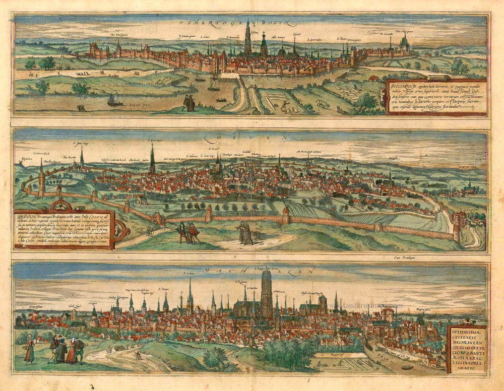
Tshertogenbosch - Buscumducis oppidum ludo Literario, ... [on sheet with] Loeven - Lovanium Perantiqua Brabantiae urbs ... [and] Machelen - Nitidissimae Civitatis Mechlin ... 1582
's Hertogenbosch, Leuven (Louvain) and Mechelen, by Georg Braun and Frans Hogenberg.
[Item number: 16669]

Machelen - Nitidissimae Civitatis Mechlineensis, ... 1572-1624
Mechelen, by Georg Braun and Frans Hogenberg.
[Item number: 17854]
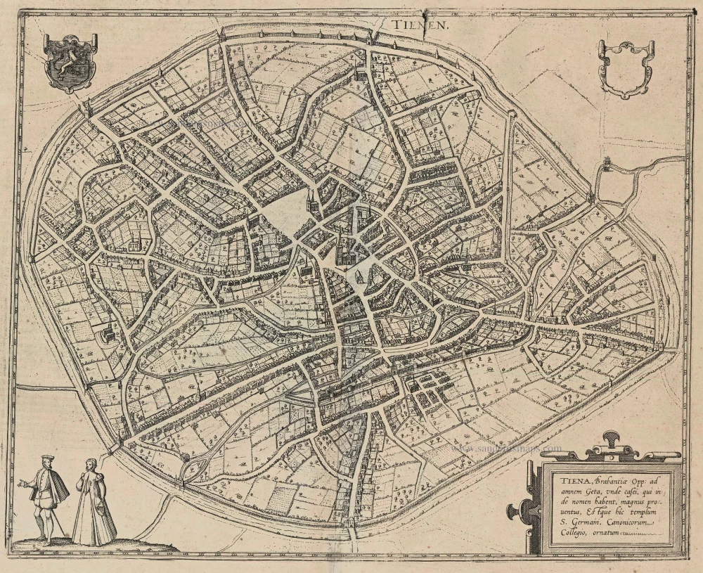
Tienen - Tiena, Brabantiae Opp: ad amnem Geta, ... 1581-88
Tienen, by Georg Braun and Frans Hogenberg.
[Item number: 22196]

Bruxella, Urbs Aulicorum Frequentia, Fontium Copia, Magnificentia Principalis Aulae ... 1612
Brussels, by Braun and Hogenberg.
[Item number: 22311]

Tshertogenbosch - Buscumducis oppidum ludo Literario, ... [on sheet with] Loeven - Lovanium Perantiqua Brabantiae urbs ... [and] Machelen - Nitidissimae Civitatis Mechlin ... 1599
's Hertogenbosch, Leuven (Louvain), and Mechelen, by Georg Braun and Frans Hogenberg.
[Item number: 23224]

Mechelen. 1656
Mechelen by Visscher N. - Schut P.H.
[Item number: 25372]

Mechlinia. 1617
Mechelen by Petrus Van den Keere (Kaerius).
[Item number: 30655]

Machlinia. 1649
Mechelen, by Joan Blaeu.
[Item number: 31178]

Carte de la Seigneyrie de Malines. 1633
Mechelen by Christophe Tassin.
[Item number: 31931]

With train station
Panorama von Mecheln - Panorama de Malines. c. 1840
Mechelen, by F.C. Eisen.
[Item number: 32122]

Mechelen - Nitidißime civitatis Mechlineensis in meditullio Brabantie ex ac lis: delineatio. 1612
Mechelen by Ludovico Guicciardini.
[Item number: 32862]
Mechelen. 1659
Mechelen, door Matthäus Merian & Martin Zeiller.
[Item number: 33201]
new