This product is successfully added to your cart
Questions about this product? (#30541)

Authenticity Guarantee
All items are guaranteed authentic prints (woodcuts or engravings) or manuscripts made at or about (c.) the given date and in good condition unless stated otherwise. We don’t sell facsimiles or reproductions. We deliver every map with a Certificate of Authenticity containing all the details.

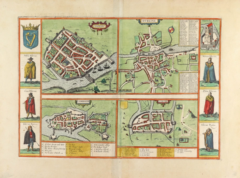
Dublin, Galway, Limerick & Cork by Georg Braun & Frans Hogenberg. 1635

GALWAY

COMMENTARY BY BRAUN (on verso): "The most distinguished city in Connacht is Galway [...]. A wall and many towers surround it, and spanning the river [...] is a stately bridge. Many small islands are not far from where the river flows into the sea [...], and the Irish say that no one can die there. [...] Now, you may believe that if you like. Such superstition comes from the vindictiveness to which this nation is prone; they care for nothing if only they can take their anger out on their enemies."

This bird's-eye view from the west shows a well-fortified city. The great bridge with its high arches and the church of St Nicholas stand out clearly. The city's character as a port is underlined by the ocean-going ships. The town was founded in the 13th century as an Anglo-Norman outpost in the west of Ireland. In the 16th century, there were several Irish revolts against English rule. Today Galway has a population of about 70,000. It is western Ireland's cultural and economic centre and an important university town. Six figures frame the plate: Irish noble / Irish burgher / Irish peasant; Irish noblewoman / Irish burgher woman / Irish peasant woman.

DUBLIN

COMMENTARY BY BRAUN (on verso): "This city is big and full of artisans and merchants. It has large and stately suburbs on both sides of the River Liffey, some of which are surrounded by walls. Here Henry II, the king of England, built a royal palace. Not far from it is a splendid college or school called Holy Trinity, which Queen Elizabeth granted the liberties of an academy or university."

In this view from the south, the city wall, on the right, Trinity College (12), founded by Elizabeth I in 1592, are readily discernible. The ships on the River Liffey refer to the city's port. Founded as a fortified Viking settlement in the 9th century, the town was expanded. It became a military base in the 12th century during the Anglo-Norman colonization of Ireland. Henry II granted it a municipal charter in 1172. However, members of the Irish population were not permitted to live in the city, so they settled in the suburbs outside the city walls.
LIMERICK

COMMENTARY BY BRAUN (on verso): "This is the most distinguished city in the countryside of Momonia and is called Luimneach by the Irish. The River Shannon divides into two arms here and flows around the city, making it well fortified and safe and suitable for goods traffic. There is an episcopal see here [...]; also a castle or a royal palace, which King John of England built.

This bird's-eye view from the west portrays Limerick as a fortified town, with defences erected in the 12th-13th centuries during the Anglo-Norman conquest of Ireland. It shows the central city and the castle fortified with bastions (G), built by King John on an island in the River Shannon in the early 13th century, and a suburb on the mainland. The cathedral of St Mary's (E), which was begun in 1172 under the last Irish ruler of Munster, Donal Mor O'Brien, can be seen in the centre.

CORK

COMMENTARY BY BRAUN (on verso): "Cork is not very big and consists of only one long, broad street, but it is densely populated and prosperous. Such rebellious people live in the surrounding areas where the citizens have no dealings with them and, above all, may not intermarry with them. This is why there is not one citizen who is not related to others by blood or by marriage. This has such a good effect on diligence, peace and friendship that the whole city is like one big household."

This is a view from the west of the fortified city on an island in the River Lee. The big Main Street is its dominant feature. Churches and monasteries were grouped around the town like outposts in the enemy country; English merchant families ruled Cork. In the 13th century, an Anglo-Norman trading base was set up on the site of an Irish settlement, which had grown up around a monastery founded by St Finbarr in the 6th century; in 1185, Cork was granted a municipal charter.


Braun G. & Hogenberg F. and the Civitates Orbis Terrarum.

The Civitates Orbis Terrarum, also known as the 'Braun & Hogenberg', is a six-volume town atlas and the most excellent book of town views and plans ever published: 363 engravings, sometimes beautifully coloured. It was one of the best-selling works in the last quarter of the 16th century. Georg Braun, a skilled writer, wrote the text accompanying the plans and views on the verso. Many plates were engraved after the original drawings of a professional artist, Joris Hoefnagel (1542-1600). The first volume was published in Latin in 1572 and the sixth in 1617. Frans Hogenberg, a talented engraver, created the tables for volumes I through IV, and Simon van den Neuwel made those for volumes V and VI. Other contributors were cartographers Daniel Freese and Heinrich Rantzau, who provided valuable geographical information. Works by Jacob van Deventer, Sebastian Münster, and Johannes Stumpf were also used as references. Translations appeared in German and French, making the atlas accessible to a wider audience.

Since its original publication of volume 1 in 1572, the Civitates Orbis Terrarum has left an indelible mark on the history of cartography. The first volume was followed by seven more editions in 1575, 1577, 1582, 1588, 1593, 1599, and 1612. Vol.2, initially released in 1575, saw subsequent editions in 1597 and 1612. The subsequent volumes, each a treasure trove of historical insights, graced the world in 1581, 1588, 1593, 1599, and 1606. The German translation of the first volume, a testament to its widespread appeal, debuted in 1574, followed by the French edition in 1575.

Several printers were involved: Theodor Graminaeus, Heinrich von Aich, Gottfried von Kempen, Johannis Sinniger, Bertram Buchholtz, and Peter von Brachel, all of whom worked in Cologne.

Georg Braun (1541-1622)

Georg Braun, the author of the text accompanying the plans and views in the Civitates Orbis Terrarum, was born in Cologne in 1541. After his studies in Cologne, he entered the Jesuit Order as a novice, indicating his commitment to learning and intellectual pursuits. In 1561, he obtained his bachelor's degree; in 1562, he received his Magister Artium, further demonstrating his academic achievements. Although he left the Jesuit Order, he continued his studies in theology, gaining a licentiate in theology. His theological background likely influenced the content and tone of the text in the Civitates Orbis Terrarum, adding a unique perspective to the work.

Frans Hogenberg (1535-1590)

Frans Hogenberg was a Flemish and German painter, engraver, and mapmaker. He was born in Mechelen as the son of Nicolaas Hogenberg.

By the end of the 1560s, Frans Hogenberg was employed upon Abraham Ortelius's Theatrum Orbis Terrarum, published in 1570; he is named an engraver of numerous maps. In 1568, he was banned from Antwerp by the Duke of Alva and travelled to London, where he stayed a few years before emigrating to Cologne. He immediately embarked on his two most important works, the Civitates, published in 1572 and the Geschichtsblätter, which appeared in several series from 1569 until about 1587.

Thanks to large-scale projects like the Geschichtsblätter and the Civitates, Hogenberg's social circumstances improved with each passing year. He died as a wealthy man in Cologne in 1590.

back

Galwaye [on sheet with] Dubline [and] Lymericke [and] Corcke.

€2800  ($3052 / £2352)
add to cart
Buy now
questions?
PRINT

Item Number:  30541 Authenticity Guarantee

Category:  Antique maps > Europe > British Isles - Cities

Old, antique map with four Irish bird's-eye view plans by Georg Braun and Frans Hogenberg: Galway, Dublin, Limerick and Cork.

Left and right borders with costumed figures. Top right view of 'Enis Kelling Fort'.
The four views are made after maps by John Speed in The Theatre of the Empire of Great Britain, 1611.

Title: Galwaye [on sheet with] Dubline [and] Lymericke [and] Corcke.

Date of the first edition: 1617.
Date of this map: 1617-18.

Copper engraving, printed on paper.
Map size: 310 x 440mm (12.2 x 17.32 inches).
Sheet size: 395 x 530mm (15.55 x 20.87 inches).
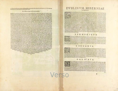
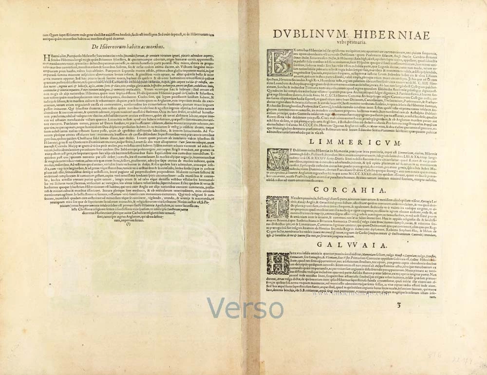
Verso: Latin text.
Condition: Original coloured, excellent.
Condition Rating: A+.

From: Civitates Orbis Terrarum. Theatri praecipuarum Totius Mundi Urbium Liber Sextus Anno MDCXVIII. Cologne, Anton Heirat, 1617-18. (Van der Krogt 4, 41:1.6)

GALWAY

COMMENTARY BY BRAUN (on verso): "The most distinguished city in Connacht is Galway [...]. A wall and many towers surround it, and spanning the river [...] is a stately bridge. Many small islands are not far from where the river flows into the sea [...], and the Irish say that no one can die there. [...] Now, you may believe that if you like. Such superstition comes from the vindictiveness to which this nation is prone; they care for nothing if only they can take their anger out on their enemies."

This bird's-eye view from the west shows a well-fortified city. The great bridge with its high arches and the church of St Nicholas stand out clearly. The city's character as a port is underlined by the ocean-going ships. The town was founded in the 13th century as an Anglo-Norman outpost in the west of Ireland. In the 16th century, there were several Irish revolts against English rule. Today Galway has a population of about 70,000. It is western Ireland's cultural and economic centre and an important university town. Six figures frame the plate: Irish noble / Irish burgher / Irish peasant; Irish noblewoman / Irish burgher woman / Irish peasant woman.

DUBLIN

COMMENTARY BY BRAUN (on verso): "This city is big and full of artisans and merchants. It has large and stately suburbs on both sides of the River Liffey, some of which are surrounded by walls. Here Henry II, the king of England, built a royal palace. Not far from it is a splendid college or school called Holy Trinity, which Queen Elizabeth granted the liberties of an academy or university."

In this view from the south, the city wall, on the right, Trinity College (12), founded by Elizabeth I in 1592, are readily discernible. The ships on the River Liffey refer to the city's port. Founded as a fortified Viking settlement in the 9th century, the town was expanded. It became a military base in the 12th century during the Anglo-Norman colonization of Ireland. Henry II granted it a municipal charter in 1172. However, members of the Irish population were not permitted to live in the city, so they settled in the suburbs outside the city walls.
LIMERICK

COMMENTARY BY BRAUN (on verso): "This is the most distinguished city in the countryside of Momonia and is called Luimneach by the Irish. The River Shannon divides into two arms here and flows around the city, making it well fortified and safe and suitable for goods traffic. There is an episcopal see here [...]; also a castle or a royal palace, which King John of England built.

This bird's-eye view from the west portrays Limerick as a fortified town, with defences erected in the 12th-13th centuries during the Anglo-Norman conquest of Ireland. It shows the central city and the castle fortified with bastions (G), built by King John on an island in the River Shannon in the early 13th century, and a suburb on the mainland. The cathedral of St Mary's (E), which was begun in 1172 under the last Irish ruler of Munster, Donal Mor O'Brien, can be seen in the centre.

CORK

COMMENTARY BY BRAUN (on verso): "Cork is not very big and consists of only one long, broad street, but it is densely populated and prosperous. Such rebellious people live in the surrounding areas where the citizens have no dealings with them and, above all, may not intermarry with them. This is why there is not one citizen who is not related to others by blood or by marriage. This has such a good effect on diligence, peace and friendship that the whole city is like one big household."

This is a view from the west of the fortified city on an island in the River Lee. The big Main Street is its dominant feature. Churches and monasteries were grouped around the town like outposts in the enemy country; English merchant families ruled Cork. In the 13th century, an Anglo-Norman trading base was set up on the site of an Irish settlement, which had grown up around a monastery founded by St Finbarr in the 6th century; in 1185, Cork was granted a municipal charter.


Braun G. & Hogenberg F. and the Civitates Orbis Terrarum.

The Civitates Orbis Terrarum, also known as the 'Braun & Hogenberg', is a six-volume town atlas and the most excellent book of town views and plans ever published: 363 engravings, sometimes beautifully coloured. It was one of the best-selling works in the last quarter of the 16th century. Georg Braun, a skilled writer, wrote the text accompanying the plans and views on the verso. Many plates were engraved after the original drawings of a professional artist, Joris Hoefnagel (1542-1600). The first volume was published in Latin in 1572 and the sixth in 1617. Frans Hogenberg, a talented engraver, created the tables for volumes I through IV, and Simon van den Neuwel made those for volumes V and VI. Other contributors were cartographers Daniel Freese and Heinrich Rantzau, who provided valuable geographical information. Works by Jacob van Deventer, Sebastian Münster, and Johannes Stumpf were also used as references. Translations appeared in German and French, making the atlas accessible to a wider audience.

Since its original publication of volume 1 in 1572, the Civitates Orbis Terrarum has left an indelible mark on the history of cartography. The first volume was followed by seven more editions in 1575, 1577, 1582, 1588, 1593, 1599, and 1612. Vol.2, initially released in 1575, saw subsequent editions in 1597 and 1612. The subsequent volumes, each a treasure trove of historical insights, graced the world in 1581, 1588, 1593, 1599, and 1606. The German translation of the first volume, a testament to its widespread appeal, debuted in 1574, followed by the French edition in 1575.

Several printers were involved: Theodor Graminaeus, Heinrich von Aich, Gottfried von Kempen, Johannis Sinniger, Bertram Buchholtz, and Peter von Brachel, all of whom worked in Cologne.

Georg Braun (1541-1622)

Georg Braun, the author of the text accompanying the plans and views in the Civitates Orbis Terrarum, was born in Cologne in 1541. After his studies in Cologne, he entered the Jesuit Order as a novice, indicating his commitment to learning and intellectual pursuits. In 1561, he obtained his bachelor's degree; in 1562, he received his Magister Artium, further demonstrating his academic achievements. Although he left the Jesuit Order, he continued his studies in theology, gaining a licentiate in theology. His theological background likely influenced the content and tone of the text in the Civitates Orbis Terrarum, adding a unique perspective to the work.

Frans Hogenberg (1535-1590)

Frans Hogenberg was a Flemish and German painter, engraver, and mapmaker. He was born in Mechelen as the son of Nicolaas Hogenberg.

By the end of the 1560s, Frans Hogenberg was employed upon Abraham Ortelius's Theatrum Orbis Terrarum, published in 1570; he is named an engraver of numerous maps. In 1568, he was banned from Antwerp by the Duke of Alva and travelled to London, where he stayed a few years before emigrating to Cologne. He immediately embarked on his two most important works, the Civitates, published in 1572 and the Geschichtsblätter, which appeared in several series from 1569 until about 1587.

Thanks to large-scale projects like the Geschichtsblätter and the Civitates, Hogenberg's social circumstances improved with each passing year. He died as a wealthy man in Cologne in 1590.
References: Van der Krogt 4 - #1437; Fauser - #4436,3282,7781,2769; Taschen (Br. Hog.) - p.443