
Norwich, by Georg Braun and Frans Hogenberg. 1581
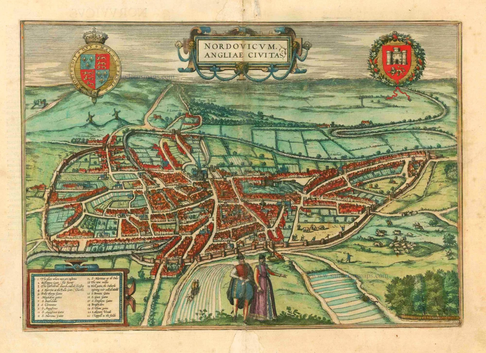


COMMENTARY BY BRAUN: "Norwich, in Latin Nordovicum or, as others like, Norvicus, is a densely populated city in England. It is roughly the shape of a taught bow: it lies on a hill, which is, however, not very steep, and reaches out far and wide in all directions. According to common legend, two townsmen encircled the city with ring walls in the year 1374. The townsmen of Norwich are subject to the same jurisprudence, the same ceremonies and provisions in the city regiment as currently the townspeople of London."
Situated on the River Wensum, the eastern English city of Norwich is presented in an oblique view from the northwest. Standing out clearly in the city centre are the Norman Cathedral of the Holy and Undivided Trinity and, to the right, on top of a grassy hillock, the castle (The Castell), which was initially built as a wooden structure after the Norman Conquest in 1066, but around 1100 was replaced by a stone fortress. Over time, both structures underwent multiple expansions. In 1194, Norwich was granted its city charter. In the first half of the 14th century, the extensive town wall was erected, which, over 4 km in length, enclosed a municipal area larger than that of London.
Braun G. & Hogenberg F. and the Civitates Orbis Terrarum.
The Civitates Orbis Terrarum, also known as the 'Braun & Hogenberg', is a six-volume town atlas and the most excellent book of town views and plans ever published: 363 engravings, sometimes beautifully coloured. It was one of the best-selling works in the last quarter of the 16th century. Georg Braun, a skilled writer, wrote the text accompanying the plans and views on the verso. Many plates were engraved after the original drawings of a professional artist, Joris Hoefnagel (1542-1600). The first volume was published in Latin in 1572 and the sixth in 1617. Frans Hogenberg, a talented engraver, created the tables for volumes I through IV, and Simon van den Neuwel made those for volumes V and VI. Other contributors were cartographers Daniel Freese and Heinrich Rantzau, who provided valuable geographical information. Works by Jacob van Deventer, Sebastian Münster, and Johannes Stumpf were also used as references. Translations appeared in German and French, making the atlas accessible to a broader audience.
Since its original publication of volume 1 in 1572, the Civitates Orbis Terrarum has left an indelible mark on the history of cartography. Seven more editions followed the first volume in 1575, 1577, 1582, 1588, 1593, 1599, and 1612. Vol.2, initially released in 1575, saw subsequent editions in 1597 and 1612. The subsequent volumes, each a treasure trove of historical insights, graced the world in 1581, 1588, 1593, 1599, and 1606. The German translation of the first volume, a testament to its widespread appeal, debuted in 1574, followed by the French edition in 1575.
Several printers were involved: Theodor Graminaeus, Heinrich von Aich, Gottfried von Kempen, Johannis Sinniger, Bertram Buchholtz, and Peter von Brachel, all of whom worked in Cologne.
Georg Braun (1541-1622)
Georg Braun, the author of the text accompanying the plans and views in the Civitates Orbis Terrarum, was born in Cologne in 1541. After his studies in Cologne, he entered the Jesuit Order as a novice, indicating his commitment to learning and intellectual pursuits. In 1561, he obtained his bachelor's degree; in 1562, he received his Magister Artium, further demonstrating his academic achievements. Although he left the Jesuit Order, he continued his studies in theology, gaining a licentiate in theology. His theological background likely influenced the content and tone of the text in the Civitates Orbis Terrarum, adding a unique perspective to the work.
Frans Hogenberg (1535-1590)
Frans Hogenberg was a Flemish and German painter, engraver, and mapmaker. He was born in Mechelen as the son of Nicolaas Hogenberg.
By the end of the 1560s, Frans Hogenberg was employed upon Abraham Ortelius's Theatrum Orbis Terrarum, published in 1570; he is named an engraver of numerous maps. In 1568, he was banned from Antwerp by the Duke of Alva and travelled to London, where he stayed a few years before emigrating to Cologne. He immediately embarked on his two most important works, the Civitates, published in 1572 and the Geschichtsblätter, which appeared in several series from 1569 until about 1587.
Thanks to large-scale projects like the Geschichtsblätter and the Civitates, Hogenberg's social circumstances improved with each passing year. He died as a wealthy man in Cologne in 1590.
Nordovicum, Angliae Civitas.
Item Number: 25426 Authenticity Guarantee
Category: Antique maps > Europe > British Isles - Cities
Norwich, by Georg Braun and Frans Hogenberg.
Title: Nordovicum, Angliae Civitas.
Date of the first edition: 1581.
Date of this map: 1581.
Copper engraving, printed on paper.
Image size: 295 x 420mm (11½ x 16½ inches).
Sheet size: 380 x 500mm (15 x 19¾ inches).
Verso: Latin text.
Condition: Original coloured, old reinforcement at centrefold (in margins).
Condition Rating: A+.
From: Civitates Orbis Terrarum. . Liber tertius. Cologne, Gottfried von Kempen, 1581. (Van der Krogt 4, 41:1.3)
COMMENTARY BY BRAUN: "Norwich, in Latin Nordovicum or, as others like, Norvicus, is a densely populated city in England. It is roughly the shape of a taught bow: it lies on a hill, which is, however, not very steep, and reaches out far and wide in all directions. According to common legend, two townsmen encircled the city with ring walls in the year 1374. The townsmen of Norwich are subject to the same jurisprudence, the same ceremonies and provisions in the city regiment as currently the townspeople of London."
Situated on the River Wensum, the eastern English city of Norwich is presented in an oblique view from the northwest. Standing out clearly in the city centre are the Norman Cathedral of the Holy and Undivided Trinity and, to the right, on top of a grassy hillock, the castle (The Castell), which was initially built as a wooden structure after the Norman Conquest in 1066, but around 1100 was replaced by a stone fortress. Over time, both structures underwent multiple expansions. In 1194, Norwich was granted its city charter. In the first half of the 14th century, the extensive town wall was erected, which, over 4 km in length, enclosed a municipal area larger than that of London.
Braun G. & Hogenberg F. and the Civitates Orbis Terrarum.
The Civitates Orbis Terrarum, also known as the 'Braun & Hogenberg', is a six-volume town atlas and the most excellent book of town views and plans ever published: 363 engravings, sometimes beautifully coloured. It was one of the best-selling works in the last quarter of the 16th century. Georg Braun, a skilled writer, wrote the text accompanying the plans and views on the verso. Many plates were engraved after the original drawings of a professional artist, Joris Hoefnagel (1542-1600). The first volume was published in Latin in 1572 and the sixth in 1617. Frans Hogenberg, a talented engraver, created the tables for volumes I through IV, and Simon van den Neuwel made those for volumes V and VI. Other contributors were cartographers Daniel Freese and Heinrich Rantzau, who provided valuable geographical information. Works by Jacob van Deventer, Sebastian Münster, and Johannes Stumpf were also used as references. Translations appeared in German and French, making the atlas accessible to a broader audience.
Since its original publication of volume 1 in 1572, the Civitates Orbis Terrarum has left an indelible mark on the history of cartography. Seven more editions followed the first volume in 1575, 1577, 1582, 1588, 1593, 1599, and 1612. Vol.2, initially released in 1575, saw subsequent editions in 1597 and 1612. The subsequent volumes, each a treasure trove of historical insights, graced the world in 1581, 1588, 1593, 1599, and 1606. The German translation of the first volume, a testament to its widespread appeal, debuted in 1574, followed by the French edition in 1575.
Several printers were involved: Theodor Graminaeus, Heinrich von Aich, Gottfried von Kempen, Johannis Sinniger, Bertram Buchholtz, and Peter von Brachel, all of whom worked in Cologne.
Georg Braun (1541-1622)
Georg Braun, the author of the text accompanying the plans and views in the Civitates Orbis Terrarum, was born in Cologne in 1541. After his studies in Cologne, he entered the Jesuit Order as a novice, indicating his commitment to learning and intellectual pursuits. In 1561, he obtained his bachelor's degree; in 1562, he received his Magister Artium, further demonstrating his academic achievements. Although he left the Jesuit Order, he continued his studies in theology, gaining a licentiate in theology. His theological background likely influenced the content and tone of the text in the Civitates Orbis Terrarum, adding a unique perspective to the work.
Frans Hogenberg (1535-1590)
Frans Hogenberg was a Flemish and German painter, engraver, and mapmaker. He was born in Mechelen as the son of Nicolaas Hogenberg.
By the end of the 1560s, Frans Hogenberg was employed upon Abraham Ortelius's Theatrum Orbis Terrarum, published in 1570; he is named an engraver of numerous maps. In 1568, he was banned from Antwerp by the Duke of Alva and travelled to London, where he stayed a few years before emigrating to Cologne. He immediately embarked on his two most important works, the Civitates, published in 1572 and the Geschichtsblätter, which appeared in several series from 1569 until about 1587.
Thanks to large-scale projects like the Geschichtsblätter and the Civitates, Hogenberg's social circumstances improved with each passing year. He died as a wealthy man in Cologne in 1590.
Related items
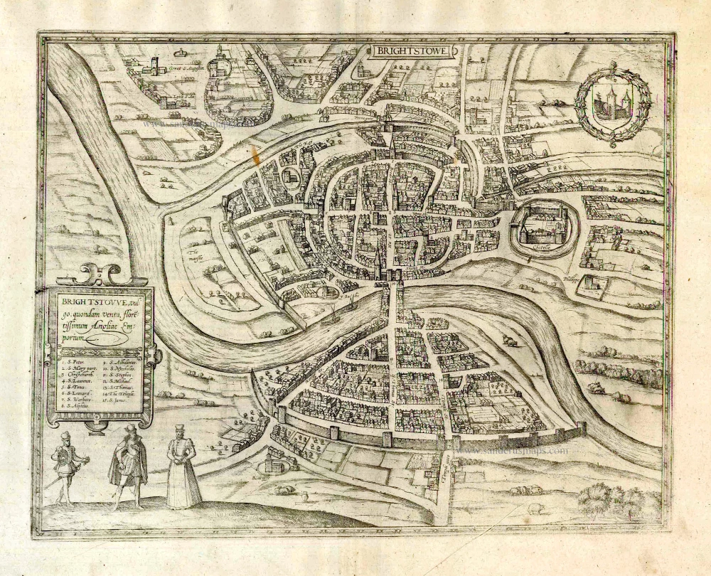
Brightstowe, Vulgo; Quondam Venta, Florentissimum. 1616
Bristol, by Braun Georg & Hogenberg Frans
[Item number: 26909]
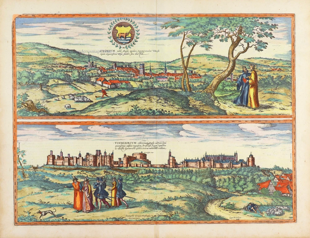
Oxonium Nobile Anglie Oppidum [on sheet with] Vindesorium Celeberrimum Angliae Castrum ... 1623
Oxford and Windsor Castel, by Georg Braun and Frans Hogenberg.
[Item number: 29346]