
Old, antique map of York - Shrewsbury - Lancashire - Richmond, by Georg Braun and Frans Hogenberg. 1617
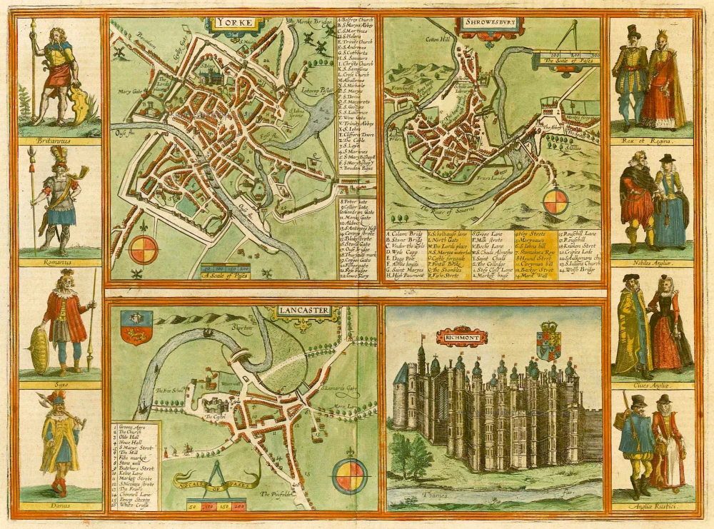
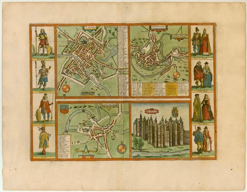


YORK
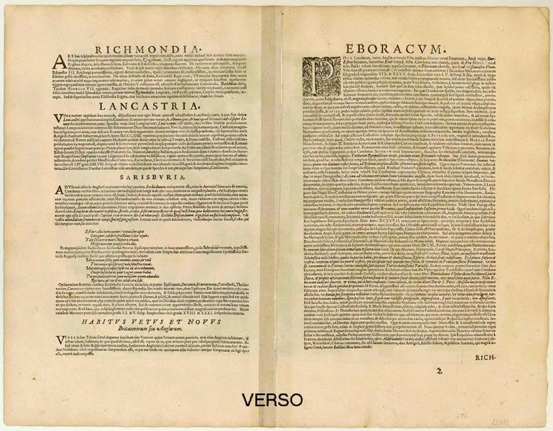
COMMENTARY BY BRAUN (on verso): "After London this is the most distinguished city in the whole of England. [...] It is a large and splendid city with an abundance of people and goods, well protected by walls and ramparts and embellished with fine houses and buildings. [...] There William the Norman built a mighty castle, which is now falling into decay. [...] Towards the Ouse was a monastery called St Mary's, which has been converted into a royal palace and used for worldly purposes."
This view of York, depicted in the manner of a town plan, indicates that north is at the top. The minster (S. Peters) stands out, together with the Benedictine abbey of St Mary, which had stood empty since the dissolution of the monasteries in 1536 and was falling into decay. The Council of the North had its seat in the former house of the abbot. The Gothic Minster, England's biggest cathedral, was completed in 1472. The castle can be seen at the confluence of the Ouse and the Foss. York, under the name Eboracum, was once the capital of the Roman province of Brittannia Inferior, and in the Middle Ages it was a flourishing centre in the north of England as a trade city and an episcopal see, but its importance declined after the 15th century.
SHREWSBURY
COMMENTARY BY BRAUN: "This city belongs to the County of Wiltshire. According to Camden, it is the old Sorbiodunum mentioned in the Itinerarium Antonini. But it used to be at another place, where today the village of old Shrewsbury is. That the inhabitants left the Old Town is said to be due to the lack of water. After the town had been moved, Bishop Richard began to build a most splendid church, which was fully completed within 40 years."
This plate, which indicates that north is at the top, neatly depicts the city of Shrewsbury in central England, which can be deduced from the names of the streets, the city gates and its characteristic position in a meander of the River Severn. But the text refers to the southern English episcopal city of Salisbury, which due to lack of water was moved about 3 km from Old Sarum to the banks of the Avon in 1220 under the aegis of Bishop Richard Poore; the cathedral was begun in the same year, and consecrated in 1258.
LANCASTER
COMMENTARY BY BRAUN: "According to Camden's account, this city was known in Roman times. [...] Today there are not many fine buildings, with the exception of the castle, the church and the bridge. The castle lies on a hill of the same name, and is not very big, but handsome and well fortified. Not far from it, where the hill is steepest, part of an old wall can be seen, which based on its appearances was erected by the Romans."
Lancaster, mentioned for the first time in 1086, is shown from the south in a bird's-eye perspective. The only recognizable buildings are the Norman castle (The Castel) and the priory church of St Mary. Lancaster was probably included because the castle was the seat of the ruling House of Lancaster, which fought the House of York for the throne in the Wars of the Roses in the 15th century.
RICHMOND PALACE
COMMENTARY BY BRAUN: "As a princely palace Richmond was formerly called Sheen. [...] Under King Henry VII it was almost completely burned down, but immediately, like a phoenix from the ashes, it rose again more beautiful and more splendid than before, and was given this name by the said king, who was previously the Earl of Richmond. A few years ago Queen Elizabeth, who was particularly fond of staying here, died in this palace."
This is a view from the southwest from a slightly elevated position of the Gothic palace surrounded by Richmond Park. The earlier Sheen (or Shene) Palace was a manor house near the village of Sheen, close to London, in the royal hunting grounds. Mentioned for the first time at the beginning of the 12th century, it served as a residence of the English kings from the 14th century. After a disastrous fire in 1497 Henry VII had it rebuilt and in 1501 he renamed it and the town Richmond. The palace was destroyed in the 17th century, during the English Civil War. (Taschen)
Braun G. & Hogenberg F. and the Civitates Orbis Terrarum.
The Civitates Orbis Terrarum, also known as the 'Braun & Hogenberg', is a six-volume town atlas and the most excellent book of town views and plans ever published: 363 engravings, sometimes beautifully coloured. It was one of the best-selling works in the last quarter of the 16th century. Georg Braun, a skilled writer, wrote the text accompanying the plans and views on the verso. Many plates were engraved after the original drawings of a professional artist, Joris Hoefnagel (1542-1600). The first volume was published in Latin in 1572 and the sixth in 1617. Frans Hogenberg, a talented engraver, created the tables for volumes I through IV, and Simon van den Neuwel made those for volumes V and VI. Other contributors were cartographers Daniel Freese and Heinrich Rantzau, who provided valuable geographical information. Works by Jacob van Deventer, Sebastian Münster, and Johannes Stumpf were also used as references. Translations appeared in German and French, making the atlas accessible to a wider audience.
Since its original publication of volume 1 in 1572, the Civitates Orbis Terrarum has left an indelible mark on the history of cartography. The first volume was followed by seven more editions in 1575, 1577, 1582, 1588, 1593, 1599, and 1612. Vol.2, initially released in 1575, saw subsequent editions in 1597 and 1612. The subsequent volumes, each a treasure trove of historical insights, graced the world in 1581, 1588, 1593, 1599, and 1606. The German translation of the first volume, a testament to its widespread appeal, debuted in 1574, followed by the French edition in 1575.
Several printers were involved: Theodor Graminaeus, Heinrich von Aich, Gottfried von Kempen, Johannis Sinniger, Bertram Buchholtz, and Peter von Brachel, all of whom worked in Cologne.
Georg Braun (1541-1622)
Georg Braun, the author of the text accompanying the plans and views in the Civitates Orbis Terrarum, was born in Cologne in 1541. After his studies in Cologne, he entered the Jesuit Order as a novice, indicating his commitment to learning and intellectual pursuits. In 1561, he obtained his bachelor's degree; in 1562, he received his Magister Artium, further demonstrating his academic achievements. Although he left the Jesuit Order, he continued his studies in theology, gaining a licentiate in theology. His theological background likely influenced the content and tone of the text in the Civitates Orbis Terrarum, adding a unique perspective to the work.
Frans Hogenberg (1535-1590)
Frans Hogenberg was a Flemish and German painter, engraver, and mapmaker. He was born in Mechelen as the son of Nicolaas Hogenberg.
By the end of the 1560s, Frans Hogenberg was employed upon Abraham Ortelius's Theatrum Orbis Terrarum, published in 1570; he is named an engraver of numerous maps. In 1568, he was banned from Antwerp by the Duke of Alva and travelled to London, where he stayed a few years before emigrating to Cologne. He immediately embarked on his two most important works, the Civitates, published in 1572 and the Geschichtsblätter, which appeared in several series from 1569 until about 1587.
Thanks to large-scale projects like the Geschichtsblätter and the Civitates, Hogenberg's social circumstances improved with each passing year. He died as a wealthy man in Cologne in 1590.
Yorke [on sheet with] Shrowesbury [and] Lancaster [and] Richmont
Item Number: 22123 Authenticity Guarantee
Category: Antique maps > Europe > British Isles
Old, antique map of York - Shrewsbury - Lancashire - Richmond, by Georg Braun and Frans Hogenberg.
Title: Yorke [on sheet with] Shrowesbury [and] Lancaster [and] Richmont
Date of the first edition: 1617.
Date of this map: 1617.
Copper engraving, printed on paper.
Size (not including margins): 310 x 425mm (12.2 x 16.73 inches).
Verso: Latin text.
Condition: Original coloured, excellent.
Condition Rating: A.
From: Theatri praecipuarum Totius Mundi Urbium Liber Sextus Anno MDCXVII. (Koeman, B&H6)
YORK
COMMENTARY BY BRAUN (on verso): "After London this is the most distinguished city in the whole of England. [...] It is a large and splendid city with an abundance of people and goods, well protected by walls and ramparts and embellished with fine houses and buildings. [...] There William the Norman built a mighty castle, which is now falling into decay. [...] Towards the Ouse was a monastery called St Mary's, which has been converted into a royal palace and used for worldly purposes."
This view of York, depicted in the manner of a town plan, indicates that north is at the top. The minster (S. Peters) stands out, together with the Benedictine abbey of St Mary, which had stood empty since the dissolution of the monasteries in 1536 and was falling into decay. The Council of the North had its seat in the former house of the abbot. The Gothic Minster, England's biggest cathedral, was completed in 1472. The castle can be seen at the confluence of the Ouse and the Foss. York, under the name Eboracum, was once the capital of the Roman province of Brittannia Inferior, and in the Middle Ages it was a flourishing centre in the north of England as a trade city and an episcopal see, but its importance declined after the 15th century.
SHREWSBURY
COMMENTARY BY BRAUN: "This city belongs to the County of Wiltshire. According to Camden, it is the old Sorbiodunum mentioned in the Itinerarium Antonini. But it used to be at another place, where today the village of old Shrewsbury is. That the inhabitants left the Old Town is said to be due to the lack of water. After the town had been moved, Bishop Richard began to build a most splendid church, which was fully completed within 40 years."
This plate, which indicates that north is at the top, neatly depicts the city of Shrewsbury in central England, which can be deduced from the names of the streets, the city gates and its characteristic position in a meander of the River Severn. But the text refers to the southern English episcopal city of Salisbury, which due to lack of water was moved about 3 km from Old Sarum to the banks of the Avon in 1220 under the aegis of Bishop Richard Poore; the cathedral was begun in the same year, and consecrated in 1258.
LANCASTER
COMMENTARY BY BRAUN: "According to Camden's account, this city was known in Roman times. [...] Today there are not many fine buildings, with the exception of the castle, the church and the bridge. The castle lies on a hill of the same name, and is not very big, but handsome and well fortified. Not far from it, where the hill is steepest, part of an old wall can be seen, which based on its appearances was erected by the Romans."
Lancaster, mentioned for the first time in 1086, is shown from the south in a bird's-eye perspective. The only recognizable buildings are the Norman castle (The Castel) and the priory church of St Mary. Lancaster was probably included because the castle was the seat of the ruling House of Lancaster, which fought the House of York for the throne in the Wars of the Roses in the 15th century.
RICHMOND PALACE
COMMENTARY BY BRAUN: "As a princely palace Richmond was formerly called Sheen. [...] Under King Henry VII it was almost completely burned down, but immediately, like a phoenix from the ashes, it rose again more beautiful and more splendid than before, and was given this name by the said king, who was previously the Earl of Richmond. A few years ago Queen Elizabeth, who was particularly fond of staying here, died in this palace."
This is a view from the southwest from a slightly elevated position of the Gothic palace surrounded by Richmond Park. The earlier Sheen (or Shene) Palace was a manor house near the village of Sheen, close to London, in the royal hunting grounds. Mentioned for the first time at the beginning of the 12th century, it served as a residence of the English kings from the 14th century. After a disastrous fire in 1497 Henry VII had it rebuilt and in 1501 he renamed it and the town Richmond. The palace was destroyed in the 17th century, during the English Civil War. (Taschen)
Braun G. & Hogenberg F. and the Civitates Orbis Terrarum.
The Civitates Orbis Terrarum, also known as the 'Braun & Hogenberg', is a six-volume town atlas and the most excellent book of town views and plans ever published: 363 engravings, sometimes beautifully coloured. It was one of the best-selling works in the last quarter of the 16th century. Georg Braun, a skilled writer, wrote the text accompanying the plans and views on the verso. Many plates were engraved after the original drawings of a professional artist, Joris Hoefnagel (1542-1600). The first volume was published in Latin in 1572 and the sixth in 1617. Frans Hogenberg, a talented engraver, created the tables for volumes I through IV, and Simon van den Neuwel made those for volumes V and VI. Other contributors were cartographers Daniel Freese and Heinrich Rantzau, who provided valuable geographical information. Works by Jacob van Deventer, Sebastian Münster, and Johannes Stumpf were also used as references. Translations appeared in German and French, making the atlas accessible to a wider audience.
Since its original publication of volume 1 in 1572, the Civitates Orbis Terrarum has left an indelible mark on the history of cartography. The first volume was followed by seven more editions in 1575, 1577, 1582, 1588, 1593, 1599, and 1612. Vol.2, initially released in 1575, saw subsequent editions in 1597 and 1612. The subsequent volumes, each a treasure trove of historical insights, graced the world in 1581, 1588, 1593, 1599, and 1606. The German translation of the first volume, a testament to its widespread appeal, debuted in 1574, followed by the French edition in 1575.
Several printers were involved: Theodor Graminaeus, Heinrich von Aich, Gottfried von Kempen, Johannis Sinniger, Bertram Buchholtz, and Peter von Brachel, all of whom worked in Cologne.
Georg Braun (1541-1622)
Georg Braun, the author of the text accompanying the plans and views in the Civitates Orbis Terrarum, was born in Cologne in 1541. After his studies in Cologne, he entered the Jesuit Order as a novice, indicating his commitment to learning and intellectual pursuits. In 1561, he obtained his bachelor's degree; in 1562, he received his Magister Artium, further demonstrating his academic achievements. Although he left the Jesuit Order, he continued his studies in theology, gaining a licentiate in theology. His theological background likely influenced the content and tone of the text in the Civitates Orbis Terrarum, adding a unique perspective to the work.
Frans Hogenberg (1535-1590)
Frans Hogenberg was a Flemish and German painter, engraver, and mapmaker. He was born in Mechelen as the son of Nicolaas Hogenberg.
By the end of the 1560s, Frans Hogenberg was employed upon Abraham Ortelius's Theatrum Orbis Terrarum, published in 1570; he is named an engraver of numerous maps. In 1568, he was banned from Antwerp by the Duke of Alva and travelled to London, where he stayed a few years before emigrating to Cologne. He immediately embarked on his two most important works, the Civitates, published in 1572 and the Geschichtsblätter, which appeared in several series from 1569 until about 1587.
Thanks to large-scale projects like the Geschichtsblätter and the Civitates, Hogenberg's social circumstances improved with each passing year. He died as a wealthy man in Cologne in 1590.
Related items
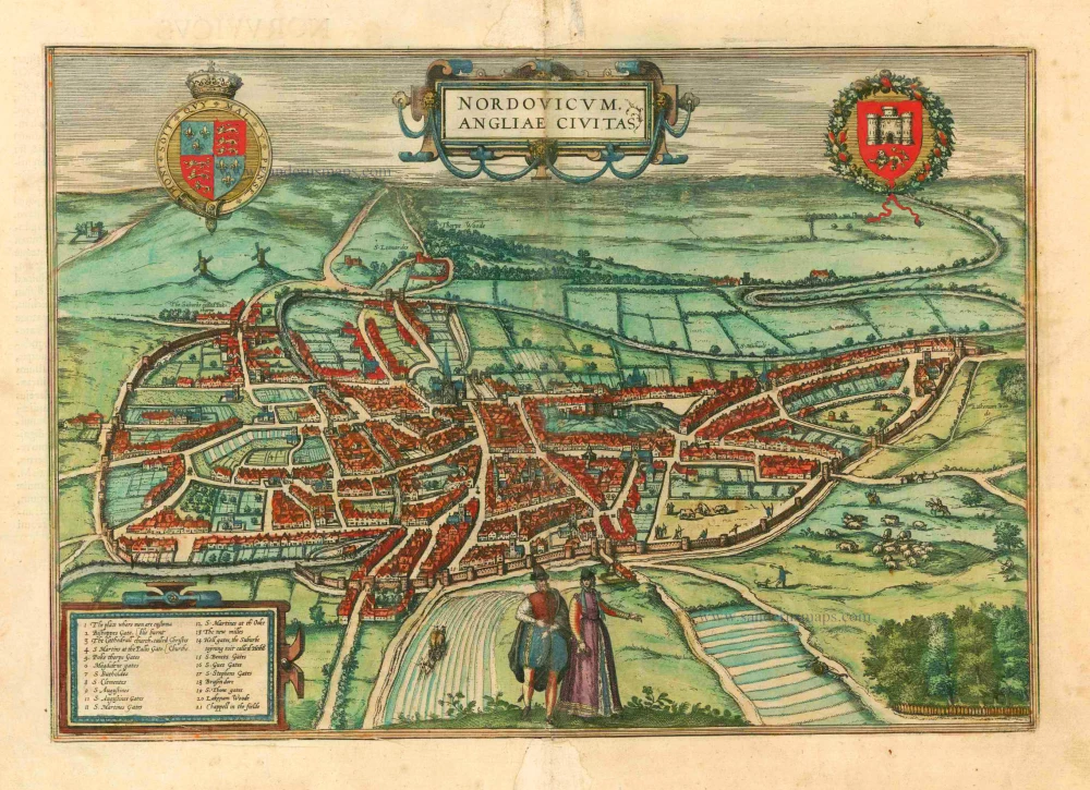
Nordovicum, Angliae Civitas. 1581
Norwich, by Georg Braun and Frans Hogenberg.
[Item number: 25426]

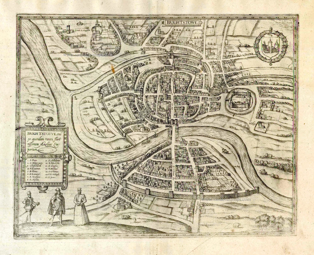
Brightstowe, Vulgo; Quondam Venta, Florentissimum. 1581
Bristol, by Georg Braun & Frans Hogenberg.
[Item number: 26681]
Brightstowe, Vulgo; Quondam Venta, Florentissimum. 1616
Bristol, by Braun Georg & Hogenberg Frans
[Item number: 26909]
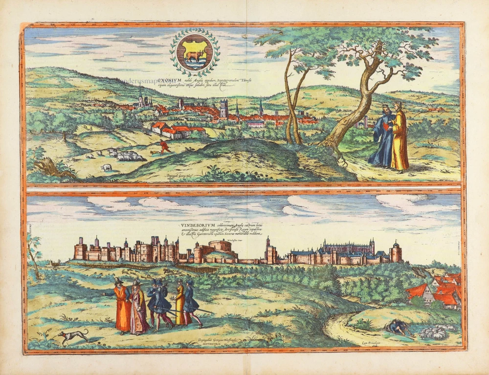
Oxonium Nobile Anglie Oppidum [on sheet with] Vindesorium Celeberrimum Angliae Castrum ... 1623
Oxford and Windsor Castel, by Georg Braun and Frans Hogenberg.
[Item number: 29346]