
Scotland (North and South), by Petrus Bertius. 1618
Petrus Bertius (1565-1629)
Petrus Bertius, born at Beveren, Flanders, in 1565, was related to Pieter van den Keere (Kaerius) and Jodocus Hondius. Both famous cartographers were brothers-in-law of Petrus Bertius. As a refugee, he settled in Amsterdam, and after finishing his studies, he became a professor of mathematics and librarian at the University of Leiden. In 1618, he became a cosmographer and historiographer for Louis XIII of France. He lived in Paris, where he died in 1629.
Petrus Bertius's remarkable work ethic is evident in the numerous geographical and theological works he produced. His contributions to the works of Clüver and Herrera further solidified his reputation in geography.
His fame among geographers was established by his text in the pocket atlas Tabularum Geographicarum and by his edition of Ptolemy’s Geographia.
The origin of the Tabularum Geographicum lies in the well-known miniature atlas Caert thresoor, published by Barent Langenes in 1598 in Middelburg. Bertius engraved 169 maps for this small but attractive atlas, sold for the first time in 1599 by Cornelis Claesz in Amsterdam. In 1600, Claesz published the pocket atlas with a Latin text composed by Petrus Bertius. From then on, new editions, often enlarged with new maps, regularly appeared, subsequently published by Cornelis Claesz, Jodocus Hondius, Johannes Janssonius and ultimately, in 1649, by Claes Jansz. Visscher.
Koeman divides this series of pocketbooks into two atlases: The Caert-thresoor, published by Langenes and Claesz., with five editions between 1598 and 1609, and the Tabularum Geographicarum Contractarum by Petrus Bertius with ten editions between 1600 and 1650.
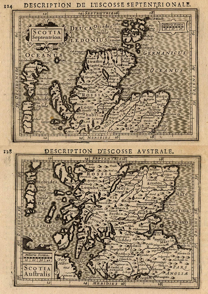
Scotia Septentrion [in set with] Scotia Australis.
Currently not available
Item Number: 18212 Authenticity Guarantee
Category: Antique maps > Europe > British Isles
Old, antique map of Scotland (North and South), by Petrus Bertius.
Title: Scotia Septentrion [in set with] Scotia Australis.
Date of the first edition: 1618.
Date of this map: 1618.
Copper engraving, printed on paper.
Size (not including margins): 95 x 135mm (3.74 x 5.31 inches).
Verso: French text.
Condition: Excellent.
Condition Rating: A+.
From: La Geographie Recourcie de Pierre Bertius. Amsterdam, J. Hondius, 1618.
Petrus Bertius (1565-1629)
Petrus Bertius, born at Beveren, Flanders, in 1565, was related to Pieter van den Keere (Kaerius) and Jodocus Hondius. Both famous cartographers were brothers-in-law of Petrus Bertius. As a refugee, he settled in Amsterdam, and after finishing his studies, he became a professor of mathematics and librarian at the University of Leiden. In 1618, he became a cosmographer and historiographer for Louis XIII of France. He lived in Paris, where he died in 1629.
Petrus Bertius's remarkable work ethic is evident in the numerous geographical and theological works he produced. His contributions to the works of Clüver and Herrera further solidified his reputation in geography.
His fame among geographers was established by his text in the pocket atlas Tabularum Geographicarum and by his edition of Ptolemy’s Geographia.
The origin of the Tabularum Geographicum lies in the well-known miniature atlas Caert thresoor, published by Barent Langenes in 1598 in Middelburg. Bertius engraved 169 maps for this small but attractive atlas, sold for the first time in 1599 by Cornelis Claesz in Amsterdam. In 1600, Claesz published the pocket atlas with a Latin text composed by Petrus Bertius. From then on, new editions, often enlarged with new maps, regularly appeared, subsequently published by Cornelis Claesz, Jodocus Hondius, Johannes Janssonius and ultimately, in 1649, by Claes Jansz. Visscher.
Koeman divides this series of pocketbooks into two atlases: The Caert-thresoor, published by Langenes and Claesz., with five editions between 1598 and 1609, and the Tabularum Geographicarum Contractarum by Petrus Bertius with ten editions between 1600 and 1650.
Related items

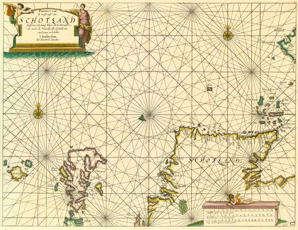
Pascaert, vande Westkust van Schotlant, als mede een Gedeelte vande Lewys Eylanden, van S. Patricius tot Nary, Nog t' I. Roda ofte Barre en t' I. S. Kilda ... 1697-1709
Scotland, with Lewis Island, by J. Van Keulen. Sea chart.
[Item number: 12461]
Pascaert van de Westcust van Schotland Tusschen t Eyland Kye en de Orcades, als mede de Noordlyckste Eylande van Lewys en S. Kilda. 1686
Scotland, by Doncker H.
[Item number: 13737]
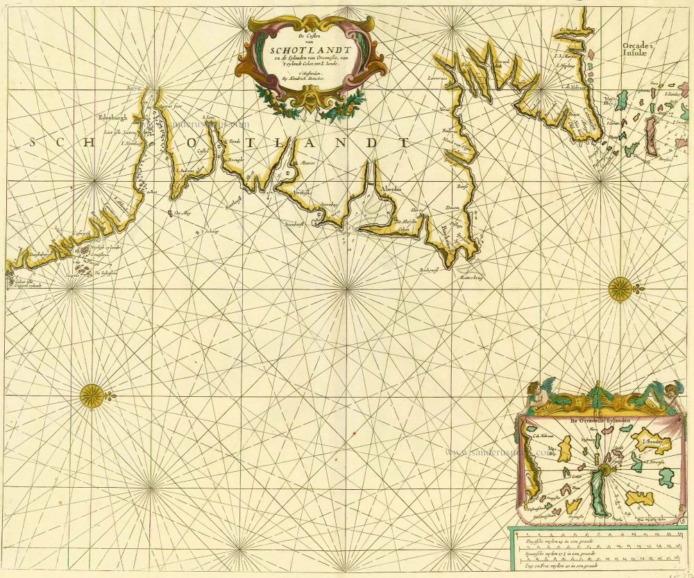
De Custen van Schotlandt en de Eylanden van Orcanese, van 't eylandt Coket tot I. Sande. 1686
Scotland and Orkney Islands, by Doncker H.
[Item number: 15386]
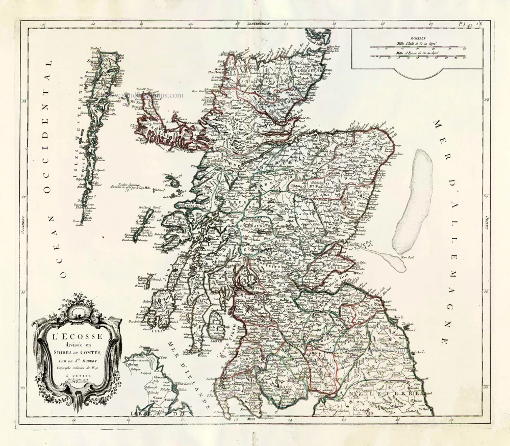
L'Ecosse Divisée en Shires ou Comtés. 1776-79
Scotland, by Francesco Santini.
[Item number: 26961]

Scotia Regnum divisum in Partem Septentrionalem et Meridionalem. After 1721
Scotland by Frederik de Wit, published by Covens & Mortier.
[Item number: 28242]
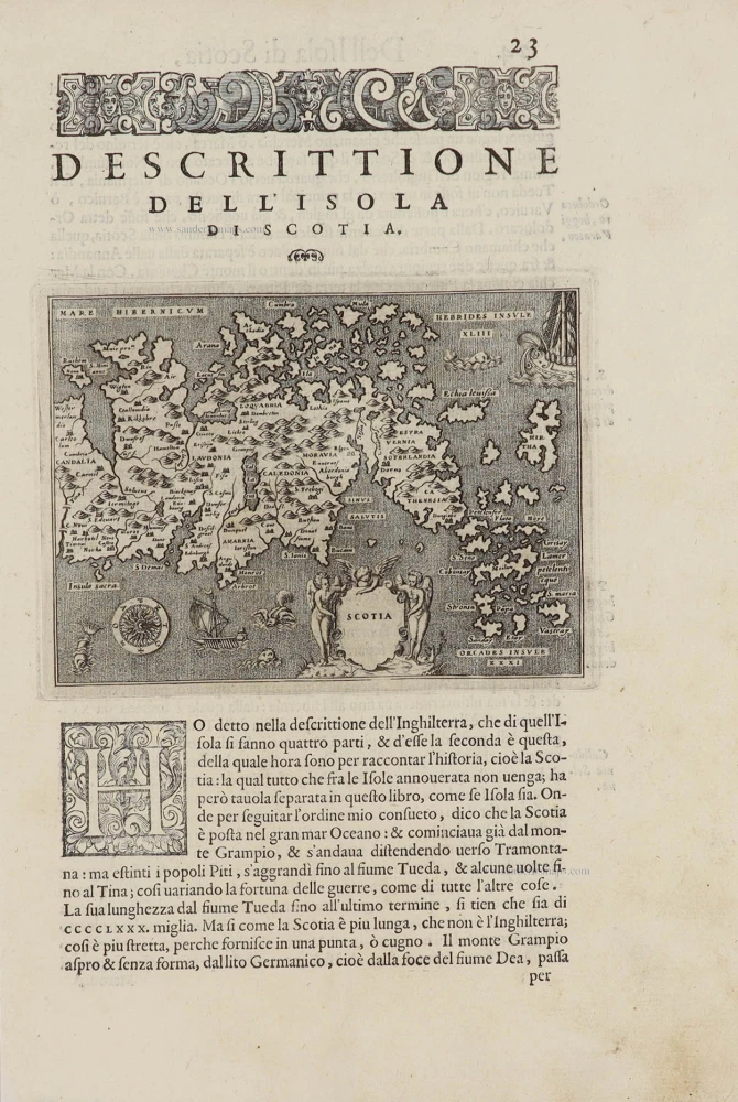
Scotia. - [Above map :] Descrittione del L'Isola di Scotia. 1572
Scotland by Thomaso Porcacchi.
[Item number: 28915]
Scotia Regnum. c. 1610-1650
Scotland, by Gerard Mercator.
[Item number: 31015]
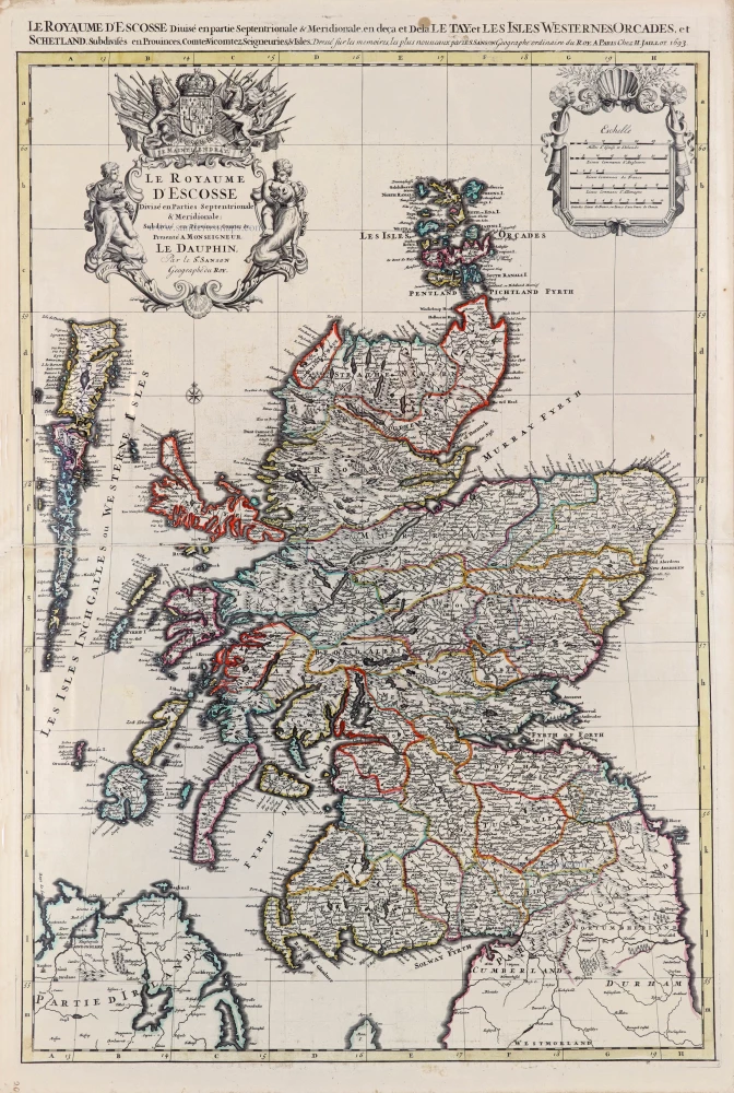
Le Royaume d'Escosse Divisé en Parties Septentrionale & Meridionale; Subdivisé en Provinces, Comtez &c. 1692
Scotland by N. Sanson, so-called published by Hubert Jaillot. (Pirated edition by Pierre Mortier).
[Item number: 31173]