
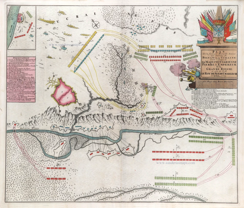
Map of the Battle of Poltawa (Ukraine) in 1709, by Pierre Husson. c. 1709


Pierre Husson (1678-1733)
Pierre (Pieter), a publisher in Den Haag, was a neighbour of Mrs Anna Beek, with whom he shared his interest in publishing plans of battlefields and fortifications during the War of Succession (1702-1713).
A collection of maps and plans by various authors was brought together in an atlas, to which was added the title page of Nicolas Visscher's Variae tabulae geographicae in quibus loca in orbe bello, now with the address of Pierre Husson.
Plan de la fameuse Bataille donnee aux environs de Poltawa en Ucraine Entre l'Armee de sa Majesté Csarienne Pierre I. Empereur de la Grande Russie et celle de S.M. le Roy de Suede Charles XII. me 27 Juin -8 Jullet 1709.
Item Number: 29587 Authenticity Guarantee
Category: Antique maps > Europe > Eastern Europe
Old, antique map of the Battle of Poltawa (Ukraine) in 1709, by Pierre Husson.
VERY RARE.
Title: Plan de la fameuse Bataille donnee aux environs de Poltawa en Ucraine Entre l'Armee de sa Majesté Csarienne Pierre I. Empereur de la Grande Russie et celle de S.M. le Roy de Suede Charles XII. me 27 Juin -8 Jullet 1709.
P.V.Cal.J.
A la Haye chez Pierre Husson.
Oriented to the northeast.
Date: c. 1709.
Copper engraving, printed on paper.
Map size: 500 x 580mm (19.69 x 22.83 inches).
Sheet size: 510 x 610mm (20.08 x 24.02 inches).
Verso: Blank.
Condition: Original coloured, excellent.
Condition Rating: A+.
From: Variae tabulae geographicae un quibus loca in orbe bello flagrantia conspiciuntur ut in Flandria, Brabantia, Leodiensi Tractu, Germania, Hungaria, . . . Diverses cartes de geographie, où l'on peut voir le theatre de la guerre dans tout le monde. Comme dans les pais de Flandres, de Brabant, de Liège, d'Allemagne, de Hongrie, . . . Den Haag, P. Husson, s.d. (c. 1709). (Koeman II, p. 155, Hus1)
Pierre Husson (1678-1733)
Pierre (Pieter), a publisher in Den Haag, was a neighbour of Mrs Anna Beek, with whom he shared his interest in publishing plans of battlefields and fortifications during the War of Succession (1702-1713).
A collection of maps and plans by various authors was brought together in an atlas, to which was added the title page of Nicolas Visscher's Variae tabulae geographicae in quibus loca in orbe bello, now with the address of Pierre Husson.
Related items

Taurica Chersonesus VS. nostra Aetate Przecopsca et Gazara Dicitur. 1641
Ukraine - Crimea by Henricus Hondius.
[Item number: 26264]

Carte de la Lithuanie Russienne qui Comprend les Palatinats de Livonie, de Witepsk, de Miscislaw, et une Partie de ceux de Polock et de Minsk Cédés par la Pologne a la Russie. 1776-79
Bellarus and parts of Lithuania and Ukraine, by Francesco Santini.
[Item number: 26969]

Rade de Sébastopol. Observée par quatre Vapeurs de la Flotte Anglo-Française. / Road of Sebastopol. Overseen by four Steamer of the English and French Fleet. 1854
Sebastopol (Ukraine), by Max Beeger.
[Item number: 27436]
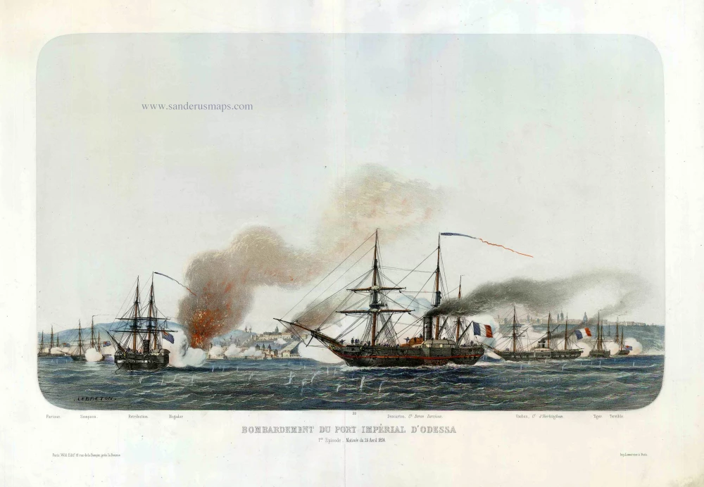
Bombardement du Port Impérial d'Odessa. c.1854
Odessa (Ukraine), by Louis Le Breton.
[Item number: 27443]

A bird's-eye view of the Town, Harbours & Forts of Odessa. 1854
Odessa (Ukraine), by H. Whittock.
[Item number: 27448]

Germano-Sarmatia in qua populi maiores Venedi et Aestiaei Peucini et Bastarnae in minores populos divisi ad hodiernam locorum et regionum positionem respondent. 1658
Poland, Lithuania, Ukraine, Latvia, by Nicolas Sanson.
[Item number: 27918]

Cimmeria quae Postea Scythia Europaea Seu Parua Scythia. 1665
Ukraine, by Nicolas Sanson.
[Item number: 27919]
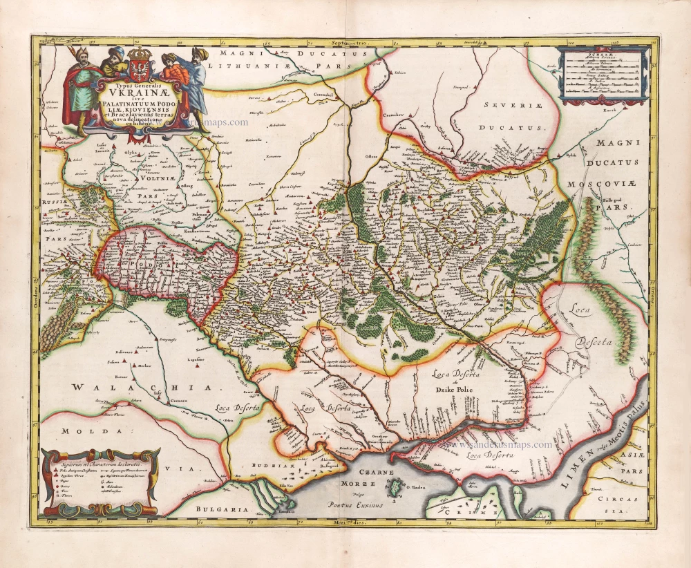
Typus Generalis Ukrainae sive Palatinatuum Podoliae, Kioviensis et Braczlaviensis Terras Nova Delineatione Exhibens. 1666
Ukraine, by Johannes Janssonius.
[Item number: 29957]

[Title on verso:] Tabula .VIII. Europae. 1525
Ptolemy map of Eastern Europe, Ukraine - Russia by Lorenz Fries, after Martin Waldseemüller.
[Item number: 30369]

Li Palatinati della Russia Rossa Podolia e Wolhynia. 1779-1785
Western Ukraine, by Antonio Zatta.
[Item number: 32042]
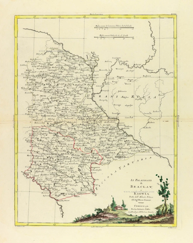
Li Palatinati di Braclaw, e Kiowia. 1779-1785
Ukraine, by Antonio Zatta.
[Item number: 32134]