
Poland, Lithuania, Ukraine, Latvia, by Nicolas Sanson. 1658

SANSON FAMILY
Nicolas Sanson (1600-1667) - Guillaume Sanson (1633-1703) - Pierre Moullart-Sanson (? -1730)
Originally from Abbeville, Nicolas I Sanson showed a keen interest in historical geography. He was still very young; he published a map of ancient Gaul and two treatises, Britannia and Portus Itius on Abbeville and Boulogne's origins. His meeting with Melchior Tavernier was decisive: it prompted him to give up his duties as a military engineer in Picardy and devote himself to engraved cartography.
At the same time, Sanson had drawn up the outline of modern France. He got the help of Tavernier, who encouraged him to compete with the Dutch map publishers. Tavernier contacted other French cartographers whose works he published.
From 1643, N. Sanson obtained a privilege to publish a work personally, the Princes souverains de l'Italie. Then, in 1644 and 1645, he had his famous geographical tables printed, which significantly contributed to his fame. He also published a series of atlases in quarto of the four continents.
In 1648, N. Sanson associated himself with Mariette to publish atlases. From then on, specific maps bore his name and others Mariette's. N. Sanson and Mariette worked together for more than 20 years. After the death of N. Sanson, Mariette acquired the entire fund. Since Mariette only wanted to publish complete atlases, individual maps were no longer sold, and some army generals complained to the king.
The disagreement between the Sanson family and Pierre II Mariette culminated in 1671 when Guillaume Sanson took the case to court. There was no longer any question of collaboration: Guillaume Sanson started working for another publisher, Alexis-Hubert Jaillot.
The Sanson family faced financial difficulties, and in 1692, their cousin, Pierre Moullart-Sanson, bought the entire geographic fund from his uncles and aunt. Pierre Moullart-Sanson was the son of Françoise Sanson (third child of Nicolas) and Pierre Moullart. He restarted the publishing of Sanson's world atlas, and in 1704 he acquired a privilege for publishing all the works of Nicolas and Guillaume Sanson, which continued to be published until 1730.
Germano-Sarmatia in qua populi maiores Venedi et Aestiaei Peucini et Bastarnae in minores populos divisi ad hodiernam locorum et regionum positionem respondent.
Item Number: 27918 Authenticity Guarantee
Category: Antique maps > Europe > Eastern Europe
SANSON FAMILY
Nicolas Sanson (1600-1667) - Guillaume Sanson (1633-1703) - Pierre Moullart-Sanson (? -1730)
Originally from Abbeville, Nicolas I Sanson showed a keen interest in historical geography. He was still very young; he published a map of ancient Gaul and two treatises, Britannia and Portus Itius on Abbeville and Boulogne's origins. His meeting with Melchior Tavernier was decisive: it prompted him to give up his duties as a military engineer in Picardy and devote himself to engraved cartography.
At the same time, Sanson had drawn up the outline of modern France. He got the help of Tavernier, who encouraged him to compete with the Dutch map publishers. Tavernier contacted other French cartographers whose works he published.
From 1643, N. Sanson obtained a privilege to publish a work personally, the Princes souverains de l'Italie. Then, in 1644 and 1645, he had his famous geographical tables printed, which significantly contributed to his fame. He also published a series of atlases in quarto of the four continents.
In 1648, N. Sanson associated himself with Mariette to publish atlases. From then on, specific maps bore his name and others Mariette's. N. Sanson and Mariette worked together for more than 20 years. After the death of N. Sanson, Mariette acquired the entire fund. Since Mariette only wanted to publish complete atlases, individual maps were no longer sold, and some army generals complained to the king.
The disagreement between the Sanson family and Pierre II Mariette culminated in 1671 when Guillaume Sanson took the case to court. There was no longer any question of collaboration: Guillaume Sanson started working for another publisher, Alexis-Hubert Jaillot.
The Sanson family faced financial difficulties, and in 1692, their cousin, Pierre Moullart-Sanson, bought the entire geographic fund from his uncles and aunt. Pierre Moullart-Sanson was the son of Françoise Sanson (third child of Nicolas) and Pierre Moullart. He restarted the publishing of Sanson's world atlas, and in 1704 he acquired a privilege for publishing all the works of Nicolas and Guillaume Sanson, which continued to be published until 1730.
Related items

Cimmeria quae Postea Scythia Europaea Seu Parua Scythia. 1665
Ukraine, by Nicolas Sanson.
[Item number: 27919]

Friderico Augusto Vero Augusto Polon. Lithua. Borus. Pomer. Regi. Duci. Principi. Saxon. Utr. Duci. S. Imp. Elect. Haec. Imperii Sui Regna. c. 1715
Poland - Lithuania by Petrus Schenk.
[Item number: 28264]
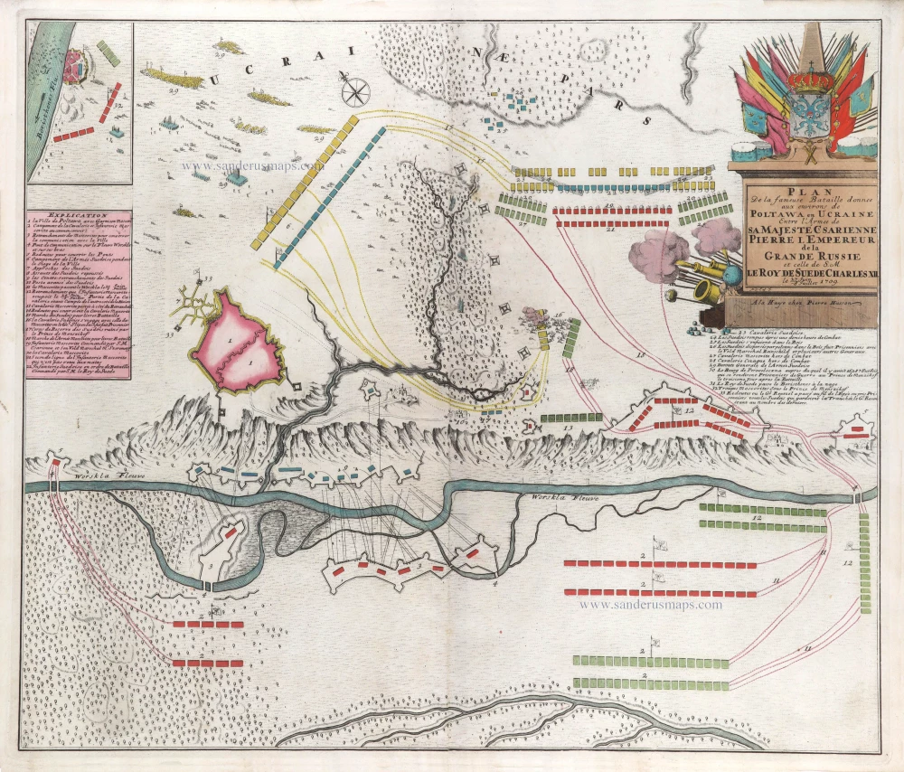
Plan de la fameuse Bataille donnee aux environs de Poltawa en Ucraine Entre l'Armee de sa Majesté Csarienne Pierre I. Empereur de la Grande Russie et celle de S.M. le Roy de Suede Charles XII. me 27 Juin -8 Jullet 1709. c. 1709
Map of the Battle of Poltawa (Ukraine) in 1709, by Pierre Husson.
[Item number: 29587]

Polonia et Silesia. 1613
Poland, by Gerard Mercator.
[Item number: 29762]

Exceptional nice copy of the first edition
Poloniae, Lituaniaeq. Descriptio. 1595
Lithuania, Poland & Ukraine by Abraham Ortelius
[Item number: 29857]
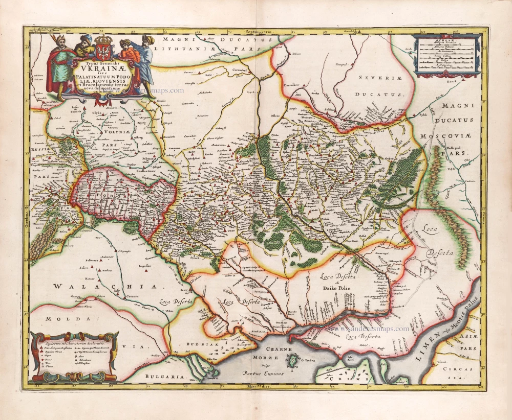
Typus Generalis Ukrainae sive Palatinatuum Podoliae, Kioviensis et Braczlaviensis Terras Nova Delineatione Exhibens. 1666
Ukraine, by Johannes Janssonius.
[Item number: 29957]

[Title on verso:] Tabula .VIII. Europae. 1525
Ptolemy map of Eastern Europe, Ukraine - Russia by Lorenz Fries, after Martin Waldseemüller.
[Item number: 30369]
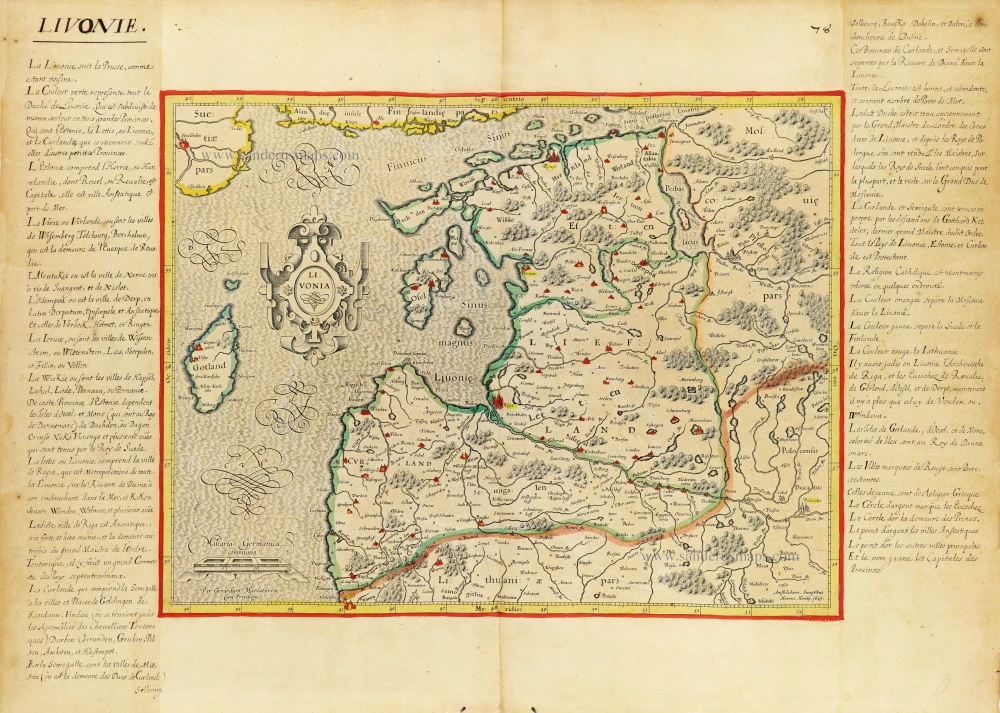
Livonia. 1627
Estonia & Latvia by Gerard Mercator, published by Henricus Hondius.
[Item number: 30997]

Estats de Pologne Subdivises Suivant l'Estendue des Palatinats 1692
Poland by N. Sanson, so-called published by Hubert Jaillot. (Pirated edition by Pierre Mortier).
[Item number: 31436]

Poloigne Cassubie & Pomerellie. 1633
Poland by C. Tassin.
[Item number: 31754]

Li Palatinati della Russia Rossa Podolia e Wolhynia. 1779-1785
Western Ukraine, by Antonio Zatta.
[Item number: 32042]
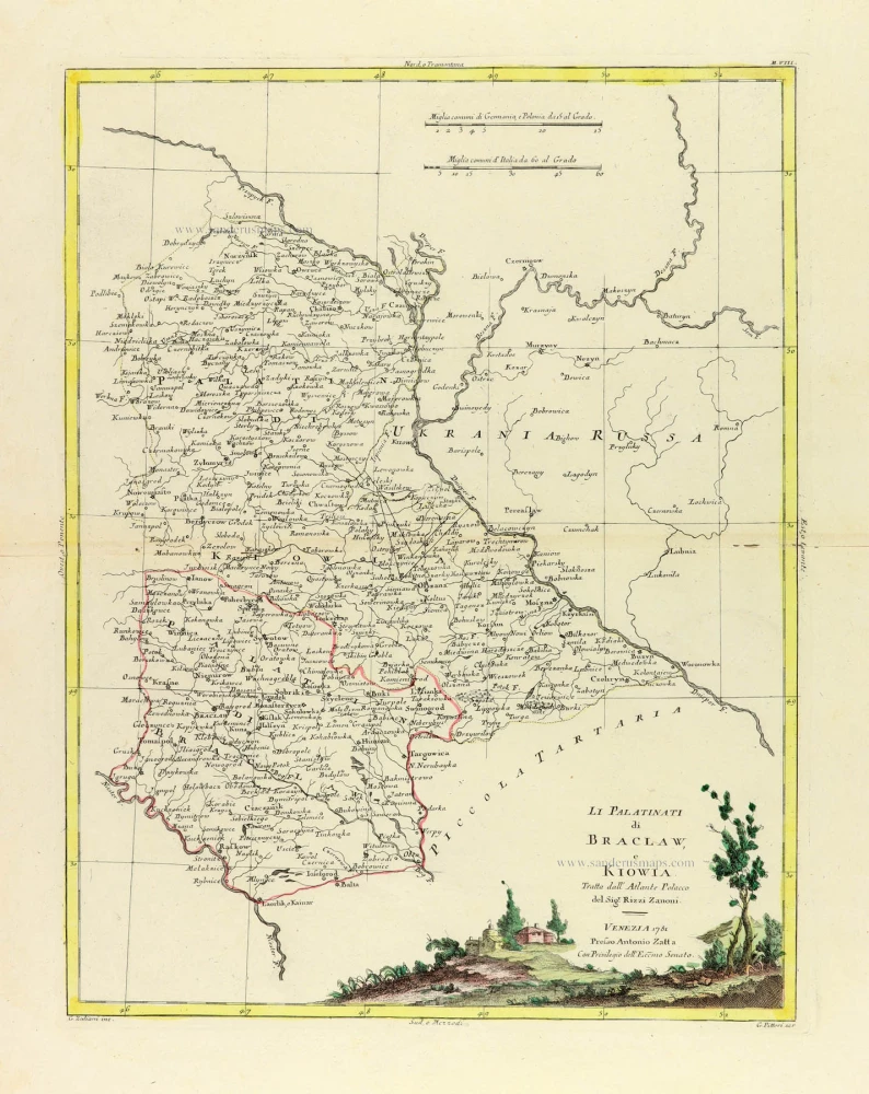
Li Palatinati di Braclaw, e Kiowia. 1779-1785
Ukraine, by Antonio Zatta.
[Item number: 32134]

Li Palatinati di Wilna, Troji, Inflant, coi Ducati di Kurlandia, e Smuz. 1779-1785
Lithuania - Latvia, by Antonio Zatta.
[Item number: 32135]

Ducatuum Livoniae et Curlandiae cum vicinis Insulis c. 1720
Livonia & Curlandia (Latvia), by J.B. Homann.
[Item number: 32273]

RARE
Ducatuum Livoniae et Curlandiae Novissima Tabula in Quibus sunt Estonia Litlandia et Aliae Minoriss Provinciae. 1696-1713
Livonia & Curlandia (Latvia) by Justus Danckerts
[Item number: 32512]
Scarce
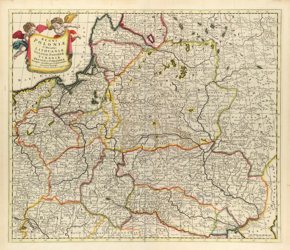
Regni Poloniae et Ducatus Lithuaniae Voliniae, Podoliae Ucraniae Prussiae et Curlandiae. c. 1680
Poland, Lithuania, and Ukraine by Justus Danckerts
[Item number: 32513]

Reipublicae et Status Generalis Poloniae Nova Tabula, Comprehendens Maioris et Minoris Poloniae Regni Magni Ducatus Lithuaniae, Ducatus Prussiae, Curlandiae, Russiae, Ucraniae et Podoliae. c. 1691-97
Lithuania by Frederick de Wit.
[Item number: 32698]

RARE FIRST STATE
Stati della Corona di Polonia. 1684
Poland - Lithuania, by Nicolas Sanson, published by Giovanni Giacomo de Rossi.
[Item number: 32904]
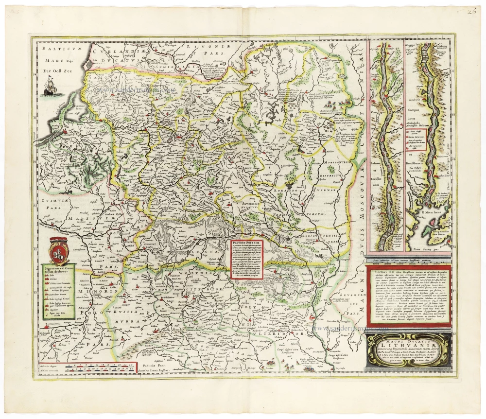
Magni Ducatus Lithuaniae Caeterarumq. Regionum Illi Adiacentium Exacta Descrip. . . . 1666
Lithuania by Johannes Janssonius.
[Item number: 33097]
new