
Przemysl (Poland), by Georg Braun and Frans Hogenberg. c. 1625
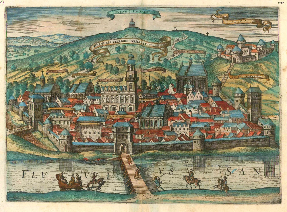

BANDEROLE: Przemysl, the renowned city in Russia.
COMMENTARY BY BRAUN (on verso): "Although the origin of the name of this city has not yet been discovered in the histories, it can be assumed that it takes its name from its founder (probably a Polish prince of this name). There are two bishoprics here, of which one is Roman or Latin, the other being presided over by a Russian of Greek bishop, and each conducts the liturgy in his own way. The city was conquered by Boleslav, the Bold, son of Casimir, for the Kingdom of Poland. In the war that he began against Russia, he succeeded in capturing nearly all cities and fortresses within a very short time; but when he came to Przemysl he did not find it so easy and he captured the city only with great difficulty."
The plate shows Przemysl from the north beside the River San. The city is protected by three mighty bastion-like gates, towers and a wall. It is dominated by the town hall in the middle, to the left of which is the church of the Franciscans. The cathedral of St John, a three-nave late Gothic hall church, is on the right, next to the city wall. The royal castle dating from the 14th century can be identified in the upper right-hand corner. Przemysl belonged originally to the empire of Kievan Rus' and passed to Poland only in 1344. The city prospered in the 16th century. In this period, many imposing townhouses were built, which can still be seen today in the well-preserved Old Town, as a witness to the city's past wealth as a trade centre. Przemysl lies on the border with Ukraine in Subcarpathia. (Taschen)
Braun G. & Hogenberg F. and the Civitates Orbis Terrarum.
The Civitates Orbis Terrarum, also known as the 'Braun & Hogenberg', is a six-volume town atlas and the most excellent book of town views and plans ever published: 363 engravings, sometimes beautifully coloured. It was one of the best-selling works in the last quarter of the 16th century. Georg Braun, a skilled writer, wrote the text accompanying the plans and views on the verso. Many plates were engraved after the original drawings of a professional artist, Joris Hoefnagel (1542-1600). The first volume was published in Latin in 1572 and the sixth in 1617. Frans Hogenberg, a talented engraver, created the tables for volumes I through IV, and Simon van den Neuwel made those for volumes V and VI. Other contributors were cartographers Daniel Freese and Heinrich Rantzau, who provided valuable geographical information. Works by Jacob van Deventer, Sebastian Münster, and Johannes Stumpf were also used as references. Translations appeared in German and French, making the atlas accessible to a broader audience.
Since its original publication of volume 1 in 1572, the Civitates Orbis Terrarum has left an indelible mark on the history of cartography. Seven more editions followed the first volume in 1575, 1577, 1582, 1588, 1593, 1599, and 1612. Vol.2, initially released in 1575, saw subsequent editions in 1597 and 1612. The subsequent volumes, each a treasure trove of historical insights, graced the world in 1581, 1588, 1593, 1599, and 1606. The German translation of the first volume, a testament to its widespread appeal, debuted in 1574, followed by the French edition in 1575.
Several printers were involved: Theodor Graminaeus, Heinrich von Aich, Gottfried von Kempen, Johannis Sinniger, Bertram Buchholtz, and Peter von Brachel, all of whom worked in Cologne.
Georg Braun (1541-1622)
Georg Braun, the author of the text accompanying the plans and views in the Civitates Orbis Terrarum, was born in Cologne in 1541. After his studies in Cologne, he entered the Jesuit Order as a novice, indicating his commitment to learning and intellectual pursuits. In 1561, he obtained his bachelor's degree; in 1562, he received his Magister Artium, further demonstrating his academic achievements. Although he left the Jesuit Order, he continued his studies in theology, gaining a licentiate in theology. His theological background likely influenced the content and tone of the text in the Civitates Orbis Terrarum, adding a unique perspective to the work.
Frans Hogenberg (1535-1590)
Frans Hogenberg was a Flemish and German painter, engraver, and mapmaker. He was born in Mechelen as the son of Nicolaas Hogenberg.
By the end of the 1560s, Frans Hogenberg was employed upon Abraham Ortelius's Theatrum Orbis Terrarum, published in 1570; he is named an engraver of numerous maps. In 1568, he was banned from Antwerp by the Duke of Alva and travelled to London, where he stayed a few years before emigrating to Cologne. He immediately embarked on his two most important works, the Civitates, published in 1572 and the Geschichtsblätter, which appeared in several series from 1569 until about 1587.
Thanks to large-scale projects like the Geschichtsblätter and the Civitates, Hogenberg's social circumstances improved with each passing year. He died as a wealthy man in Cologne in 1590.
Premislia Celebris Russiae Civitas.
Item Number: 16482 Authenticity Guarantee
Category: Antique maps > Europe > Eastern Europe
Old, antique bird’s-eye view plan of Przemysl (Poland), by Georg Braun and Frans Hogenberg.
Title: Premislia Celebris Russiae Civitas.
Date of the first edition: 1617.
Date of this map: c. 1625.
Copper engraving, printed on paper.
Size (not including margins): 350 x 488mm (13.78 x 19.21 inches).
Verso: French text.
Condition: Original coloured, lower centrefold split reinforced.
Condition Rating: A.
From: Théatre des Principales Villes de tout l'Univers Vol. VI. c. 1625. (Van der Krogt 4, 41:3.6)
BANDEROLE: Przemysl, the renowned city in Russia.
COMMENTARY BY BRAUN (on verso): "Although the origin of the name of this city has not yet been discovered in the histories, it can be assumed that it takes its name from its founder (probably a Polish prince of this name). There are two bishoprics here, of which one is Roman or Latin, the other being presided over by a Russian of Greek bishop, and each conducts the liturgy in his own way. The city was conquered by Boleslav, the Bold, son of Casimir, for the Kingdom of Poland. In the war that he began against Russia, he succeeded in capturing nearly all cities and fortresses within a very short time; but when he came to Przemysl he did not find it so easy and he captured the city only with great difficulty."
The plate shows Przemysl from the north beside the River San. The city is protected by three mighty bastion-like gates, towers and a wall. It is dominated by the town hall in the middle, to the left of which is the church of the Franciscans. The cathedral of St John, a three-nave late Gothic hall church, is on the right, next to the city wall. The royal castle dating from the 14th century can be identified in the upper right-hand corner. Przemysl belonged originally to the empire of Kievan Rus' and passed to Poland only in 1344. The city prospered in the 16th century. In this period, many imposing townhouses were built, which can still be seen today in the well-preserved Old Town, as a witness to the city's past wealth as a trade centre. Przemysl lies on the border with Ukraine in Subcarpathia. (Taschen)
Braun G. & Hogenberg F. and the Civitates Orbis Terrarum.
The Civitates Orbis Terrarum, also known as the 'Braun & Hogenberg', is a six-volume town atlas and the most excellent book of town views and plans ever published: 363 engravings, sometimes beautifully coloured. It was one of the best-selling works in the last quarter of the 16th century. Georg Braun, a skilled writer, wrote the text accompanying the plans and views on the verso. Many plates were engraved after the original drawings of a professional artist, Joris Hoefnagel (1542-1600). The first volume was published in Latin in 1572 and the sixth in 1617. Frans Hogenberg, a talented engraver, created the tables for volumes I through IV, and Simon van den Neuwel made those for volumes V and VI. Other contributors were cartographers Daniel Freese and Heinrich Rantzau, who provided valuable geographical information. Works by Jacob van Deventer, Sebastian Münster, and Johannes Stumpf were also used as references. Translations appeared in German and French, making the atlas accessible to a broader audience.
Since its original publication of volume 1 in 1572, the Civitates Orbis Terrarum has left an indelible mark on the history of cartography. Seven more editions followed the first volume in 1575, 1577, 1582, 1588, 1593, 1599, and 1612. Vol.2, initially released in 1575, saw subsequent editions in 1597 and 1612. The subsequent volumes, each a treasure trove of historical insights, graced the world in 1581, 1588, 1593, 1599, and 1606. The German translation of the first volume, a testament to its widespread appeal, debuted in 1574, followed by the French edition in 1575.
Several printers were involved: Theodor Graminaeus, Heinrich von Aich, Gottfried von Kempen, Johannis Sinniger, Bertram Buchholtz, and Peter von Brachel, all of whom worked in Cologne.
Georg Braun (1541-1622)
Georg Braun, the author of the text accompanying the plans and views in the Civitates Orbis Terrarum, was born in Cologne in 1541. After his studies in Cologne, he entered the Jesuit Order as a novice, indicating his commitment to learning and intellectual pursuits. In 1561, he obtained his bachelor's degree; in 1562, he received his Magister Artium, further demonstrating his academic achievements. Although he left the Jesuit Order, he continued his studies in theology, gaining a licentiate in theology. His theological background likely influenced the content and tone of the text in the Civitates Orbis Terrarum, adding a unique perspective to the work.
Frans Hogenberg (1535-1590)
Frans Hogenberg was a Flemish and German painter, engraver, and mapmaker. He was born in Mechelen as the son of Nicolaas Hogenberg.
By the end of the 1560s, Frans Hogenberg was employed upon Abraham Ortelius's Theatrum Orbis Terrarum, published in 1570; he is named an engraver of numerous maps. In 1568, he was banned from Antwerp by the Duke of Alva and travelled to London, where he stayed a few years before emigrating to Cologne. He immediately embarked on his two most important works, the Civitates, published in 1572 and the Geschichtsblätter, which appeared in several series from 1569 until about 1587.
Thanks to large-scale projects like the Geschichtsblätter and the Civitates, Hogenberg's social circumstances improved with each passing year. He died as a wealthy man in Cologne in 1590.
Related items
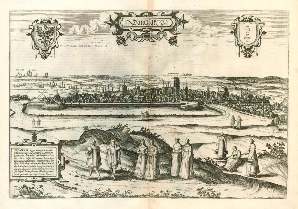
Dantzigk - Gedanum, Krantio, in sua Wandalia Gdanum; . . . 1576
Gdansk, by Georg Braun and Frans Hogenberg.
[Item number: 4056]
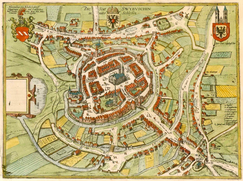
Die Stat Swybuschin in Nider Schlesien. 1596
Poland - Swiebodzin, by Braun & Hogenberg.
[Item number: 22102]
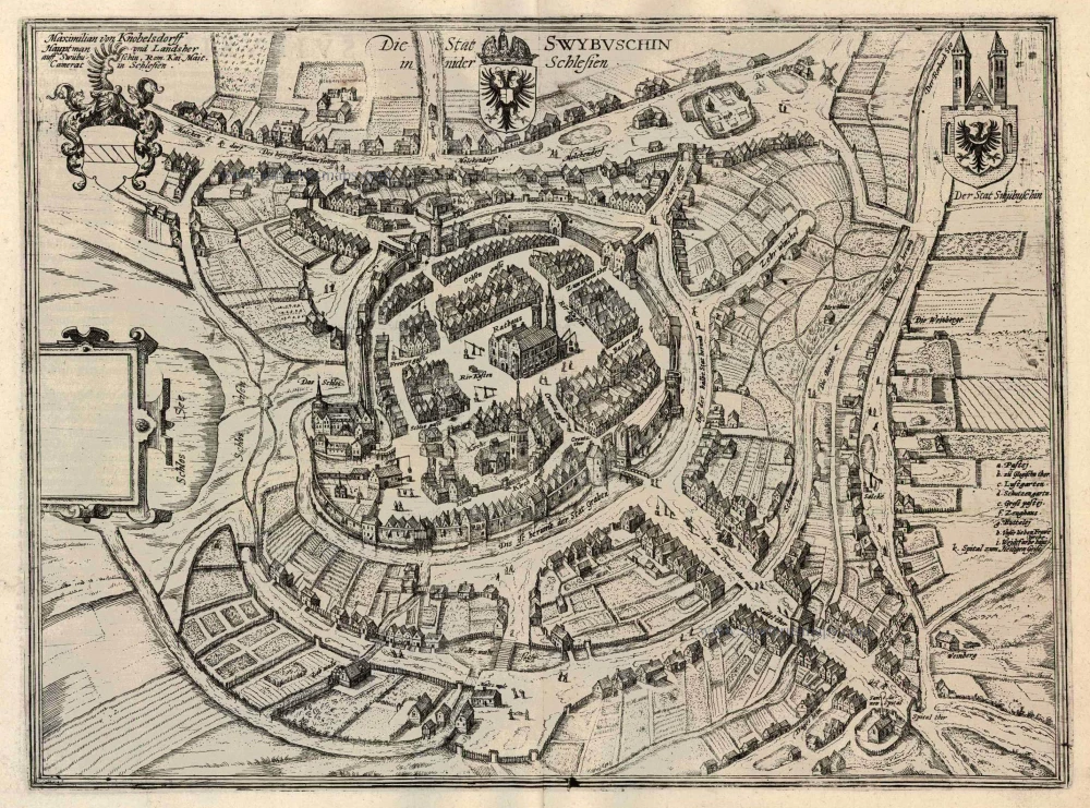
Die Stat Swybuschin in Nider Schlesien 1596
Swiebodzin, by Georg Braun and Frans Hogenberg.
[Item number: 24182]
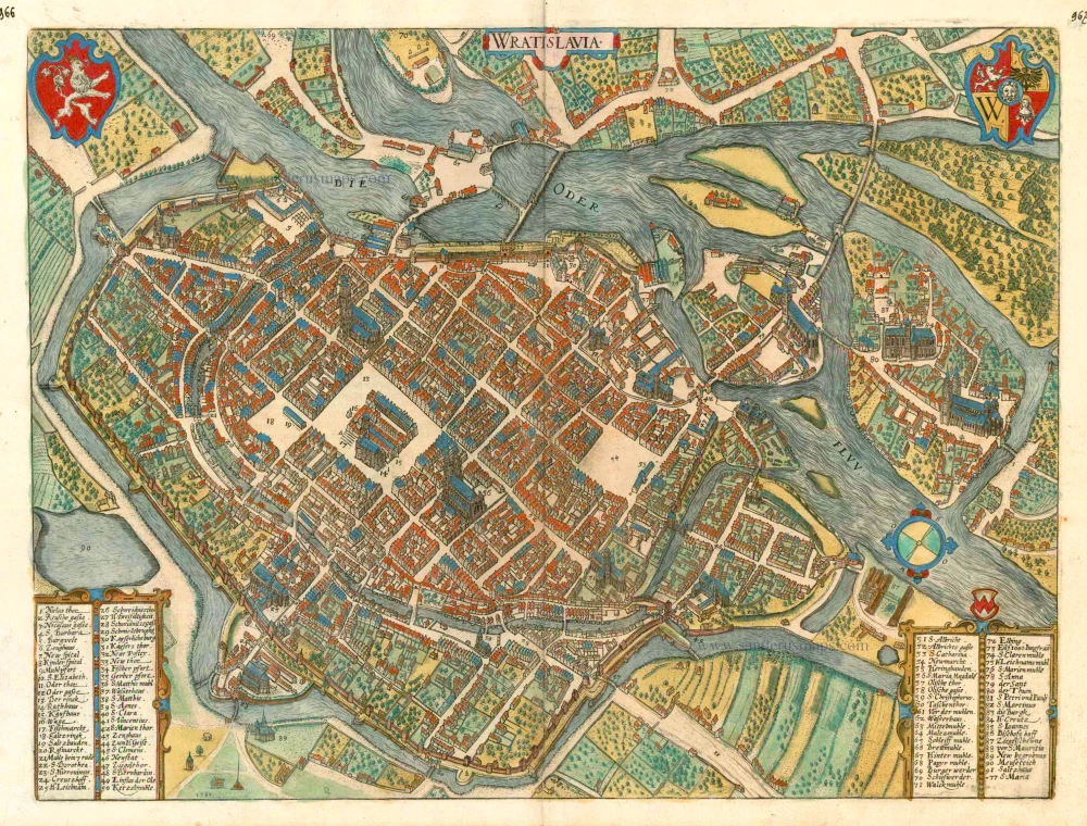
Wratislavia. c. 1593
Wroclaw (Breslau), by Georg Braun and Frans Hogenberg.
[Item number: 24572]
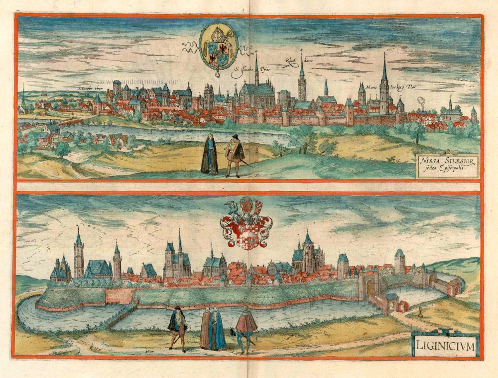
Nissa Silesior Sedes Episcopalis [on sheet with] Liginicium c. 1625
Nysa and Legnica (Poland), by Georg Braun and Frans Hogenberg.
[Item number: 24584]
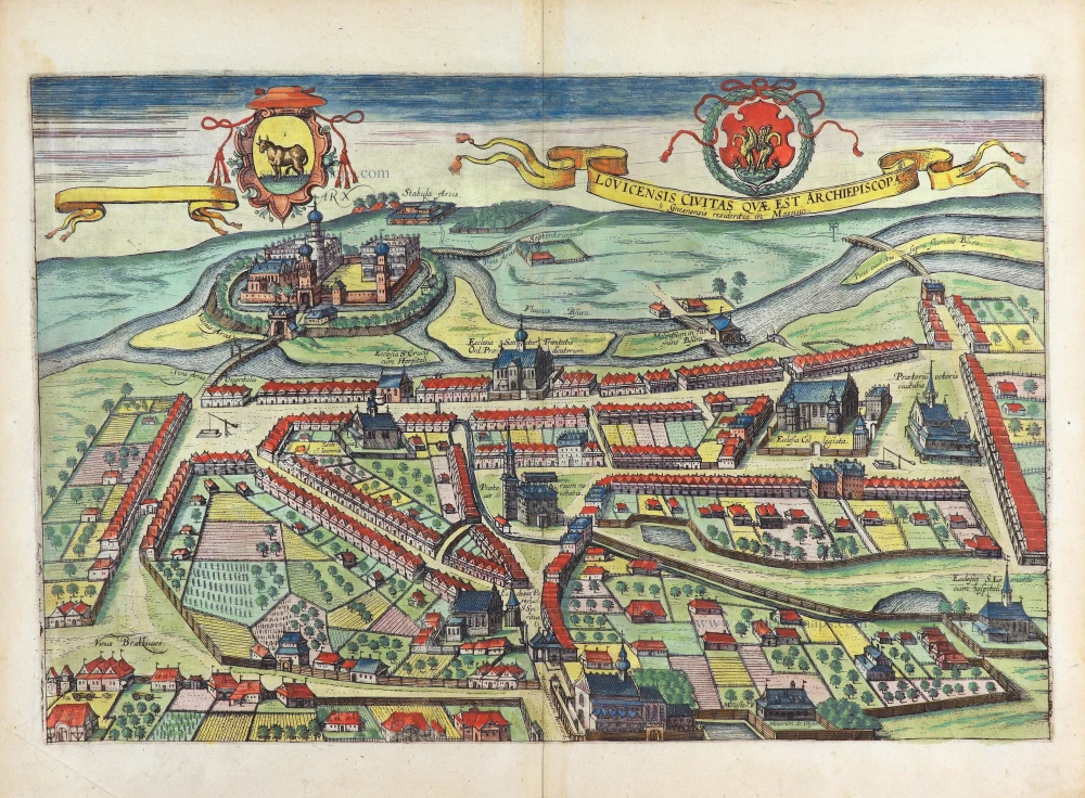
Lovicensis Civitas quae est Archiepiscopa. 1617-18
Lowicz by Georg Braun & Frans Hogenberg
[Item number: 29282]