
Poland, by Abraham Ortelius. 1572


Abraham Ortelius (1527-1598)
The maker of the 'first atlas', the Theatrum Orbis Terrarum (1570), was born on 4 April 1527 into an old Antwerp family. He learned Latin and studied Greek and mathematics.
Abraham and his sisters Anne and Elizabeth took up map colouring. He was admitted to the Guild of St. Luke as an "illuminator of maps." Besides colouring maps, Ortelius was a dealer in antiques, coins, maps, and books, with the book and map trade gradually becoming his primary occupation.
Business went well because his means permitted him to start an extensive collection of medals, coins, antiques, and a library of many volumes. In addition, he travelled a lot and visited Italy and France, made contacts everywhere with scholars and editors, and maintained extensive correspondence with them.
In 1564 he published his first map, a large and ambitious world wall map. The inspiration for this map may well have been Gastaldi's large world map. In 1565 he published a map of Egypt and a map of the Holy Land, a large map of Asia followed.
In 1568 the production of individual maps for his atlas Theatrum Orbis Terrarum was already in full swing. He completed the atlas in 1569, and in May of 1570, the Theatrum was available for sale. It was one of the most expensive books ever published.
This first edition contained seventy maps on fifty-three sheets. Franciscus Hogenberg engraved the maps.
Later editions included Additamenta (additions), resulting in Ortelius' historical atlas, the Parergon, mostly bound together with the atlas. The Parergon can be called a truly original work of Ortelius, who drew the maps based on his research.
The importance of the Theatrum Orbis Terrarum for geographical knowledge in the last quarter of the sixteenth century is difficult to overemphasize. Nothing was like it until Mercator's atlas appeared twenty-five years later. Demand for the Theatrum was remarkable. Some 24 editions appeared during Ortelius's lifetime and another ten after his death in 1598. Editions were published in Dutch, German, French, Spanish, English, and Italian. The number of map sheets grew from 53 in 1570 to 167 in 1612 in the last edition.
In 1577, engraver Philip Galle and poet-translator Pieter Heyns published the first pocket-sized edition of the Theatrum, the Epitome. The work was trendy. Over thirty editions of this Epitome were published in different languages.
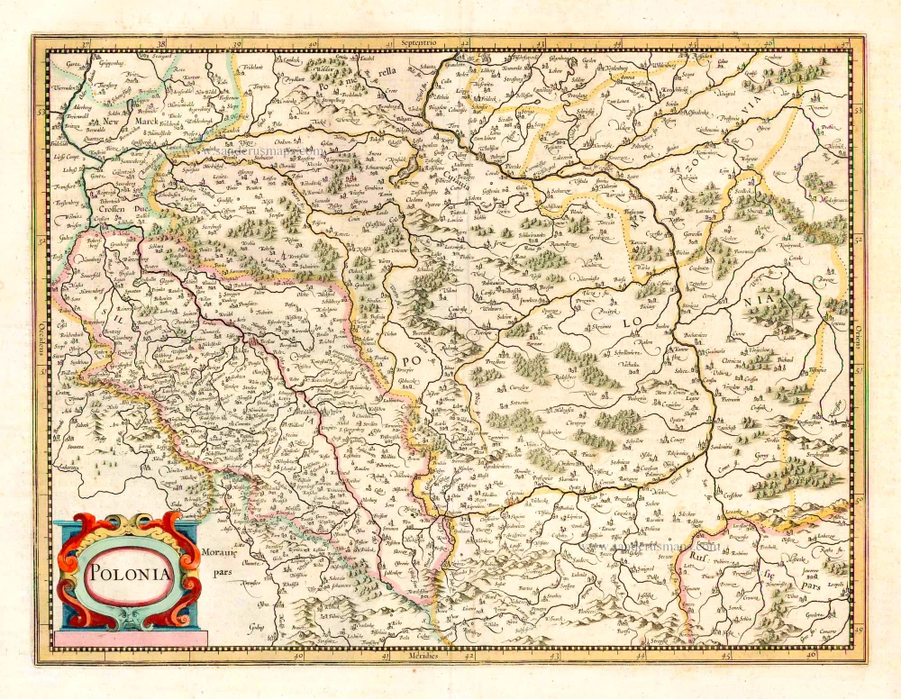
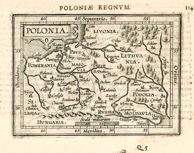
Poloniae Finitimarumque Locorum Descriptio Auctore Wenceslao Godreccio Polono.
Item Number: 16790 Authenticity Guarantee
Category: Antique maps > Europe > Eastern Europe
Old antique map of Poland by A. Ortelius.
Title: Poloniae Finitimarumque Locorum Descriptio Auctore Wenceslao Godreccio Polono.
Cartographer: W. Godrecki.
Date of the first edition: 1570.
Date of this map: 1572.
Copper engraving, printed on paper.
Size (not including margins): 371 x 497mm (14.61 x 19.57 inches).
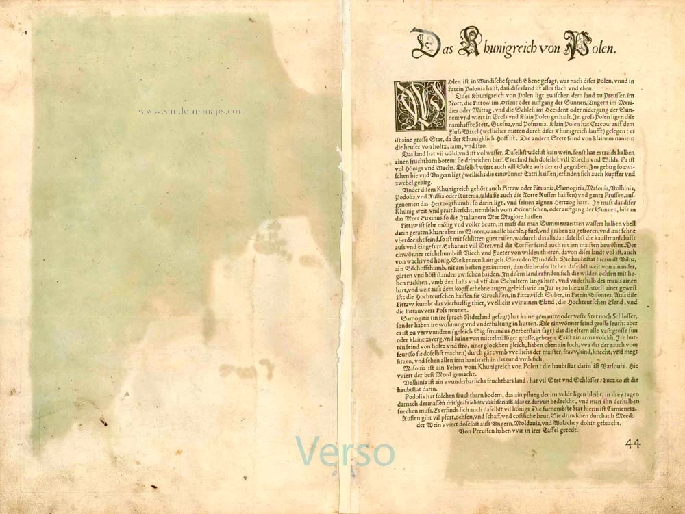
Verso: German text.
Condition: Original coloured, excellent.
Condition Rating: A+.
From: Theatrum oder Schawplatz des Erdbodems. Antwerpen, Gielis Coppens van Diest, 1572. (Van der Krogt, 3, 201)
Abraham Ortelius (1527-1598)
The maker of the 'first atlas', the Theatrum Orbis Terrarum (1570), was born on 4 April 1527 into an old Antwerp family. He learned Latin and studied Greek and mathematics.
Abraham and his sisters Anne and Elizabeth took up map colouring. He was admitted to the Guild of St. Luke as an "illuminator of maps." Besides colouring maps, Ortelius was a dealer in antiques, coins, maps, and books, with the book and map trade gradually becoming his primary occupation.
Business went well because his means permitted him to start an extensive collection of medals, coins, antiques, and a library of many volumes. In addition, he travelled a lot and visited Italy and France, made contacts everywhere with scholars and editors, and maintained extensive correspondence with them.
In 1564 he published his first map, a large and ambitious world wall map. The inspiration for this map may well have been Gastaldi's large world map. In 1565 he published a map of Egypt and a map of the Holy Land, a large map of Asia followed.
In 1568 the production of individual maps for his atlas Theatrum Orbis Terrarum was already in full swing. He completed the atlas in 1569, and in May of 1570, the Theatrum was available for sale. It was one of the most expensive books ever published.
This first edition contained seventy maps on fifty-three sheets. Franciscus Hogenberg engraved the maps.
Later editions included Additamenta (additions), resulting in Ortelius' historical atlas, the Parergon, mostly bound together with the atlas. The Parergon can be called a truly original work of Ortelius, who drew the maps based on his research.
The importance of the Theatrum Orbis Terrarum for geographical knowledge in the last quarter of the sixteenth century is difficult to overemphasize. Nothing was like it until Mercator's atlas appeared twenty-five years later. Demand for the Theatrum was remarkable. Some 24 editions appeared during Ortelius's lifetime and another ten after his death in 1598. Editions were published in Dutch, German, French, Spanish, English, and Italian. The number of map sheets grew from 53 in 1570 to 167 in 1612 in the last edition.
In 1577, engraver Philip Galle and poet-translator Pieter Heyns published the first pocket-sized edition of the Theatrum, the Epitome. The work was trendy. Over thirty editions of this Epitome were published in different languages.
Related items
Ducatus Silesiae Ligniciensis 1632+
Poland - Legnica, by Hondius H. - Janssonius J.
[Item number: 6942]
Ducatus Silesiae Ligniciensis. 1659-72
Poland - Legnica, by Joan Blaeu.
[Item number: 15615]
Ducatus Silesiae Glogani Vera Delineatio. 1659-72
Poland - Glogów, by Blaeu J.
[Item number: 15616]
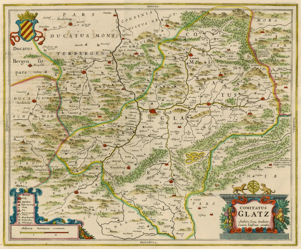
Comitatus Glatz. 1658
Poland - Klodzko, by J. Janssonius.
[Item number: 15619]
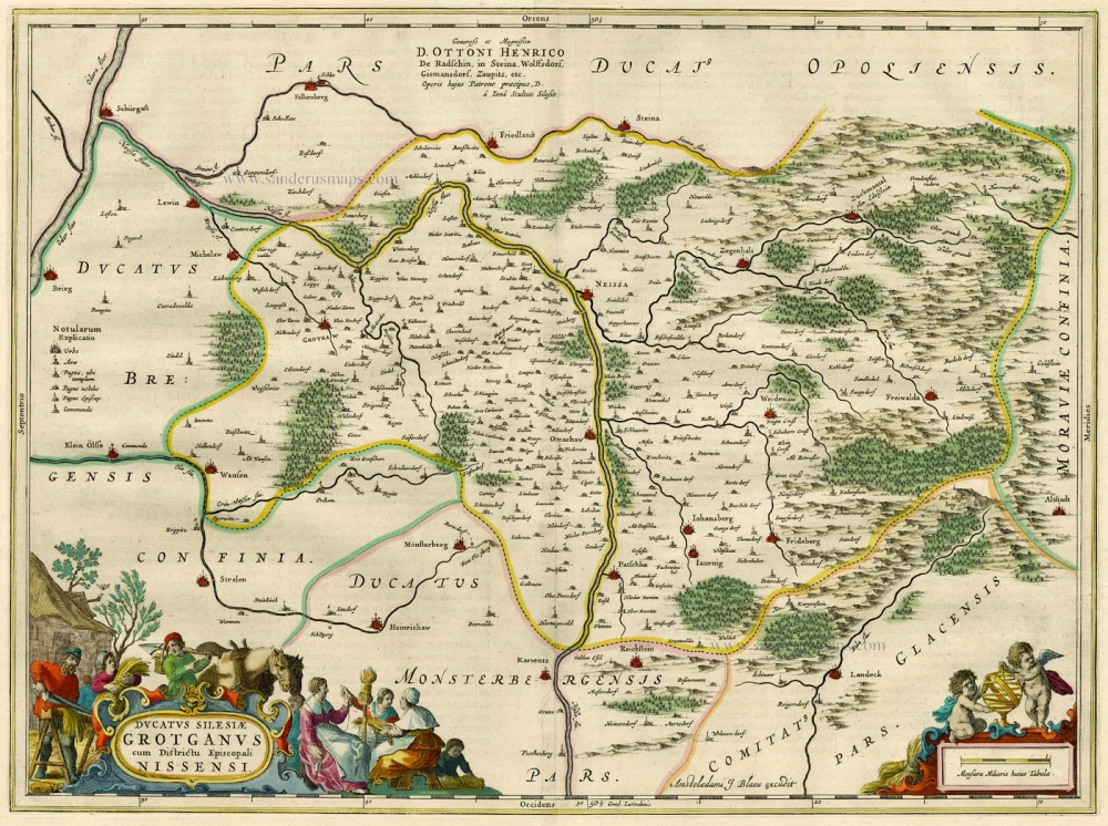
Ducatus Silesiae Grotganus cum Districtu Episcopali Nissensi. 1662
Poland - Grodków and Nysa, by Blaeu J.
[Item number: 15621]
Polonia. 1618
Poland, by Petrus Bertius.
[Item number: 18262]
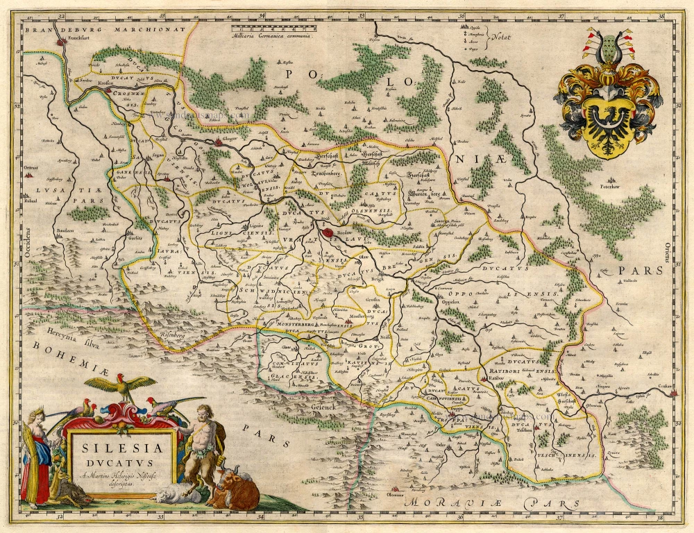
Silesia Ducatus. 1642-43
Silesia, by W. & J. Blaeu.
[Item number: 18723]
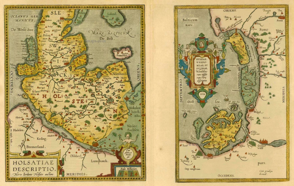
Holsatiae Descriptio [on sheet with] Rugiae, Usedomiae, et Iulinae, Wandalicarum Insularum Vera Descriptio. 1601
Poland - Rügen - Holstein, by Ortelius A.
[Item number: 21277]
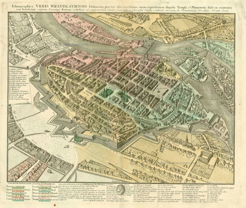
Ichnographica Urbis Wratislaviensis Delineatio ... c. 1757
Breslau, by Homann Heirs.
[Item number: 21289]
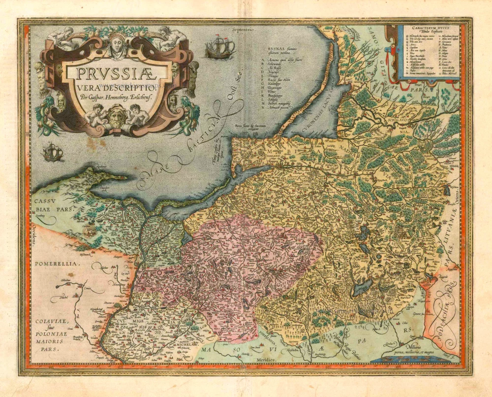
Prussiae Vera Descriptio. 1601
Prussia (Poland) by Abraham Ortelius.
[Item number: 25260]
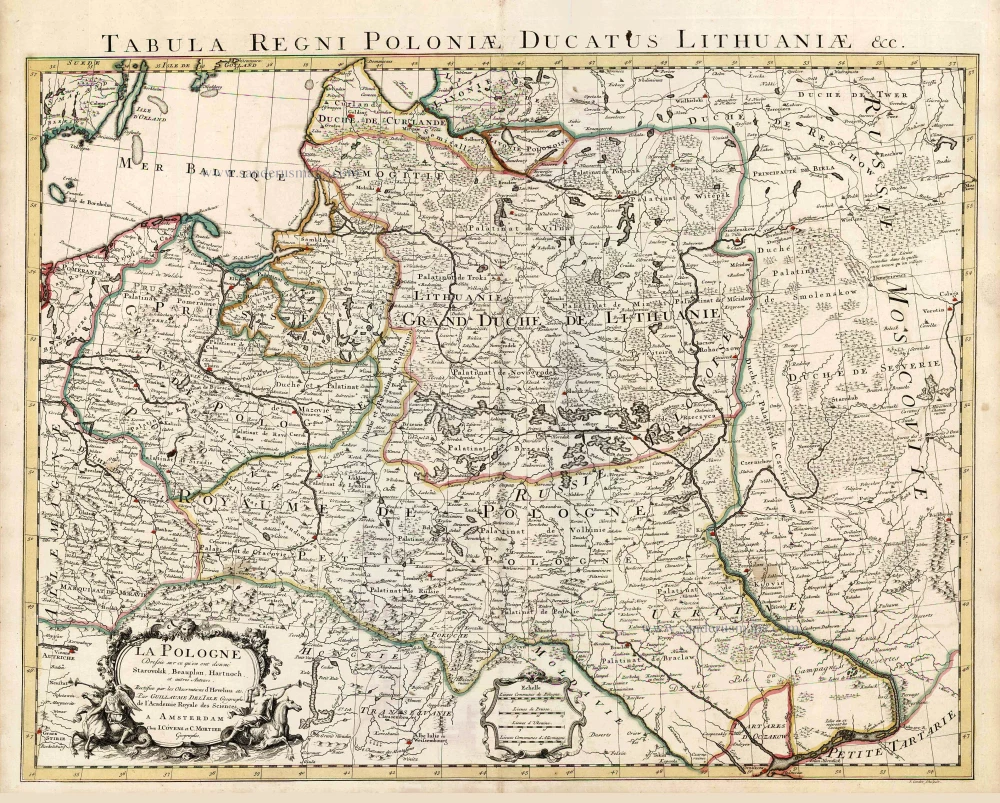
La Pologne Dressée sur ce qu'en ont donné Starovolsk, Beauplan, Hartnoch, et autres auteurs. [Latin title in upper margin:] Tabula Regni Poloniae, Ducatus Lithuaniae &c. 1730
Poland - Lithuania by Guillaume Delisle, published by Covens & Mortier.
[Item number: 25890]
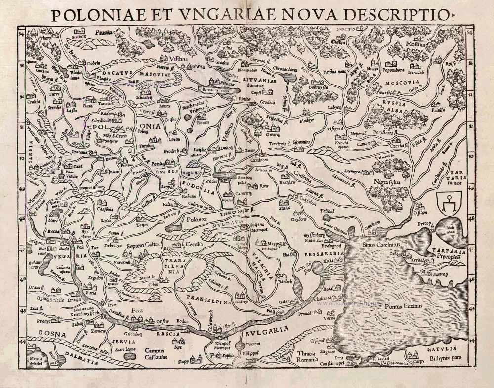
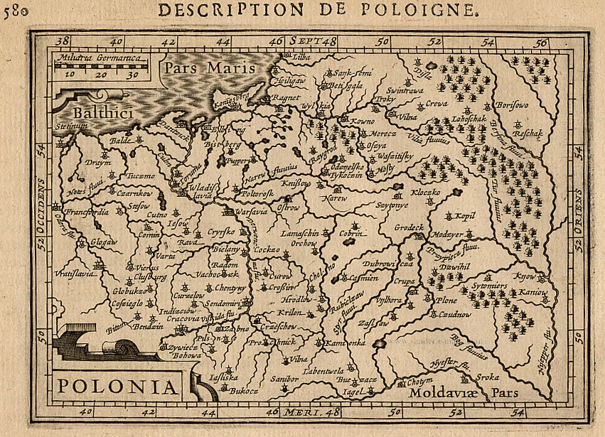
Poloniae et Ungariae Nova Descriptio. 1552
Poland and Hungary, by S. Münster.
[Item number: 25905]
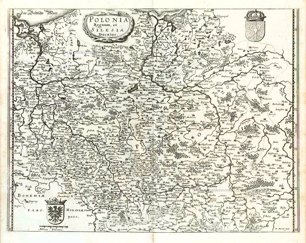
Polonia Regnum et Silesia Ducatus. 1638
Poland, by M. Merian.
[Item number: 25927]
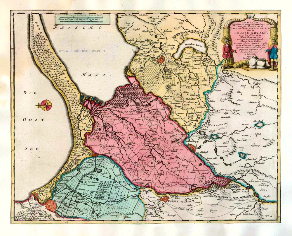
Les trois Iles, appellées en Allemand Werders, ou sont les Territoires de Dantzic, Marienbourg et Elbing dans la Prusse Royale, avec les Côtes de la Mer Baltique, suivant la description de Olaus Jean Gotho, ... 1713
Gdansk, Marlbork and Elblag, by Pieter van der Aa.
[Item number: 26041]
Polonia. 1641
Poland, by Henricus Hondius.
[Item number: 26267]
Polonia. 1609
Poland, by Abraham Ortelius.
[Item number: 27696]
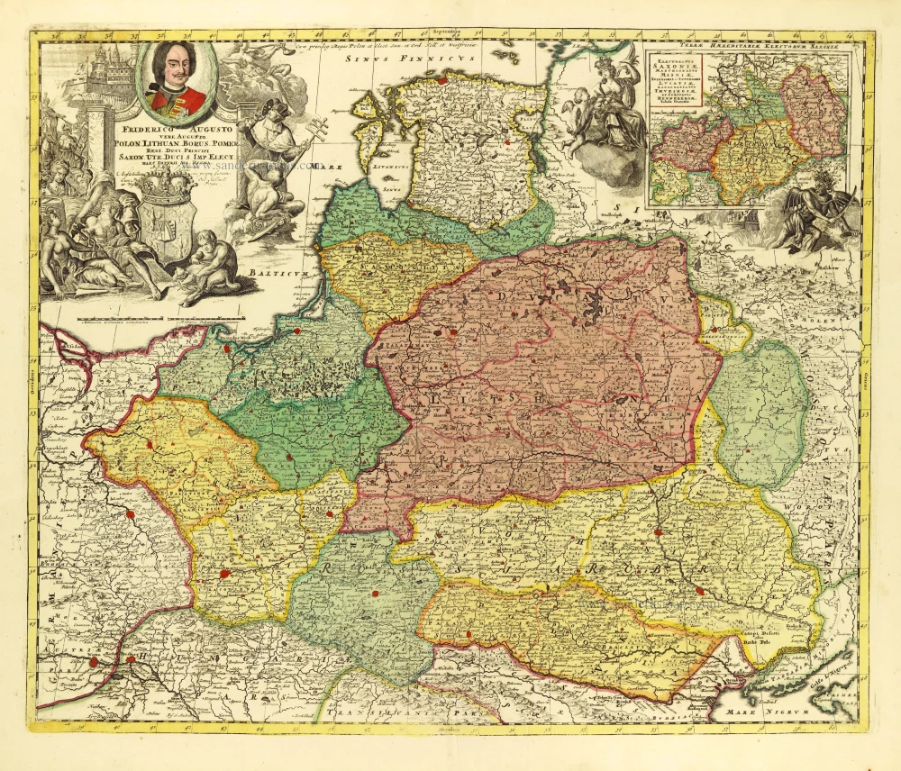
Friderico Augusto Vero Augusto Polon. Lithua. Borus. Pomer. Regi. Duci. Principi. Saxon. Utr. Duci. S. Imp. Elect. Haec. Imperii Sui Regna. c. 1715
Poland - Lithuania by Petrus Schenk.
[Item number: 28264]
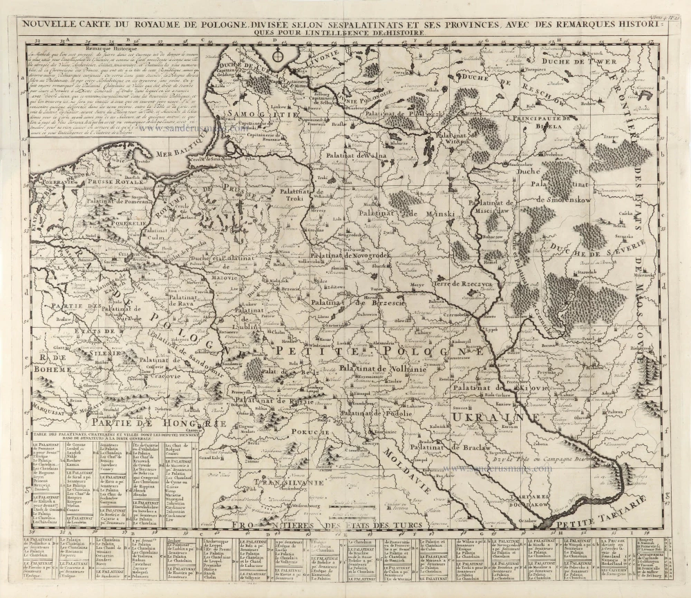
Nouvelle Carte du Royaume de Pologne, divisée selon ses Palatinats et ses Provinces, avec des Remarques Historiques pour l'Intelligence de l'Histoire. 1714
Poland by Zacharias Châtelain.
[Item number: 29427]
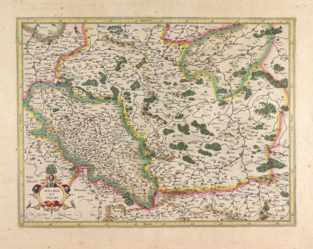
Polonia et Silesia. 1613
Poland, by Gerard Mercator.
[Item number: 29762]
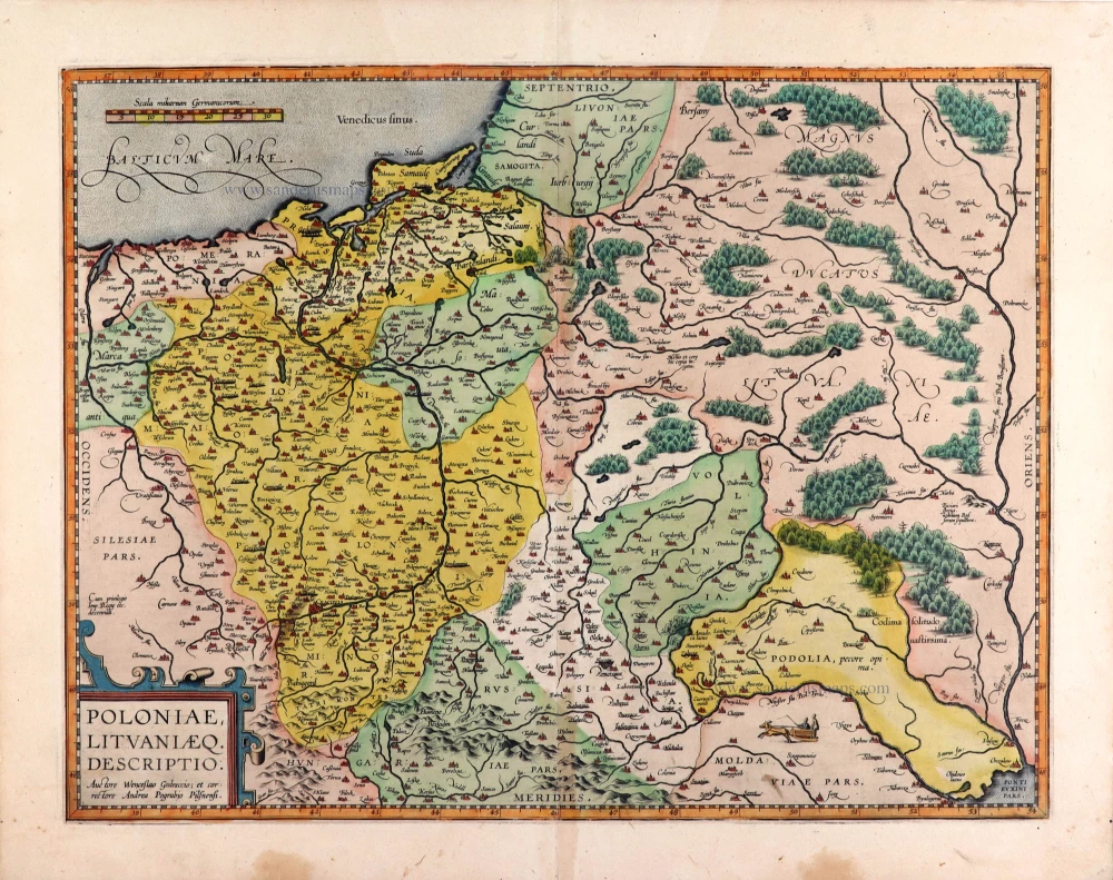
Poloniae, Lituaniaeq. Descriptio. 1595
Lithuania, Poland & Ukraine by Abraham Ortelius
[Item number: 29857]
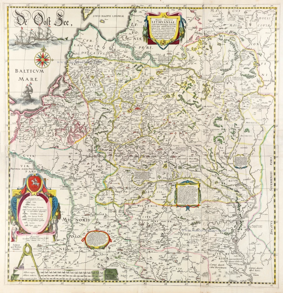
The most important wall map of Lithuania from the 17th century.
Magni Ducatus Lithuaniae Caeterarumque Regionum illi Adiacentium Exacta Descriptio. 1643
Lithuania, by Willem Blaeu.
[Item number: 30171]
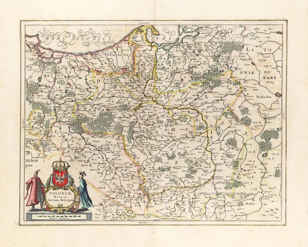
Poloniae Nova et Descriptio. 1653
Poland by Johannes Janssonius.
[Item number: 30345]
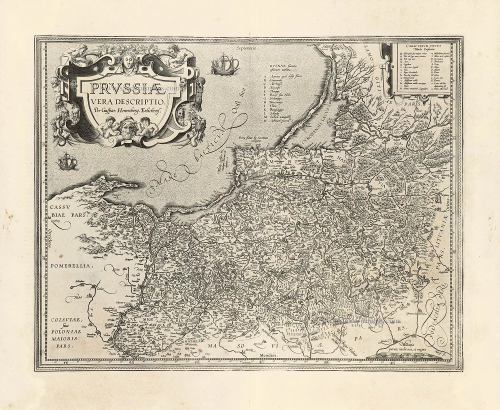
Prussiae Vera Descriptio. 1601
Prussia (Poland) by Abraham Ortelius.
[Item number: 30679]

Reise Charte durch das Könichreich Polen mit allen darzu gehörigen Laendern. c. 1745.
Poland by J.G. Schreiber.
[Item number: 31107]