
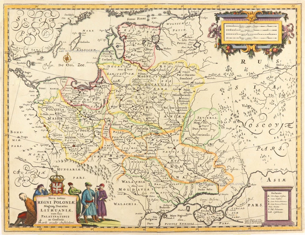
Poland, Lithuania, and Ukraine by Hugo (Huych) Allard. c. 1655
Rare first state map of Poland, Lithuania, and Ukraine, by Hugo (Huych) Allard.
The Allard Family
The founder of this family of map-makers, publishers and print-sellers was Huych (Hugo) Allard (1625-1691). He worked in Amsterdam in 1684, and he is supposed to have begun his business as early as 1645. He died in 1691, leaving his shop to his son, Carel Allard (1648-c. 1706). Carel brought out many maps and some atlases. His atlases are mainly composed of maps from the stock of other publishers like Janssonius and De Wit. However, some maps were his original creations. For these maps, the States of Holland granted him a privilege in 1683.
One of the sons of Carel, Abraham Allard (1676-c.1730), joined his father in the map trade and was accepted as a member of the ‘Constvercoopers gilde’ (Art dealer’s Guild) in 1708.
The original geographical maps by Allard, designed and cut between 1680 and 1700, are very decorative, well-composed and up-to-date.
Nova totius Regni Poloniae, Magniq Ducatus Lithuaniae, cum suis Palatinatibus ac Confiniis.
Item Number: 29028 Authenticity Guarantee
Category: Antique maps > Europe > Eastern Europe
Old, antique map of Poland, Lithuania, and Ukraine by Hugo (Huych) Allard.
Title: Nova totius Regni Poloniae, Magniq Ducatus Lithuaniae, cum suis Palatinatibus ac Confiniis.
HAlardt excudit Amstelodami.
Exacta delineato per G. le Vaßeur de Beauplan S.R.M.tis Architectum milit. et Capitaneum.
Cartographer: Le Vasseur de Beauplan (1595-1885).
Engraver: Hugo Allard.
Date: c. 1655.
Copper engraving, printed on paper.
Map size: 390 x 505mm (15.35 x 19.88 inches).
Sheet size: 400 x 520mm (15.75 x 20.47 inches).
Verso: Blank.
Condition: Hand coloured, some small repairs at the back.
Condition Rating: B.
Separate publication.
Rare first state map of Poland, Lithuania, and Ukraine, by Hugo (Huych) Allard.
The Allard Family
The founder of this family of map-makers, publishers and print-sellers was Huych (Hugo) Allard (1625-1691). He worked in Amsterdam in 1684, and he is supposed to have begun his business as early as 1645. He died in 1691, leaving his shop to his son, Carel Allard (1648-c. 1706). Carel brought out many maps and some atlases. His atlases are mainly composed of maps from the stock of other publishers like Janssonius and De Wit. However, some maps were his original creations. For these maps, the States of Holland granted him a privilege in 1683.
One of the sons of Carel, Abraham Allard (1676-c.1730), joined his father in the map trade and was accepted as a member of the ‘Constvercoopers gilde’ (Art dealer’s Guild) in 1708.
The original geographical maps by Allard, designed and cut between 1680 and 1700, are very decorative, well-composed and up-to-date.
Related items

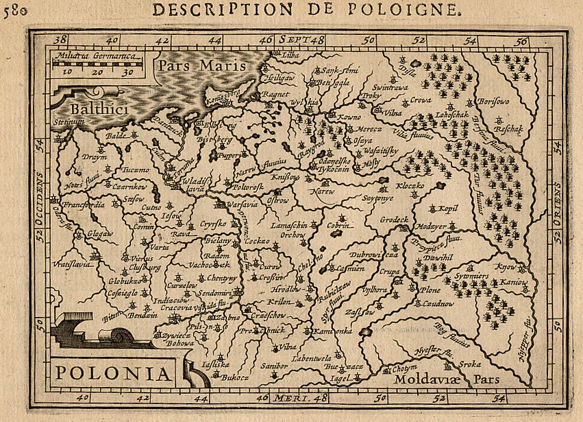
Poloniae Finitimarumque Locorum Descriptio Auctore Wenceslao Godreccio Polono. 1572
Poland, by Abraham Ortelius.
[Item number: 16790]
Polonia. 1618
Poland, by Petrus Bertius.
[Item number: 18262]
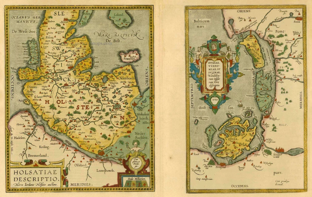
Holsatiae Descriptio [on sheet with] Rugiae, Usedomiae, et Iulinae, Wandalicarum Insularum Vera Descriptio. 1601
Poland - Rügen - Holstein, by Ortelius A.
[Item number: 21277]
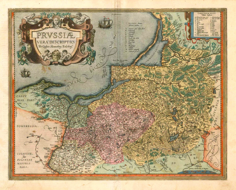
Prussiae Vera Descriptio. 1601
Prussia (Poland) by Abraham Ortelius.
[Item number: 25260]
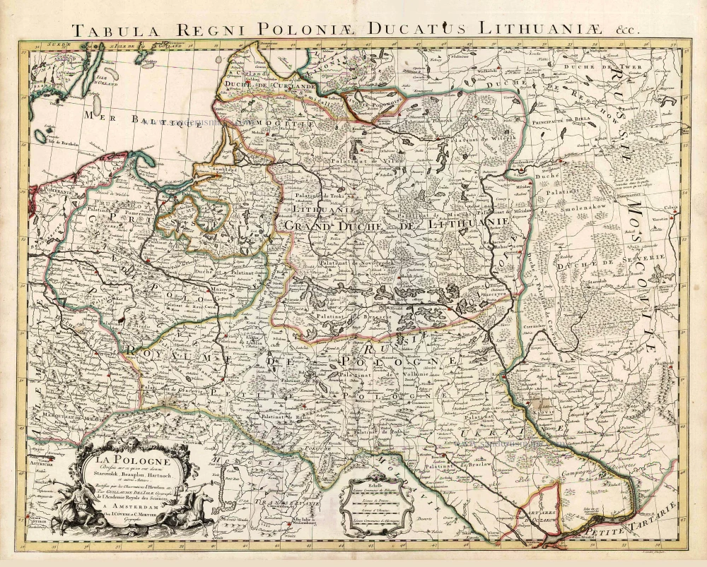
La Pologne Dressée sur ce qu'en ont donné Starovolsk, Beauplan, Hartnoch, et autres auteurs. [Latin title in upper margin:] Tabula Regni Poloniae, Ducatus Lithuaniae &c. 1730
Poland - Lithuania by Guillaume Delisle, published by Covens & Mortier.
[Item number: 25890]
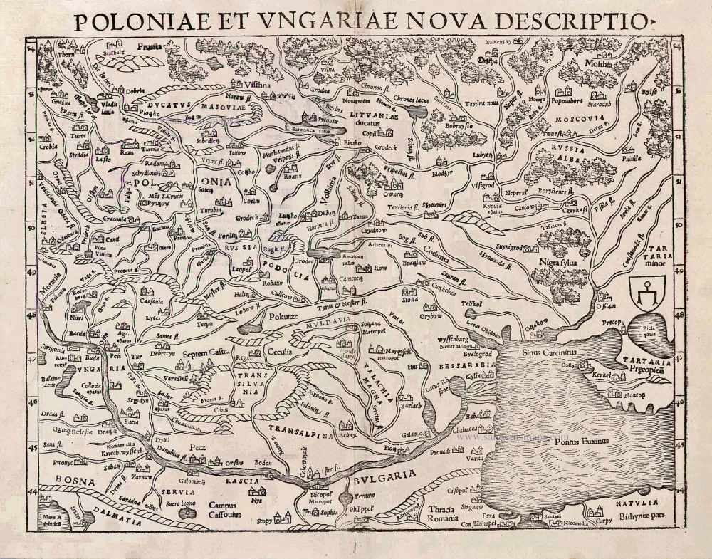
Poloniae et Ungariae Nova Descriptio. 1552
Poland and Hungary, by S. Münster.
[Item number: 25905]
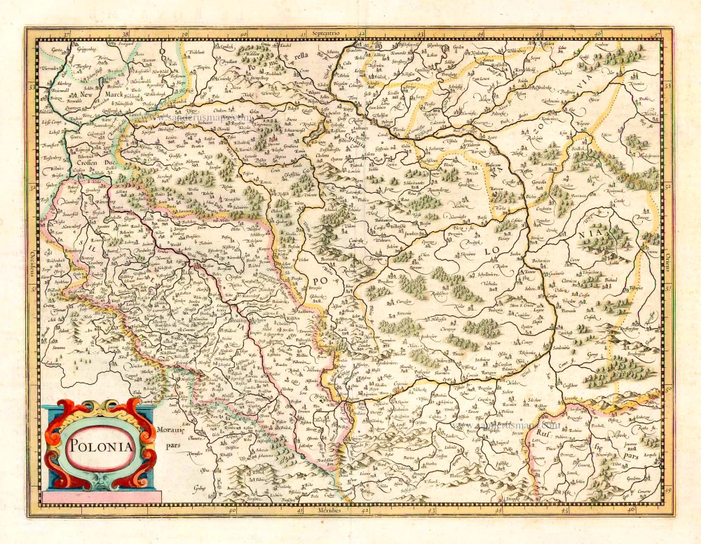
Polonia. 1641
Poland, by Henricus Hondius.
[Item number: 26267]
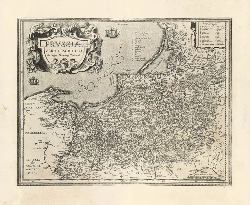
Prussiae Vera Descriptio. 1601
Prussia (Poland) by Abraham Ortelius.
[Item number: 30679]