
Très rare.
France, by Isaak Verbiest. 1628


EXTREMELY RARE MAP OF FRANCE, BY ISAAK VERBIEST.
The title appears in a cartouche at the upper right. This cartouche is decorated at the top by a crowned shield with the French coat of arms flanked by seated figures of Justice and Minerva, and at the bottom by twelve coats of arms: Les Pères de France. The map is framed on four sides by decorative borders. In the upper left and right corners are portraits of King Louis XIII and Queen Anne. Along the upper edge of the map, the image runs a row of seven towns in oval frames: Poictiers - Bourges - Marseille - Paris - Lion - Orleans - Angiers. In the centre of the decorative bottom border of the map is a long oval cartouche with a legend concerning the eight seats of the houses of parliament, the twelve representatives of the Empire's class structure in Paris, and the seventeen residences of the archbishops. This cartouche (with some 17th-century handwriting) is flanked on each side by three town views: Tours - Beaumont - Rochelle and Bordeaux - Roan - Cales. These views (except Rochelle) were copied from a Hondius map. Costumed figures representing the different social classes frame the map's borders.
Schilder quotes three copies of this first edition: one in Paris, Bibl. Nat., but without borders; one in an atlas on a Sotheby's sale (1982), but with the town views cut off and mounted separately at the end, and one in a private collection. There is also a second state dated 1636 (2 recorded copies) and a third state dated 1653 (1 recorded copy).
Pieter Verbiest II (Petrus Verbist) and Isaak Verbiest (Isack Verbist)
Pieter Verbiest (Antwerpen, 1605-1693) was an Antwerp cartographer and engraver. Little is known about his life.
One of his most important works is the Novus Tabularum Geographicorum Belgicae (Antwerp, 1636), a pocket atlas of which two more editions were published later (1644 and 1652). Isaak Verbiest, probably a brother of Pieter, drew and engraved certain maps. Their collaboration also led to the production of two rare world maps.
Pieter Verbiest also published folio maps as separate publications. Koeman describes three editions of a Verbiest Atlas of the Netherlands, published between 1636 and 1652. Only one copy of each of these atlases is known.
Verbiest maps, some with beautiful decorative borders, city views, costumed figures, and coats of arms, were sometimes bound in composite atlases. Occasionally, copies of these scarce maps come onto the market.
Pieter Verbiest II was the son of Pieter Verbiest I (c. 1585-c. 1642), publisher and illuminator of maps in Antwerp.
Nova Totius Geographica Regni Galliae Descriptio Isack Verbiest Antwerpia Anno, 1628.
Item Number: 27740 Authenticity Guarantee
Category: Antique maps > Europe > France
France, by Isaak Verbiest.
Title: Nova Totius Geographica Regni Galliae Descriptio Isack Verbiest Antwerpia Anno, 1628.
Date of the first edition: 1628.
Date of this map: 1628.
Date on map: 1628.
Copper engraving, printed on paper.
Size (not including margins): 460 x 555mm (18 x 21¾ inches).
Verso: Blank.
Condition: Original coloured, two additional vertical folds, small reinforcements to folds at the back, new side margins. Good copy.
Condition Rating: A+.
Separate publication.
EXTREMELY RARE MAP OF FRANCE, BY ISAAK VERBIEST.
The title appears in a cartouche at the upper right. This cartouche is decorated at the top by a crowned shield with the French coat of arms flanked by seated figures of Justice and Minerva, and at the bottom by twelve coats of arms: Les Pères de France. The map is framed on four sides by decorative borders. In the upper left and right corners are portraits of King Louis XIII and Queen Anne. Along the upper edge of the map, the image runs a row of seven towns in oval frames: Poictiers - Bourges - Marseille - Paris - Lion - Orleans - Angiers. In the centre of the decorative bottom border of the map is a long oval cartouche with a legend concerning the eight seats of the houses of parliament, the twelve representatives of the Empire's class structure in Paris, and the seventeen residences of the archbishops. This cartouche (with some 17th-century handwriting) is flanked on each side by three town views: Tours - Beaumont - Rochelle and Bordeaux - Roan - Cales. These views (except Rochelle) were copied from a Hondius map. Costumed figures representing the different social classes frame the map's borders.
Schilder quotes three copies of this first edition: one in Paris, Bibl. Nat., but without borders; one in an atlas on a Sotheby's sale (1982), but with the town views cut off and mounted separately at the end, and one in a private collection. There is also a second state dated 1636 (2 recorded copies) and a third state dated 1653 (1 recorded copy).
Pieter Verbiest II (Petrus Verbist) and Isaak Verbiest (Isack Verbist)
Pieter Verbiest (Antwerpen, 1605-1693) was an Antwerp cartographer and engraver. Little is known about his life.
One of his most important works is the Novus Tabularum Geographicorum Belgicae (Antwerp, 1636), a pocket atlas of which two more editions were published later (1644 and 1652). Isaak Verbiest, probably a brother of Pieter, drew and engraved certain maps. Their collaboration also led to the production of two rare world maps.
Pieter Verbiest also published folio maps as separate publications. Koeman describes three editions of a Verbiest Atlas of the Netherlands, published between 1636 and 1652. Only one copy of each of these atlases is known.
Verbiest maps, some with beautiful decorative borders, city views, costumed figures, and coats of arms, were sometimes bound in composite atlases. Occasionally, copies of these scarce maps come onto the market.
Pieter Verbiest II was the son of Pieter Verbiest I (c. 1585-c. 1642), publisher and illuminator of maps in Antwerp.
Related items
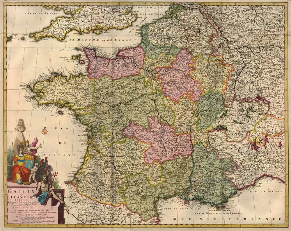
Galliae seu Franciae Tabula, ... 1683-1696
France, by Visscher N. II.
[Item number: 15637]
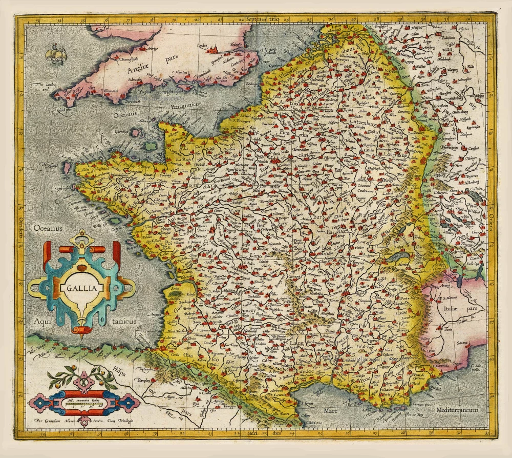
Gallia / Per Gerardum Mercatorem. 1609
France, by Gerard Mercator.
[Item number: 19119]

Galliae Veteris Typus. 1652-53
Ancient France by Joannes Janssonius.
[Item number: 20936]

Galliae Veteris. 1601
France, by Ortelius A.
[Item number: 21253]

[No title] 1607
France, by Jodocus Hondius.
[Item number: 25294]

Rare!
Galliae Amplissimi Regni Tabula. 1593
France, by Gerard de Jode.
[Item number: 26035]
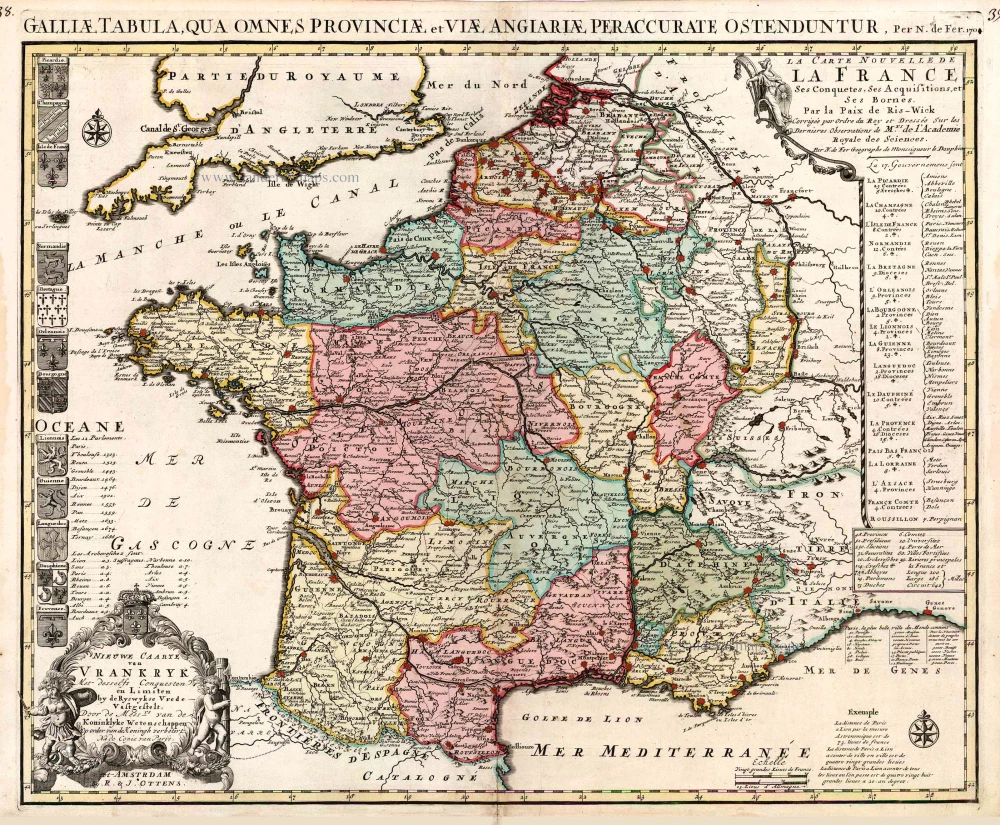
Nieuwe Caarte van Vrankryk Met desselfs Conquesten en Limiten by de Ryswykse Vrede Vastgestelt, ... 1730-45
France, by R. & I. Ottens.
[Item number: 26251]
Rare.
Gallia. 1630
France, by Joannes Janssonius.
[Item number: 28022]

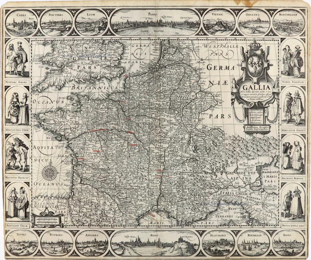
Gallia. 1619
France, by Jodocus Hondius.
[Item number: 28840]

Le Royaume de France et ses Acquisitions vers les Pays Bas, l'Allemagne, l'Italie et l'Espagne. 1665
France by Nicolas Sanson.
[Item number: 30082]

Gallia Vetus, ad Julii Caesaris commentaria. 1595
Ancient France by Ortelius A.
[Item number: 30941]

Galliae Veteris. 1624
Ancient France, by Ortelius A.
[Item number: 31191]

Gallia - Nova totius Galliae geographica descriptio, ... Ineaque archiepiscopatus, episcopatus omnes, academiae item et parlamenta singula suis quaequae notis distincta a Iuodoco Hondio. c. 1610-1650
France by Jodocus Hondius, published by Melchior Tavernier.
[Item number: 31308]

Galliae Veteris Typus. c. 1610-1650
Ancient France by Jodocus Hondius
[Item number: 31312]