
France, by Gerard Mercator. 1609


Gerard Mercator (1512 – 1594)
Gerard Mercator was born Gerard de Cremere in Rupelmonde (near Antwerp) on 5 March 1512.
Young Gerard learned what Latin he could in Rupelmonde, and when he was about fifteen, his uncle sent him to s'Hertogenbosch to study at a school run by the Brothers of the Common Life. One of Mercator’s teachers was the celebrated humanist Macropedius. After three and a half years with the brothers, Gerard went to Louvain, where he enrolled in the university in 1530 as one of the poor students at Castle College.
By this time, he had Latinized his name to Mercator. He studied philosophy and took his master’s degree in 1532. The problems of the creation of the Universe and the Earth interested him in particular, and this is reflected in his works written in later years.
After spending a few years in Antwerp, he returned to Louvain in c. 1535, where he took courses in mathematics under Gemma Frisius. Soon, he was recognised as an expert on the construction of mathematical instruments, as a land surveyor and, after 1537, as a cartographer. He drew his income from these activities after his marriage on August 3, 1536. He also qualified himself as a copper engraver, the first to introduce italic handwriting to this trade. The first maps, drawn and engraved by Gerard Mercator, are Palestine, 1537; the World in double heart-shaped projection, 1538; and Flanders, 1540.
In 1544, Mercator came into great danger: he was arrested on the accusation of heresy and put into jail. Thanks to the intervention of the University of Louvain, he was released after four months. In 1552, he moved with his family to Duisburg (Germany). In 1560, Mercator became a cosmographer in service of the Duke of Jülich-Cleve-Berge, and in 1563, he became a lecturer at the Grammar School of the new University in Duisburg. During this period, he made wall maps of Europe, 1554; of Loraine, 1564; the British Isles, 1564; and the famous world map with increasing latitudes, 1569. About this time, Mercator was also working on the project for a complete description of the creation, the Heavens, Earth, Sea and world history. This resulted in his Atlas, sive cosmographicae meditationes de fabrica mundi et fabricati figura. He also worked on an edition of Ptolemy’s Geographia in 1578. The first part of his book, which contains modern maps (France, Germany, and the Netherlands), appeared in 1585.
Shortly after the publication of the second part of his map book (not yet called Atlas) with the maps of Italy (1589), he had a stroke that ended his highly significant productivity. The great man passed away on 2 December 1594, leaving the responsibility of finishing the map book to his son Rumold. The final part of it appeared in 1595. Its title is Pars Altera, and it constitutes an essential part of what was then called Mercator’s Atlas.
The map of Europe and the world map in the Atlas are by Rumold Mercator. After Rumold died in 1599, the Atlas was reissued in 1602.
The plates of the maps, both of the Ptolemy edition and the Atlas, were sold in 1604 to Jodocus Hondius of Amsterdam. The following year, Hondius managed to bring out Ptolemy’s Geographia. In 1606, the first Amsterdam edition of the Mercator Atlas appeared in the next year. From then to 1638, the Atlas saw many enlarged editions in various languages.
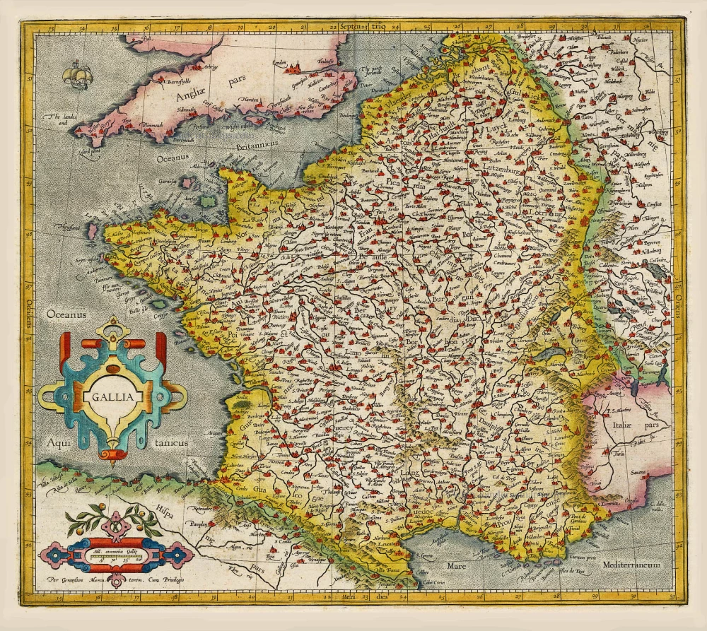
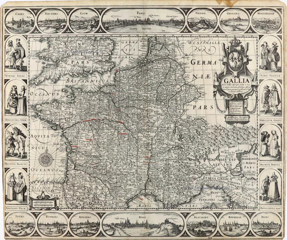
Gallia / Per Gerardum Mercatorem.
Item Number: 19119 Authenticity Guarantee
Category: Antique maps > Europe > France
Old, antique map of France, by Gerard Mercator.
Title: Gallia / Per Gerardum Mercatorem.
Date of the first edition: 1585.
Date of this map: 1609.
Copper engraving, printed on paper.
Size (not including margins): 355 x 405mm (13.98 x 15.94 inches).
Verso: French text.
Condition: Original coloured, excellent.
Condition Rating: A.
From: Gerardi Mercatoris - L'Atlas ou méditations Cosmographiques de la Fabrique du Monde et Figure d'Iceluy. Commencé en Latin par le très docte Gerard Mercator, parachevé per Jodocus Hondius. Amsterdam, 1609. (Van der Krogt 1, 111)
Gerard Mercator (1512 – 1594)
Gerard Mercator was born Gerard de Cremere in Rupelmonde (near Antwerp) on 5 March 1512.
Young Gerard learned what Latin he could in Rupelmonde, and when he was about fifteen, his uncle sent him to s'Hertogenbosch to study at a school run by the Brothers of the Common Life. One of Mercator’s teachers was the celebrated humanist Macropedius. After three and a half years with the brothers, Gerard went to Louvain, where he enrolled in the university in 1530 as one of the poor students at Castle College.
By this time, he had Latinized his name to Mercator. He studied philosophy and took his master’s degree in 1532. The problems of the creation of the Universe and the Earth interested him in particular, and this is reflected in his works written in later years.
After spending a few years in Antwerp, he returned to Louvain in c. 1535, where he took courses in mathematics under Gemma Frisius. Soon, he was recognised as an expert on the construction of mathematical instruments, as a land surveyor and, after 1537, as a cartographer. He drew his income from these activities after his marriage on August 3, 1536. He also qualified himself as a copper engraver, the first to introduce italic handwriting to this trade. The first maps, drawn and engraved by Gerard Mercator, are Palestine, 1537; the World in double heart-shaped projection, 1538; and Flanders, 1540.
In 1544, Mercator came into great danger: he was arrested on the accusation of heresy and put into jail. Thanks to the intervention of the University of Louvain, he was released after four months. In 1552, he moved with his family to Duisburg (Germany). In 1560, Mercator became a cosmographer in service of the Duke of Jülich-Cleve-Berge, and in 1563, he became a lecturer at the Grammar School of the new University in Duisburg. During this period, he made wall maps of Europe, 1554; of Loraine, 1564; the British Isles, 1564; and the famous world map with increasing latitudes, 1569. About this time, Mercator was also working on the project for a complete description of the creation, the Heavens, Earth, Sea and world history. This resulted in his Atlas, sive cosmographicae meditationes de fabrica mundi et fabricati figura. He also worked on an edition of Ptolemy’s Geographia in 1578. The first part of his book, which contains modern maps (France, Germany, and the Netherlands), appeared in 1585.
Shortly after the publication of the second part of his map book (not yet called Atlas) with the maps of Italy (1589), he had a stroke that ended his highly significant productivity. The great man passed away on 2 December 1594, leaving the responsibility of finishing the map book to his son Rumold. The final part of it appeared in 1595. Its title is Pars Altera, and it constitutes an essential part of what was then called Mercator’s Atlas.
The map of Europe and the world map in the Atlas are by Rumold Mercator. After Rumold died in 1599, the Atlas was reissued in 1602.
The plates of the maps, both of the Ptolemy edition and the Atlas, were sold in 1604 to Jodocus Hondius of Amsterdam. The following year, Hondius managed to bring out Ptolemy’s Geographia. In 1606, the first Amsterdam edition of the Mercator Atlas appeared in the next year. From then to 1638, the Atlas saw many enlarged editions in various languages.
Related items

Das gantz Franckreich, so vorzeiten Narbonensis, Lugdunensis, Belgica und Celtica ist genennt worden. 1588
France by Sebastian Münster.
[Item number: 14634]
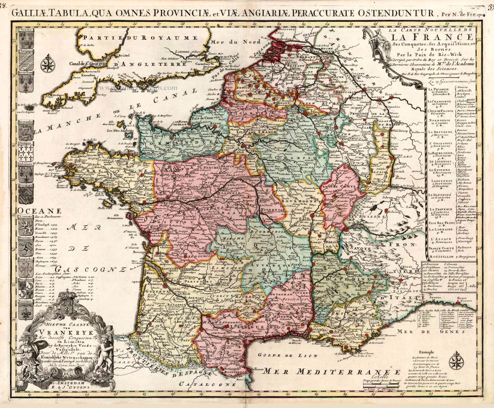
Galliae seu Franciae Tabula, ... 1683-1696
France, by Visscher N. II.
[Item number: 15637]

Galliae Veteris Typus. 1652-53
Ancient France by Joannes Janssonius.
[Item number: 20936]

[No title] 1607
France, by Jodocus Hondius.
[Item number: 25294]

Gubernatio Insulae Franciae, dicisa in Electiones Lutetiae, Augustae Suessionum, Novioduni, Lauduni, Compendii, Bellovaci, Dresiae, Nemursii etc. ... c. 1745
Île de France, by Valk G. & L
[Item number: 25665]

Rare!
Galliae Amplissimi Regni Tabula. 1593
France, by Gerard de Jode.
[Item number: 26035]
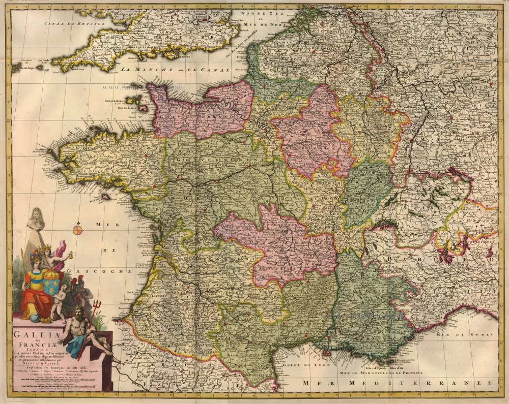
Nieuwe Caarte van Vrankryk Met desselfs Conquesten en Limiten by de Ryswykse Vrede Vastgestelt, ... 1730-45
France, by R. & I. Ottens.
[Item number: 26251]
Gallia Vetus. 1640
Ancient France, by Willem Blaeu.
[Item number: 27153]

Description Générale de Toute la France. 1575
France, by François de Belleforest.
[Item number: 27166]

One of the first modern maps of France
[No title] 1525
France, by Lorenz Fries.
[Item number: 27936]

[No title] - [On verso:] Tabula .III. Europae. 1525
France, by Lorenz Fries.
[Item number: 27957]
Rare.
Gallia. 1630
France, by Joannes Janssonius.
[Item number: 28022]

Gallia. 1619
France, by Jodocus Hondius.
[Item number: 28840]

Typus Galliae Veteris. 1640
Ancient France, by Willem Blaeu.
[Item number: 28895]

La Francia Antica, e Moderna. 1696
France, by Vincenzo Coronelli.
[Item number: 29296]

Galliae Antiquae Descriptio Geograpfica. 1659
Ancient France by Nicolas Sanson, published by Melchior Tavernier
[Item number: 30031]

Le Royaume de France et ses Acquisitions vers les Pays Bas, l'Allemagne, l'Italie et l'Espagne. 1665
France by Nicolas Sanson.
[Item number: 30082]

Extremely rare wall-map of France by C. Tassin, in four sheets
Carte Generalle [sic] de France. 1634-37
France, Christophe Tassin, with a panoramic view of Paris.
[Item number: 30989]

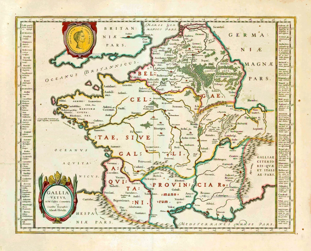
Galliae Veteris. 1624
Ancient France, by Ortelius A.
[Item number: 31191]

Gallia - Nova totius Galliae geographica descriptio, ... Ineaque archiepiscopatus, episcopatus omnes, academiae item et parlamenta singula suis quaequae notis distincta a Iuodoco Hondio. c. 1610-1650
France by Jodocus Hondius, published by Melchior Tavernier.
[Item number: 31308]

Galliae Veteris Typus. c. 1610-1650
Ancient France by Jodocus Hondius
[Item number: 31312]
Gallia - Le Royaume de France. 1642-43
France, by Willem Blaeu.
[Item number: 32434]
Scarce
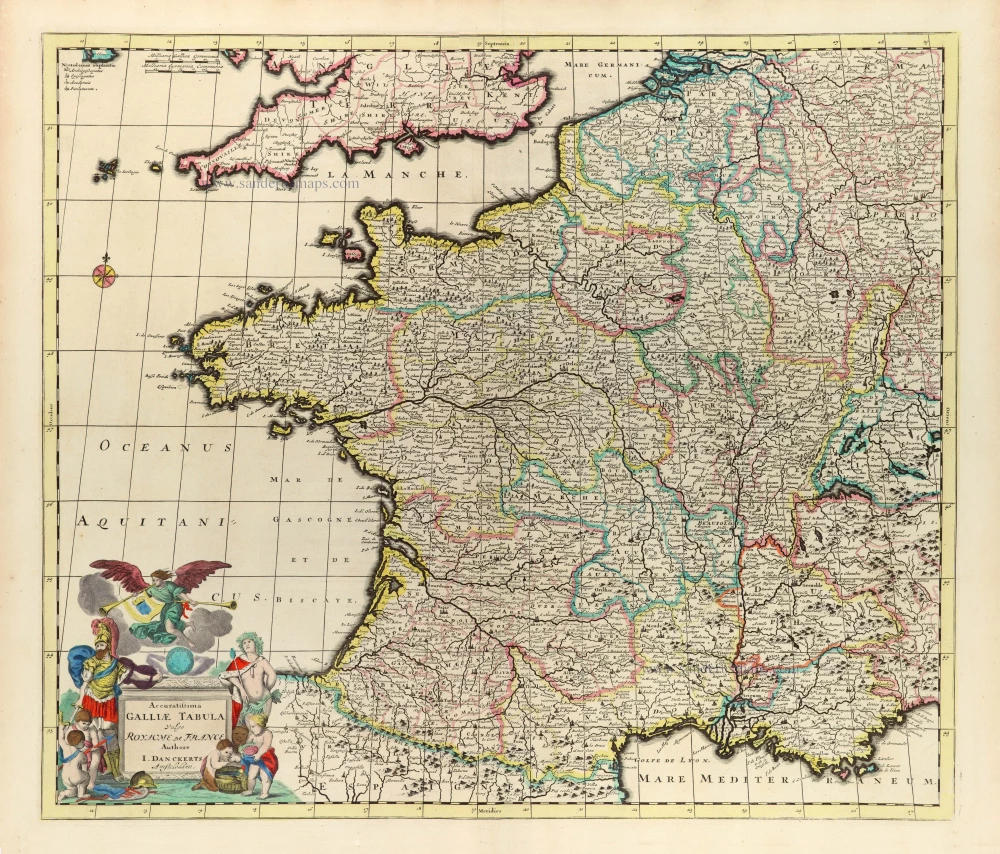
Accuratissima Galliae Tabula Vulgo Royaume de France. c. 1680
France by Justus Danckerts
[Item number: 32463]