
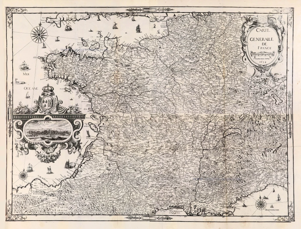
Extremely rare wall-map of France by C. Tassin, in four sheets
France, Christophe Tassin, with a panoramic view of Paris. 1634-37
One recorded copy in France: Paris, Bibl. Sorbonne.
Tassin Christophe Nicolas. (? - 1660)
Christophe Tassin was a French cartographer known for his atlases of France, Spain, Germany, and Switzerland.
He was 'Ingenieur-géographe du roi'. He used this title only between 1633 and 1638. In 1633 Tassin published an atlas of France and Spain, Cartes générales des provinces de France et d’ Espagne; one of Germany, Cartes généralis des royaumes et provinces de la haute et basse Allemagna; and one of the Low Countries, Plans et profils des principales villes du duché de Lorraine, avec les cartes generale et particulieres de chacun gouvernement d’iucelles.
In 1644, Tassin ended his work and sold his copper plates of maps to Antoine de Fer, who published them in many subsequent editions.
Carte Generalle [sic] de France.
Item Number: 30989 Authenticity Guarantee
Category: Antique maps > Europe > France
Wall map of France by C. Tassin.
With an unrecorded view of Paris. (7 x 14,3 cm) - Not in Boudier.
Title: Carte Generalle [sic] de France.
Par previllege [sic] du Roy. 1634.
Date of the first edition: 1634.
Date of this map: 1634-37.
Date on map: 1634.
Copper engraving, printed on paper.
Image size: 655 x 880mm (25.79 x 34.65 inches).
Sheet size: 725 x 915mm (28.54 x 36.02 inches).
Verso: Blank.
Condition: Lower centrefold split reinforced.
Condition Rating: A+
From: Les cartes generales de toutes les provinces de France, royaumes et provinces de l'Europe, Reveües, corrigées & augmentées par le S[ieu]r Tassin geographe ordinaire de sa majesté Par privilege du roy. 1637. (Pastoureau, p. 441, TASSIN II B)
One recorded copy in France: Paris, Bibl. Sorbonne.
Tassin Christophe Nicolas. (? - 1660)
Christophe Tassin was a French cartographer known for his atlases of France, Spain, Germany, and Switzerland.
He was 'Ingenieur-géographe du roi'. He used this title only between 1633 and 1638. In 1633 Tassin published an atlas of France and Spain, Cartes générales des provinces de France et d’ Espagne; one of Germany, Cartes généralis des royaumes et provinces de la haute et basse Allemagna; and one of the Low Countries, Plans et profils des principales villes du duché de Lorraine, avec les cartes generale et particulieres de chacun gouvernement d’iucelles.
In 1644, Tassin ended his work and sold his copper plates of maps to Antoine de Fer, who published them in many subsequent editions.
Related items
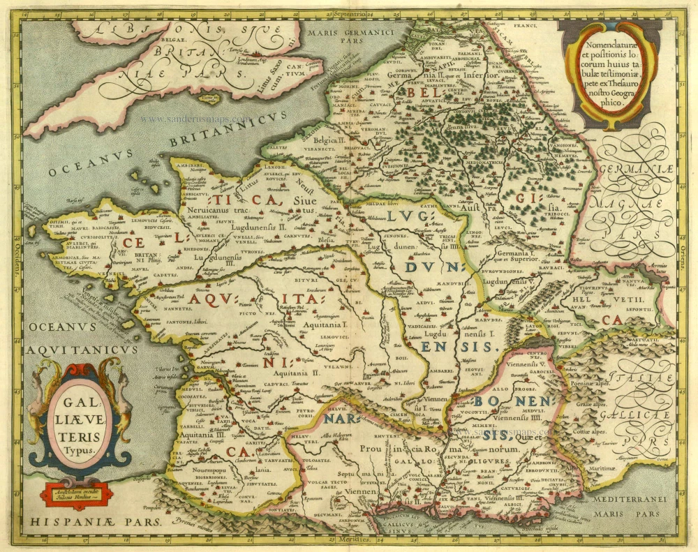
Galliae Veteris Typus. 1630
Ancient France by Janssonius J.
[Item number: 6911]

Das gantz Franckreich, so vorzeiten Narbonensis, Lugdunensis, Belgica und Celtica ist genennt worden. 1588
France by Sebastian Münster.
[Item number: 14634]
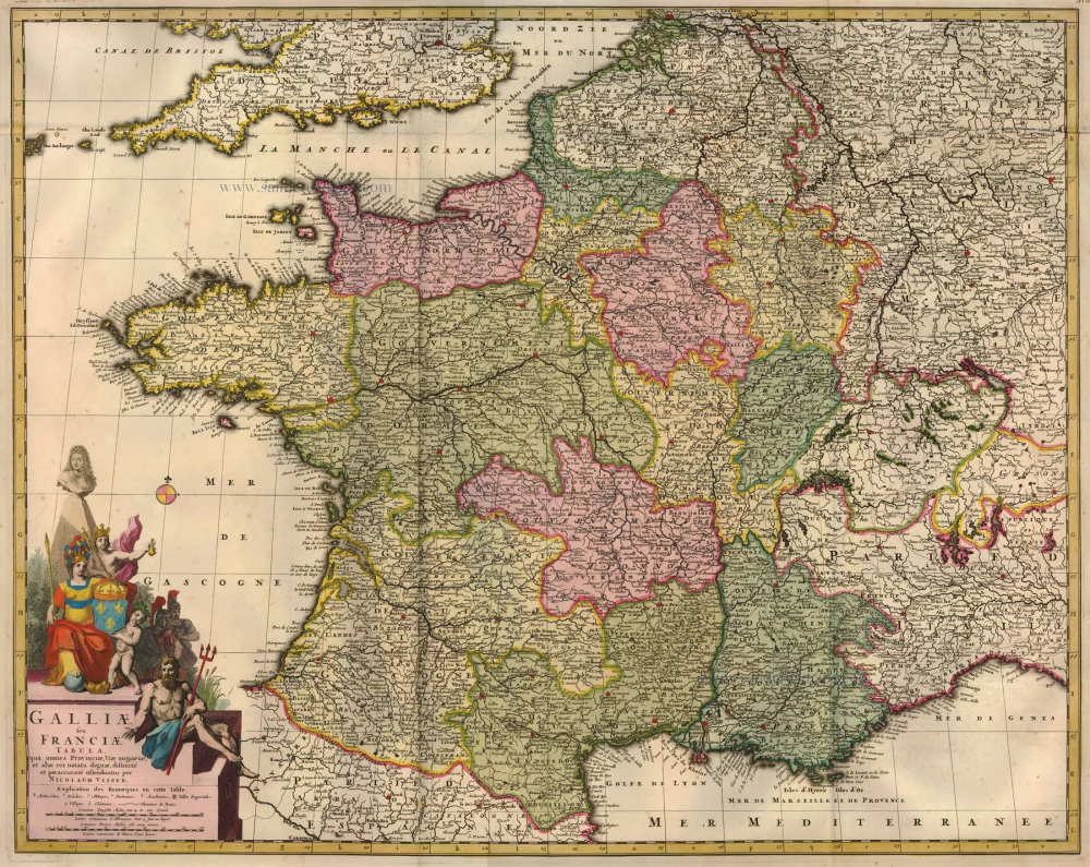
Galliae seu Franciae Tabula, ... 1683-1696
France, by Visscher N. II.
[Item number: 15637]
Gallia / Per Gerardum Mercatorem. 1609
France, by Gerard Mercator.
[Item number: 19119]

Galliae Veteris Typus. 1652-53
Ancient France by Joannes Janssonius.
[Item number: 20936]

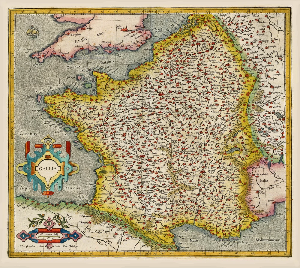
Galliae Veteris. 1601
France, by Ortelius A.
[Item number: 21253]

Galliae Veteris. 1624
Ancient France, by Ortelius A.
[Item number: 31191]

Gallia - Nova totius Galliae geographica descriptio, ... Ineaque archiepiscopatus, episcopatus omnes, academiae item et parlamenta singula suis quaequae notis distincta a Iuodoco Hondio. c. 1610-1650
France by Jodocus Hondius, published by Melchior Tavernier.
[Item number: 31308]

Galliae Veteris Typus. c. 1610-1650
Ancient France by Jodocus Hondius
[Item number: 31312]

Veüe et Perspective du College des 4 Nations. 1728
View of Paris - Collège des Quatre-Nations, by Pieter Van der Aa.
[Item number: 31438]

La Porte St. Bernard. 1728
View of Paris - Collège des Quatre-Nations, by Pieter Van der Aa.
[Item number: 31439]

La Porte de la Conference 1728
View of Paris - Porte de la Conference, by Pieter Van der Aa.
[Item number: 31441]

La Porte St. Martin 1728
View of Paris - Porte St. Martin, by Pieter Van der Aa.
[Item number: 31442]

La Nouvelle Porte St. Honoré [...] Le Dôme des Filles de Lassomption. 1728
View of Paris - Porte St. Honoré & Dôme des Filles de Lassomption.
[Item number: 31443]

Vue de la Sortie de Paris prise du Pont Neuf. c. 1750
Optical View of Paris, by Martin Engelbrecht.
[Item number: 31910]

Optical View
l'Eglise de Notre Dame à Paris - Die Kirche Unser Lieben Frauen zu Paris. c. 1750
Notre Dame of Paris, by Martin Engelbrecht.
[Item number: 31919]

Optical View
La Place Dauphine du Cote du Pont neuf à Paris - Place des Dauphins von der Seite der neuen Brücke zu Paris. c. 1750
Place Dauphine of Paris, by Martin Engelbrecht.
[Item number: 31920]

Optical view
Veuë et perspective de l'hostelle de Ville à Paris. - Perspectivische Vorstellung des Rathhauses zu Paris. c. 1750
City Hall of Paris, by Martin Engelbrecht.
[Item number: 31921]

Optical View
La Porte S. Antoine à Paris. - Das Thor des Heil. Antonii zu Paris. c. 1750
Porte St. Antoine of Paris, by Martin Engelbrecht.
[Item number: 31922]
Scarce
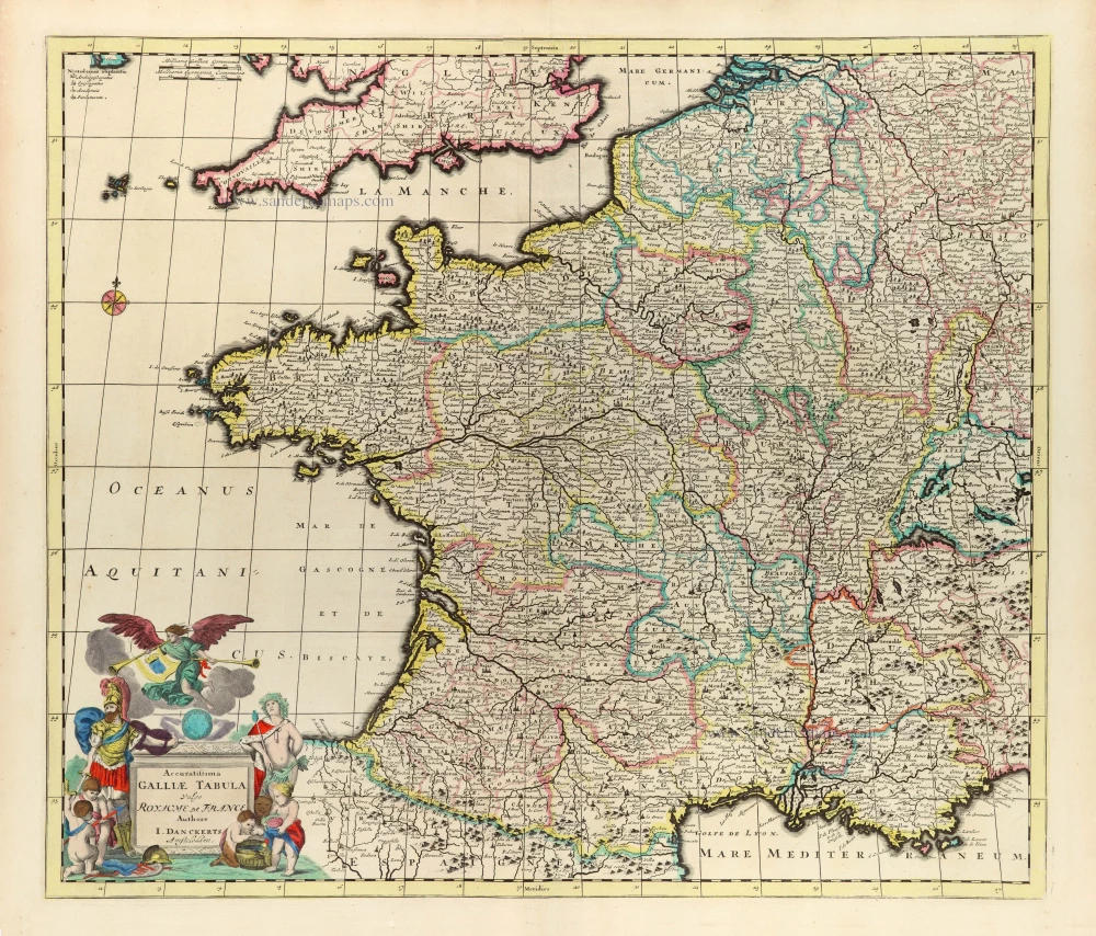
Accuratissima Galliae Tabula Vulgo Royaume de France. c. 1680
France by Justus Danckerts
[Item number: 32463]

Superb colouring
Le Plan de Paris, ses Faubourgs et ses Environs, divisé suivant ses Meridiens et Paralells par Minutes et Secondes. 1631-1641
Paris, by Matthaeus Seutter
[Item number: 32538]

Spectacular 17th century view
Parys. 1638
Paris by Matthäus Merian
[Item number: 33022]