
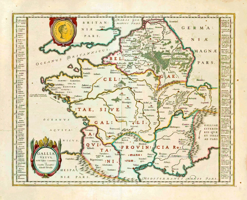
Ancient France, by Willem Blaeu. 1640
The Blaeus: Willem Janszoon, Cornelis & Joan
Willem Jansz. Blaeu and his son Joan Blaeu are the seventeenth century's most widely known cartographic publishers.
Willem Jansz. (also written Guilielmus Janssonius) = Willem Janszoon Blaeu was born in Uitgeest (Netherlands), near Alkmaar, in 1571. He studied mathematics under Tycho Brahe and learned the theory and practice of astronomical observations and the art of instrument- and globe-making.
In 1596, he came to Amsterdam, where he settled down as a globe-, instrument- and mapmaker. He published his first cartographic work (a globe) in 1599 and probably published his first printed map (a map of the Netherlands) in 1604. He specialised in maritime cartography, published the first edition of the pilot guide Het Licht der Zeevaert in 1608, and was appointed Hydrographer of the V.O.C. (United East India Company) in 1633. After publishing books, wall maps, globes, charts and pilot guides for thirty years, he brought out his first atlas, Atlas Appendix (1630). This was the beginning of the great tradition of atlas-making by the Blaeus.
In 1618, another mapmaker, bookseller and publisher, Johannes Janssonius, established himself in Amsterdam next door to Blaeu's shop. No wonder these two neighbours began accusing each other of copying and stealing their information and became fierce competitors who did not have a good word to say about each other. In about 1621 Willem Jansz. decided to end the confusion between his name and his competitor's and assumed his grandfather's nickname, 'blauwe Willem' ('blue Willem'), as the family name; after that, he called himself Willem Jansz. Blaeu.
Willem Janszoon Blaeu died in 1638, leaving his prospering business to his sons, Cornelis and Joan. We only know that Cornelis's name occurs in the prefaces of books and atlases until c. 1645.
Joan Blaeu, born in Amsterdam in 1596, became a partner in his father's book trade and printing business. 1638, he was appointed his father's successor in the Hydrographic Office of the V.O.C. His efforts culminated in the magnificent Atlas Major and the town books of the Netherlands and Italy – works unsurpassed in history and modern times, giving eternal fame to the name of the Blaeu's.
A fire ruined the business on February 23, 1672, and one year later, Dr. Joan Blaeu died. The fire and the director's passing caused the complete sale of the Blaeu House's stock. Five public auctions dispersed the remaining books, atlases, copperplates, globes, etc., among many other map dealers and publishers in Amsterdam. The majority was acquired by several booksellers acting in partnership.
In the succeeding years, the remaining printing department remained in the hands of the Blaeu family until 1695, when the printing house's inventory was sold at a public auction. That meant the end of the Blaeu family as a printing house of world renown.
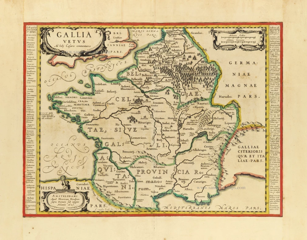
Gallia Vetus.
Item Number: 27153 Authenticity Guarantee
Category: Antique maps > Europe > France
Old, antique map of France, by Willem Blaeu.
Ancienne carte antique de la France, par Willem Blaeu.
Cartographer: Abraham Ortelius
Date of the first edition: 1634
Date of this map: 1640
Copper engraving, printed on paper.
Size (not including margins): 38.5 x 50cm (15 x 19.5 inches)
Verso text: French
Condition: Original coloured, excellent.
Condition Rating: A+
References: Van der Krogt 2, 4000H:2A.
From: Théâtre du Monde ou Nouvel Atlas. Seconde partie. J. Blaeu, 1640. (Van der Krogt 2, 211.2C)
The Blaeus: Willem Janszoon, Cornelis & Joan
Willem Jansz. Blaeu and his son Joan Blaeu are the seventeenth century's most widely known cartographic publishers.
Willem Jansz. (also written Guilielmus Janssonius) = Willem Janszoon Blaeu was born in Uitgeest (Netherlands), near Alkmaar, in 1571. He studied mathematics under Tycho Brahe and learned the theory and practice of astronomical observations and the art of instrument- and globe-making.
In 1596, he came to Amsterdam, where he settled down as a globe-, instrument- and mapmaker. He published his first cartographic work (a globe) in 1599 and probably published his first printed map (a map of the Netherlands) in 1604. He specialised in maritime cartography, published the first edition of the pilot guide Het Licht der Zeevaert in 1608, and was appointed Hydrographer of the V.O.C. (United East India Company) in 1633. After publishing books, wall maps, globes, charts and pilot guides for thirty years, he brought out his first atlas, Atlas Appendix (1630). This was the beginning of the great tradition of atlas-making by the Blaeus.
In 1618, another mapmaker, bookseller and publisher, Johannes Janssonius, established himself in Amsterdam next door to Blaeu's shop. No wonder these two neighbours began accusing each other of copying and stealing their information and became fierce competitors who did not have a good word to say about each other. In about 1621 Willem Jansz. decided to end the confusion between his name and his competitor's and assumed his grandfather's nickname, 'blauwe Willem' ('blue Willem'), as the family name; after that, he called himself Willem Jansz. Blaeu.
Willem Janszoon Blaeu died in 1638, leaving his prospering business to his sons, Cornelis and Joan. We only know that Cornelis's name occurs in the prefaces of books and atlases until c. 1645.
Joan Blaeu, born in Amsterdam in 1596, became a partner in his father's book trade and printing business. 1638, he was appointed his father's successor in the Hydrographic Office of the V.O.C. His efforts culminated in the magnificent Atlas Major and the town books of the Netherlands and Italy – works unsurpassed in history and modern times, giving eternal fame to the name of the Blaeu's.
A fire ruined the business on February 23, 1672, and one year later, Dr. Joan Blaeu died. The fire and the director's passing caused the complete sale of the Blaeu House's stock. Five public auctions dispersed the remaining books, atlases, copperplates, globes, etc., among many other map dealers and publishers in Amsterdam. The majority was acquired by several booksellers acting in partnership.
In the succeeding years, the remaining printing department remained in the hands of the Blaeu family until 1695, when the printing house's inventory was sold at a public auction. That meant the end of the Blaeu family as a printing house of world renown.
Related items
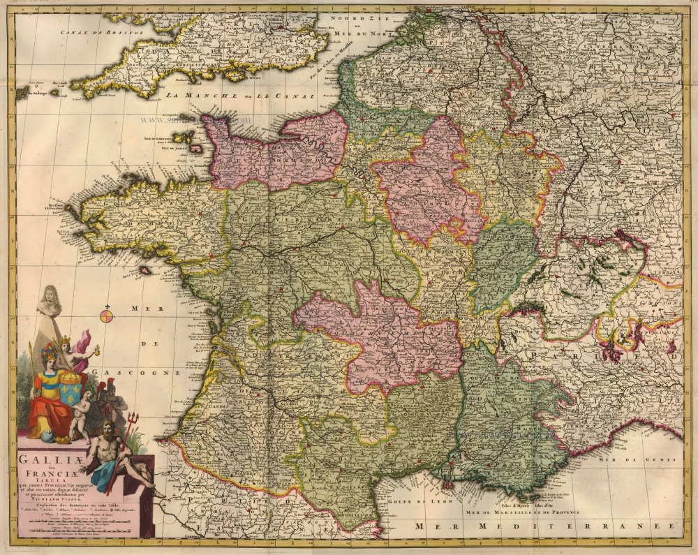
Galliae seu Franciae Tabula, ... 1683-1696
France, by Visscher N. II.
[Item number: 15637]
Gallia / Per Gerardum Mercatorem. 1609
France, by Gerard Mercator.
[Item number: 19119]

Galliae Veteris Typus. 1652-53
Ancient France by Joannes Janssonius.
[Item number: 20936]

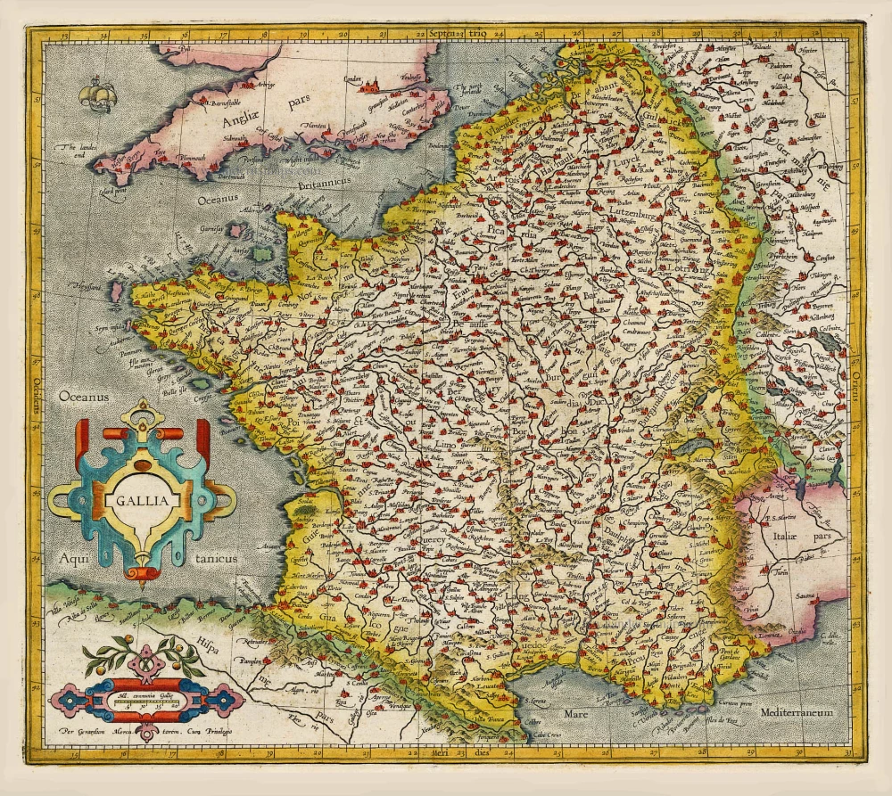
Galliae Veteris. 1601
France, by Ortelius A.
[Item number: 21253]

[No title] 1607
France, by Jodocus Hondius.
[Item number: 25294]

Rare!
Galliae Amplissimi Regni Tabula. 1593
France, by Gerard de Jode.
[Item number: 26035]
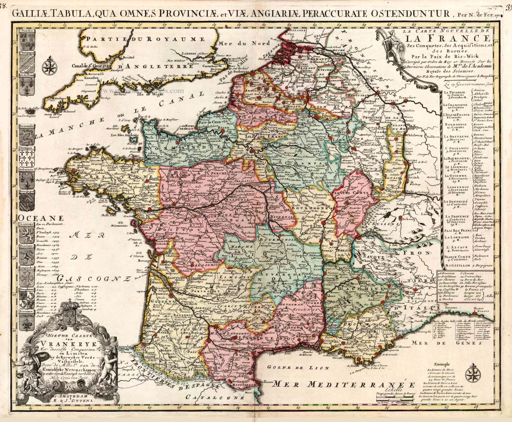
Nieuwe Caarte van Vrankryk Met desselfs Conquesten en Limiten by de Ryswykse Vrede Vastgestelt, ... 1730-45
France, by R. & I. Ottens.
[Item number: 26251]

Description Générale de Toute la France. 1575
France, by François de Belleforest.
[Item number: 27166]
Rare.
Gallia. 1630
France, by Joannes Janssonius.
[Item number: 28022]

Gallia. 1619
France, by Jodocus Hondius.
[Item number: 28840]

Galliae Antiquae Descriptio Geograpfica. 1659
Ancient France by Nicolas Sanson, published by Melchior Tavernier
[Item number: 30031]

Le Royaume de France et ses Acquisitions vers les Pays Bas, l'Allemagne, l'Italie et l'Espagne. 1665
France by Nicolas Sanson.
[Item number: 30082]

Galliae Veteris. 1624
Ancient France, by Ortelius A.
[Item number: 31191]

Gallia - Nova totius Galliae geographica descriptio, ... Ineaque archiepiscopatus, episcopatus omnes, academiae item et parlamenta singula suis quaequae notis distincta a Iuodoco Hondio. c. 1610-1650
France by Jodocus Hondius, published by Melchior Tavernier.
[Item number: 31308]

Galliae Veteris Typus. c. 1610-1650
Ancient France by Jodocus Hondius
[Item number: 31312]
Gallia Vetus. c. 1630-1650
Ancient France by Henricus Hondius.
[Item number: 31599]
Gallia - Le Royaume de France. 1642-43
France, by Willem Blaeu.
[Item number: 32434]
Scarce
Accuratissima Galliae Tabula Vulgo Royaume de France. c. 1680
France by Justus Danckerts
[Item number: 32463]