
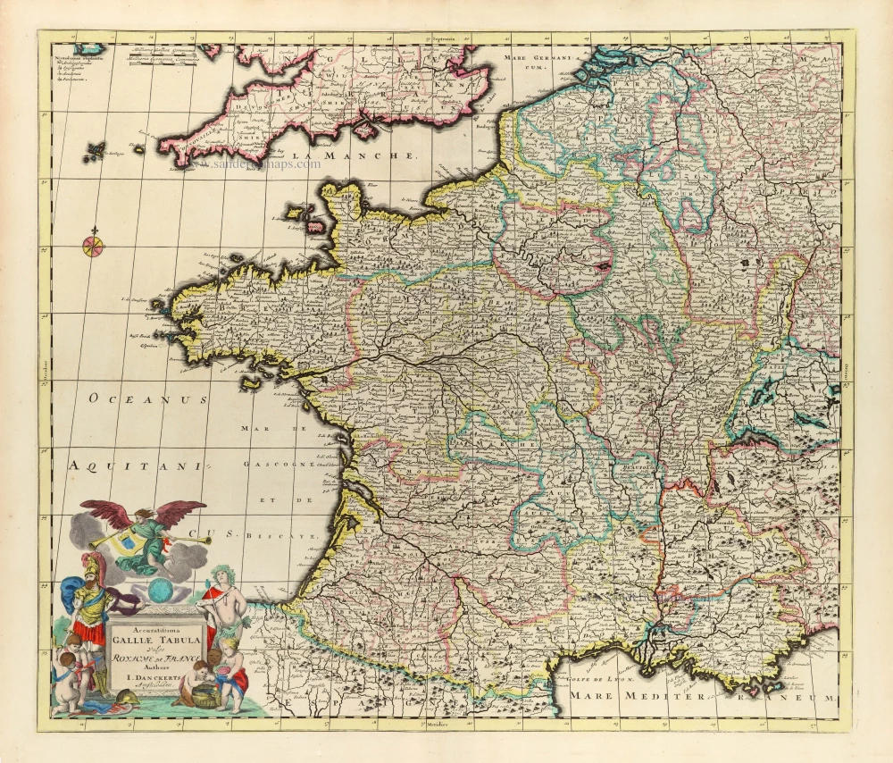
France, by Vincenzo Coronelli. 1696


Vincenzo Coronelli (1650-1718)
Vincenzo Coronelli was born in Venice on 16 August 1650 and primarily brought up in Ravenna. He returned to Venice in 1665 and joined the convent of the Minor Conventuals. Five years later, he was sent to Rome to study, and by 1673, he was already a doctor of theology.
Having achieved fame by constructing two globes for the Duke of Parma, he was invited to Paris for three years in 1681 and made two enormous examples for Louis XIV. On his return to Venice, he assiduously collected cartographic material and founded the Academy of the Argonauts. In 1685, he was appointed Cosmographer to the Republic of Venice and authorised to publish a large atlas. He became a geography lecturer at the University of Venice and brought out an Atlante Veneto the following year.
In 1696, he visited Germany, Holland and southern England. During intervals in compiling his vast encyclopaedia, he continued with cartographic projects up to 1709. He died in his native Venice on 9 December 1718.
Coronelli became famous for his globes. In addition, he was a renowned encyclopaedist, mapmaker and geographer. Most of his maps and other material are gathered in his Atlante Veneto (13 vols, 1690-1705). The first volume, subtitled Descrizione generale istorica geografica, was his masterpiece, planned as an extension of Blaeu’s atlas.
Other volumes of the atlas which contain maps are Isolario, two parts (1696-8), with detailed maps and plans, mostly of islands; Corso geografico, two parts based on the edition 1694-7; Libro de’ globi (1697); and Lo Specchio del Mare, a reprint of Levanto's Lo Specchio del Mare Mediterraneo of 1664.
The other vital aspects of his mapping are those arising from the Venetian conquest and his travels. His most extensive military compilation was the Teatro della Guerra, in more than 30 volumes.
La Francia Antica, e Moderna.
Item Number: 29296 Authenticity Guarantee
Category: Antique maps > Europe > France
Old, antique map of France, by Vincenzo Coronelli.
Title: La Francia Antica, e Moderna.
Dedicata All' Illustrißimo Signore Marchese Michiele Sagramoso, Accademico degli Argonauti, già Inviato di S.A. del Duca di Mantova, appresso S.M. Cristianissimo.
Date of the first edition: 1696.
Date of this map: 1696.
Copper engraving, printed on two sheets of paper, unjoined.
Map size each: 600 x 450mm (23.62 x 17.72 inches).
Map size when joined: 600 x 900mm (23.62 x 35.44 inches)
Sheet size: 695 x 480mm (27.36 x 18.9 inches).
Verso: Italian text.
Condition: Brown stain at western Bretagne.
Condition Rating: A+.
From: Isolario Descrittione Geografico-Historica, Sacro-Profano, Antico-Moderna, Politica, Naturale e Poetica ... di Tutti l'Isole ... Tomo II dell'Atlante Veneto ... del P.Maestro Vincenzo Coronelli ... A'Spese dell'Autore MDCLXXXXVI. (Shirley (Brit.Lib), T.CORO-13a)
On verso: Deux vues: L'Île-Bouchard et Saint-Malo.
Vincenzo Coronelli (1650-1718)
Vincenzo Coronelli was born in Venice on 16 August 1650 and primarily brought up in Ravenna. He returned to Venice in 1665 and joined the convent of the Minor Conventuals. Five years later, he was sent to Rome to study, and by 1673, he was already a doctor of theology.
Having achieved fame by constructing two globes for the Duke of Parma, he was invited to Paris for three years in 1681 and made two enormous examples for Louis XIV. On his return to Venice, he assiduously collected cartographic material and founded the Academy of the Argonauts. In 1685, he was appointed Cosmographer to the Republic of Venice and authorised to publish a large atlas. He became a geography lecturer at the University of Venice and brought out an Atlante Veneto the following year.
In 1696, he visited Germany, Holland and southern England. During intervals in compiling his vast encyclopaedia, he continued with cartographic projects up to 1709. He died in his native Venice on 9 December 1718.
Coronelli became famous for his globes. In addition, he was a renowned encyclopaedist, mapmaker and geographer. Most of his maps and other material are gathered in his Atlante Veneto (13 vols, 1690-1705). The first volume, subtitled Descrizione generale istorica geografica, was his masterpiece, planned as an extension of Blaeu’s atlas.
Other volumes of the atlas which contain maps are Isolario, two parts (1696-8), with detailed maps and plans, mostly of islands; Corso geografico, two parts based on the edition 1694-7; Libro de’ globi (1697); and Lo Specchio del Mare, a reprint of Levanto's Lo Specchio del Mare Mediterraneo of 1664.
The other vital aspects of his mapping are those arising from the Venetian conquest and his travels. His most extensive military compilation was the Teatro della Guerra, in more than 30 volumes.
Related items
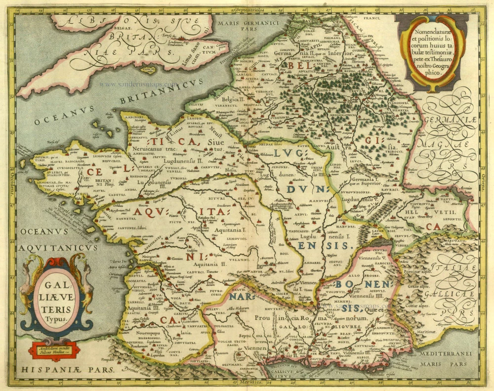
Galliae Veteris Typus. 1630
Ancient France by Janssonius J.
[Item number: 6911]

Das gantz Franckreich, so vorzeiten Narbonensis, Lugdunensis, Belgica und Celtica ist genennt worden. 1588
France by Sebastian Münster.
[Item number: 14634]
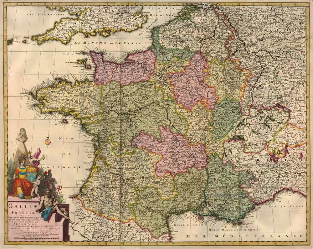
Galliae seu Franciae Tabula, ... 1683-1696
France, by Visscher N. II.
[Item number: 15637]
Gallia / Per Gerardum Mercatorem. 1609
France, by Gerard Mercator.
[Item number: 19119]

Galliae Veteris Typus. 1652-53
Ancient France by Joannes Janssonius.
[Item number: 20936]

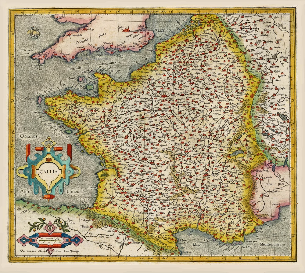
Galliae Veteris. 1601
France, by Ortelius A.
[Item number: 21253]

Galliae Antiquae Descriptio Geograpfica. 1659
Ancient France by Nicolas Sanson, published by Melchior Tavernier
[Item number: 30031]

Galliae Veteris. 1624
Ancient France, by Ortelius A.
[Item number: 31191]

Gallia - Nova totius Galliae geographica descriptio, ... Ineaque archiepiscopatus, episcopatus omnes, academiae item et parlamenta singula suis quaequae notis distincta a Iuodoco Hondio. c. 1610-1650
France by Jodocus Hondius, published by Melchior Tavernier.
[Item number: 31308]

Galliae Veteris Typus. c. 1610-1650
Ancient France by Jodocus Hondius
[Item number: 31312]
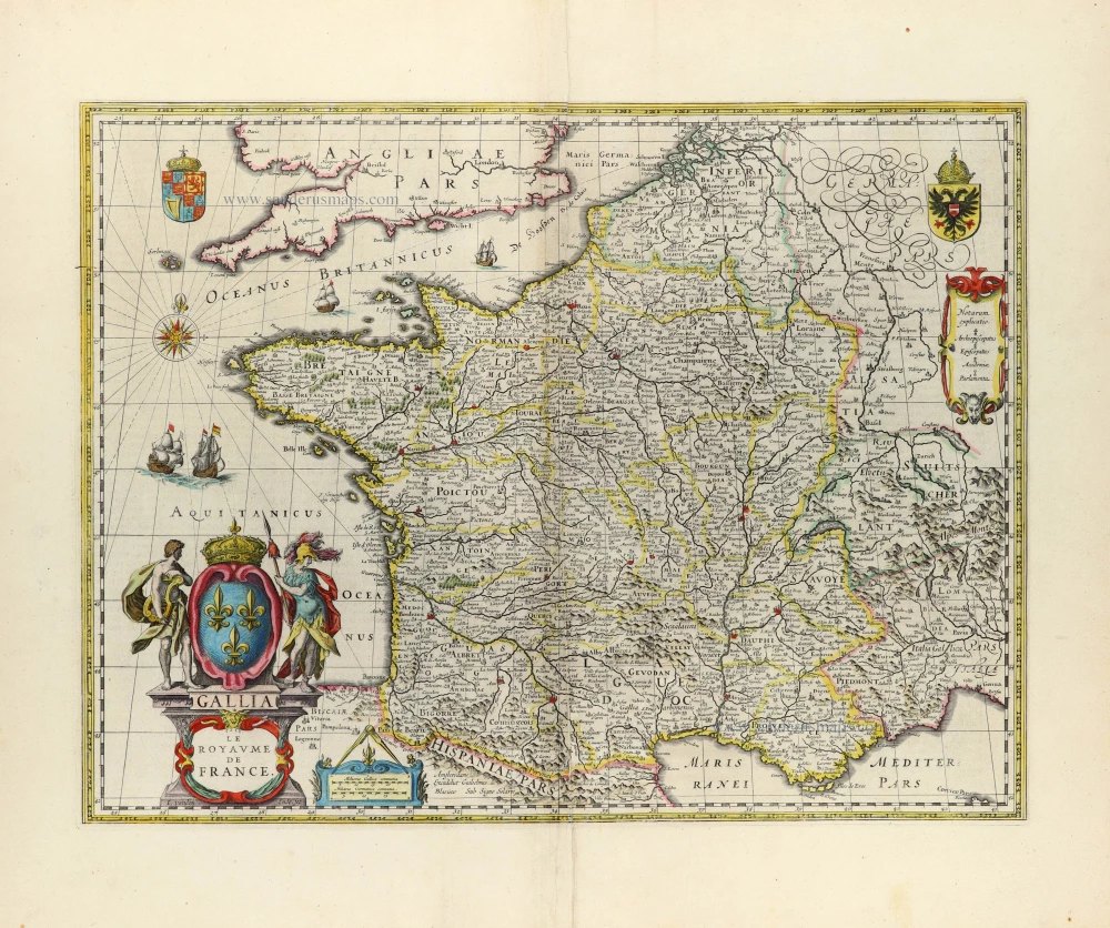
Gallia - Le Royaume de France. 1642-43
France, by Willem Blaeu.
[Item number: 32434]
Scarce
Accuratissima Galliae Tabula Vulgo Royaume de France. c. 1680
France by Justus Danckerts
[Item number: 32463]