
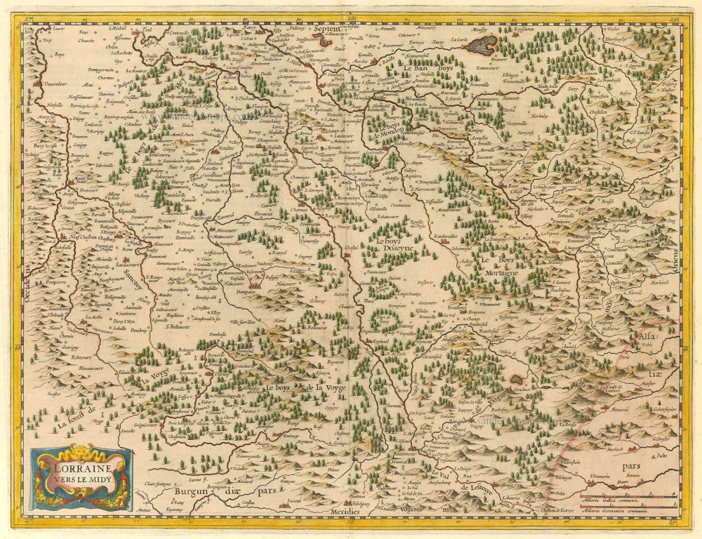
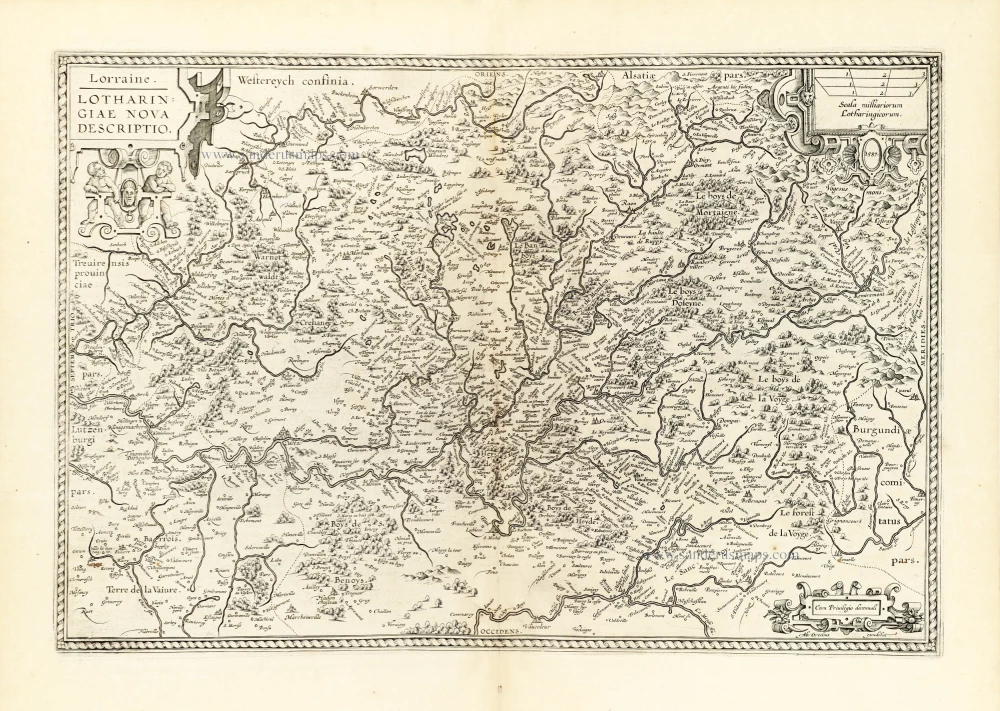
Lorraine (South) by Maurice Bouguereau. Rare c. 1610-1650

Jean Le Clerc (1560-c. 1622)
Geographer, publisher, and engraver, fourth in a dynasty of printers and booksellers. Trades from 'Rue S. Jean de Latran à la Sallemandre Royalle'. He worked for a while for Maurice Bouguereau, the plates for whose Le Théâtre François passed to Leclerc sometime before 1619. These formed the core of his own Théâtre.
Lorraine, vers le Midy.
Item Number: 31309 Authenticity Guarantee
Category: Antique maps > Europe > France
Lorraine (South) by Maurice Bouguereau.
Title: Lorraine, vers le Midy.
Caesarodunj Turonum in Aedibus Mauricij Boguerealdi.
Cartographer: Maurice Bouguereau.
Date of the first edition: 1593.
Date of this map: c. 1610-1650.
Copper engraving, printed on paper.
Image size: 360 x 465mm (14.17 x 18.31 inches).
Sheet size: 505 x 680mm (19.88 x 26.77 inches).
Verso: Blank.
Condition: Original coloured in outline, side margins extended, on heavy paper, excellent.
Condition Rating: A+.
Separate publication - from a French Composite Atlas, c. 1610-1650.
Appeared in: Le Theatre Francois, Tours, M. Bougereau, 1594. and: Theatre geographique du royaume de France. ... Paris, Jean Le Clerc, 1619. (Pastoureau, p. 295, Leclerc A 1619)
Jean Le Clerc (1560-c. 1622)
Geographer, publisher, and engraver, fourth in a dynasty of printers and booksellers. Trades from 'Rue S. Jean de Latran à la Sallemandre Royalle'. He worked for a while for Maurice Bouguereau, the plates for whose Le Théâtre François passed to Leclerc sometime before 1619. These formed the core of his own Théâtre.
Related items

Generalis Lotharingiae Ducatus Tabula ... 1683-1696
Lorraine by Visscher N.
[Item number: 1278]
Lorraine, Vers Le Midi 1636
Lorraine by Hondius - Janssonius
[Item number: 8502]
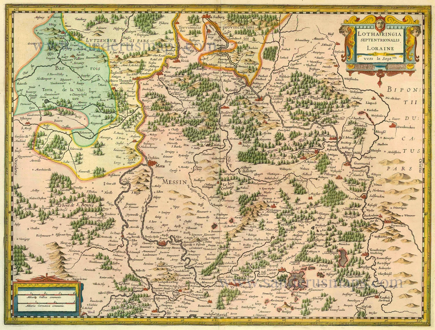
Lotharingia Septentrionalis Loraine 1633
Lorraine (Nord) by Janssonius - Hondius
[Item number: 8513]
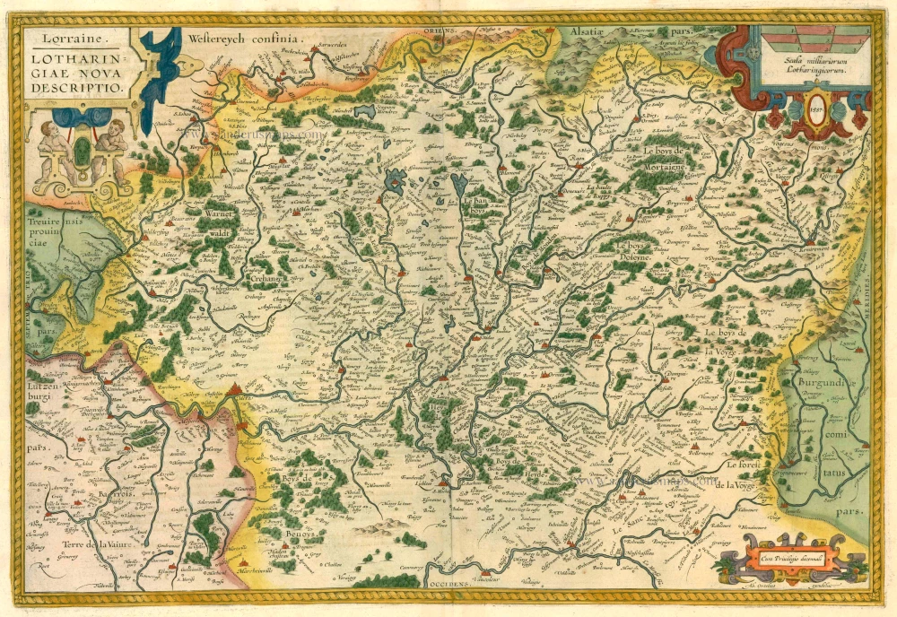
Lorraine. - Lotharingiae Nova Descriptio. 1612
Lorraine, by Abraham Ortelius.
[Item number: 13689]

Lotharingia Ducatus, Vulgo Lorraine 1642-43
Lorraine, by Blaeu W. & J.
[Item number: 14385]
Scarce
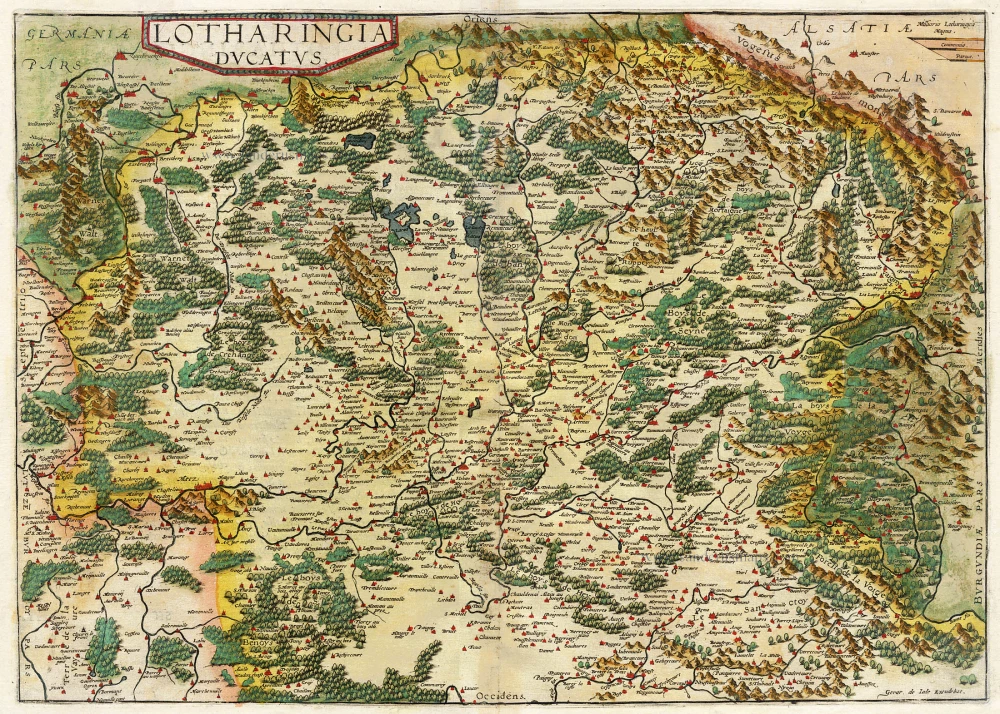
Lotharingia Ducatus. 1593
Lorraine, by Gerard de Jode.
[Item number: 15608]
Lorraine. - Lotharingiae Nova Descriptio. 1603
Lorraine by Ortelius A.
[Item number: 22882]
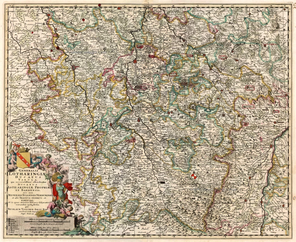
Generalis Lotharingiae Ducatus Tabula qua accuratissimé oftenduntur Ducatus Lotharingiae Propriae et Barrensis, nec non Metensis, Tullensis, Verdunensis, et alii Tractus Inserti et Finitimi, ... c. 1680
Lorraine, by F. De Wit.
[Item number: 24374]

Lotharingia Ducatus 1623
Lorraine by Gerard Mercator.
[Item number: 24939]
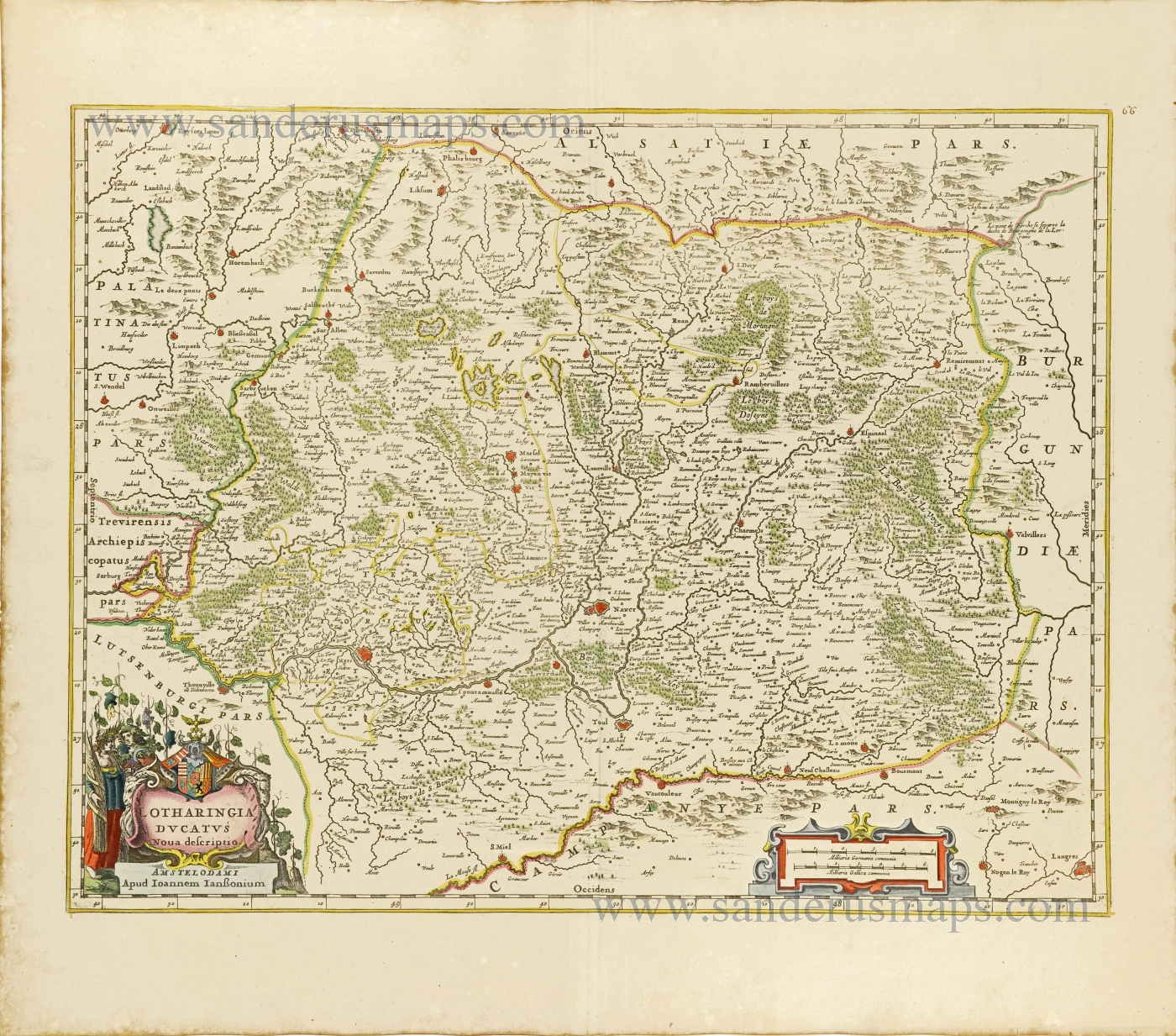
Lotharingia Ducatus.Nova descriptio. 1656-80
Lorraine by Joannes Janssonius.
[Item number: 28621]
Tres rare!
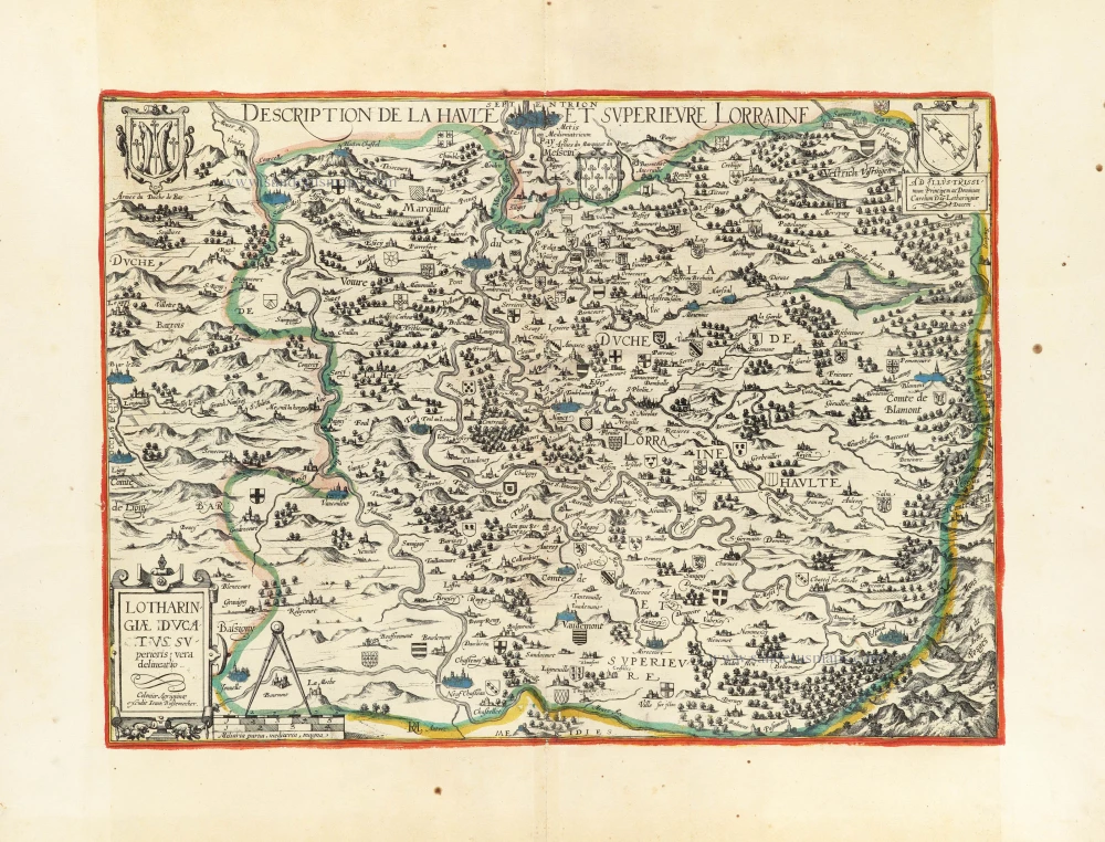
Lotharingiae Ducatus Superioris vera delineatio. - Description de la Haulte et Superieure Lorraine. c. 1610-1650
Lorraine by Johann Bussemacher.
[Item number: 30897]

Lorraine vers Septentrion. Rare c. 1610-1650
Lorraine by Maurice Bouguereau, published by Jean Leclerc.
[Item number: 31307]