
Rare
Normandy (Normandie) by Damien de Templeux, published by Jean Leclerc. 1621
Extremely rare map, known from only a few copies.
According to Pastoureau, this map was part of Leclerc's Atlas Théâtre géographique du Royaume de France, 1621. Two copies are known of this atlas (Bibl. Nat. Paris, and Brit. Lib.);
Jean Le Clerc (1560-c. 1622)
Geographer, publisher, and engraver, fourth in a dynasty of printers and booksellers. Trades from 'Rue S. Jean de Latran à la Sallemandre Royalle'. He worked for a while for Maurice Bouguereau, the plates for whose Le Théâtre François passed to Leclerc sometime before 1619. These formed the core of his own Théâtre.
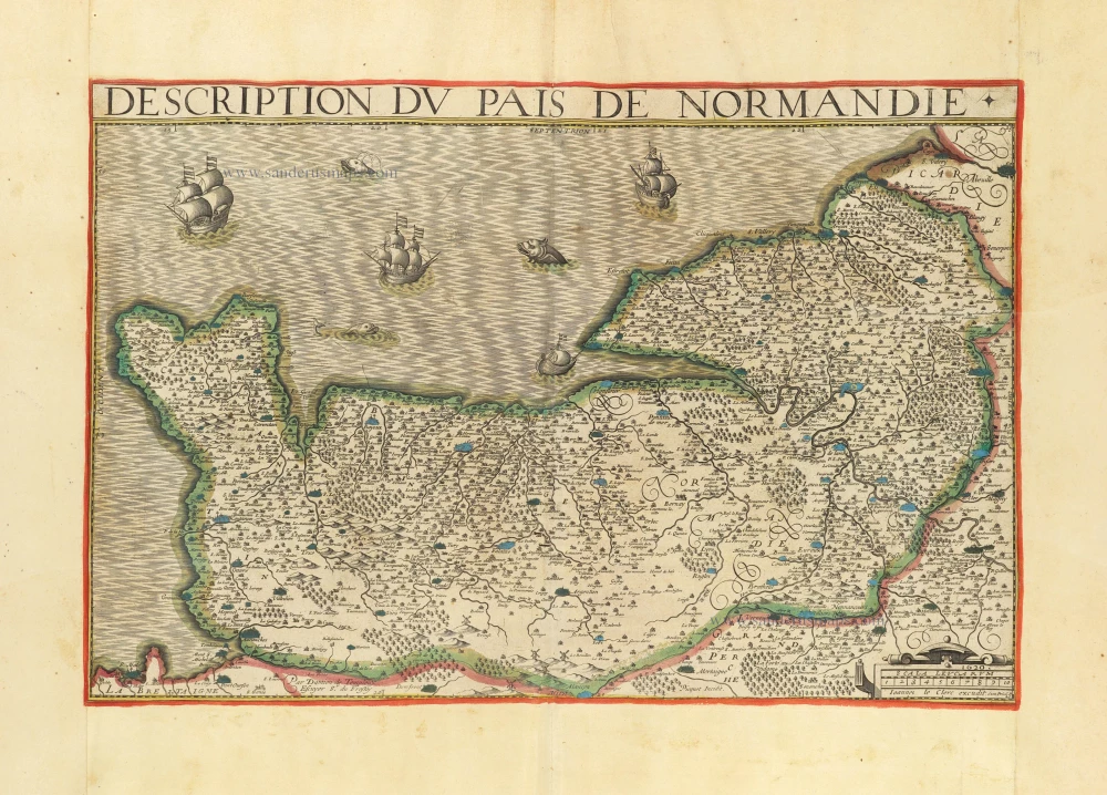
Description du Pais de Normandie.
Item Number: 30902 Authenticity Guarantee
Category: Antique maps > Europe > France
Normandy (Normandie) by Damien de Templeux, published by Jean Leclerc.
Title: Description du Pais de Normandie.
Par Damien de Templeux escuyer Sre. du Frestoy.
1620. Ioannes le Clerc excudit. Cum Privil. R 23
Cartographer: Damien de Templeux.
Date of the first edition: 1620.
Date of this map: 1621.
Date on map: 1620.
Copper engraving, printed on paper.
Image size: 340 x 515mm (13.39 x 20.28 inches).
Sheet size: 505 x 680mm (19.88 x 26.77 inches).
Verso: Blank.
Condition: Original coloured in outline, on thick paper, side margins extended; excellent.
Condition Rating: A+.
Separate publication - from a French Composite Atlas, c. 1610-1650.
Appeared in: Théâtre géographique du Royaume de France. Paris, Jean Leclerc, 1621. (Pastoureau, p. 297, Leclerc C 1621).
Extremely rare map, known from only a few copies.
According to Pastoureau, this map was part of Leclerc's Atlas Théâtre géographique du Royaume de France, 1621. Two copies are known of this atlas (Bibl. Nat. Paris, and Brit. Lib.);
Jean Le Clerc (1560-c. 1622)
Geographer, publisher, and engraver, fourth in a dynasty of printers and booksellers. Trades from 'Rue S. Jean de Latran à la Sallemandre Royalle'. He worked for a while for Maurice Bouguereau, the plates for whose Le Théâtre François passed to Leclerc sometime before 1619. These formed the core of his own Théâtre.
Related items
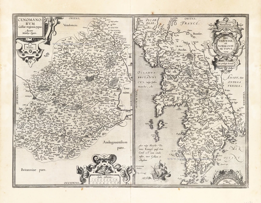
Cenomanorum Galliae regionis typus.La Mans. [on sheet with] Neustria. Britanniae, et Normandiae Typus, 1594. 1601
Maine - Bretagne - Normandie by Abraham Ortelius.
[Item number: 22772]
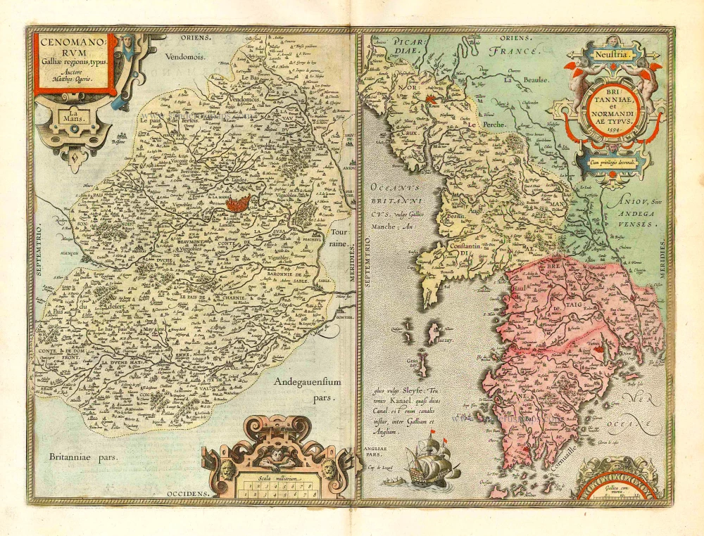
Cenomanorum Galliae regionis typus. [on sheet with] Britanniae, et Normandiae Typus, 1594. 1612
Le Maine and Bretagne / Normandy by Abraham Ortelius
[Item number: 23070]
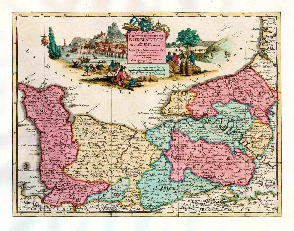
Carte du Gouvernement de Normandie. 1713
Normandy, by Pieter Van der Aa.
[Item number: 26169]
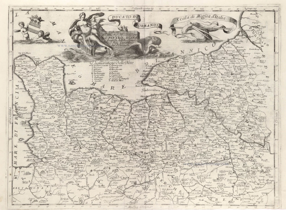
Ducato di Normandia. 1696
Normandy, by Vincenzo Coronelli.
[Item number: 29434]
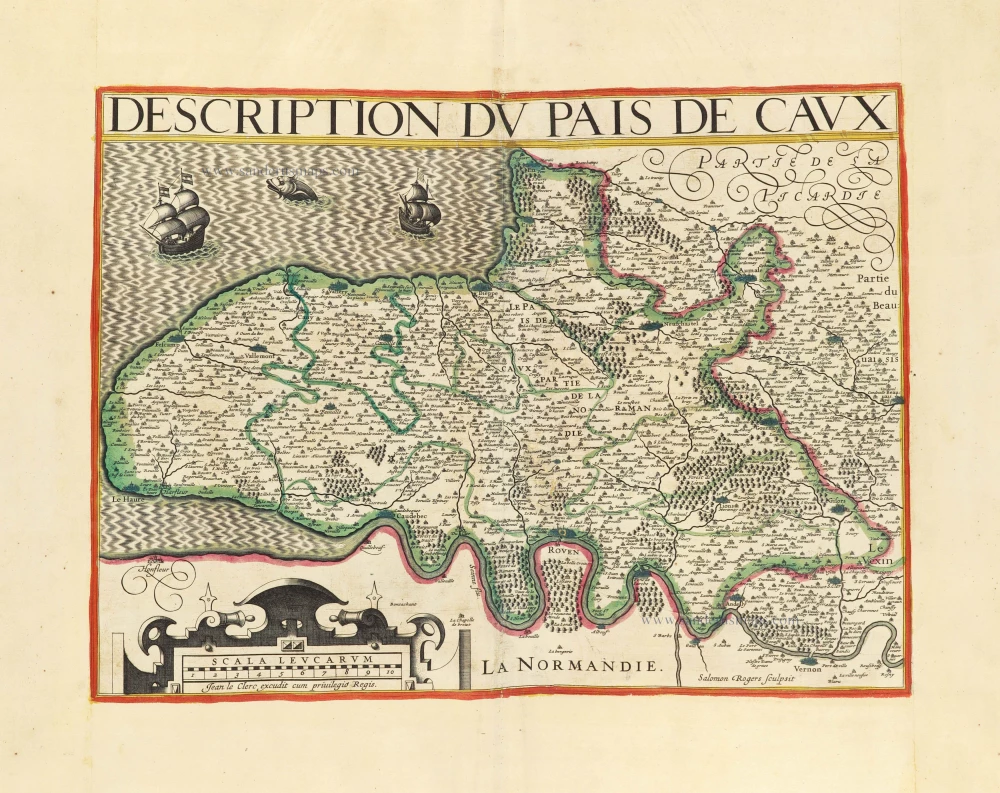
Description du Pais de Caux. 1619-21
Normandie - Pays de Caux, by Jean Leclerc.
[Item number: 30900]
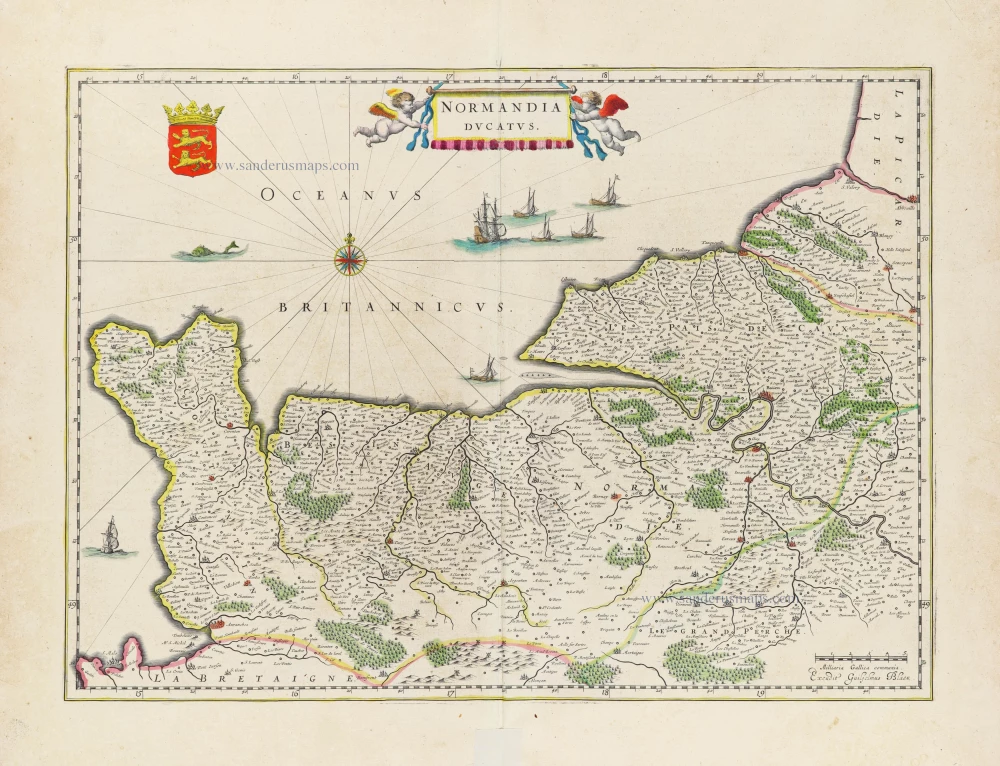
Normandia Ducatus. 1640
Normandy, by W. Blaeu.
[Item number: 31263]
new