
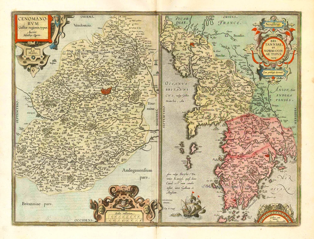
Maine - Bretagne - Normandie by Abraham Ortelius. 1601
Abraham Ortelius (1527-1598)
The maker of the 'first atlas', the Theatrum Orbis Terrarum (1570), was born on 4 April 1527 into an old Antwerp family. He learned Latin and studied Greek and mathematics.
Abraham and his sisters Anne and Elizabeth took up map colouring. He was admitted to the Guild of St. Luke as an "illuminator of maps." Besides colouring maps, Ortelius was a dealer in antiques, coins, maps, and books, with the book and map trade gradually becoming his primary occupation.
Business went well because his means permitted him to start an extensive collection of medals, coins, antiques, and a library of many volumes. In addition, he travelled a lot and visited Italy and France, made contacts everywhere with scholars and editors, and maintained extensive correspondence with them.
In 1564 he published his first map, a large and ambitious world wall map. The inspiration for this map may well have been Gastaldi's large world map. In 1565 he published a map of Egypt and a map of the Holy Land, a large map of Asia followed.
In 1568 the production of individual maps for his atlas Theatrum Orbis Terrarum was already in full swing. He completed the atlas in 1569, and in May of 1570, the Theatrum was available for sale. It was one of the most expensive books ever published.
This first edition contained seventy maps on fifty-three sheets. Franciscus Hogenberg engraved the maps.
Later editions included Additamenta (additions), resulting in Ortelius' historical atlas, the Parergon, mostly bound together with the atlas. The Parergon can be called a truly original work of Ortelius, who drew the maps based on his research.
The importance of the Theatrum Orbis Terrarum for geographical knowledge in the last quarter of the sixteenth century is difficult to overemphasize. Nothing was like it until Mercator's atlas appeared twenty-five years later. Demand for the Theatrum was remarkable. Some 24 editions appeared during Ortelius's lifetime and another ten after his death in 1598. Editions were published in Dutch, German, French, Spanish, English, and Italian. The number of map sheets grew from 53 in 1570 to 167 in 1612 in the last edition.
In 1577, engraver Philip Galle and poet-translator Pieter Heyns published the first pocket-sized edition of the Theatrum, the Epitome. The work was trendy. Over thirty editions of this Epitome were published in different languages.
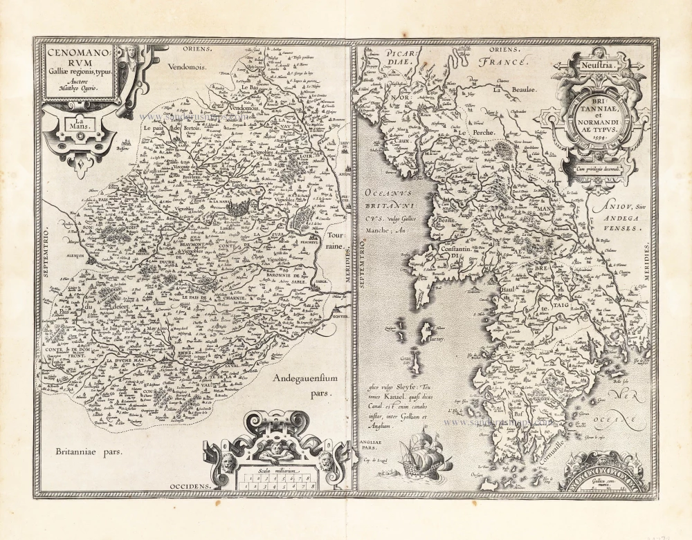
Cenomanorum Galliae regionis typus.La Mans. [on sheet with] Neustria. Britanniae, et Normandiae Typus, 1594.
Item Number: 22772 Authenticity Guarantee
Category: Antique maps > Europe > France
Maine - Bretagne - Normandie by Abraham Ortelius.
Title: Cenomanorum Galliae regionis typus.La Mans. [on sheet with] Neustria. Britanniae, et Normandiae Typus, 1594.
Cum privilegio decennali.
Cartographer: Macé Ogier (Maine).
Date of the first edition: 1595.
Date of this map: 1601.
Copper engraving, printed on paper.
Image size: 375 x 505mm (14.76 x 19.88 inches).
Sheet size: 470 x 560mm (18.5 x 22.05 inches).
Verso: Latin text.
Condition: Excellent.
Condition Rating: A+.
From: Theatrum Orbis Terrarum Abrahami Ortelii Antverp. Geographi Regii. Antwerpen, Plantin Press, 1601. (Van der Krogt 3, 1:052)
Abraham Ortelius (1527-1598)
The maker of the 'first atlas', the Theatrum Orbis Terrarum (1570), was born on 4 April 1527 into an old Antwerp family. He learned Latin and studied Greek and mathematics.
Abraham and his sisters Anne and Elizabeth took up map colouring. He was admitted to the Guild of St. Luke as an "illuminator of maps." Besides colouring maps, Ortelius was a dealer in antiques, coins, maps, and books, with the book and map trade gradually becoming his primary occupation.
Business went well because his means permitted him to start an extensive collection of medals, coins, antiques, and a library of many volumes. In addition, he travelled a lot and visited Italy and France, made contacts everywhere with scholars and editors, and maintained extensive correspondence with them.
In 1564 he published his first map, a large and ambitious world wall map. The inspiration for this map may well have been Gastaldi's large world map. In 1565 he published a map of Egypt and a map of the Holy Land, a large map of Asia followed.
In 1568 the production of individual maps for his atlas Theatrum Orbis Terrarum was already in full swing. He completed the atlas in 1569, and in May of 1570, the Theatrum was available for sale. It was one of the most expensive books ever published.
This first edition contained seventy maps on fifty-three sheets. Franciscus Hogenberg engraved the maps.
Later editions included Additamenta (additions), resulting in Ortelius' historical atlas, the Parergon, mostly bound together with the atlas. The Parergon can be called a truly original work of Ortelius, who drew the maps based on his research.
The importance of the Theatrum Orbis Terrarum for geographical knowledge in the last quarter of the sixteenth century is difficult to overemphasize. Nothing was like it until Mercator's atlas appeared twenty-five years later. Demand for the Theatrum was remarkable. Some 24 editions appeared during Ortelius's lifetime and another ten after his death in 1598. Editions were published in Dutch, German, French, Spanish, English, and Italian. The number of map sheets grew from 53 in 1570 to 167 in 1612 in the last edition.
In 1577, engraver Philip Galle and poet-translator Pieter Heyns published the first pocket-sized edition of the Theatrum, the Epitome. The work was trendy. Over thirty editions of this Epitome were published in different languages.
Related items
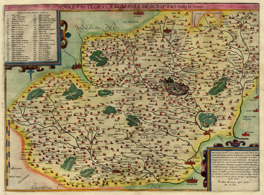
Nova et Integra Caenomaniae Descriptio vulg: la Mans 1593
Maine (Le Mans), by Gerard de Jode.
[Item number: 3942]
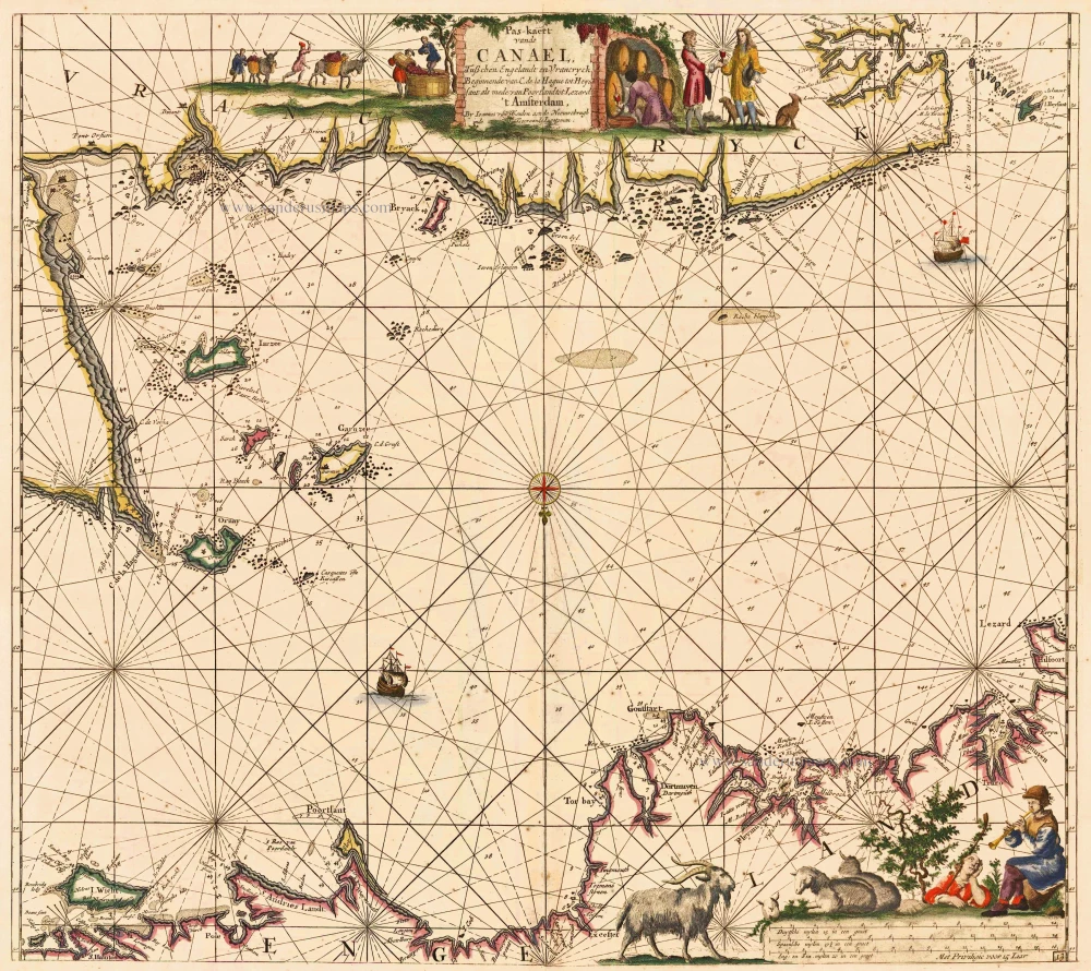
Pas-kaert vande Canael, Tusschen Engelandt en Vrancryck Beginnende van C. de la Hague tot Heyssant, als mede van Poortland tot Lezard. 1697-1709
Bretagne and the Channel, by Van Keulen Johannes.
[Item number: 5406]
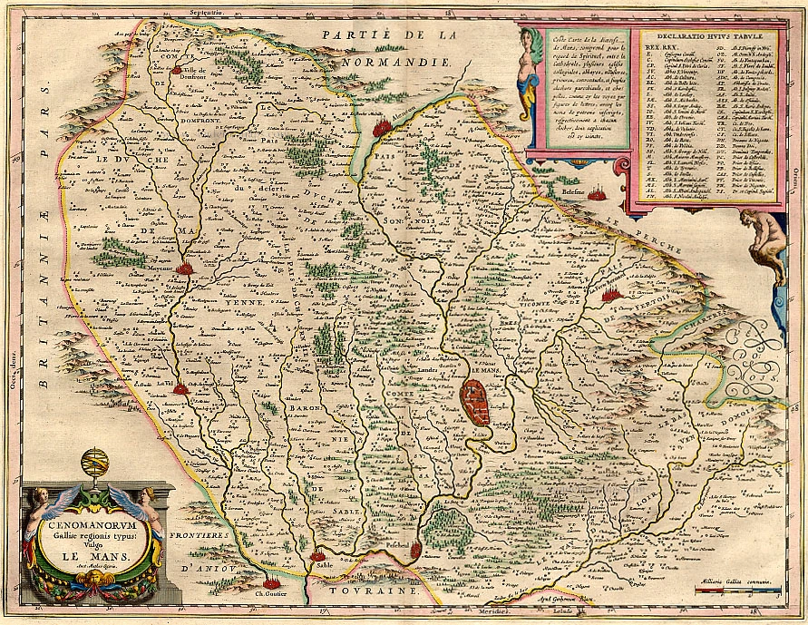
Cenomanorum Galliae regionis typus: vulgo Le Mans. 1642-43
Maine, by Willem Blaeu.
[Item number: 14349]
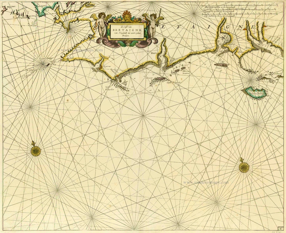
De Cust van Bretaigne, van Heysandt tot aan 't eylant Boelyn. 1686
Bretagne, by Doncker H.
[Item number: 15394]
Cenomanorum Galliae regionis typus. [on sheet with] Britanniae, et Normandiae Typus, 1594. 1612
Le Maine and Bretagne / Normandy by Abraham Ortelius
[Item number: 23070]
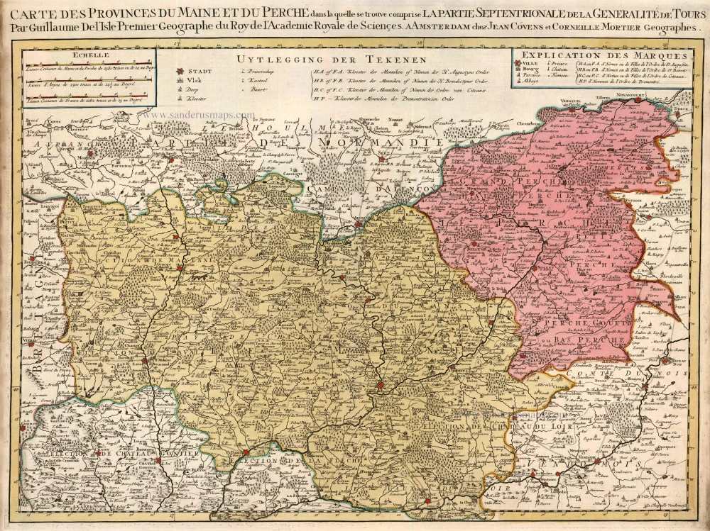
Carte des provinces du Maine et du Perche dans laquelle se trouve comprise La Partie Septentrionale de la Généralité de Tours. 1721-41
Maine - Perche by Guillaume Delisle, published by Covens & Mortier.
[Item number: 23778]
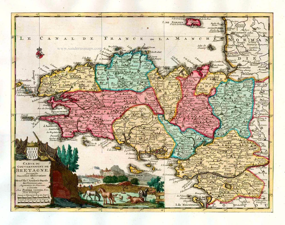
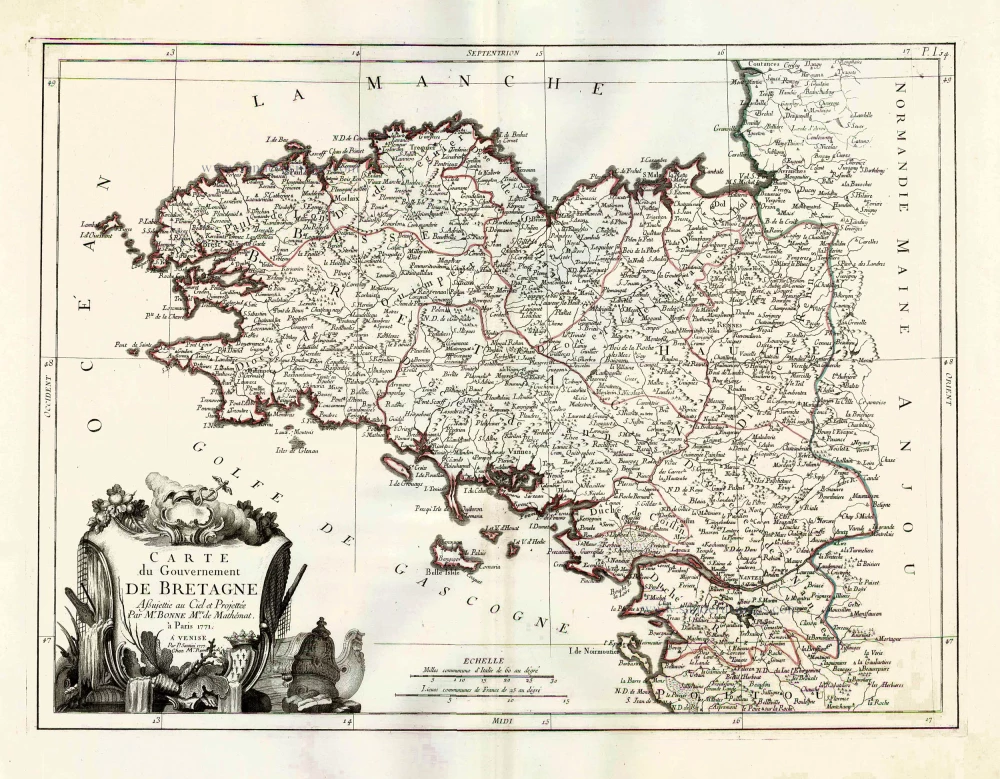
Carte du Gouvernement de Bretagne. 1713
Bretagne, by P. Van der Aa.
[Item number: 26166]
Carte du Gouvernement de Bretagne. 1776-79
Bretagne by Francesco & Paolo Santini
[Item number: 26956]
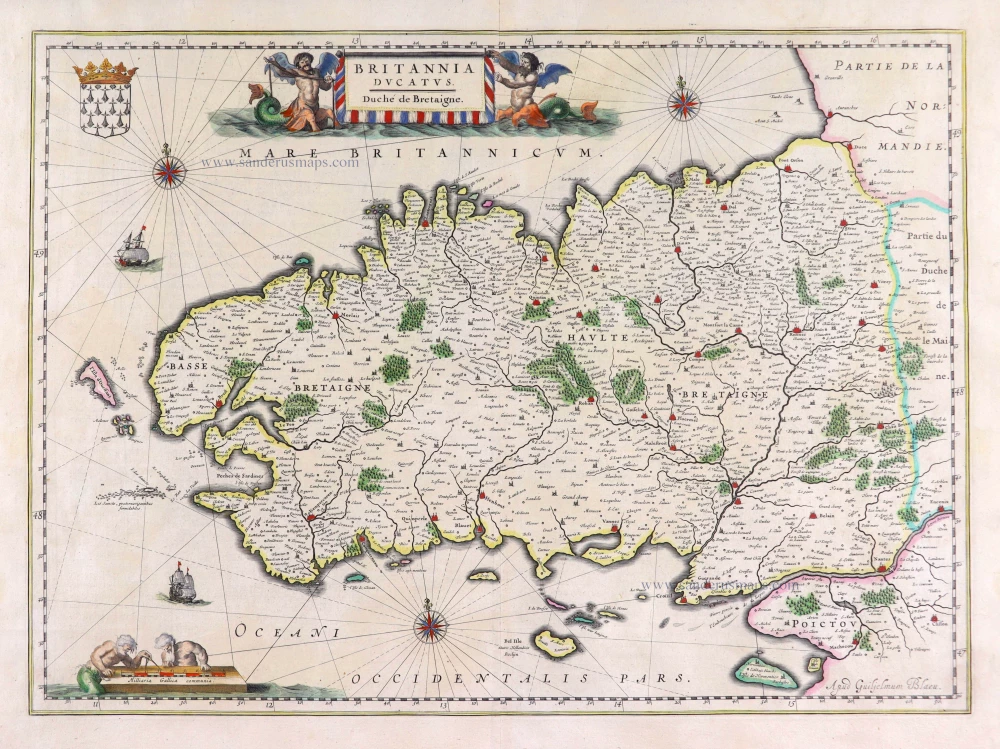
Britannia Ducatus. 1640
Bretagne, by Willem Blaeu.
[Item number: 27970]
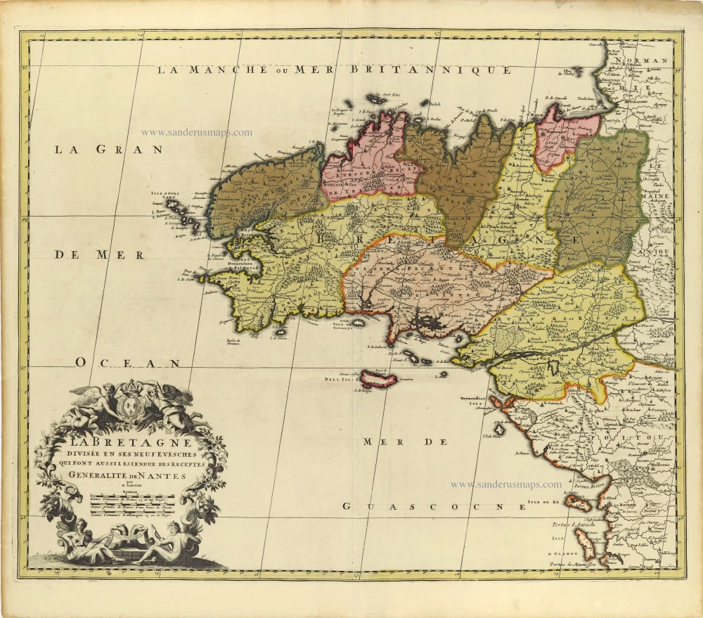
La Bretagne divisée en ses Neuf Evesches qui font aussilesiendue des Receptes Generalite de Nantes. c. 1660
Bretagne par Nicolas Sanson.
[Item number: 28380]

Duche et Gouvernement de Bretagne. 1700-1710
Bretagne by Nicolas Sanson.
[Item number: 28511]

Duché, et Gouvernement de Bretagne. 1652
Bretagne par Nicolas Sanson.
[Item number: 29668]
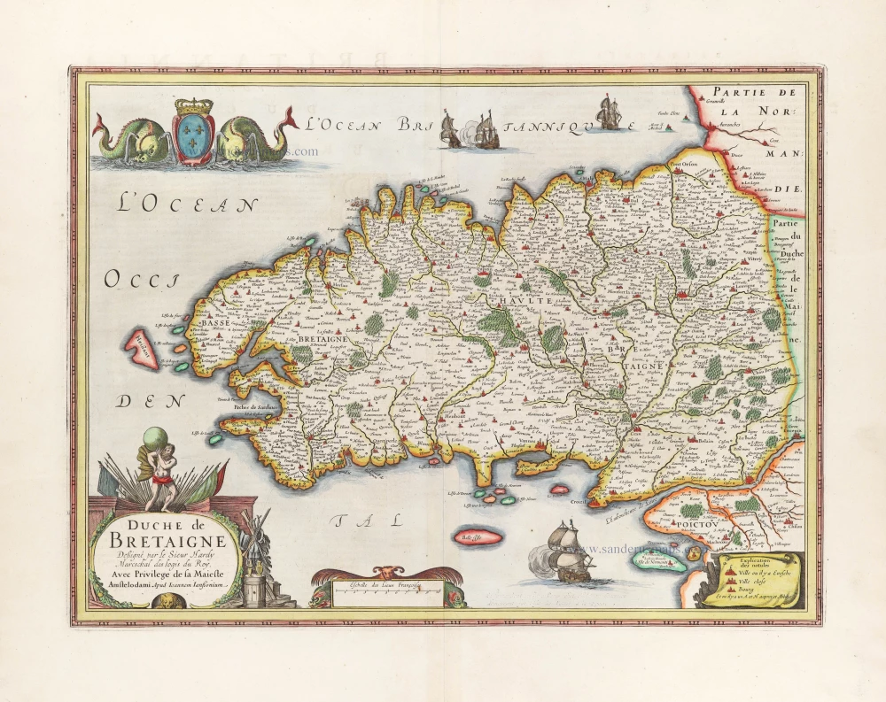
Duche de Bretaigne. 1666
Bretagne, par Joannes Janssonius.
[Item number: 30289]
Rare
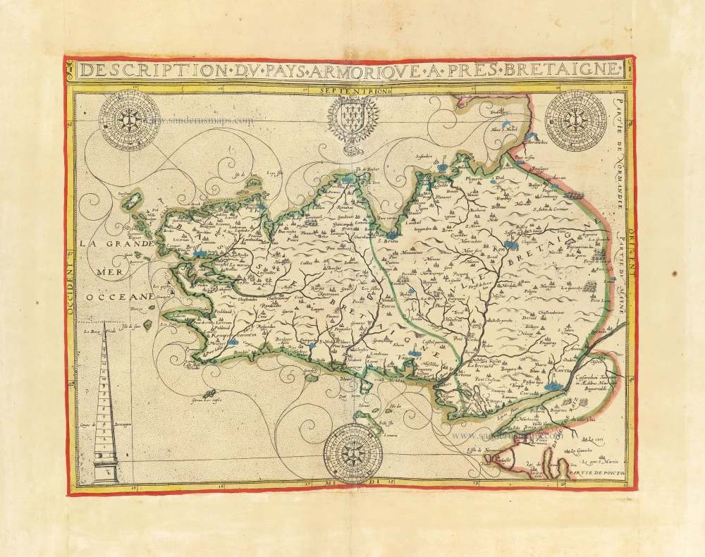
Description du Pays Armorique a pres Bretaigne. 1619-21
Bretagne by Maurice Bouguereau, published by Jean Leclerc.
[Item number: 30899]
new
Rare
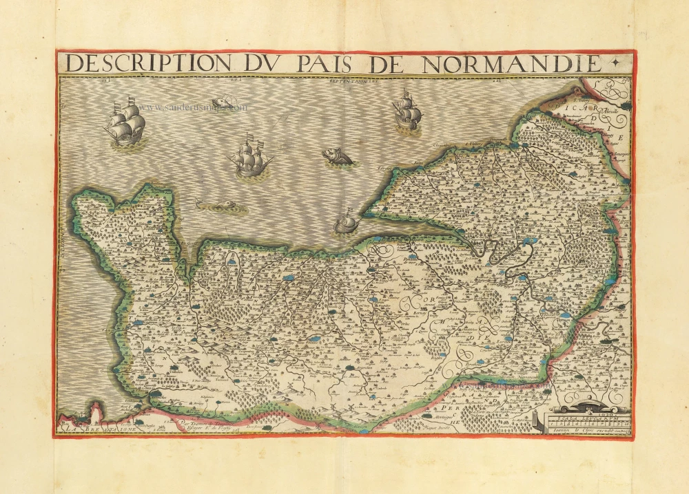
Description du Pais de Normandie. 1621
Normandy (Normandie) by Damien de Templeux, published by Jean Leclerc.
[Item number: 30902]
new