
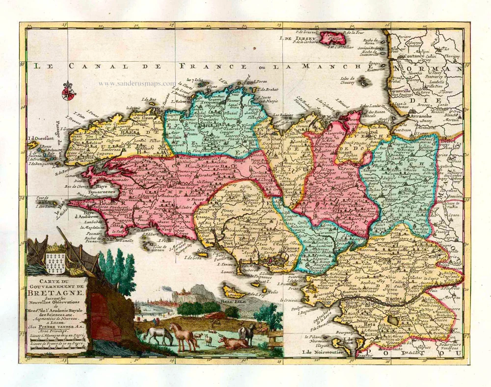
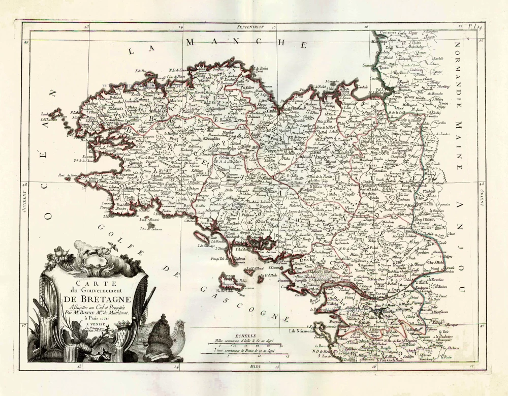
Bretagne, by P. Van der Aa. 1713
Pieter van der Aa (Leiden, 1659-1733)
Pieter van der Aa was already in 1682 owner of a bookshop and auction house. During his life, he has published an enormous amount of printed material.
After 1700, van der Aa increasingly specialised in books on geography and travel.
He published composite atlases, a series of geographical descriptions of European countries, and some very spectacular works. Between 1706 and 1708 he published the Naauweurige versameling der gedenkwaardigste zee- en land-reysen, in 28 volumes.
Many of Van der Aa’s publications are richly illustrated with maps and plates. He took over many copperplates and prints from other publishers such as Carel Allard and Frederik De Wit. The composite atlases that appeared from his workshop contain a curious mixture of his own material, copies of maps from other publishers, and reprints made from old copper plates, now with his own imprint.
The Galérie agréable du monde, was completed in 1729, and comprised 66 parts, bound in 27 volumes. Van der Aa presented it as a good investment; after publication, the antiquarian value of the work would double, the more so since it was printed in a limited edition of only one hundred copies.
Carte du Gouvernement de Bretagne.
Item Number: 26166 Authenticity Guarantee
Category: Antique maps > Europe > France
Old, antique map of Bretagne, by P. Van der Aa.
Carte ancienne de la Bretagne, par P. Van der Aa.
Date of the first edition: 1713
Date of this map: 1713
Copper engraving, printed on paper.
Size (not including margins): 23 x 30cm (8.9 x 11.6 inches)
Verso: Blank
Condition: Original body colour, trimmed to neatline and mounted on heavy paper at an early time.
Condition Rating: A
References: Van der Krogt A, 07:06; Koeman, Aa7 (69).
From: Nouvel Atlas, très exact et fort commode pour toutes sortes de personnes, Contenant Les Principales cartes géographiques. Leiden, P. Van der Aa, n.d. (1713) (Koeman, Aa7).
Van der Aa maps are rarely found in original colouring.
Pieter van der Aa (Leiden, 1659-1733)
Pieter van der Aa was already in 1682 owner of a bookshop and auction house. During his life, he has published an enormous amount of printed material.
After 1700, van der Aa increasingly specialised in books on geography and travel.
He published composite atlases, a series of geographical descriptions of European countries, and some very spectacular works. Between 1706 and 1708 he published the Naauweurige versameling der gedenkwaardigste zee- en land-reysen, in 28 volumes.
Many of Van der Aa’s publications are richly illustrated with maps and plates. He took over many copperplates and prints from other publishers such as Carel Allard and Frederik De Wit. The composite atlases that appeared from his workshop contain a curious mixture of his own material, copies of maps from other publishers, and reprints made from old copper plates, now with his own imprint.
The Galérie agréable du monde, was completed in 1729, and comprised 66 parts, bound in 27 volumes. Van der Aa presented it as a good investment; after publication, the antiquarian value of the work would double, the more so since it was printed in a limited edition of only one hundred copies.
Related items
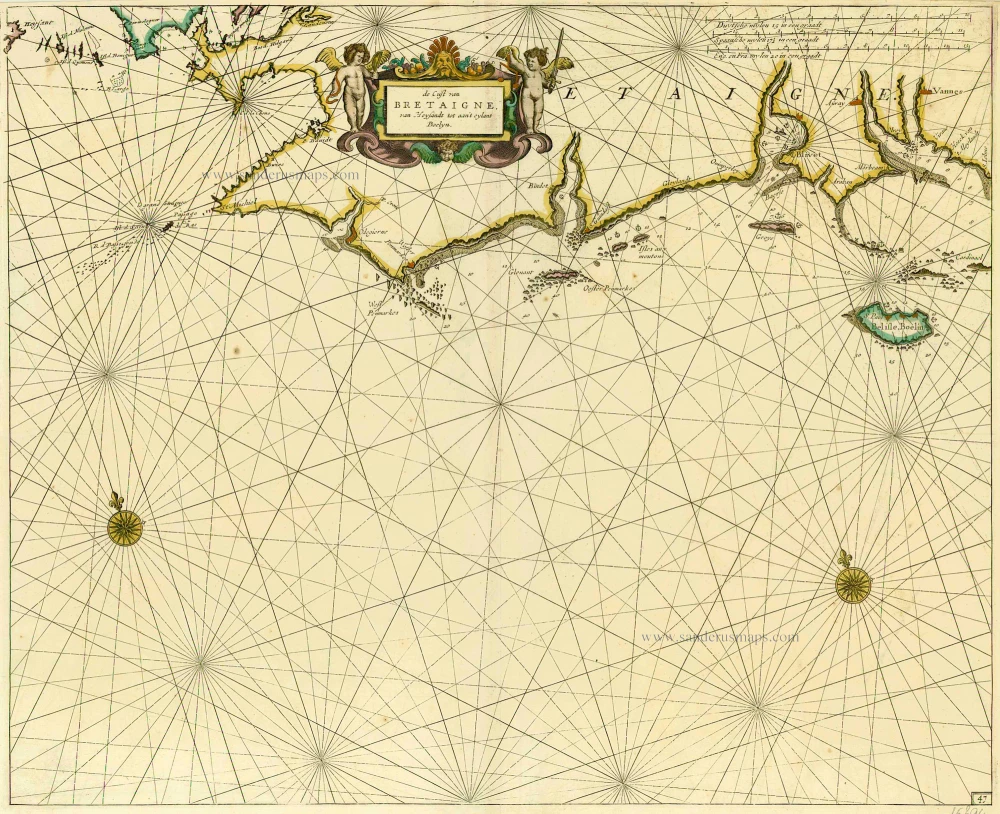
De Cust van Bretaigne, van Heysandt tot aan 't eylant Boelyn. 1686
Bretagne, by Doncker H.
[Item number: 15394]
Cenomanorum Galliae regionis typus.La Mans. [on sheet with] Neustria. Britanniae, et Normandiae Typus, 1594. 1601
Maine - Bretagne - Normandie by Abraham Ortelius.
[Item number: 22772]
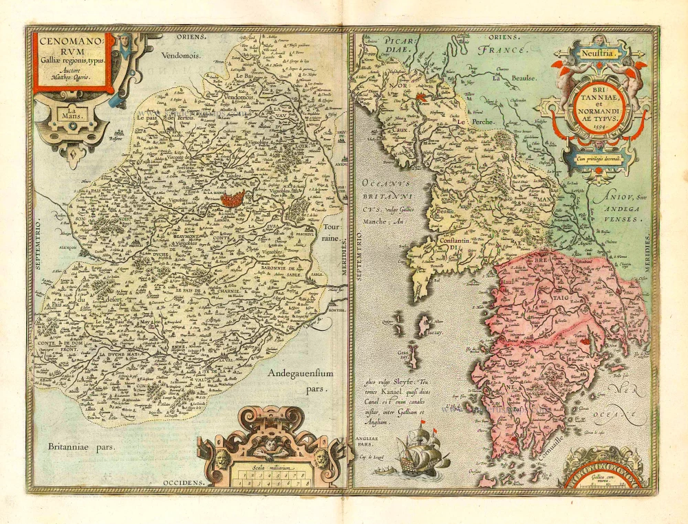
Cenomanorum Galliae regionis typus. [on sheet with] Britanniae, et Normandiae Typus, 1594. 1612
Le Maine and Bretagne / Normandy by Abraham Ortelius
[Item number: 23070]
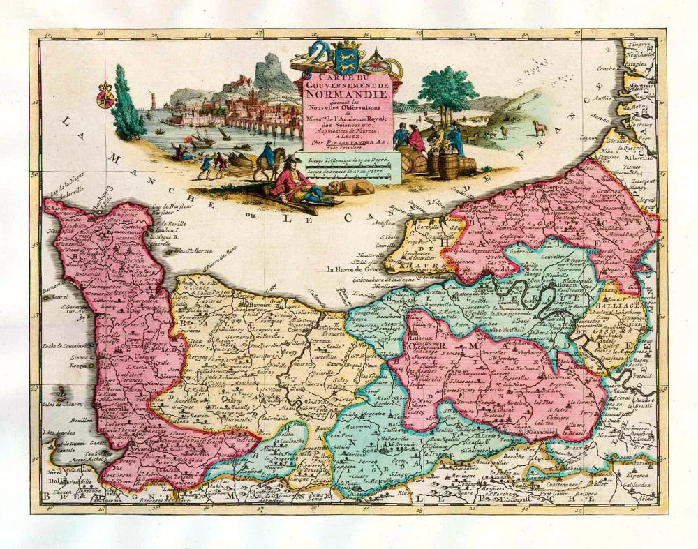
Carte du Gouvernement de Normandie. 1713
Normandy, by Pieter Van der Aa.
[Item number: 26169]
Carte du Gouvernement de Bretagne. 1776-79
Bretagne by Francesco & Paolo Santini
[Item number: 26956]
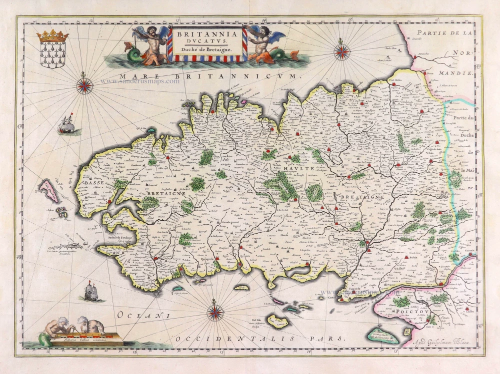
Britannia Ducatus. 1640
Bretagne, by Willem Blaeu.
[Item number: 27970]
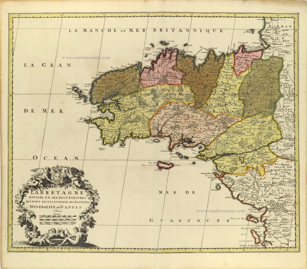
La Bretagne divisée en ses Neuf Evesches qui font aussilesiendue des Receptes Generalite de Nantes. c. 1660
Bretagne par Nicolas Sanson.
[Item number: 28380]

Duche et Gouvernement de Bretagne. 1700-1710
Bretagne by Nicolas Sanson.
[Item number: 28511]

Duché, et Gouvernement de Bretagne. 1652
Bretagne par Nicolas Sanson.
[Item number: 29668]
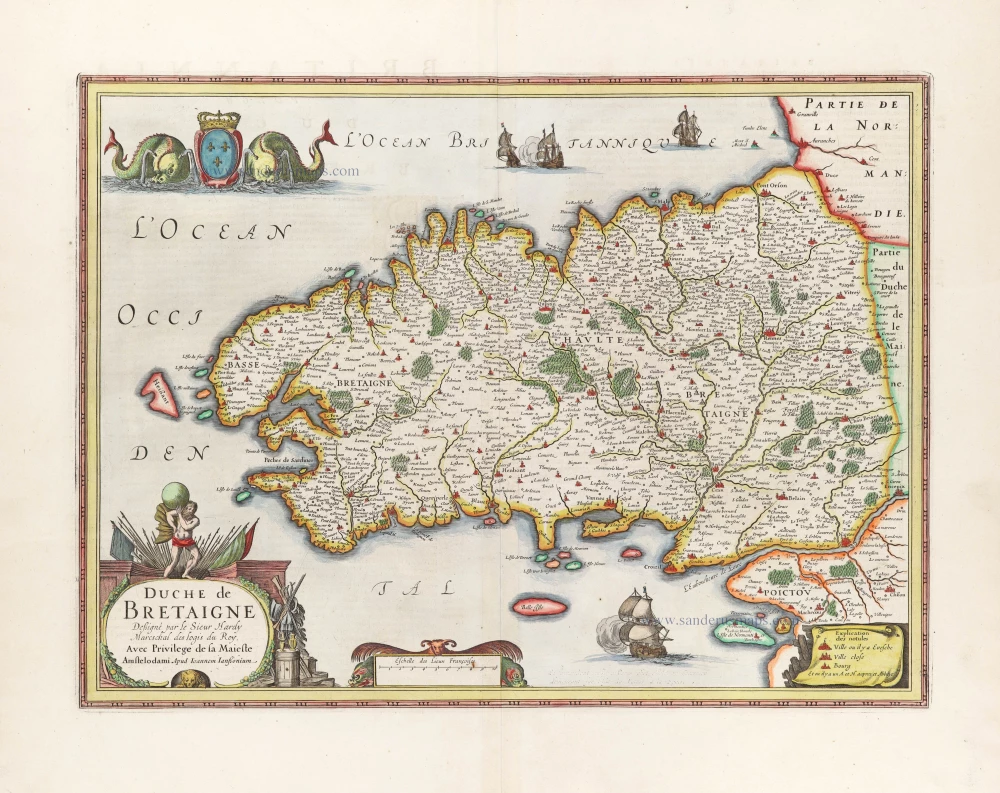
Duche de Bretaigne. 1666
Bretagne, par Joannes Janssonius.
[Item number: 30289]