
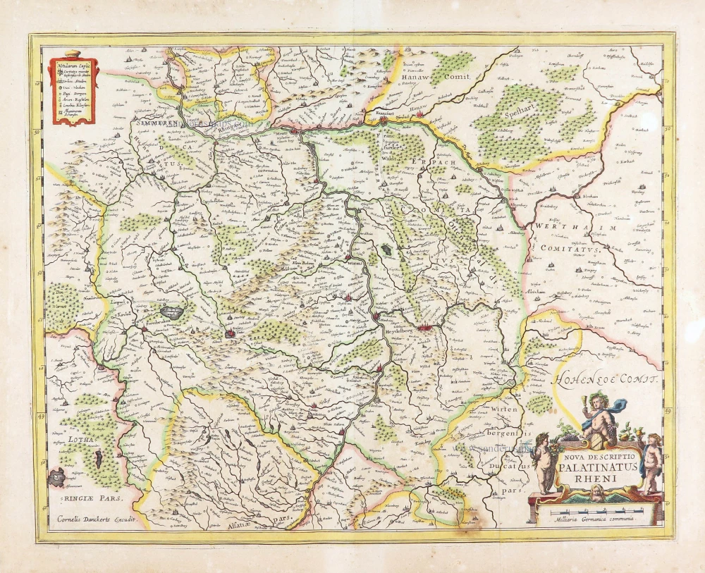
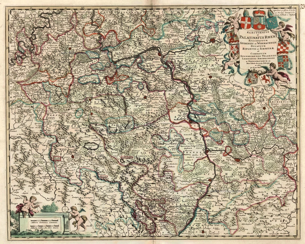
The Rhine-Palatinate (Rheinpfalz), by Cornelis Danckerts. c. 1640


The Danckerts Family.
The Danckerts family of Amsterdam was one of the best-known print and map sellers in 17th century Amsterdam. Their business activity covered a vast period, from ca. 1633. From 1669 until 1701, father Justus and his sons had their shop in the ‘Calverstraet in de Danckbaerheyt’.
Cornelis Danckerts (1561-1631) was a printseller born in Amsterdam and active in Antwerp.
Cornelis Danckerts, the elder (1603-1656) was an engraver and publisher in Amsterdam and Nieuwendijk. Son of Cornelis (above), whom he succeeded in 1631.
The house of Danckerts gained its greatest fame from Justus Danckerts (1635-1701 - son of Cornelis the elder) and his two sons, Theodorus and Cornelis. Dancker Danckerts (1634-1666), the elder brother of Justus, was known for his etchings of paintings, maps, and publications.
The grandfather, father, and sons were highly skilled and excellent artistic drafters and engravers. They are famous for the edition of their Atlas, which appeared from ca. 1686, and for several monumental and beautiful wall maps and views. However, compared with that published by the Blaeu's or Janssonius's, their cartographic work has attracted little attention and has never received proper recognition.
On 14 August 1684, Justus and his sons obtained the privilege from the States of Holland for their publications. In 1713, twelve years after Justus Danckerts, the heirs decided to sell part of the stock of maps and atlases and many copperplates. In 1727, after the death of the last surviving brother Theodorus, a final sale took place.
Nova Descriptio Palatinatus Rheni.
Item Number: 29013 Authenticity Guarantee
Category: Antique maps > Europe > Germany
Antique map of the Rhine-Palatinate (Rheinpfalz), by Cornelis Danckerts.
Title: Nova Descriptio Palatinatus Rheni.
Cornelis Danckerts excudit.
RARE!
Date: c. 1640.
Copper engraving, printed on paper.
Map size: 365 x 465mm (14.37 x 18.31 inches).
Sheet size: 420 x 515mm (16.54 x 20.28 inches).
Verso: Blank.
Condition: Original coloured, two additional vertical folds, stain at lower right.
Condition Rating: A.
Separate publication.
The Danckerts Family.
The Danckerts family of Amsterdam was one of the best-known print and map sellers in 17th century Amsterdam. Their business activity covered a vast period, from ca. 1633. From 1669 until 1701, father Justus and his sons had their shop in the ‘Calverstraet in de Danckbaerheyt’.
Cornelis Danckerts (1561-1631) was a printseller born in Amsterdam and active in Antwerp.
Cornelis Danckerts, the elder (1603-1656) was an engraver and publisher in Amsterdam and Nieuwendijk. Son of Cornelis (above), whom he succeeded in 1631.
The house of Danckerts gained its greatest fame from Justus Danckerts (1635-1701 - son of Cornelis the elder) and his two sons, Theodorus and Cornelis. Dancker Danckerts (1634-1666), the elder brother of Justus, was known for his etchings of paintings, maps, and publications.
The grandfather, father, and sons were highly skilled and excellent artistic drafters and engravers. They are famous for the edition of their Atlas, which appeared from ca. 1686, and for several monumental and beautiful wall maps and views. However, compared with that published by the Blaeu's or Janssonius's, their cartographic work has attracted little attention and has never received proper recognition.
On 14 August 1684, Justus and his sons obtained the privilege from the States of Holland for their publications. In 1713, twelve years after Justus Danckerts, the heirs decided to sell part of the stock of maps and atlases and many copperplates. In 1727, after the death of the last surviving brother Theodorus, a final sale took place.
Related items

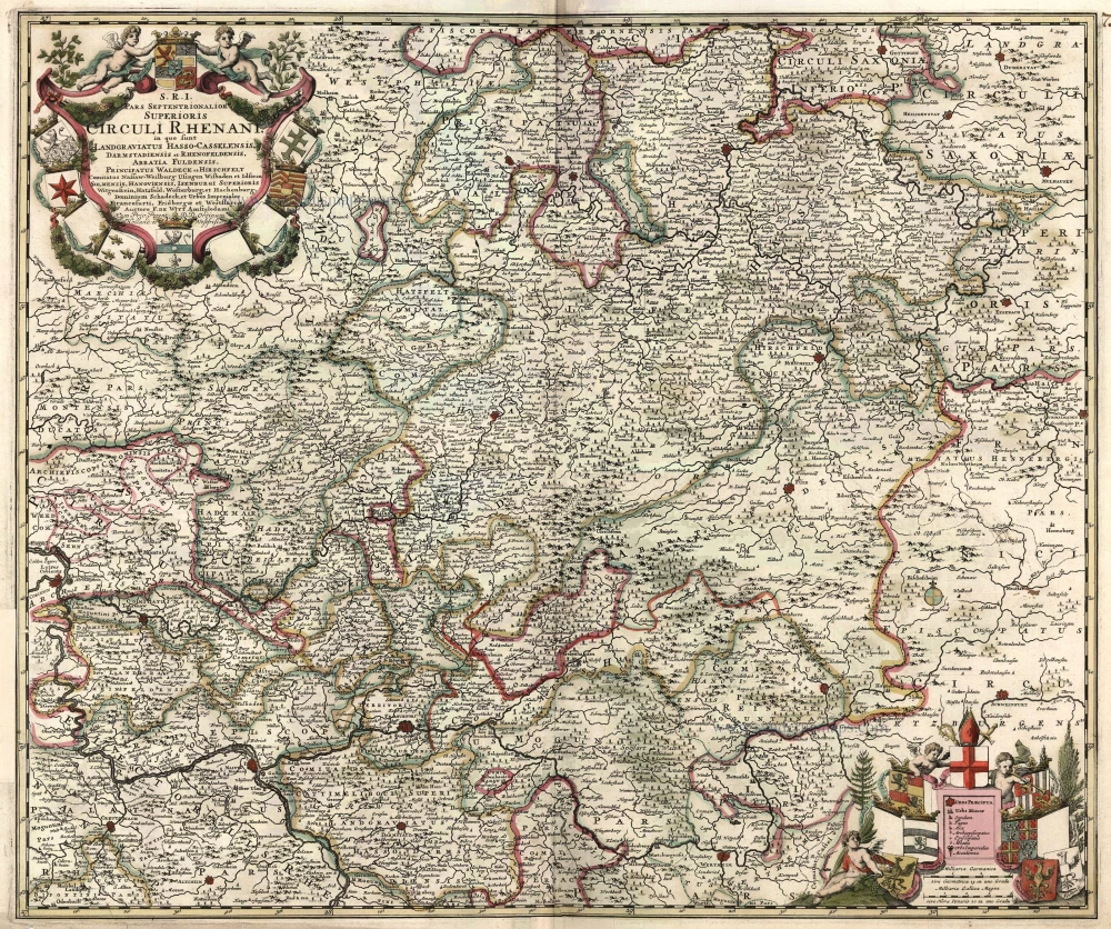
S.R.I. Pars Septentrionalor Superioris Circuli Rhenani, c. 1715
Rheinland-Pfalz, by Frederick de Wit - Covens & Mortier.
[Item number: 1265]

Scarce
Palatinatus Rheni & Circumiacentes Regiones, Alsatica, Witebergica, Zweibruckselis 1593
Rheinland-Pfalz by Gerard de Jode.
[Item number: 5335]
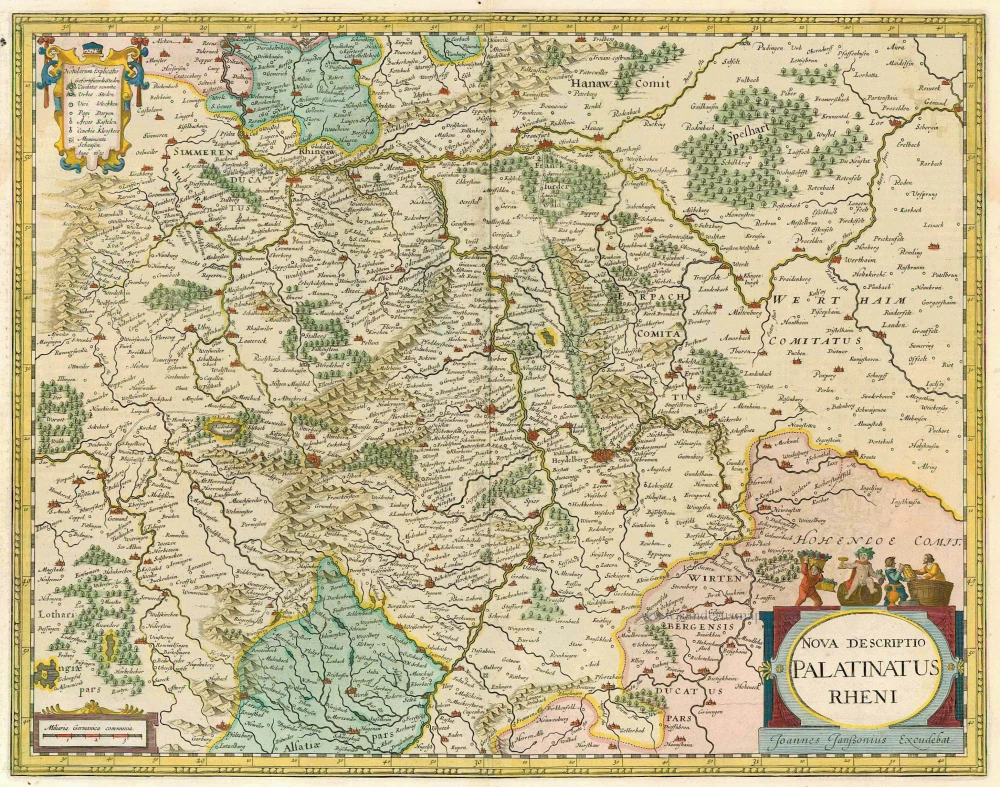
Nova Descriptio Palatinatus Rheni 1633
Rheinpfalz, by J. Janssonius.
[Item number: 7797]
S.R.I. Pars Septentrionalor Superioris Circuli Rhenani, ... c. 1680
Rheinland-Pfalz, by F. De Wit.
[Item number: 10613]
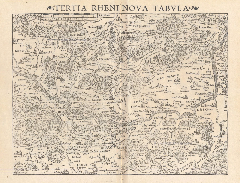
Tertia Rheni Nova Tabula 1542
Rheinland-Pfalz, by Sebastian Münster.
[Item number: 15390]

Palatinatus ad Rhenum. 1642-43
Rheinpfalz, by Blaeu W.
[Item number: 18718]

Palatinatus Bavariae Descriptio, Erhardo Reych Tirolense Auctore [on sheet with] Argentoratensis Agri Descriptio 1603
Oberpfalz and the vicinity of Strasbourg, by Ortelius A.
[Item number: 22834]

Partie Occidentale du Palatinat et Eslectorat du Rhein Le Duché de Simmeren, Les Comtés de Spanheim et de Veldentz à la Maison Palatine. 1710
Rheinland-Pfalz, by Covens & Mortier.
[Item number: 23829]
Electoratus et Palatinatus Rheni Episcopatuum Spirensis et Wormacensis Ducatuum Bipontii et Simmerae et Comitatuum Sponheimensis Veldensis Leiningensis Bircofeldensis et Rhenograviorum etc. c. 1680
Rheinland-Pfalz by Frederik De Wit.
[Item number: 24426]
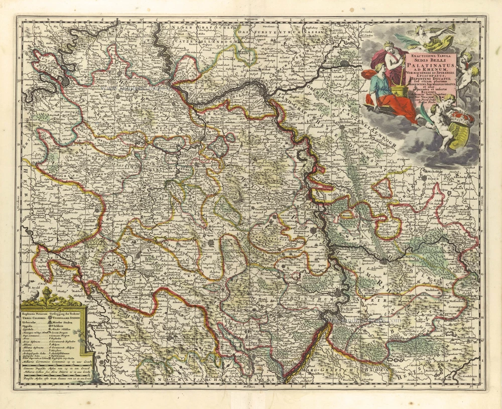
Exactissima Tabula Sedis Belli Palatinatus ad Rhenum, Vormaciensis et Spirensis Episcopatus, Bipontini Ducatus; sed etiam plurimae Moguntini Archiepiscopatus, et aliae adjacentes et insertae Regiones, distincte ostenduntur. c. 1716.
Rheinland-Pfalz by Nicolas Visscher II.
[Item number: 29657]

Palatinatus ad Rhenum. 1653
Rheinpfalz by Johannes Janssonius.
[Item number: 30339]