
Rheinland-Pfalz, by Sebastian Münster. 1542


Sebastian Münster (1488-1552)
Sebastian Münster, a German geographer, cartographer, Hebraist, and theologian, was born in Ingelheim, near Mainz In 1505, he went to Heidelberg to enter the Franciscan order. In 1507 he went to Louvain, where he studied mathematics, geography, and astronomy. In 1509 Münster became a student of Konrad Pelikan, who taught Hebrew and Greek as well as mathematics and cosmography. In 1518 he completed his studies at the University of Tübingen. He was the favorite of the famous mathematician and astronomer Johann Stöffler.
In 1524 Münster was appointed professor of Hebrew at Heidelberg University. In 1525 he published his first map as part of a broadside: The Instrument of the Suns combined a map, calendar, astrological almanac, sundial, and nocturnal on one attractive sheet, suitable for wall mounting.
In 1540 he published a Latin edition of Ptolemy's Geographia with illustrations. He based this edition on the Latin translation by Willibald Pirkheimer and produced new maps to supplement the Ptolemaic maps. The twenty-seven maps of the Ptolemaic canon are supplemented by twenty-one new maps. Further editions appeared in 1541 and 1542.
In 1544 he published the Cosmographia, a bulky book with 659 pages and some 520 woodcuts. Maps in this edition included three maps from the Ptolemaic canon and fourteen modern maps (from previous editions of the Geographia), as well as nine new maps. Later editions (1545, 1546, 1548) enlarged the Cosmographia. The 1550 edition contains cities, portraits, and costumes. These editions in both Latin and German constitute the full fruition of Münster's dream of a comprehensive geography.
The Cosmographia was one of the most successful works of the 16th century. It passed through 24 editions in 100 years, in different languages, including Latin, French, Italian, English, and even Czech. The last German edition was published in 1628.
He died at Basel of the plague in 1552.
As a cartographer, Münster deserves special recognition for formulating a plan for a comprehensive and uniform map of a country. As a geographer, his greatest achievement was the Cosmographia. (Karrow).
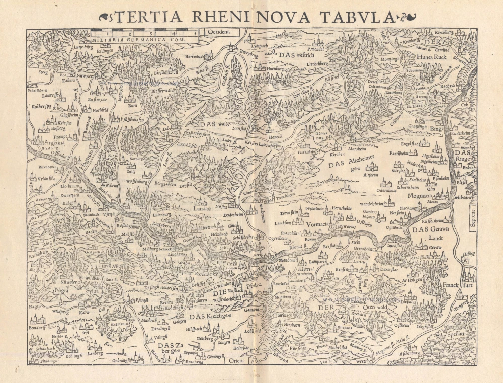
Tertia Rheni Nova Tabula
Item Number: 15390 Authenticity Guarantee
Category: Antique maps > Europe > Germany
Old, antique map of Rheinland-Pfalz, by Sebastian Münster.
Title: Tertia Rheni Nova Tabula
Date of the first edition: 1540.
Date of this map: 1542.
Woodcut, printed on paper.
Size (not including margins): 260 x 340mm (10.24 x 13.39 inches).
Verso: Latin text.
Condition: Excellent.
Condition Rating: A+.
From: Geographia Universalis, Vetus et Nova, complectens Claudii Prolemaei Alexandrini enarrationis libros VIII. Basel, Heinrich Petri, 1542.
Sebastian Münster (1488-1552)
Sebastian Münster, a German geographer, cartographer, Hebraist, and theologian, was born in Ingelheim, near Mainz In 1505, he went to Heidelberg to enter the Franciscan order. In 1507 he went to Louvain, where he studied mathematics, geography, and astronomy. In 1509 Münster became a student of Konrad Pelikan, who taught Hebrew and Greek as well as mathematics and cosmography. In 1518 he completed his studies at the University of Tübingen. He was the favorite of the famous mathematician and astronomer Johann Stöffler.
In 1524 Münster was appointed professor of Hebrew at Heidelberg University. In 1525 he published his first map as part of a broadside: The Instrument of the Suns combined a map, calendar, astrological almanac, sundial, and nocturnal on one attractive sheet, suitable for wall mounting.
In 1540 he published a Latin edition of Ptolemy's Geographia with illustrations. He based this edition on the Latin translation by Willibald Pirkheimer and produced new maps to supplement the Ptolemaic maps. The twenty-seven maps of the Ptolemaic canon are supplemented by twenty-one new maps. Further editions appeared in 1541 and 1542.
In 1544 he published the Cosmographia, a bulky book with 659 pages and some 520 woodcuts. Maps in this edition included three maps from the Ptolemaic canon and fourteen modern maps (from previous editions of the Geographia), as well as nine new maps. Later editions (1545, 1546, 1548) enlarged the Cosmographia. The 1550 edition contains cities, portraits, and costumes. These editions in both Latin and German constitute the full fruition of Münster's dream of a comprehensive geography.
The Cosmographia was one of the most successful works of the 16th century. It passed through 24 editions in 100 years, in different languages, including Latin, French, Italian, English, and even Czech. The last German edition was published in 1628.
He died at Basel of the plague in 1552.
As a cartographer, Münster deserves special recognition for formulating a plan for a comprehensive and uniform map of a country. As a geographer, his greatest achievement was the Cosmographia. (Karrow).
Related items

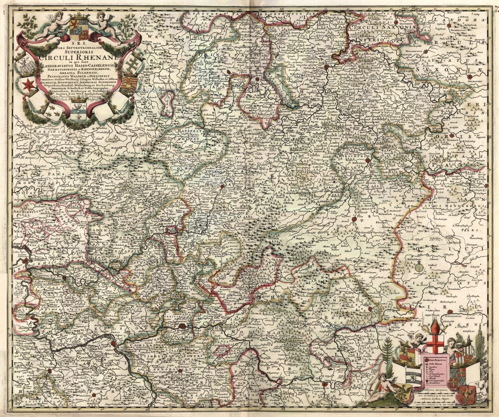
S.R.I. Pars Septentrionalor Superioris Circuli Rhenani, c. 1715
Rheinland-Pfalz, by Frederick de Wit - Covens & Mortier.
[Item number: 1265]

Scarce
Palatinatus Rheni & Circumiacentes Regiones, Alsatica, Witebergica, Zweibruckselis 1593
Rheinland-Pfalz by Gerard de Jode.
[Item number: 5335]
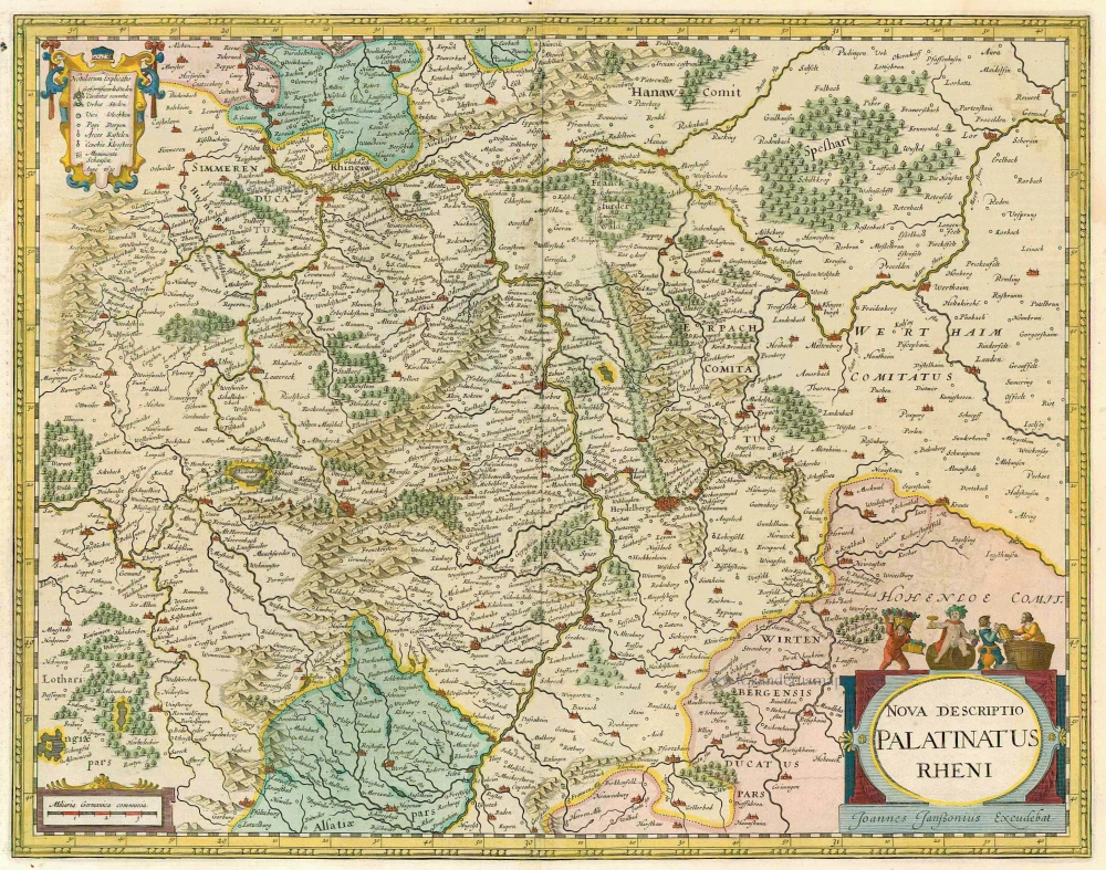
Nova Descriptio Palatinatus Rheni 1633
Rheinpfalz, by J. Janssonius.
[Item number: 7797]

Palatinatus Bavariae. 1659-72
The Oberpfalz, by Willem Blaeu.
[Item number: 9806]
S.R.I. Pars Septentrionalor Superioris Circuli Rhenani, ... c. 1680
Rheinland-Pfalz, by F. De Wit.
[Item number: 10613]

Palatinatus Bavariae 1619
Oberpfalz, by G. Mercator.
[Item number: 11701]

Palatinatus ad Rhenum. 1642-43
Rheinpfalz, by Blaeu W.
[Item number: 18718]

Palatinatus Bavariae Descriptio, Erhardo Reych Tirolense Auctore [on sheet with] Argentoratensis Agri Descriptio 1603
Oberpfalz and the vicinity of Strasbourg, by Ortelius A.
[Item number: 22834]

Partie Occidentale du Palatinat et Eslectorat du Rhein Le Duché de Simmeren, Les Comtés de Spanheim et de Veldentz à la Maison Palatine. 1710
Rheinland-Pfalz, by Covens & Mortier.
[Item number: 23829]
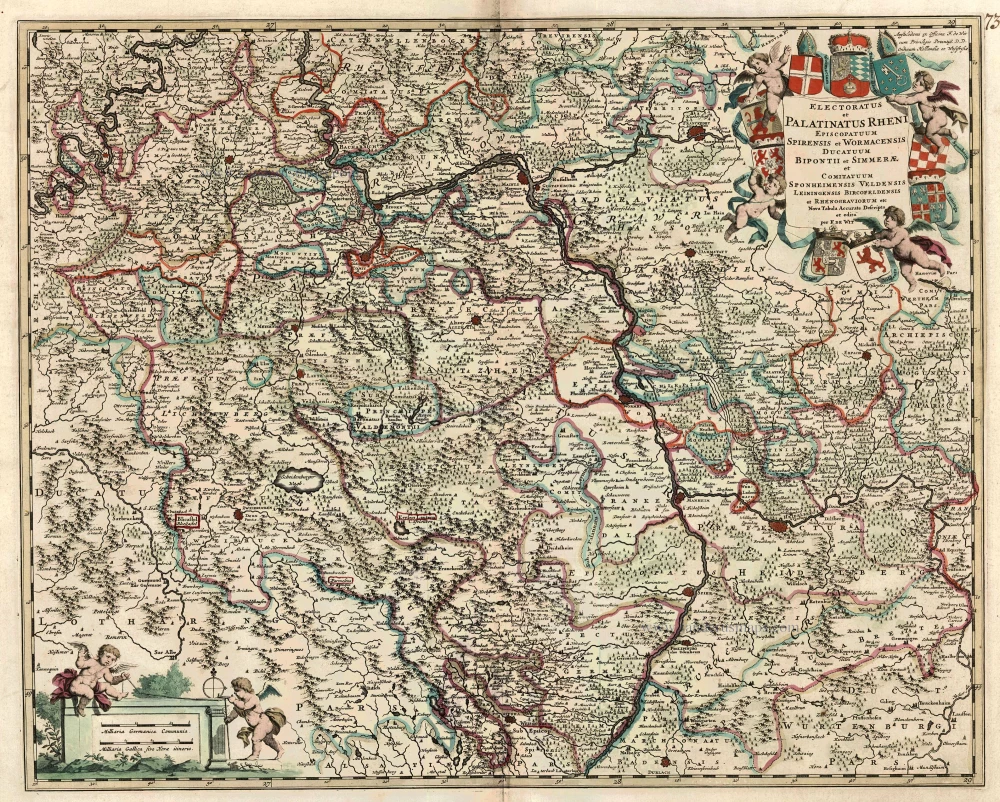
Electoratus et Palatinatus Rheni Episcopatuum Spirensis et Wormacensis Ducatuum Bipontii et Simmerae et Comitatuum Sponheimensis Veldensis Leiningensis Bircofeldensis et Rhenograviorum etc. c. 1680
Rheinland-Pfalz by Frederik De Wit.
[Item number: 24426]

Palatinatus Rheni 1623
Rheinpfalz , by G. Mercator.
[Item number: 24965]

Tabu Provi. Rheni. 1525
Rheinland-Pfalz (Lorraine on verso) by Lorenz Fries.
[Item number: 28200]

Palatinatus Rheni Nova et Accurata Descriptio. 1656-80
Rheinland-Pfalz by Nicolaes Visscher I.
[Item number: 28592]
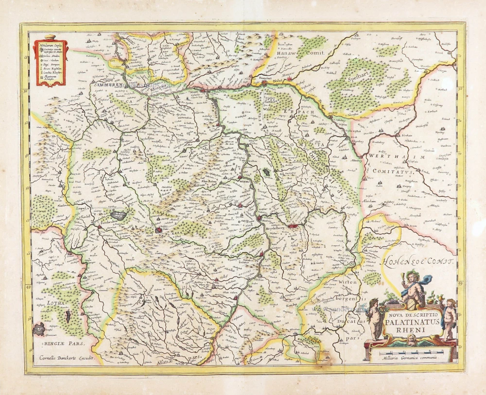
Nova Descriptio Palatinatus Rheni. c. 1640
The Rhine-Palatinate (Rheinpfalz), by Cornelis Danckerts.
[Item number: 29013]
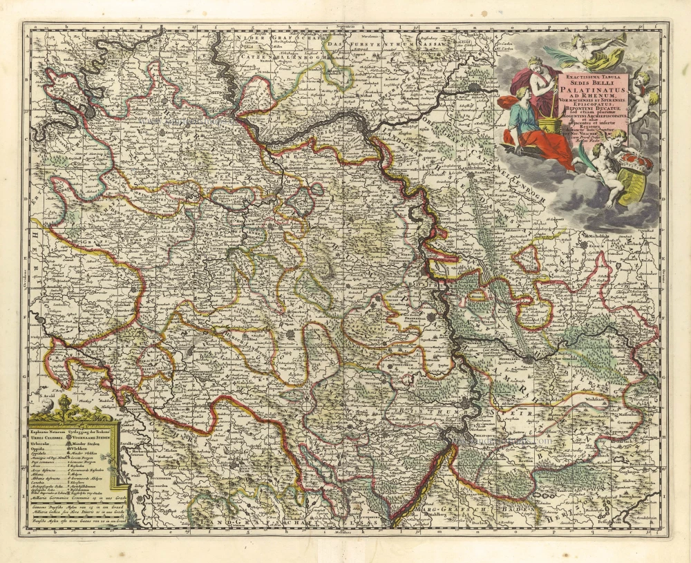
Exactissima Tabula Sedis Belli Palatinatus ad Rhenum, Vormaciensis et Spirensis Episcopatus, Bipontini Ducatus; sed etiam plurimae Moguntini Archiepiscopatus, et aliae adjacentes et insertae Regiones, distincte ostenduntur. c. 1716.
Rheinland-Pfalz by Nicolas Visscher II.
[Item number: 29657]

Palatinat du Rhein, Alsace, et Partie de Souabe de Franconie &c. 1652
Rheinland-Pfalz by Nicolas Sanson.
[Item number: 29696]