
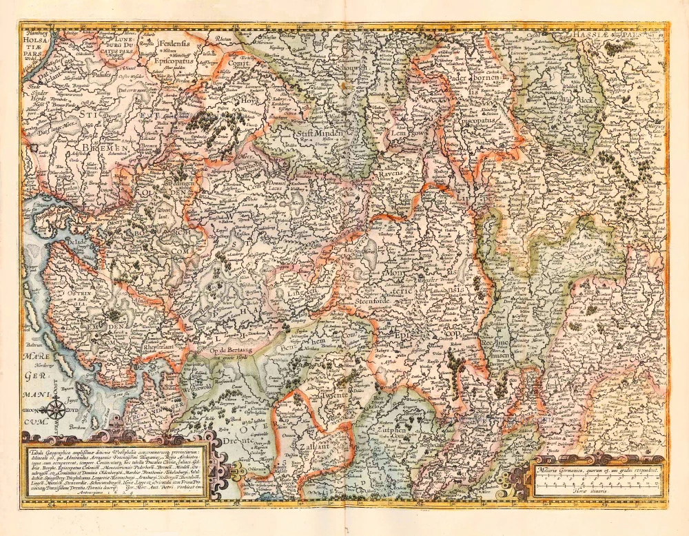
Westfalen, by Abraham Ortelius. 1601


Abraham Ortelius (1527-1598)
The maker of the 'first atlas', the Theatrum Orbis Terrarum (1570), was born on 4 April 1527 into an old Antwerp family. He learned Latin and studied Greek and mathematics.
Abraham and his sisters Anne and Elizabeth took up map colouring. He was admitted to the Guild of St. Luke as an "illuminator of maps." Besides colouring maps, Ortelius was a dealer in antiques, coins, maps, and books, with the book and map trade gradually becoming his primary occupation.
Business went well because his means permitted him to start an extensive collection of medals, coins, antiques, and a library of many volumes. In addition, he travelled a lot and visited Italy and France, made contacts everywhere with scholars and editors, and maintained extensive correspondence with them.
In 1564 he published his first map, a large and ambitious world wall map. The inspiration for this map may well have been Gastaldi's large world map. In 1565 he published a map of Egypt and a map of the Holy Land, a large map of Asia followed.
In 1568 the production of individual maps for his atlas Theatrum Orbis Terrarum was already in full swing. He completed the atlas in 1569, and in May of 1570, the Theatrum was available for sale. It was one of the most expensive books ever published.
This first edition contained seventy maps on fifty-three sheets. Franciscus Hogenberg engraved the maps.
Later editions included Additamenta (additions), resulting in Ortelius' historical atlas, the Parergon, mostly bound together with the atlas. The Parergon can be called a truly original work of Ortelius, who drew the maps based on his research.
The importance of the Theatrum Orbis Terrarum for geographical knowledge in the last quarter of the sixteenth century is difficult to overemphasize. Nothing was like it until Mercator's atlas appeared twenty-five years later. Demand for the Theatrum was remarkable. Some 24 editions appeared during Ortelius's lifetime and another ten after his death in 1598. Editions were published in Dutch, German, French, Spanish, English, and Italian. The number of map sheets grew from 53 in 1570 to 167 in 1612 in the last edition.
In 1577, engraver Philip Galle and poet-translator Pieter Heyns published the first pocket-sized edition of the Theatrum, the Epitome. The work was trendy. Over thirty editions of this Epitome were published in different languages.
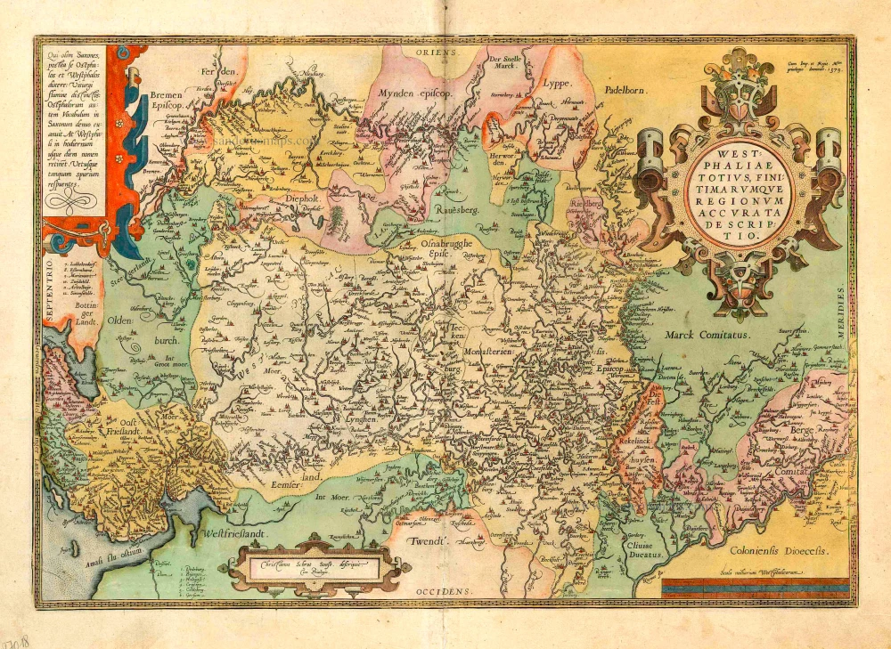
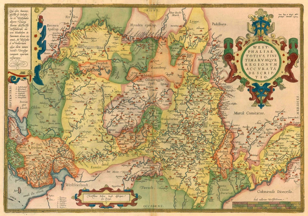
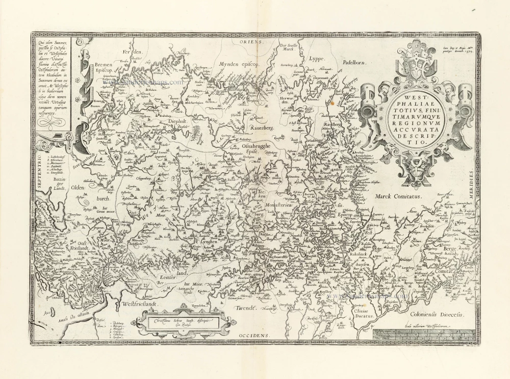
Westphaliae totius, finitimarumque Regionum accurata descriptio.
Item Number: 27018 Authenticity Guarantee
Category: Antique maps > Europe > Germany
Old antique map of Westfalen, by Abraham Ortelius.
Title: Westphaliae totius, finitimarumque Regionum accurata descriptio.
Cum Imp, et Regie Mtm privilegio decennali. 1579.
Christianus Schrot Sonsb. descripsit. Cum Privilegio.
Oriented to the east.
Cartographer: Christian Sgroten.
Date of the first edition: 1579.
Date of this map: 1601.
Date on map: 1579.
Copper engraving, printed on paper.
Size (not including margins): 340 x 495mm (13.39 x 19.49 inches).
Verso: Latin text.
Condition: Original coloured, excellent.
Condition Rating: A+.
From: Ortelius A.,Theatrum Orbis Terrarum Abrahami Ortelii Antverp. Geographi Regii. Antwerpen, Plantin Press, 1601. (Van der Krogt 3, 1:052)
Abraham Ortelius (1527-1598)
The maker of the 'first atlas', the Theatrum Orbis Terrarum (1570), was born on 4 April 1527 into an old Antwerp family. He learned Latin and studied Greek and mathematics.
Abraham and his sisters Anne and Elizabeth took up map colouring. He was admitted to the Guild of St. Luke as an "illuminator of maps." Besides colouring maps, Ortelius was a dealer in antiques, coins, maps, and books, with the book and map trade gradually becoming his primary occupation.
Business went well because his means permitted him to start an extensive collection of medals, coins, antiques, and a library of many volumes. In addition, he travelled a lot and visited Italy and France, made contacts everywhere with scholars and editors, and maintained extensive correspondence with them.
In 1564 he published his first map, a large and ambitious world wall map. The inspiration for this map may well have been Gastaldi's large world map. In 1565 he published a map of Egypt and a map of the Holy Land, a large map of Asia followed.
In 1568 the production of individual maps for his atlas Theatrum Orbis Terrarum was already in full swing. He completed the atlas in 1569, and in May of 1570, the Theatrum was available for sale. It was one of the most expensive books ever published.
This first edition contained seventy maps on fifty-three sheets. Franciscus Hogenberg engraved the maps.
Later editions included Additamenta (additions), resulting in Ortelius' historical atlas, the Parergon, mostly bound together with the atlas. The Parergon can be called a truly original work of Ortelius, who drew the maps based on his research.
The importance of the Theatrum Orbis Terrarum for geographical knowledge in the last quarter of the sixteenth century is difficult to overemphasize. Nothing was like it until Mercator's atlas appeared twenty-five years later. Demand for the Theatrum was remarkable. Some 24 editions appeared during Ortelius's lifetime and another ten after his death in 1598. Editions were published in Dutch, German, French, Spanish, English, and Italian. The number of map sheets grew from 53 in 1570 to 167 in 1612 in the last edition.
In 1577, engraver Philip Galle and poet-translator Pieter Heyns published the first pocket-sized edition of the Theatrum, the Epitome. The work was trendy. Over thirty editions of this Epitome were published in different languages.
Related items

[No title] 1636
Central Westfalen, by Gerard Mercator, published by Henricus Hondius.
[Item number: 7356]
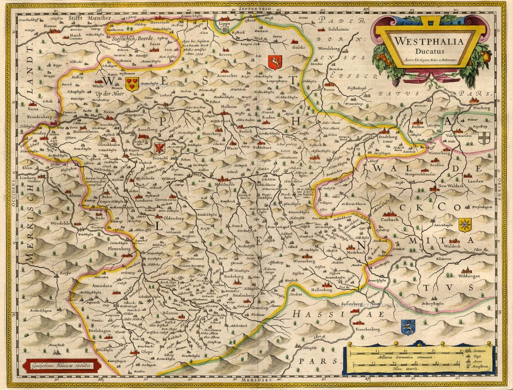
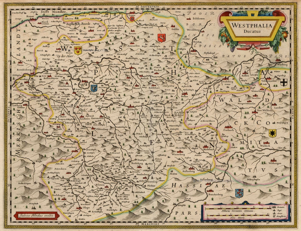
Westphalia Ducatus. 1662
Westfalen, by Blaeu W. & J.
[Item number: 9687]
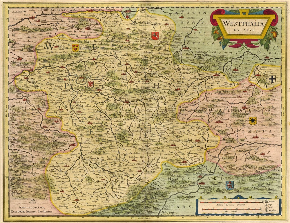
Westphalia Ducatus 1636
Westfalen by Hondius-Janssonius.
[Item number: 9712]

S.R.I. Circulus Westphalicus in quo sunt Episcopatus Monarsteriensis Paderbornensis et Osnabrugiensis, Ducatus Iuliasnensis, Clivensis, et Montensis, Principatus Mindensis, Ferdensis et Frisiae Orientalis, Comitatus Marchiae, Oldenburgi, Ravenspergae ... c. 1680
Rheinland-Westfalen & Nieder Sachsen, by F. De Wit.
[Item number: 10569]
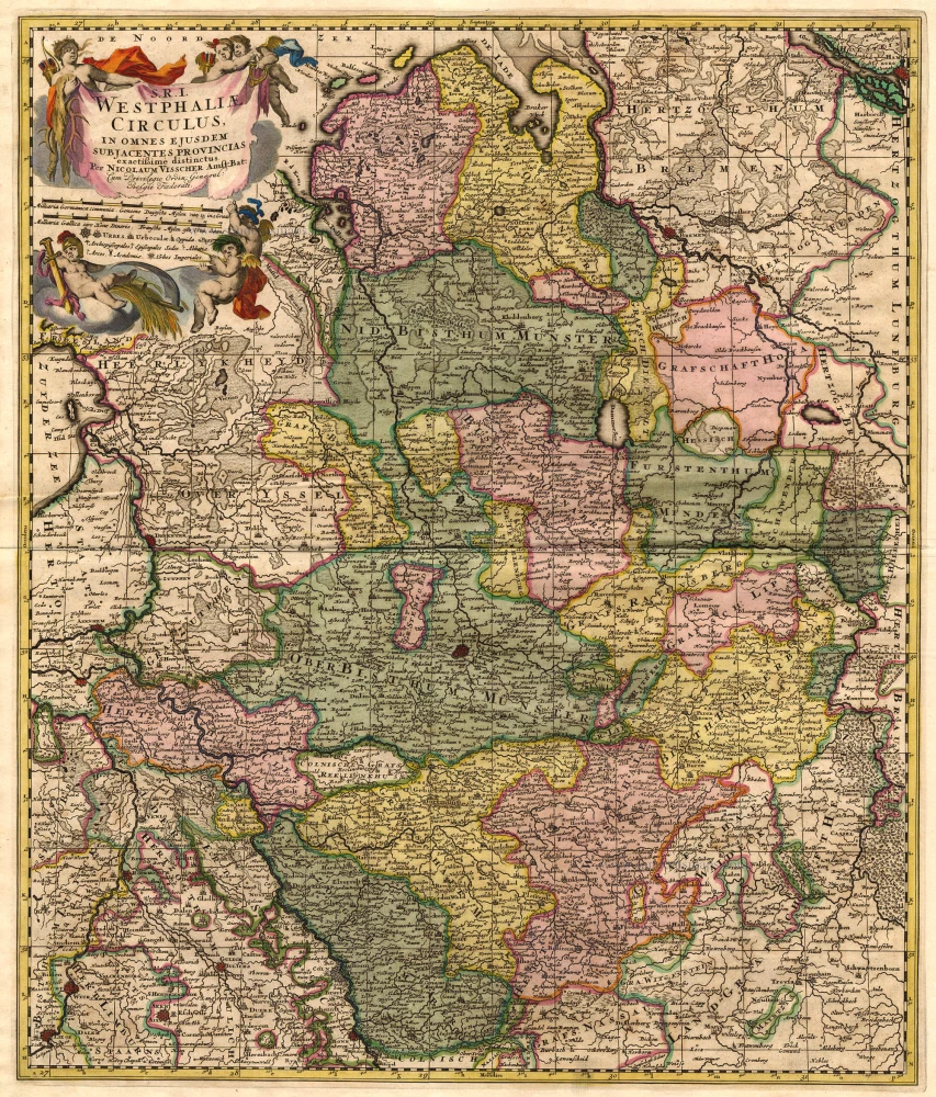
S.R.I. Westphaliae Circulus, in omnes ejusdem subjacentes Provincias. 1683-1696
Westfalen, by Visscher N. II.
[Item number: 18690]
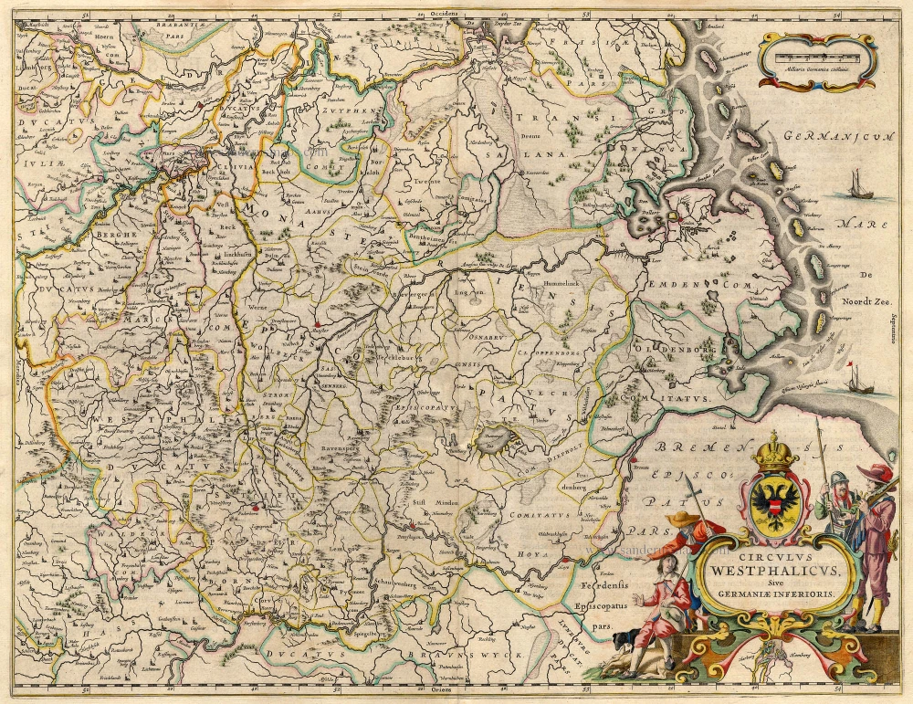
Circulus Westphalicus sive Germaniae Inferioris 1642-43
Westfalen, by Blaeu W.
[Item number: 18715]
Westphalia Ducatus. 1630
Westfalen, by Hondius J.
[Item number: 18975]
Westphaliae totius, finitimarumque Regionum accurata descriptio. 1603
Antique map of Westfalen by A. Ortelius
[Item number: 22878]
Westphaliae totius, finitimarumque Regionum accurata descriptio. 1612
Westfalen by Ortelius A.
[Item number: 23121]
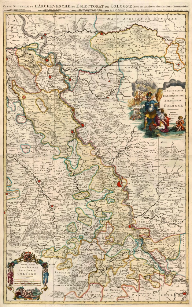
Carte Nouvelle de L'Archevesché et Eslectorat de Cologne avec ses Enclaves dans les Pays Circomvoisins. 1710
Westphalia (Westfalen), by N. Sanson - Covens & Mortier.
[Item number: 23837]
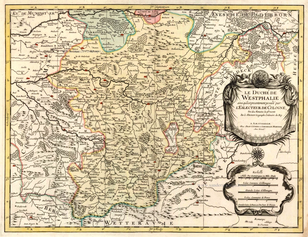
Le Duché de Westphalie ainsi qu'il est presentement possedé par l'Eslecteur de Cologne 1710
Westphalia (Westfalen), by N. Sanson - Covens & Mortier.
[Item number: 23838]
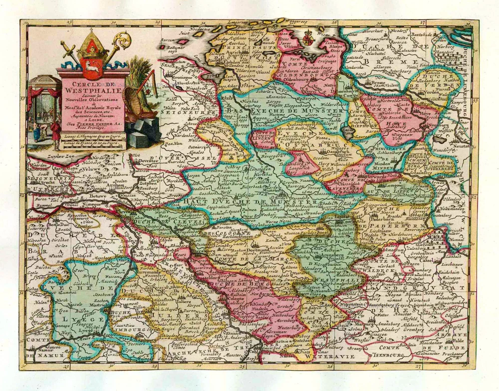
Cercle de Westphalie. 1713
Westfalen, by Pieter van der Aa.
[Item number: 26190]
Tabula Geographica amplißimae ditionis Westphaliae conterminarumq provinciarium: delineata eo, quo Admirandus Arragoniae Potentißimi Hispaniar Regis Archistrategus, eam occupaverat, tempore. Continenturq haec tabella Ducatus Cliviae, Juliaci, Geldriae, Be 1624
*** Extremely rare map of Westphalia, by Pieter Verbiest. ***
[Item number: 27741]