
Orvieto - Lauretum, by Braun & Hogenberg. 1581-88
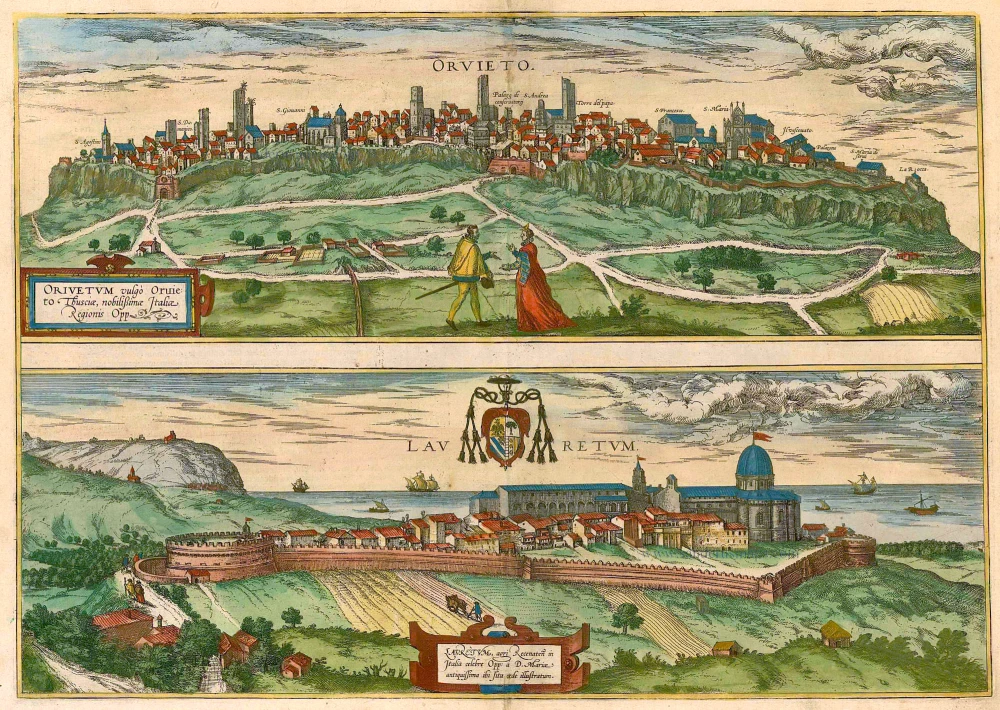
ORVIETO
TRANSLATION OF CARTOUCHE TEXT: Orivetum, in Italian Orvieto, a town in the well-known Italian region of Tuscia.
COMMENTARY BY BRAUN: "Orvieto is a city in the heart of Etruria, lying on the flat top of a vast rocky plateau in a range of steep hills. It has no city walls but is surrounded by craggy and high scarps. There is an extremely great cathedral whose façade is adorned with celebrated marble statues sculpted by the greatest artists. Among other things, they show the story of the rib that was taken from Adam by the Supreme Creator to create Eve."
This is a view of Orvieto from the southwest, showing the distinctive city rock and characteristic dynastic towers. The magnificent façade of the cathedral of Santa Maria is easily recognizable on the right. Its construction was begun in 1290 following the Miracle of Bolsena (1293), in which blood dripped out of a consecrated host during transubstantiation. Among other things, this miracle gave rise to the feast of Corpus Christi. Orvieto probably developed out of the Etruscan city of Velzna, which was captured by the Romans in 264 BC. They subsequently called it Urbs Vetus ("Old City"), which became Orivetum and Orvieto.
LORETO
CARTOUCHE: Loreto, a famous town near Recanati, is adorned by an ancient church dedicated to the Virgin Mary.
COMMENTARY BY BRAUN: "Loreto is renowned throughout the Christian world as a place of pilgrimage; it lies on the hill dedicated to Our Lady of Loreto and is surrounded by mighty walls that contain a village inhabited by no more than innkeepers, hostlers and tavern servants of all kinds - except for those who come here daily from all over Europe, especially in spring and autumn, to fulfil their vow. The entire sanctuary is so well protected by thick walls and all possible weapons that it is capable not only of defending itself but also, for instance, of counter-attacking, for example, by firing guns, so that it will never again be plundered and destroyed by pirates, as once by the Turks."
Loreto is shown from the southwest. Inside the imposing town walls, a few houses are grouped around the basilica. Here stands the Santa Casa, the Holy House, which is said to have been brought to Loreto from Nazareth by angels in 1294. It is believed to be the house in which Mary was born and in which the Annunciation by the angel took place. Loreto is still an important place of pilgrimage today.
Braun G. & Hogenberg F. and the Civitates Orbis Terrarum.
The Civitates Orbis Terrarum, also known as the 'Braun & Hogenberg', is a six-volume town atlas and the most excellent book of town views and plans ever published: 363 engravings, sometimes beautifully coloured. It was one of the best-selling works in the last quarter of the 16th century. Georg Braun, a skilled writer, wrote the text accompanying the plans and views on the verso. Many plates were engraved after the original drawings of a professional artist, Joris Hoefnagel (1542-1600). The first volume was published in Latin in 1572 and the sixth in 1617. Frans Hogenberg, a talented engraver, created the tables for volumes I through IV, and Simon van den Neuwel made those for volumes V and VI. Other contributors were cartographers Daniel Freese and Heinrich Rantzau, who provided valuable geographical information. Works by Jacob van Deventer, Sebastian Münster, and Johannes Stumpf were also used as references. Translations appeared in German and French, making the atlas accessible to a broader audience.
Since its original publication of volume 1 in 1572, the Civitates Orbis Terrarum has left an indelible mark on the history of cartography. Seven more editions followed the first volume in 1575, 1577, 1582, 1588, 1593, 1599, and 1612. Vol.2, initially released in 1575, saw subsequent editions in 1597 and 1612. The subsequent volumes, each a treasure trove of historical insights, graced the world in 1581, 1588, 1593, 1599, and 1606. The German translation of the first volume, a testament to its widespread appeal, debuted in 1574, followed by the French edition in 1575.
Several printers were involved: Theodor Graminaeus, Heinrich von Aich, Gottfried von Kempen, Johannis Sinniger, Bertram Buchholtz, and Peter von Brachel, all of whom worked in Cologne.
Georg Braun (1541-1622)
Georg Braun, the author of the text accompanying the plans and views in the Civitates Orbis Terrarum, was born in Cologne in 1541. After his studies in Cologne, he entered the Jesuit Order as a novice, indicating his commitment to learning and intellectual pursuits. In 1561, he obtained his bachelor's degree; in 1562, he received his Magister Artium, further demonstrating his academic achievements. Although he left the Jesuit Order, he continued his studies in theology, gaining a licentiate in theology. His theological background likely influenced the content and tone of the text in the Civitates Orbis Terrarum, adding a unique perspective to the work.
Frans Hogenberg (1535-1590)
Frans Hogenberg was a Flemish and German painter, engraver, and mapmaker. He was born in Mechelen as the son of Nicolaas Hogenberg.
By the end of the 1560s, Frans Hogenberg was employed upon Abraham Ortelius's Theatrum Orbis Terrarum, published in 1570; he is named an engraver of numerous maps. In 1568, he was banned from Antwerp by the Duke of Alva and travelled to London, where he stayed a few years before emigrating to Cologne. He immediately embarked on his two most important works, the Civitates, published in 1572 and the Geschichtsblätter, which appeared in several series from 1569 until about 1587.
Thanks to large-scale projects like the Geschichtsblätter and the Civitates, Hogenberg's social circumstances improved with each passing year. He died as a wealthy man in Cologne in 1590.
Orvieto [on sheet with] with Lauretum
Currently not available
Item Number: 2673 Authenticity Guarantee
Category: Antique maps > Europe > Italy - Cities
Old, antique map with two bird’s-eye views: Orvieto and Loreto, by Georg Braun & Frans Hogenberg.
Title: Orvieto [on sheet with] Lauretum.
Copper engraving, printed on paper.
Size (not including margins): 345 x 490mm (13.58 x 19.29 inches).
Verso: Latin text.
Condition: Old coloured, centrefold split reinforced.
Condition Rating: A
From: Civitates Orbis Terrarum. . Liber tertius. Köln, G. Kempen, 1581-88. (Koeman, B&H3)
ORVIETO
TRANSLATION OF CARTOUCHE TEXT: Orivetum, in Italian Orvieto, a town in the well-known Italian region of Tuscia.
COMMENTARY BY BRAUN: "Orvieto is a city in the heart of Etruria, lying on the flat top of a vast rocky plateau in a range of steep hills. It has no city walls but is surrounded by craggy and high scarps. There is an extremely great cathedral whose façade is adorned with celebrated marble statues sculpted by the greatest artists. Among other things, they show the story of the rib that was taken from Adam by the Supreme Creator to create Eve."
This is a view of Orvieto from the southwest, showing the distinctive city rock and characteristic dynastic towers. The magnificent façade of the cathedral of Santa Maria is easily recognizable on the right. Its construction was begun in 1290 following the Miracle of Bolsena (1293), in which blood dripped out of a consecrated host during transubstantiation. Among other things, this miracle gave rise to the feast of Corpus Christi. Orvieto probably developed out of the Etruscan city of Velzna, which was captured by the Romans in 264 BC. They subsequently called it Urbs Vetus ("Old City"), which became Orivetum and Orvieto.
LORETO
CARTOUCHE: Loreto, a famous town near Recanati, is adorned by an ancient church dedicated to the Virgin Mary.
COMMENTARY BY BRAUN: "Loreto is renowned throughout the Christian world as a place of pilgrimage; it lies on the hill dedicated to Our Lady of Loreto and is surrounded by mighty walls that contain a village inhabited by no more than innkeepers, hostlers and tavern servants of all kinds - except for those who come here daily from all over Europe, especially in spring and autumn, to fulfil their vow. The entire sanctuary is so well protected by thick walls and all possible weapons that it is capable not only of defending itself but also, for instance, of counter-attacking, for example, by firing guns, so that it will never again be plundered and destroyed by pirates, as once by the Turks."
Loreto is shown from the southwest. Inside the imposing town walls, a few houses are grouped around the basilica. Here stands the Santa Casa, the Holy House, which is said to have been brought to Loreto from Nazareth by angels in 1294. It is believed to be the house in which Mary was born and in which the Annunciation by the angel took place. Loreto is still an important place of pilgrimage today.
Braun G. & Hogenberg F. and the Civitates Orbis Terrarum.
The Civitates Orbis Terrarum, also known as the 'Braun & Hogenberg', is a six-volume town atlas and the most excellent book of town views and plans ever published: 363 engravings, sometimes beautifully coloured. It was one of the best-selling works in the last quarter of the 16th century. Georg Braun, a skilled writer, wrote the text accompanying the plans and views on the verso. Many plates were engraved after the original drawings of a professional artist, Joris Hoefnagel (1542-1600). The first volume was published in Latin in 1572 and the sixth in 1617. Frans Hogenberg, a talented engraver, created the tables for volumes I through IV, and Simon van den Neuwel made those for volumes V and VI. Other contributors were cartographers Daniel Freese and Heinrich Rantzau, who provided valuable geographical information. Works by Jacob van Deventer, Sebastian Münster, and Johannes Stumpf were also used as references. Translations appeared in German and French, making the atlas accessible to a broader audience.
Since its original publication of volume 1 in 1572, the Civitates Orbis Terrarum has left an indelible mark on the history of cartography. Seven more editions followed the first volume in 1575, 1577, 1582, 1588, 1593, 1599, and 1612. Vol.2, initially released in 1575, saw subsequent editions in 1597 and 1612. The subsequent volumes, each a treasure trove of historical insights, graced the world in 1581, 1588, 1593, 1599, and 1606. The German translation of the first volume, a testament to its widespread appeal, debuted in 1574, followed by the French edition in 1575.
Several printers were involved: Theodor Graminaeus, Heinrich von Aich, Gottfried von Kempen, Johannis Sinniger, Bertram Buchholtz, and Peter von Brachel, all of whom worked in Cologne.
Georg Braun (1541-1622)
Georg Braun, the author of the text accompanying the plans and views in the Civitates Orbis Terrarum, was born in Cologne in 1541. After his studies in Cologne, he entered the Jesuit Order as a novice, indicating his commitment to learning and intellectual pursuits. In 1561, he obtained his bachelor's degree; in 1562, he received his Magister Artium, further demonstrating his academic achievements. Although he left the Jesuit Order, he continued his studies in theology, gaining a licentiate in theology. His theological background likely influenced the content and tone of the text in the Civitates Orbis Terrarum, adding a unique perspective to the work.
Frans Hogenberg (1535-1590)
Frans Hogenberg was a Flemish and German painter, engraver, and mapmaker. He was born in Mechelen as the son of Nicolaas Hogenberg.
By the end of the 1560s, Frans Hogenberg was employed upon Abraham Ortelius's Theatrum Orbis Terrarum, published in 1570; he is named an engraver of numerous maps. In 1568, he was banned from Antwerp by the Duke of Alva and travelled to London, where he stayed a few years before emigrating to Cologne. He immediately embarked on his two most important works, the Civitates, published in 1572 and the Geschichtsblätter, which appeared in several series from 1569 until about 1587.
Thanks to large-scale projects like the Geschichtsblätter and the Civitates, Hogenberg's social circumstances improved with each passing year. He died as a wealthy man in Cologne in 1590.
Related items
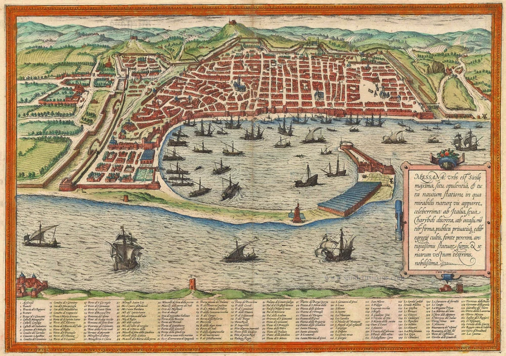
Messana, Urbs est Sicilie maxima, situ, opulentia, & tuta navium statione, ... 1574
Messina by Braun & Hogenberg
[Item number: 5497]
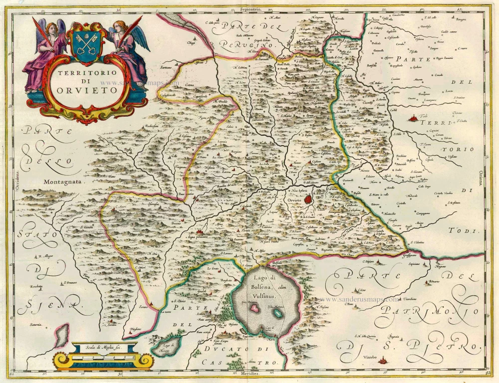
Territorio di Orvieto. 1664
Orvieto, by Willem & Joan Blaeu.
[Item number: 13002]
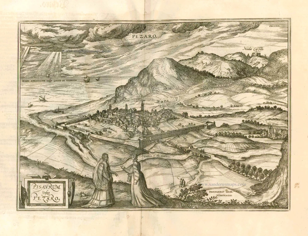
Pisaurum Vulgo Pezaro. 1582
Pesaro by Braun & Hogenberg.
[Item number: 14164]
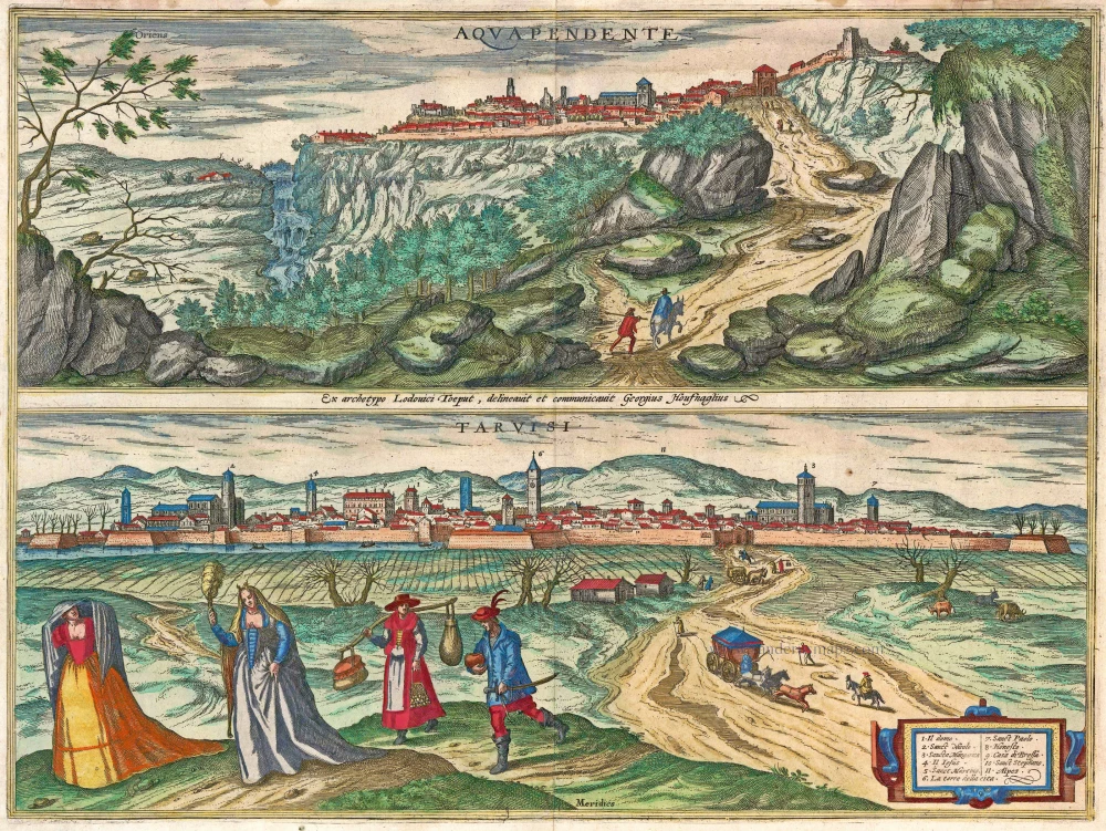
Aquapendente [on sheet with] Tarvisi c. 1610
Acquapendente and Tarvisio by Braun and Hogenberg.
[Item number: 14608]
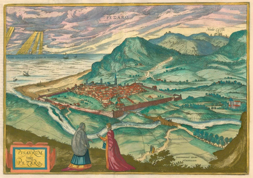
Pisaurum Vulgo Pezaro. 1588
Pesaro, by Braun & Hogenberg.
[Item number: 21465]
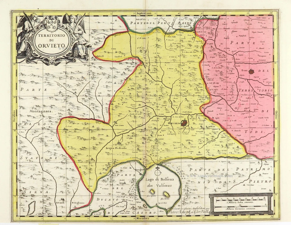
Territorio di Orvieto. c. 1700
Orvieto by Gerard Valk & Petrus Schenk
[Item number: 26757]