
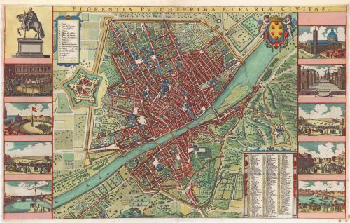
Florence (Firenze) by Pieter Van der Aa. 1714

Pieter van der Aa (Leiden, 1659-1733)
Pieter van der Aa was already in 1682 owner of a bookshop and auction house. During his life, he has published an enormous amount of printed material.
After 1700, van der Aa increasingly specialised in books on geography and travel.
He published composite atlases, a series of geographical descriptions of European countries, and some very spectacular works. Between 1706 and 1708 he published the Naauweurige versameling der gedenkwaardigste zee- en land-reysen, in 28 volumes.
Many of Van der Aa’s publications are richly illustrated with maps and plates. He took over many copperplates and prints from other publishers such as Carel Allard and Frederik De Wit. The composite atlases that appeared from his workshop contain a curious mixture of his own material, copies of maps from other publishers, and reprints made from old copper plates, now with his own imprint.
The Galérie agréable du monde, was completed in 1729, and comprised 66 parts, bound in 27 volumes. Van der Aa presented it as a good investment; after publication, the antiquarian value of the work would double, the more so since it was printed in a limited edition of only one hundred copies.
Florentia Pulcherrima et Ruriae Civitas.
Item Number: 28828 Authenticity Guarantee
Category: Antique maps > Europe > Italy - Cities
Florence (Firenze) by Pieter Van der Aa.
Title: Florentia Pulcherrima et Ruriae Civitas.
F. de Wit Excudit Amstelodami.
Date of the first edition: 1657.
Date of this map: 1728.
Copper engraving, printed on paper.
Map size: 455 x 730mm (17.91 x 28.74 inches).
Sheet size: 490 x 745mm (19.29 x 29.33 inches).
Verso: Blank.
Condition: Hand coloured, folds as issued, a few small tears reinforced at the edges.
Condition Rating: A.
From: La Galérie Agréable du Monde. Leiden, Pieter van der Aa, 1728.
With keys 1-17 (citadel), and 1-228, and the coat of arms of the De' Medici family.
Along the left and right border are nine scenes of the town and public games (each 7 x 10 cm) and the equestrian statue of Cosimo I de' Medici (made 1594) (12.5 x 10 cm).
Appeared original in the Town Books of Janssonius, 1657.
Pieter van der Aa (Leiden, 1659-1733)
Pieter van der Aa was already in 1682 owner of a bookshop and auction house. During his life, he has published an enormous amount of printed material.
After 1700, van der Aa increasingly specialised in books on geography and travel.
He published composite atlases, a series of geographical descriptions of European countries, and some very spectacular works. Between 1706 and 1708 he published the Naauweurige versameling der gedenkwaardigste zee- en land-reysen, in 28 volumes.
Many of Van der Aa’s publications are richly illustrated with maps and plates. He took over many copperplates and prints from other publishers such as Carel Allard and Frederik De Wit. The composite atlases that appeared from his workshop contain a curious mixture of his own material, copies of maps from other publishers, and reprints made from old copper plates, now with his own imprint.
The Galérie agréable du monde, was completed in 1729, and comprised 66 parts, bound in 27 volumes. Van der Aa presented it as a good investment; after publication, the antiquarian value of the work would double, the more so since it was printed in a limited edition of only one hundred copies.
Related items

Vue de la Rue de L'Arno et une partie de la Ville de Florence Ca. 1780
Florence - Optica
[Item number: 8152]

Vue du Superbe Jardin du Palais Pite nouvellement fait par l'archiduc de L'eaupol D autriche Ca. 1780
Florence (Firenze) by Basset (Paris)
[Item number: 17512]

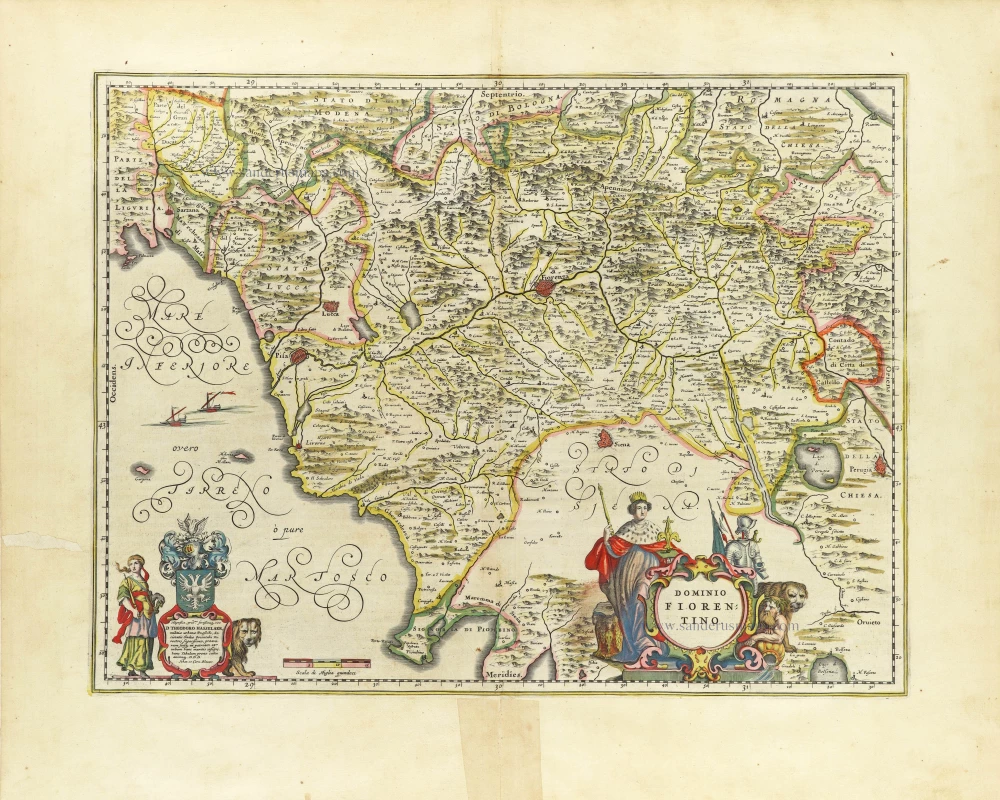
Dominio Fiorentino. c. 1700
Florence (Firenze), by Gerard Valk & Petrus Schenk.
[Item number: 26754]
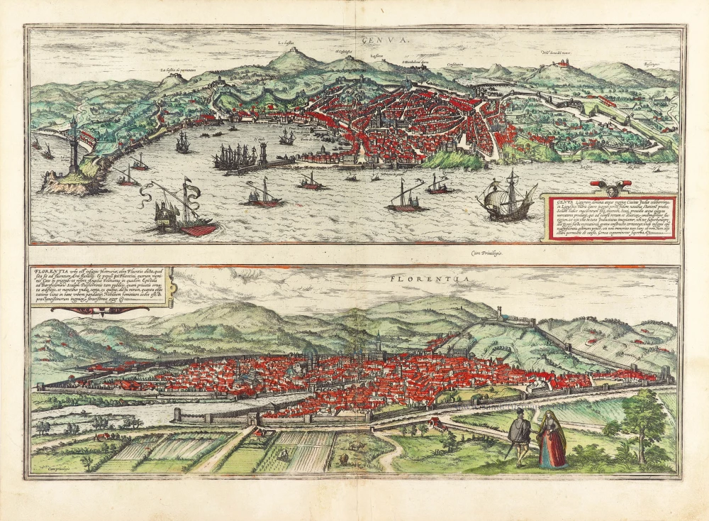
Genua Ligurum Domina [on sheet with] Florentia Urbs est Insignis Hetruariae, olim Fluentia Dicta. 1577
Genua and Florence by Georg Braun & Frans Hogenberg
[Item number: 29978]

'Incunable' view of Florence
Florencia. 1493
Firenze by Hartmann Schedel.
[Item number: 31801]
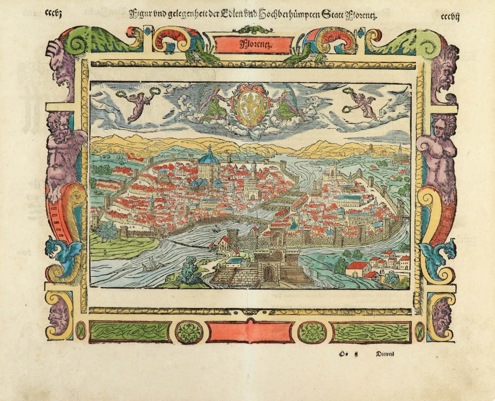
Figur und gelegenheit der Edlen undhochberhümpten Statt Florentz. 1550
Florence (Firenze), by Sebastian Münster.
[Item number: 32429]
Dominio Fiorentino. 1645
Tuscany - Florence, by Joan Blaeu.
[Item number: 32529]