
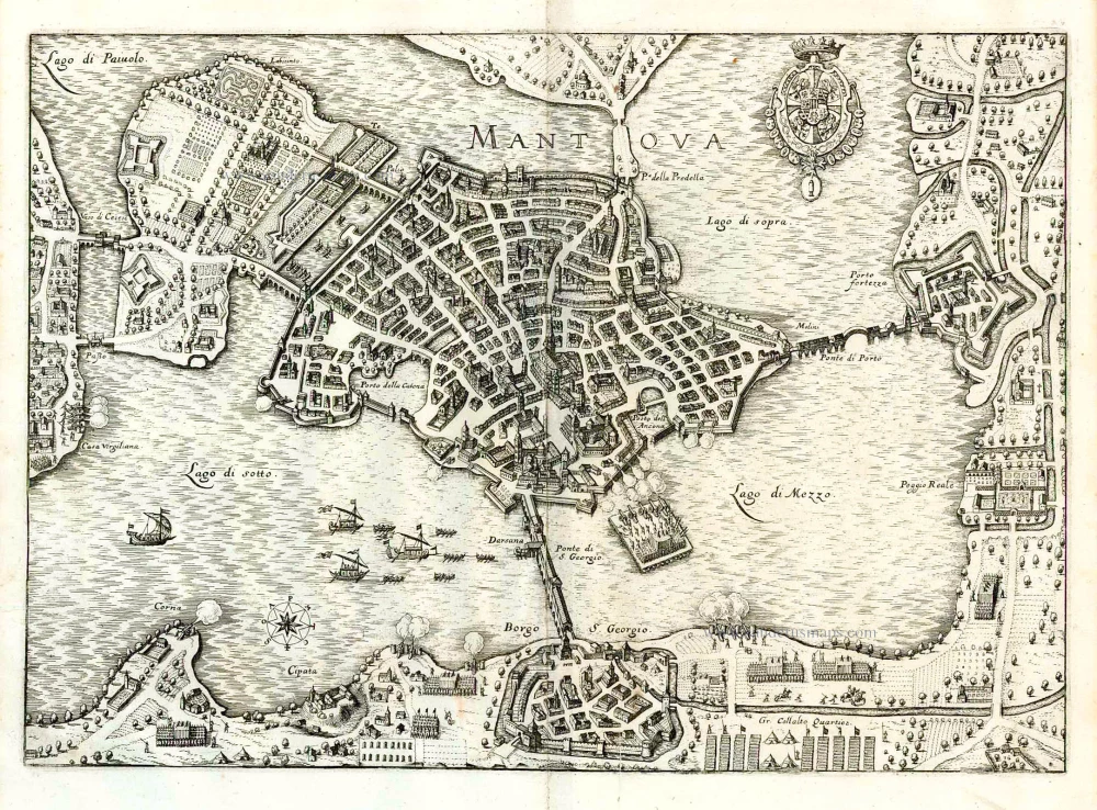
Mantua (Mantova) by Braun & Hogenberg 1575
The item displayed on this page has been sold. However, we have a similar map in stock:
Mantova by Georg Braun & Frans Hogenberg. 1593
Mantua.
[Item number: 22182]

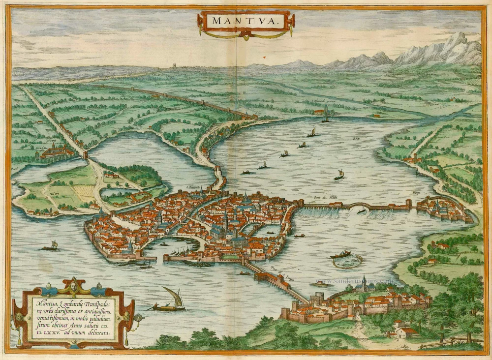
TRANSLATION OF CARTOUCHE TEXT: Mantua, famous and very old Lombardian city, situated on the far side of the Po, built in the middle of a marshland lake. Drawn true to life in the year of our Lord 1575.
COMMENTARY BY BRAUN: "Mantua lies in the middle of a stagnant lake and is therefore very easy to defend. It is very big and has fine, beautiful houses, among which the house of Andrea Mantegna is not the worst, for it is decorated with all kinds of artistic pictures and there are seven painted plaques on which the triumph of the emperor is painted in such a masterly and skilful fashion that it could easily be taken for a work by Apelles."
The engraving shows a bird's-eye view of a city in the middle of a lake. In the background flat land can be seen, behind which appear the Alps. The city is linked to the mainland by bridges and dams. Mantua was founded by the Etruscans in the 6th century BC and named after Mantus, their god of the underworld. In Roman times, the city's most famous inhabitant, Virgil, was born here, in 70 BC. After the end of the Roman era, Mantua had various rulers during the migration period. From 1328 to 1708 the Gonzaga family ruled Mantua. Their residence was the Palazzo Ducale, which can be seen in the engraving directly to the right of the San Giorgio bridge (Pont de S. Iorgio). The Camera degli Sposi was decorated with frescos by Andrea Mantegna, one of the most important painters and engravers of the early Italian Renaissance. (Taschen)
Braun G. & Hogenberg F. and the Civitates Orbis Terrarum.
The Civitates Orbis Terrarum, also known as the 'Braun & Hogenberg', is a six-volume town atlas and the most excellent book of town views and plans ever published: 363 engravings, sometimes beautifully coloured. It was one of the best-selling works in the last quarter of the 16th century. Georg Braun, a skilled writer, wrote the text accompanying the plans and views on the verso. Many plates were engraved after the original drawings of a professional artist, Joris Hoefnagel (1542-1600). The first volume was published in Latin in 1572 and the sixth in 1617. Frans Hogenberg, a talented engraver, created the tables for volumes I through IV, and Simon van den Neuwel made those for volumes V and VI. Other contributors were cartographers Daniel Freese and Heinrich Rantzau, who provided valuable geographical information. Works by Jacob van Deventer, Sebastian Münster, and Johannes Stumpf were also used as references. Translations appeared in German and French, making the atlas accessible to a broader audience.
Since its original publication of volume 1 in 1572, the Civitates Orbis Terrarum has left an indelible mark on the history of cartography. Seven more editions followed the first volume in 1575, 1577, 1582, 1588, 1593, 1599, and 1612. Vol.2, initially released in 1575, saw subsequent editions in 1597 and 1612. The subsequent volumes, each a treasure trove of historical insights, graced the world in 1581, 1588, 1593, 1599, and 1606. The German translation of the first volume, a testament to its widespread appeal, debuted in 1574, followed by the French edition in 1575.
Several printers were involved: Theodor Graminaeus, Heinrich von Aich, Gottfried von Kempen, Johannis Sinniger, Bertram Buchholtz, and Peter von Brachel, all of whom worked in Cologne.
Georg Braun (1541-1622)
Georg Braun, the author of the text accompanying the plans and views in the Civitates Orbis Terrarum, was born in Cologne in 1541. After his studies in Cologne, he entered the Jesuit Order as a novice, indicating his commitment to learning and intellectual pursuits. In 1561, he obtained his bachelor's degree; in 1562, he received his Magister Artium, further demonstrating his academic achievements. Although he left the Jesuit Order, he continued his studies in theology, gaining a licentiate in theology. His theological background likely influenced the content and tone of the text in the Civitates Orbis Terrarum, adding a unique perspective to the work.
Frans Hogenberg (1535-1590)
Frans Hogenberg was a Flemish and German painter, engraver, and mapmaker. He was born in Mechelen as the son of Nicolaas Hogenberg.
By the end of the 1560s, Frans Hogenberg was employed upon Abraham Ortelius's Theatrum Orbis Terrarum, published in 1570; he is named an engraver of numerous maps. In 1568, he was banned from Antwerp by the Duke of Alva and travelled to London, where he stayed a few years before emigrating to Cologne. He immediately embarked on his two most important works, the Civitates, published in 1572 and the Geschichtsblätter, which appeared in several series from 1569 until about 1587.
Thanks to large-scale projects like the Geschichtsblätter and the Civitates, Hogenberg's social circumstances improved with each passing year. He died as a wealthy man in Cologne in 1590.
Mantua - Mantua, Lombardie, Transpadane Urbs clarissima et antiquissima, venustissimum, in medio paludium,
Item Number: 16211 Authenticity Guarantee
Category: Antique maps > Europe > Italy - Cities
Old, antique bird’s-eye view plan of Mantua (Mantova) by Braun & Hogenberg.
Title: Mantua - Mantua, Lombardie, Transpadane Urbs clarissima et antiquissima, venustissimum, in medio paludium,
situm obtinet Anno salutis M.D.LXXV. ad vivum delineata.
Date of the first edition: 1575.
Date of this map: 1575.
Copper engraving, printed on paper.
Image size: 500 x 360mm (19.69 x 14.17 inches).
Sheet size: 405 x 530mm (15.94 x 20.87 inches).
Verso: Latin text.
Condition: Old coloured, browned along centrefold, narrow lower right margin.
Condition Rating: B.
From: Civitates Orbis Terrarum, ... Part 2: De Praecipuis, Totius Universi Urbibus, Liber Secundus. Köln, Gottfried von Kempen, 1575. (Van der Krogt 4, 41:1.2)
TRANSLATION OF CARTOUCHE TEXT: Mantua, famous and very old Lombardian city, situated on the far side of the Po, built in the middle of a marshland lake. Drawn true to life in the year of our Lord 1575.
COMMENTARY BY BRAUN: "Mantua lies in the middle of a stagnant lake and is therefore very easy to defend. It is very big and has fine, beautiful houses, among which the house of Andrea Mantegna is not the worst, for it is decorated with all kinds of artistic pictures and there are seven painted plaques on which the triumph of the emperor is painted in such a masterly and skilful fashion that it could easily be taken for a work by Apelles."
The engraving shows a bird's-eye view of a city in the middle of a lake. In the background flat land can be seen, behind which appear the Alps. The city is linked to the mainland by bridges and dams. Mantua was founded by the Etruscans in the 6th century BC and named after Mantus, their god of the underworld. In Roman times, the city's most famous inhabitant, Virgil, was born here, in 70 BC. After the end of the Roman era, Mantua had various rulers during the migration period. From 1328 to 1708 the Gonzaga family ruled Mantua. Their residence was the Palazzo Ducale, which can be seen in the engraving directly to the right of the San Giorgio bridge (Pont de S. Iorgio). The Camera degli Sposi was decorated with frescos by Andrea Mantegna, one of the most important painters and engravers of the early Italian Renaissance. (Taschen)
Braun G. & Hogenberg F. and the Civitates Orbis Terrarum.
The Civitates Orbis Terrarum, also known as the 'Braun & Hogenberg', is a six-volume town atlas and the most excellent book of town views and plans ever published: 363 engravings, sometimes beautifully coloured. It was one of the best-selling works in the last quarter of the 16th century. Georg Braun, a skilled writer, wrote the text accompanying the plans and views on the verso. Many plates were engraved after the original drawings of a professional artist, Joris Hoefnagel (1542-1600). The first volume was published in Latin in 1572 and the sixth in 1617. Frans Hogenberg, a talented engraver, created the tables for volumes I through IV, and Simon van den Neuwel made those for volumes V and VI. Other contributors were cartographers Daniel Freese and Heinrich Rantzau, who provided valuable geographical information. Works by Jacob van Deventer, Sebastian Münster, and Johannes Stumpf were also used as references. Translations appeared in German and French, making the atlas accessible to a broader audience.
Since its original publication of volume 1 in 1572, the Civitates Orbis Terrarum has left an indelible mark on the history of cartography. Seven more editions followed the first volume in 1575, 1577, 1582, 1588, 1593, 1599, and 1612. Vol.2, initially released in 1575, saw subsequent editions in 1597 and 1612. The subsequent volumes, each a treasure trove of historical insights, graced the world in 1581, 1588, 1593, 1599, and 1606. The German translation of the first volume, a testament to its widespread appeal, debuted in 1574, followed by the French edition in 1575.
Several printers were involved: Theodor Graminaeus, Heinrich von Aich, Gottfried von Kempen, Johannis Sinniger, Bertram Buchholtz, and Peter von Brachel, all of whom worked in Cologne.
Georg Braun (1541-1622)
Georg Braun, the author of the text accompanying the plans and views in the Civitates Orbis Terrarum, was born in Cologne in 1541. After his studies in Cologne, he entered the Jesuit Order as a novice, indicating his commitment to learning and intellectual pursuits. In 1561, he obtained his bachelor's degree; in 1562, he received his Magister Artium, further demonstrating his academic achievements. Although he left the Jesuit Order, he continued his studies in theology, gaining a licentiate in theology. His theological background likely influenced the content and tone of the text in the Civitates Orbis Terrarum, adding a unique perspective to the work.
Frans Hogenberg (1535-1590)
Frans Hogenberg was a Flemish and German painter, engraver, and mapmaker. He was born in Mechelen as the son of Nicolaas Hogenberg.
By the end of the 1560s, Frans Hogenberg was employed upon Abraham Ortelius's Theatrum Orbis Terrarum, published in 1570; he is named an engraver of numerous maps. In 1568, he was banned from Antwerp by the Duke of Alva and travelled to London, where he stayed a few years before emigrating to Cologne. He immediately embarked on his two most important works, the Civitates, published in 1572 and the Geschichtsblätter, which appeared in several series from 1569 until about 1587.
Thanks to large-scale projects like the Geschichtsblätter and the Civitates, Hogenberg's social circumstances improved with each passing year. He died as a wealthy man in Cologne in 1590.
Related items
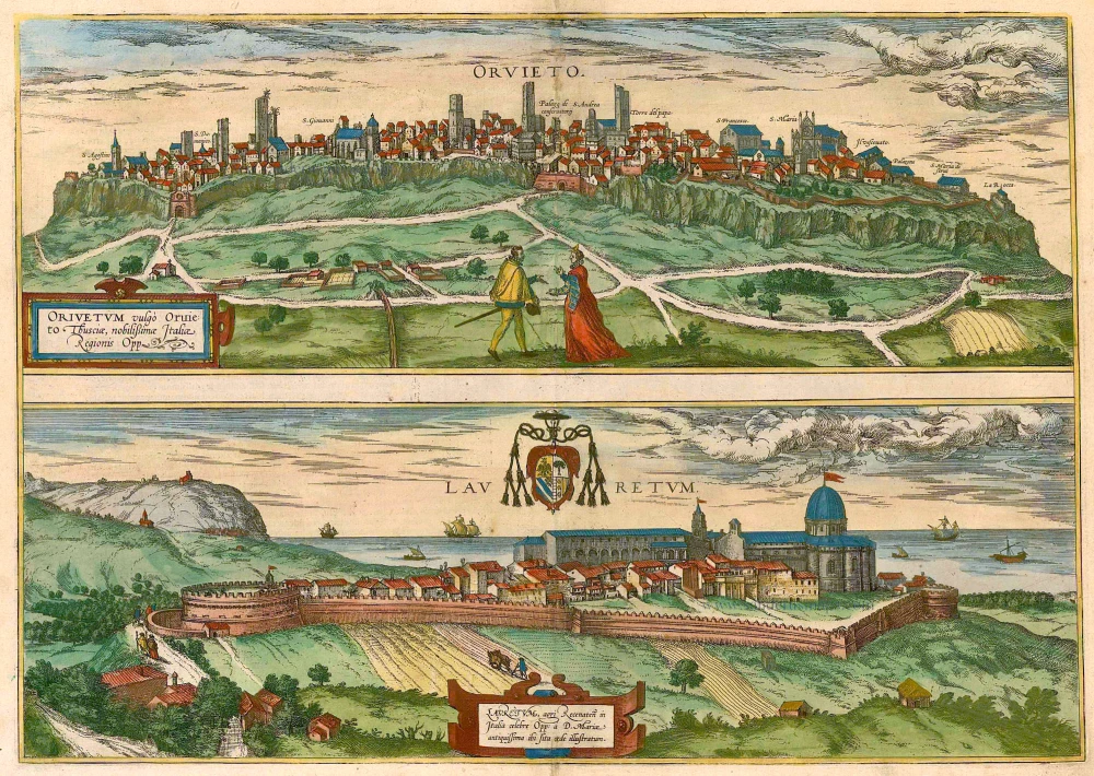
Orvieto [on sheet with] with Lauretum 1581-88
Orvieto - Lauretum, by Braun & Hogenberg.
[Item number: 2673]
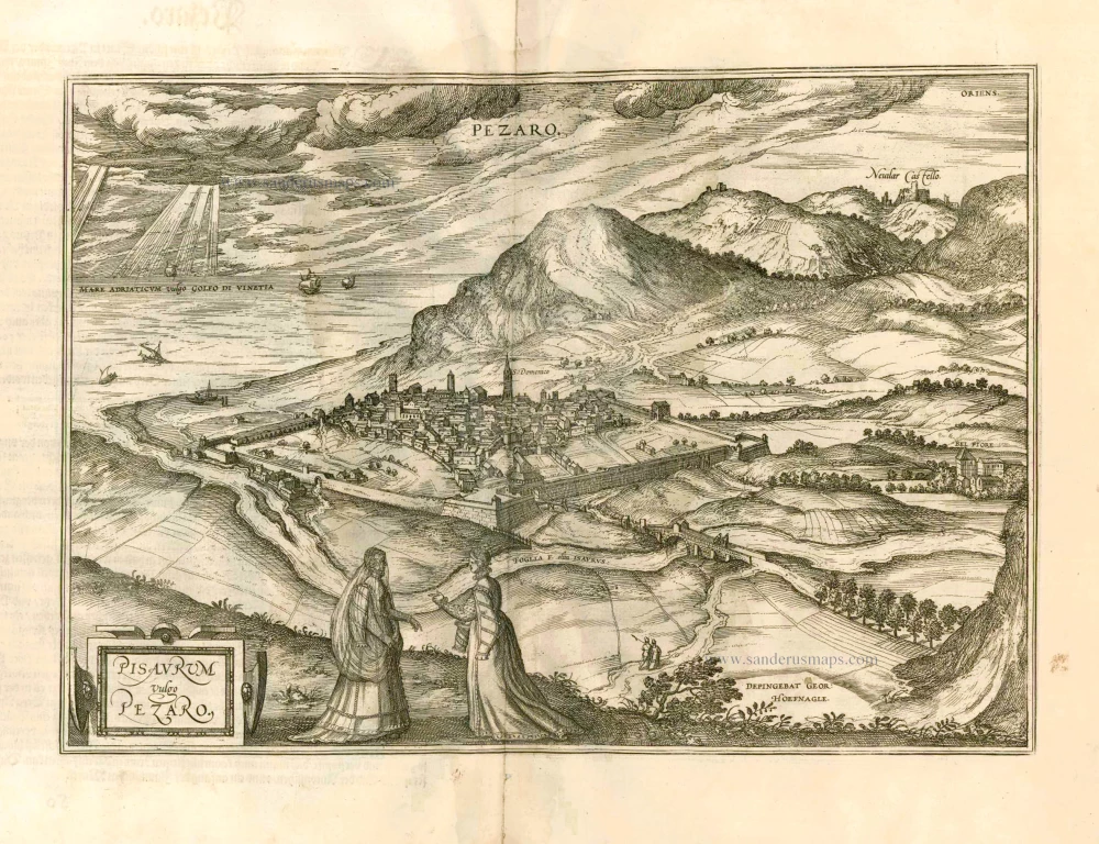
Pisaurum Vulgo Pezaro. 1582
Pesaro by Braun & Hogenberg.
[Item number: 14164]
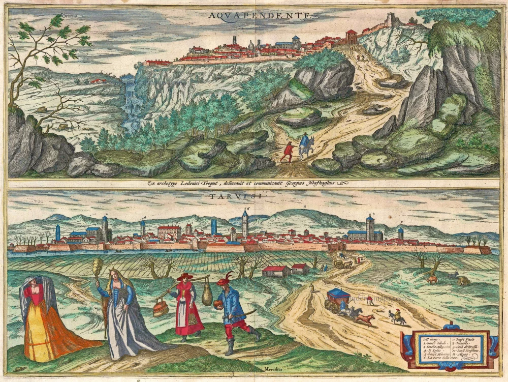
Aquapendente [on sheet with] Tarvisi c. 1610
Acquapendente and Tarvisio by Braun and Hogenberg.
[Item number: 14608]
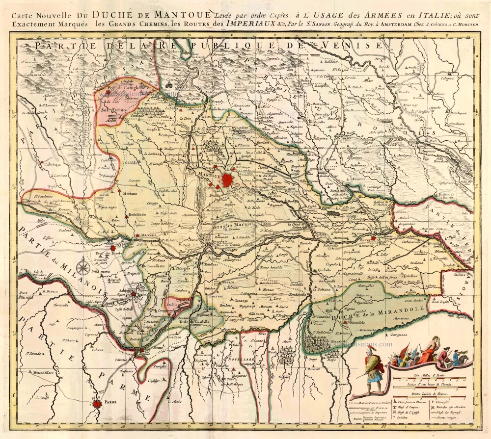
Carte Nouvelle du Duché de Mantoue. 1721-41
Mantova by Covens & Mortier.
[Item number: 23557]
Mantova. 1638
Mantua by M. Merian.
[Item number: 25951]

Mantua Ducatus. 1638
Duchy of Mantua, by M. Merian.
[Item number: 27835]
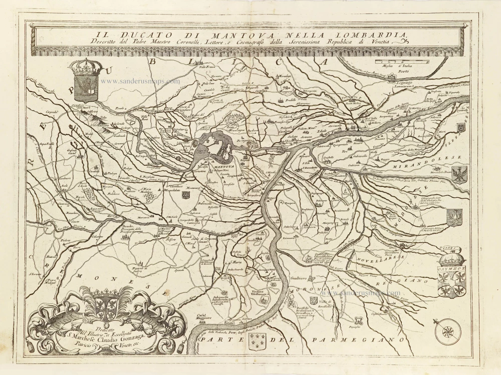
Il Ducato di Mantova nella Lombardia. 1696
The Duchy of Mantua (Mantova) by Vincenzo Coronelli.
[Item number: 28730]