
Palermo, by Georg Braun & Frans Hogenberg. 1617
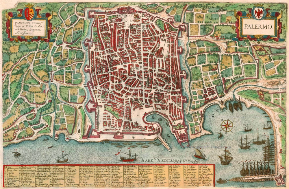
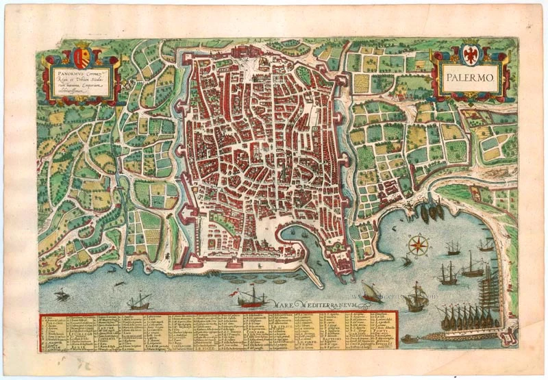

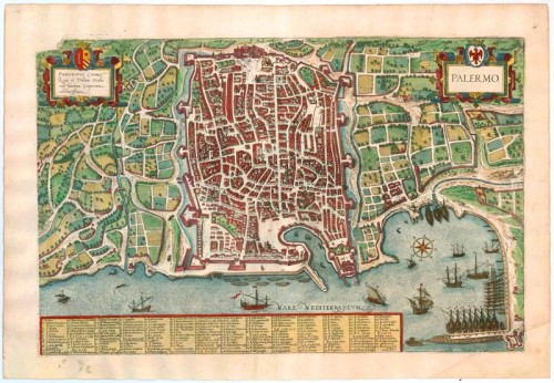

TRANSLATION OF CARTOUCHE TEXT: Palermo, capital and largest city in the Kingdom of Sicily, famed trading centre.
COMMENTARY BY BRAUN: "Then, on the highest point in the city to the west, is a splendid castle, called the Palace of the Norman Kings (72). It is built of vast hewn stones, in many places with Parian marble, and is also very ornately embellished with gold and pearls. To the right of its entrance is the church of St Peter, built by Roger, King of Sicily, which, because of its beauty and the exquisiteness of its decoration, surpasses all other extant Italian churches in our day, be they old or new, and, therefore, is visited by everyone with great admiration and great pleasure, both those who are wise, good and learned as well as the bad and the uninstructed, who live in Palermo or are merely visiting."
The port city is seen here from the northeast from bird's-eye perspective . Situated in a fertile plain in the midst of lemon and orange groves, it is secured against attack by what were then state-of-the-art fortifications. Palermo is represented as a major port, with the Old Town harbour and the large new port, in which galleys lie at anchor, their oars in a stationary position. Founded by the Phoenicians and conquered by the Arabs, Palermo was one of the world's largest cities from the 10th to the 11th century. Apart from a maze of alleys, no trace of Arab rule remains. After the Norman conquest (1072) the city flourished in the 12th century as the capital of the Kingdom of Sicily and experienced its heyday under Frederick II, the Holy Roman Emperor. The 9th-century summer seat of the Emir of Palermo was converted into the Norman palace (72) in the 12th century. Palermo then diminished in importance under changing rule. Today it is the capital of the Italian province and autonomous region of Sicily. (Taschen)
Braun G. & Hogenberg F. and the Civitates Orbis Terrarum.
The Civitates Orbis Terrarum, also known as the 'Braun & Hogenberg', is a six-volume town atlas and the most excellent book of town views and plans ever published: 363 engravings, sometimes beautifully coloured. It was one of the best-selling works in the last quarter of the 16th century. Georg Braun, a skilled writer, wrote the text accompanying the plans and views on the verso. Many plates were engraved after the original drawings of a professional artist, Joris Hoefnagel (1542-1600). The first volume was published in Latin in 1572 and the sixth in 1617. Frans Hogenberg, a talented engraver, created the tables for volumes I through IV, and Simon van den Neuwel made those for volumes V and VI. Other contributors were cartographers Daniel Freese and Heinrich Rantzau, who provided valuable geographical information. Works by Jacob van Deventer, Sebastian Münster, and Johannes Stumpf were also used as references. Translations appeared in German and French, making the atlas accessible to a wider audience.
Since its original publication of volume 1 in 1572, the Civitates Orbis Terrarum has left an indelible mark on the history of cartography. The first volume was followed by seven more editions in 1575, 1577, 1582, 1588, 1593, 1599, and 1612. Vol.2, initially released in 1575, saw subsequent editions in 1597 and 1612. The subsequent volumes, each a treasure trove of historical insights, graced the world in 1581, 1588, 1593, 1599, and 1606. The German translation of the first volume, a testament to its widespread appeal, debuted in 1574, followed by the French edition in 1575.
Several printers were involved: Theodor Graminaeus, Heinrich von Aich, Gottfried von Kempen, Johannis Sinniger, Bertram Buchholtz, and Peter von Brachel, all of whom worked in Cologne.
Georg Braun (1541-1622)
Georg Braun, the author of the text accompanying the plans and views in the Civitates Orbis Terrarum, was born in Cologne in 1541. After his studies in Cologne, he entered the Jesuit Order as a novice, indicating his commitment to learning and intellectual pursuits. In 1561, he obtained his bachelor's degree; in 1562, he received his Magister Artium, further demonstrating his academic achievements. Although he left the Jesuit Order, he continued his studies in theology, gaining a licentiate in theology. His theological background likely influenced the content and tone of the text in the Civitates Orbis Terrarum, adding a unique perspective to the work.
Frans Hogenberg (1535-1590)
Frans Hogenberg was a Flemish and German painter, engraver, and mapmaker. He was born in Mechelen as the son of Nicolaas Hogenberg.
By the end of the 1560s, Frans Hogenberg was employed upon Abraham Ortelius's Theatrum Orbis Terrarum, published in 1570; he is named an engraver of numerous maps. In 1568, he was banned from Antwerp by the Duke of Alva and travelled to London, where he stayed a few years before emigrating to Cologne. He immediately embarked on his two most important works, the Civitates, published in 1572 and the Geschichtsblätter, which appeared in several series from 1569 until about 1587.
Thanks to large-scale projects like the Geschichtsblätter and the Civitates, Hogenberg's social circumstances improved with each passing year. He died as a wealthy man in Cologne in 1590.
Palermo.
Item Number: 22684 Authenticity Guarantee
Category: Antique maps > Europe > Italy - Cities
Old, antique bird’s-eye view plan of Sicily - Palermo, by Georg Braun & Frans Hogenberg.
Title: Palermo.
Panormus Corona Regis, et Urbium Sicularum maxima, Emporium celebratissimum.
Oriented to the southwest.
Date of the first edition: 1588.
Date of this map: 1617.
Copper engraving, printed on paper.
Size (not including margins): 325 x 500mm (12.8 x 19.69 inches).
Verso: Latin text.
Condition: Old coloured, bottom corners restored with small part of image reinstated.
Condition Rating: A+.
References: Van der Krogt 4, 3275, State 2; Taschen, Br. Hog., p. 338
From: Liber Quartus Urbium Praecipuarum Totius Mundi. Cologne, Petrus von Brachel, 1617. (Van der Krogt 4, 41:1.4(1617))
TRANSLATION OF CARTOUCHE TEXT: Palermo, capital and largest city in the Kingdom of Sicily, famed trading centre.
COMMENTARY BY BRAUN: "Then, on the highest point in the city to the west, is a splendid castle, called the Palace of the Norman Kings (72). It is built of vast hewn stones, in many places with Parian marble, and is also very ornately embellished with gold and pearls. To the right of its entrance is the church of St Peter, built by Roger, King of Sicily, which, because of its beauty and the exquisiteness of its decoration, surpasses all other extant Italian churches in our day, be they old or new, and, therefore, is visited by everyone with great admiration and great pleasure, both those who are wise, good and learned as well as the bad and the uninstructed, who live in Palermo or are merely visiting."
The port city is seen here from the northeast from bird's-eye perspective . Situated in a fertile plain in the midst of lemon and orange groves, it is secured against attack by what were then state-of-the-art fortifications. Palermo is represented as a major port, with the Old Town harbour and the large new port, in which galleys lie at anchor, their oars in a stationary position. Founded by the Phoenicians and conquered by the Arabs, Palermo was one of the world's largest cities from the 10th to the 11th century. Apart from a maze of alleys, no trace of Arab rule remains. After the Norman conquest (1072) the city flourished in the 12th century as the capital of the Kingdom of Sicily and experienced its heyday under Frederick II, the Holy Roman Emperor. The 9th-century summer seat of the Emir of Palermo was converted into the Norman palace (72) in the 12th century. Palermo then diminished in importance under changing rule. Today it is the capital of the Italian province and autonomous region of Sicily. (Taschen)
Braun G. & Hogenberg F. and the Civitates Orbis Terrarum.
The Civitates Orbis Terrarum, also known as the 'Braun & Hogenberg', is a six-volume town atlas and the most excellent book of town views and plans ever published: 363 engravings, sometimes beautifully coloured. It was one of the best-selling works in the last quarter of the 16th century. Georg Braun, a skilled writer, wrote the text accompanying the plans and views on the verso. Many plates were engraved after the original drawings of a professional artist, Joris Hoefnagel (1542-1600). The first volume was published in Latin in 1572 and the sixth in 1617. Frans Hogenberg, a talented engraver, created the tables for volumes I through IV, and Simon van den Neuwel made those for volumes V and VI. Other contributors were cartographers Daniel Freese and Heinrich Rantzau, who provided valuable geographical information. Works by Jacob van Deventer, Sebastian Münster, and Johannes Stumpf were also used as references. Translations appeared in German and French, making the atlas accessible to a wider audience.
Since its original publication of volume 1 in 1572, the Civitates Orbis Terrarum has left an indelible mark on the history of cartography. The first volume was followed by seven more editions in 1575, 1577, 1582, 1588, 1593, 1599, and 1612. Vol.2, initially released in 1575, saw subsequent editions in 1597 and 1612. The subsequent volumes, each a treasure trove of historical insights, graced the world in 1581, 1588, 1593, 1599, and 1606. The German translation of the first volume, a testament to its widespread appeal, debuted in 1574, followed by the French edition in 1575.
Several printers were involved: Theodor Graminaeus, Heinrich von Aich, Gottfried von Kempen, Johannis Sinniger, Bertram Buchholtz, and Peter von Brachel, all of whom worked in Cologne.
Georg Braun (1541-1622)
Georg Braun, the author of the text accompanying the plans and views in the Civitates Orbis Terrarum, was born in Cologne in 1541. After his studies in Cologne, he entered the Jesuit Order as a novice, indicating his commitment to learning and intellectual pursuits. In 1561, he obtained his bachelor's degree; in 1562, he received his Magister Artium, further demonstrating his academic achievements. Although he left the Jesuit Order, he continued his studies in theology, gaining a licentiate in theology. His theological background likely influenced the content and tone of the text in the Civitates Orbis Terrarum, adding a unique perspective to the work.
Frans Hogenberg (1535-1590)
Frans Hogenberg was a Flemish and German painter, engraver, and mapmaker. He was born in Mechelen as the son of Nicolaas Hogenberg.
By the end of the 1560s, Frans Hogenberg was employed upon Abraham Ortelius's Theatrum Orbis Terrarum, published in 1570; he is named an engraver of numerous maps. In 1568, he was banned from Antwerp by the Duke of Alva and travelled to London, where he stayed a few years before emigrating to Cologne. He immediately embarked on his two most important works, the Civitates, published in 1572 and the Geschichtsblätter, which appeared in several series from 1569 until about 1587.
Thanks to large-scale projects like the Geschichtsblätter and the Civitates, Hogenberg's social circumstances improved with each passing year. He died as a wealthy man in Cologne in 1590.
Related items
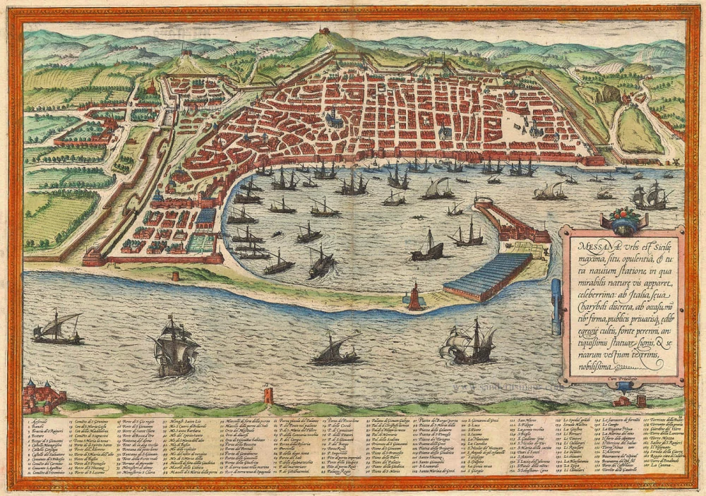
Messana, Urbs est Sicilie maxima, situ, opulentia, & tuta navium statione, ... 1574
Messina by Braun & Hogenberg
[Item number: 5497]
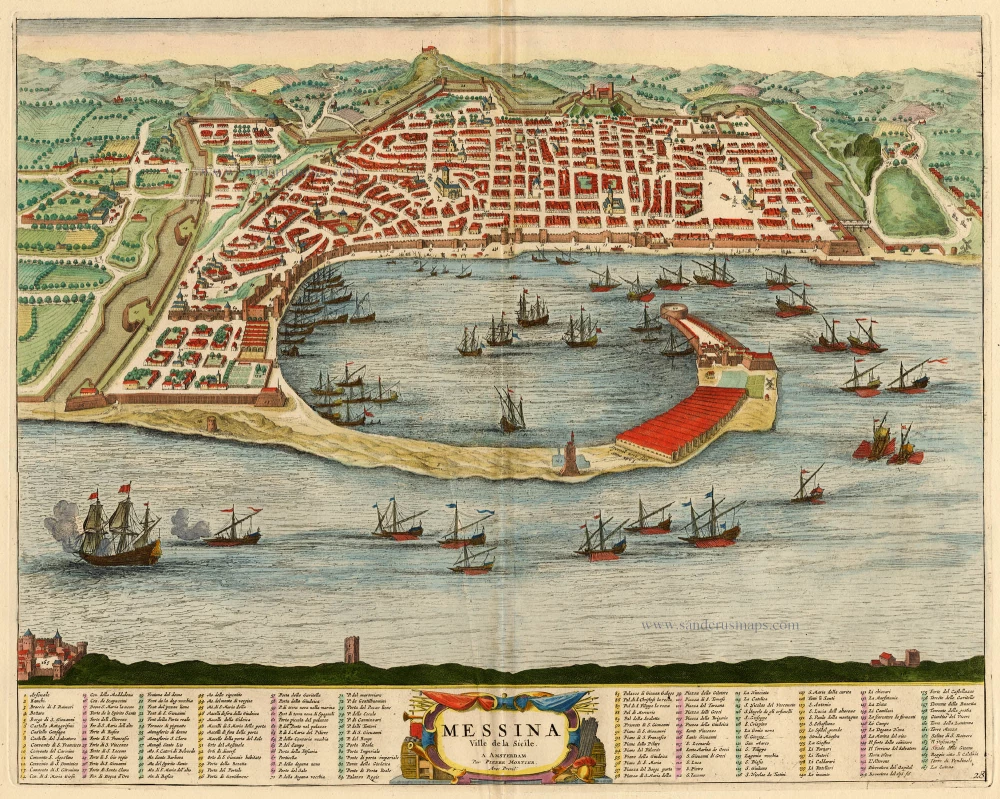
Messina Ville de la Sicile. 1704
Sicily - Messina, by Blaeu - Mortier.
[Item number: 18139]
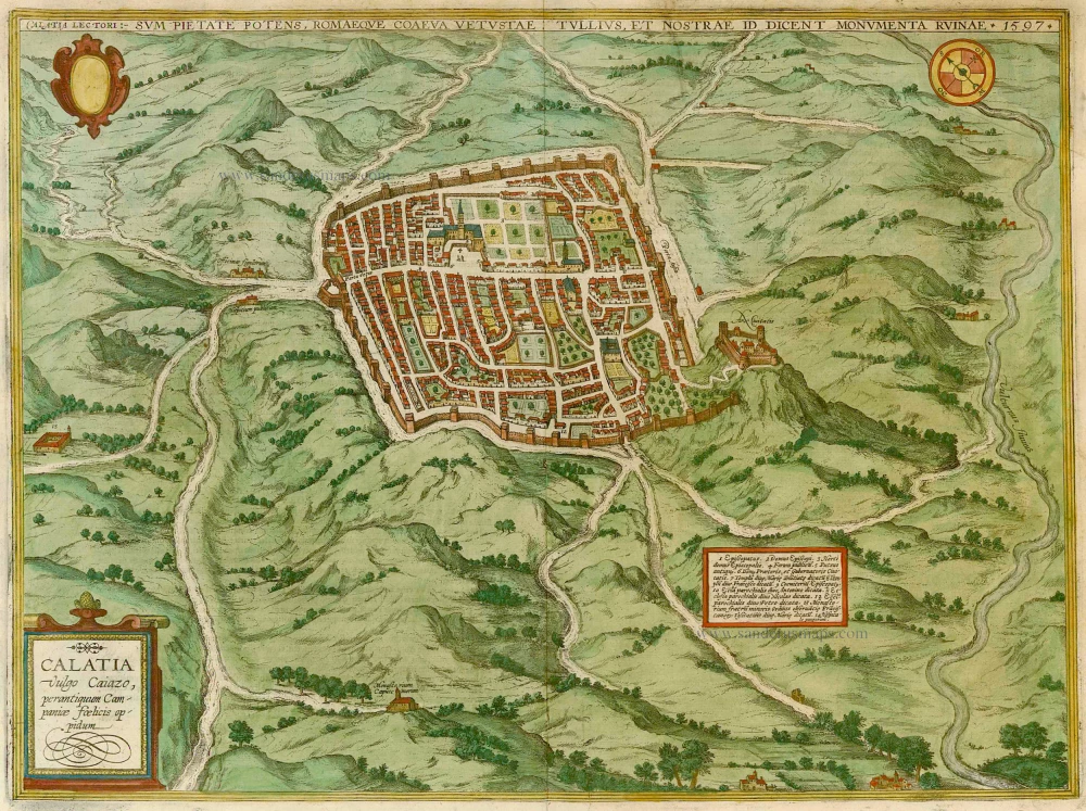
Calatia vulgo Caiazo, perantiquum Campaniae foelicis oppidum. 1596
Caiazzo, by Braun & Hogenberg.
[Item number: 22118]
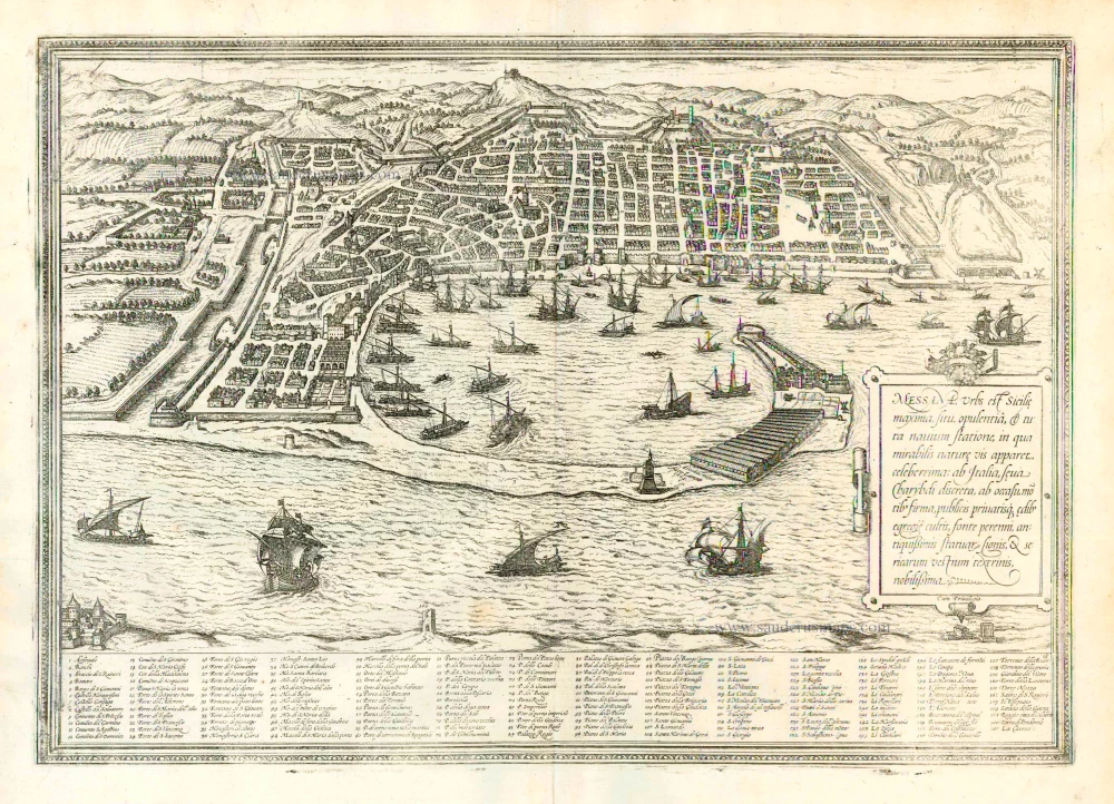
Messana, Urbs est Sicilie maxima, situ, opulentia, & tuta navium statione, ... 1612
Messina in Sicily, by Georg Braun and Frans Hogenberg.
[Item number: 22348]
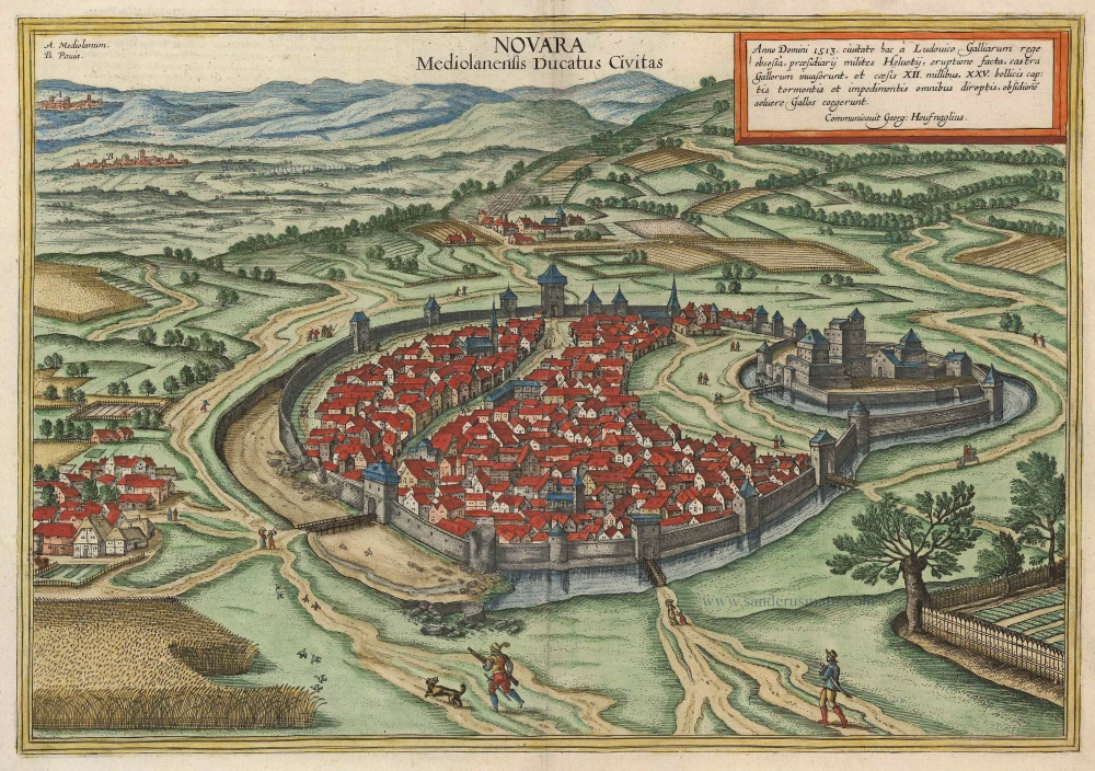
Novara Mediolanensis Ducatus Civitas c. 1625
Novara by Braun and Hogenberg.
[Item number: 24530]
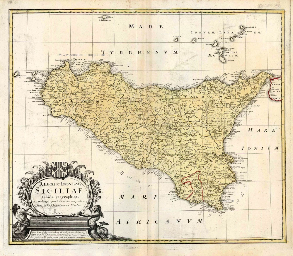
Regni & Insulae Siciliae Tabula Geographica ... c. 1720-65
Sicily, by Homann Heirs.
[Item number: 25478]
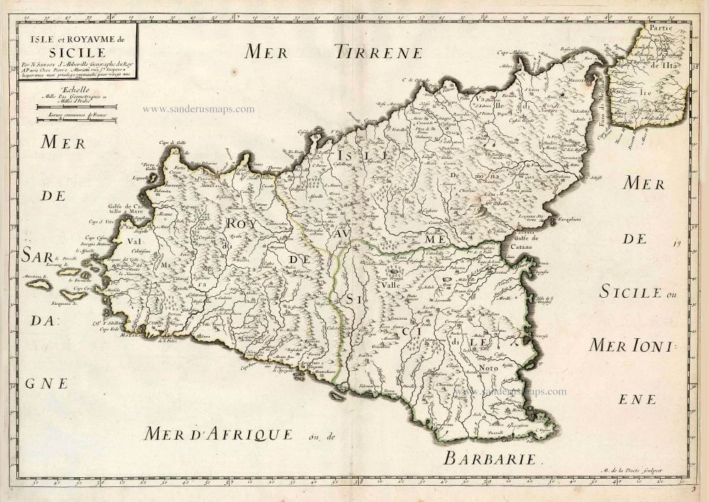
Isle et Royaume de Sicile. 1665
Sicily, by N. & G. Sanson.
[Item number: 25896]
In rare original colour.
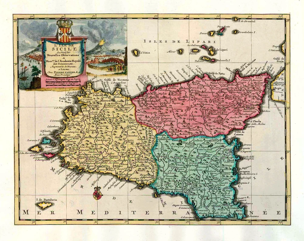
L'Ile de Sicile. 1713
Sicily, by Pieter Van der Aa.
[Item number: 26077]