
Venice (Venezia) by Sebastian Münster 1550
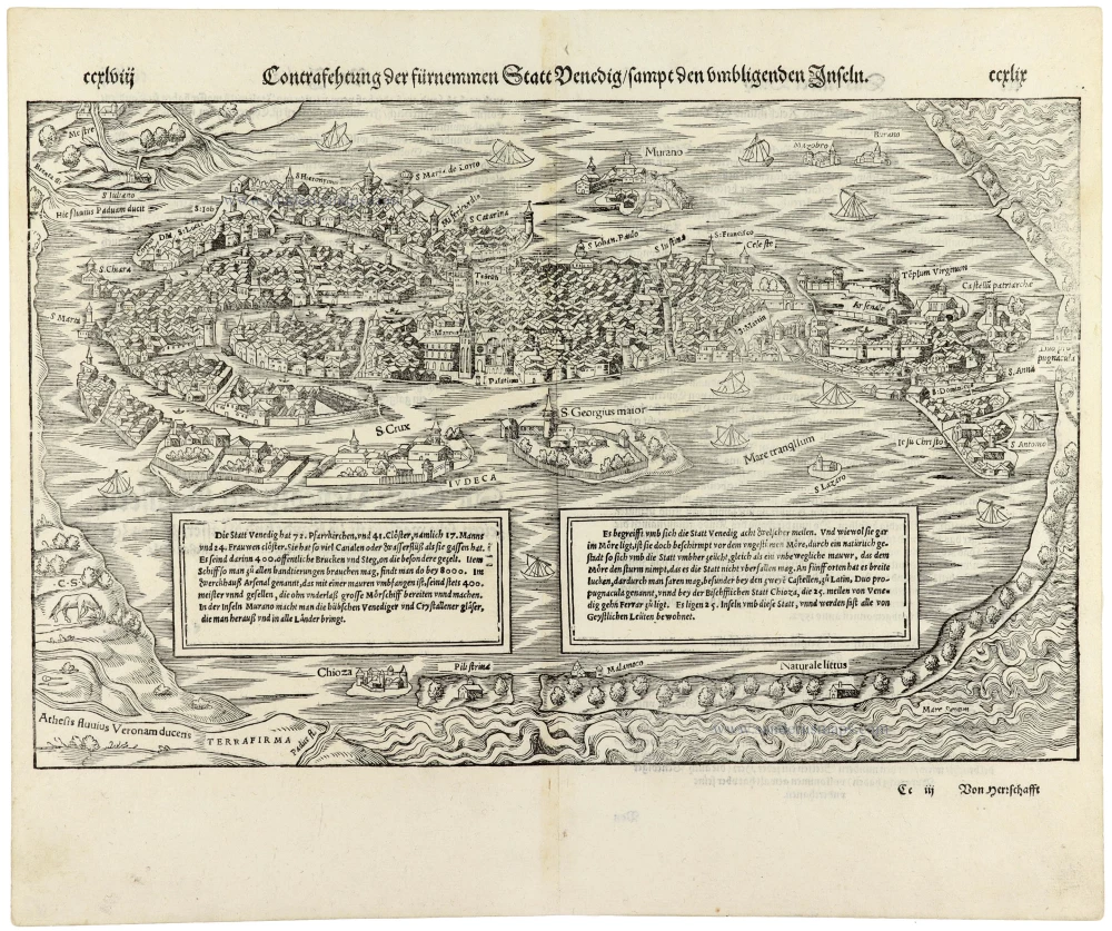
A highly decorative and historically significant Renaissance view of Venice, distinguished by its remarkable topographical detail, numerous identified landmarks and lively representation of the Venetian Lagoon.
The view presents Venice from an elevated perspective, looking northwards across the Venetian Lagoon, with the city's densely built islands, canals, churches, palaces and prominent towers carefully delineated. The composition captures Venice's extraordinary maritime character: a city built on islands and connected by an intricate network of waterways.
Among the most prominent landmarks are St Mark's Square, the Campanile, the Doge's Palace and the Basilica of San Marco, together with the Arsenal, the city's great naval shipbuilding complex. Numerous churches and monasteries are identified by name, providing a valuable record of the religious and architectural topography of Renaissance Venice.
The surrounding lagoon is equally richly depicted. The islands of Murano, San Giorgio Maggiore and Giudecca are clearly represented, together with the Lido and other smaller settlements. Numerous sailing vessels animate the waters, illustrating the city's dependence on maritime commerce and its position as one of the Mediterranean's principal trading centres.
The view is particularly interesting for its combination of topographical detail and descriptive information. Two large rectangular panels in the foreground contain German texts discussing the city's churches, monasteries, public buildings, population, commercial activities and geographical situation. These descriptions reflect the fascination that Venice exercised upon contemporary European travellers and scholars.
The elaborate composition also includes the mainland territories bordering the lagoon, coastal settlements and waterways, emphasising Venice's relationship with both the Adriatic Sea and its surrounding hinterland.
During the sixteenth century, Venice remained one of Europe's wealthiest and most influential maritime republics. Its extensive commercial networks connected Western Europe with the eastern Mediterranean and the Levant, while its distinctive architecture, political institutions and naval power made it a subject of considerable interest to Renaissance geographers.
Sebastian Münster (1488–1552), the German cosmographer, geographer and Hebrew scholar, was one of the most influential geographical authors of the sixteenth century. His Cosmographia, first published in Basel in 1544, became one of the most widely read geographical works of the Renaissance. Enlarged and revised through numerous editions, it contained an extraordinary collection of maps, city views, illustrations and geographical descriptions.
This impressive woodcut of Venice appeared in the enlarged German edition of 1550, one of the most important early editions of Münster's work.
Sebastian Münster (1488-1552)
Sebastian Münster, a German geographer, cartographer, Hebraist, and theologian, was born in Ingelheim, near Mainz In 1505, he went to Heidelberg to enter the Franciscan order. In 1507 he went to Louvain, where he studied mathematics, geography, and astronomy. In 1509 Münster became a student of Konrad Pelikan, who taught Hebrew and Greek as well as mathematics and cosmography. In 1518 he completed his studies at the University of Tübingen. He was the favorite of the famous mathematician and astronomer Johann Stöffler.
In 1524 Münster was appointed professor of Hebrew at Heidelberg University. In 1525 he published his first map as part of a broadside: The Instrument of the Suns combined a map, calendar, astrological almanac, sundial, and nocturnal on one attractive sheet, suitable for wall mounting.
In 1540 he published a Latin edition of Ptolemy's Geographia with illustrations. He based this edition on the Latin translation by Willibald Pirkheimer and produced new maps to supplement the Ptolemaic maps. The twenty-seven maps of the Ptolemaic canon are supplemented by twenty-one new maps. Further editions appeared in 1541 and 1542.
In 1544 he published the Cosmographia, a bulky book with 659 pages and some 520 woodcuts. Maps in this edition included three maps from the Ptolemaic canon and fourteen modern maps (from previous editions of the Geographia), as well as nine new maps. Later editions (1545, 1546, 1548) enlarged the Cosmographia. The 1550 edition contains cities, portraits, and costumes. These editions in both Latin and German constitute the full fruition of Münster's dream of a comprehensive geography.
The Cosmographia was one of the most successful works of the 16th century. It passed through 24 editions in 100 years, in different languages, including Latin, French, Italian, English, and even Czech. The last German edition was published in 1628.
He died at Basel of the plague in 1552.
As a cartographer, Münster deserves special recognition for formulating a plan for a comprehensive and uniform map of a country. As a geographer, his greatest achievement was the Cosmographia. (Karrow).
Contrafehtung der Furnemen Statt Venedig sampt den Umbligenden Inseln
Item Number: 33369 new Authenticity Guarantee
Category: Antique maps > Europe > Italy - Cities
Venice (Venezia) by Sebastian Münster.
Title: Contrafehtung der Furnemen Statt Venedig sampt den Umbligenden Inseln
Engraver: Christoph Stimmer ? .
Date of the first edition: 1550.
Date of this map: 1550.
Woodcut, printed on paper.
Image size: 245 x 385mm (9¾ x 15¼ inches).
Sheet size: 335 x 405mm (13¼ x 16 inches).
Verso: German text.
Condition: Excellent.
Condition Rating: A+.
From: Cosmographiae universalis Lib. VI. ... Autore Sebast. Munstero. Basel, Heinrich Petri, 1550. (Karrow, p. 429)
A highly decorative and historically significant Renaissance view of Venice, distinguished by its remarkable topographical detail, numerous identified landmarks and lively representation of the Venetian Lagoon.
The view presents Venice from an elevated perspective, looking northwards across the Venetian Lagoon, with the city's densely built islands, canals, churches, palaces and prominent towers carefully delineated. The composition captures Venice's extraordinary maritime character: a city built on islands and connected by an intricate network of waterways.
Among the most prominent landmarks are St Mark's Square, the Campanile, the Doge's Palace and the Basilica of San Marco, together with the Arsenal, the city's great naval shipbuilding complex. Numerous churches and monasteries are identified by name, providing a valuable record of the religious and architectural topography of Renaissance Venice.
The surrounding lagoon is equally richly depicted. The islands of Murano, San Giorgio Maggiore and Giudecca are clearly represented, together with the Lido and other smaller settlements. Numerous sailing vessels animate the waters, illustrating the city's dependence on maritime commerce and its position as one of the Mediterranean's principal trading centres.
The view is particularly interesting for its combination of topographical detail and descriptive information. Two large rectangular panels in the foreground contain German texts discussing the city's churches, monasteries, public buildings, population, commercial activities and geographical situation. These descriptions reflect the fascination that Venice exercised upon contemporary European travellers and scholars.
The elaborate composition also includes the mainland territories bordering the lagoon, coastal settlements and waterways, emphasising Venice's relationship with both the Adriatic Sea and its surrounding hinterland.
During the sixteenth century, Venice remained one of Europe's wealthiest and most influential maritime republics. Its extensive commercial networks connected Western Europe with the eastern Mediterranean and the Levant, while its distinctive architecture, political institutions and naval power made it a subject of considerable interest to Renaissance geographers.
Sebastian Münster (1488–1552), the German cosmographer, geographer and Hebrew scholar, was one of the most influential geographical authors of the sixteenth century. His Cosmographia, first published in Basel in 1544, became one of the most widely read geographical works of the Renaissance. Enlarged and revised through numerous editions, it contained an extraordinary collection of maps, city views, illustrations and geographical descriptions.
This impressive woodcut of Venice appeared in the enlarged German edition of 1550, one of the most important early editions of Münster's work.
Sebastian Münster (1488-1552)
Sebastian Münster, a German geographer, cartographer, Hebraist, and theologian, was born in Ingelheim, near Mainz In 1505, he went to Heidelberg to enter the Franciscan order. In 1507 he went to Louvain, where he studied mathematics, geography, and astronomy. In 1509 Münster became a student of Konrad Pelikan, who taught Hebrew and Greek as well as mathematics and cosmography. In 1518 he completed his studies at the University of Tübingen. He was the favorite of the famous mathematician and astronomer Johann Stöffler.
In 1524 Münster was appointed professor of Hebrew at Heidelberg University. In 1525 he published his first map as part of a broadside: The Instrument of the Suns combined a map, calendar, astrological almanac, sundial, and nocturnal on one attractive sheet, suitable for wall mounting.
In 1540 he published a Latin edition of Ptolemy's Geographia with illustrations. He based this edition on the Latin translation by Willibald Pirkheimer and produced new maps to supplement the Ptolemaic maps. The twenty-seven maps of the Ptolemaic canon are supplemented by twenty-one new maps. Further editions appeared in 1541 and 1542.
In 1544 he published the Cosmographia, a bulky book with 659 pages and some 520 woodcuts. Maps in this edition included three maps from the Ptolemaic canon and fourteen modern maps (from previous editions of the Geographia), as well as nine new maps. Later editions (1545, 1546, 1548) enlarged the Cosmographia. The 1550 edition contains cities, portraits, and costumes. These editions in both Latin and German constitute the full fruition of Münster's dream of a comprehensive geography.
The Cosmographia was one of the most successful works of the 16th century. It passed through 24 editions in 100 years, in different languages, including Latin, French, Italian, English, and even Czech. The last German edition was published in 1628.
He died at Basel of the plague in 1552.
As a cartographer, Münster deserves special recognition for formulating a plan for a comprehensive and uniform map of a country. As a geographer, his greatest achievement was the Cosmographia. (Karrow).
Related items

Prospectus Plateae D. Marci, à parte Sti Geminiani 1729
Venice (Venezia), by P. Van der Aa.
[Item number: 12742]

Venetae Urbis Descriptio. 1567-1596
Venice (Venezia) by Ludivico degli Avanzi.
[Item number: 25499]
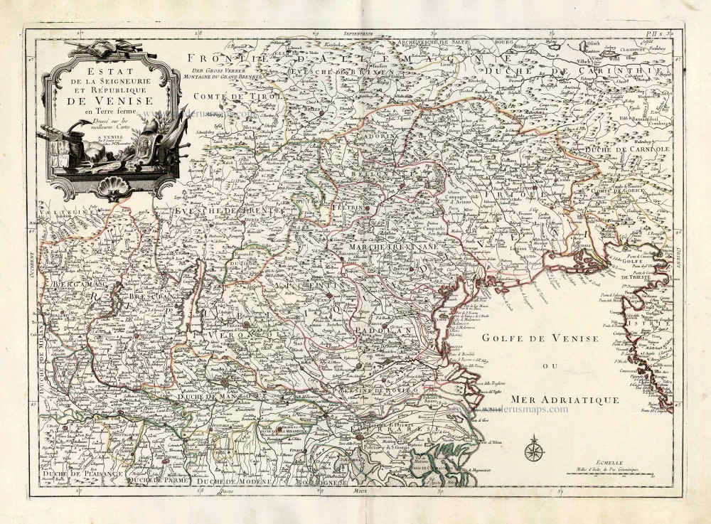
Estat de la Seigneurie, et République de Venise en Terre ferme. 1776-79
Venice, by Paolo Santini.
[Item number: 27711]
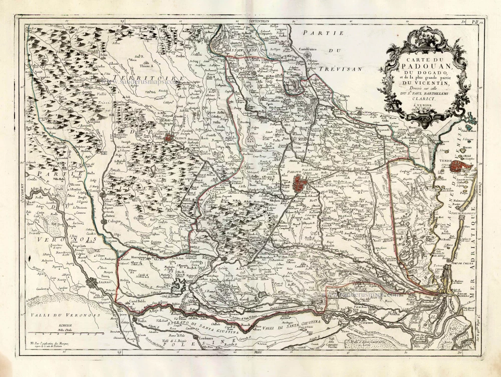
Carte du Padouan, du Dogado, et de la plus grande partie du Vincentin. Dressée sur celle du Sr. Paul Barthelemi Clarici. 1776-79
Vicenza, Padua and Venice, by Paolo Santini.
[Item number: 27717]

A View of St Eustathius's Church & the Rivo alti Buildings in Venice. 18th cent.
Venice, St Eustathius's Church & the Rivo alti Buildings
[Item number: 28984]

Augusti apud Venetos Templi D: Marci Accuratissima Effiguratio [on sheet with] Palatii Senatorii apud Venetos conflagratio Anno MDLXXVII. 1657
Venice - Piazza San Marco and Piazetta, by Georg Braun and Frans Hogenberg, published by J. Janssonius.
[Item number: 31096]
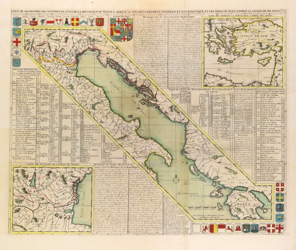
In rare original colour
Carte de Géographie des differents Etats de la République de Venise, ... 1708
Gulf of Venice, by Zacharias Châtelain.
[Item number: 31420]
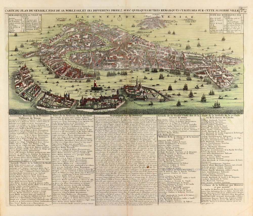
In rare original colour. - Two plates
Carte du Plan de Venise, l'Etat de sa Noblesse, et ses differens degrez, avec quelques autres remarques curieuses sur cette superbe ville. [With:] Carte du Gouvernement Militaire de la République de Venise ... 1708
Venice, by Zacharias Châtelain.
[Item number: 31423]

Veduta della Piazza di S. Marco verso D. Giminiano à Venetia. - Prospect des Platzes von S. Marco gegen S. Giminiano in Venedig. [in set with] Altra veduta della Piazza di S. Marco à Venetia. - Anderer Prospect des Platzes von S. Marco in Venedig. c. 1750
Two views of the Piazza di San Marco in Venice (Venezia), by Martin Engelbrecht.
[Item number: 31991]

Palazzo Vidimano a S. Canciano à Venetia. - Der Vidimanische Pallast beij S. Canciano in Venedig. c. 1750
Palazzo Vidimano a S. Canciano in Venice (Venezia), by Martin Engelbrecht.
[Item number: 31993]

Chiesa del Spirito Santo di Monache Agostiniani su le Zattare à Venetia. - Die Kirch des Heil: Geistes der Augustiner Mönch in Venedig. c. 1750
Church of the Holy Ghost in Venice (Venezia), by Martin Engelbrecht.
[Item number: 31994]

Veduta della Chiesa e Spiagia di S. Nicolo di Castello à Venetia. - Prospect der Kirchen von St. Nicolaus vom Schloß und derselben angenehmen Gegens in Venedig. c. 1750
Church of S. Nicolo di Castello in Venice (Venezia), by Martin Engelbrecht.
[Item number: 31999]

Chiesa di SS. Gio e Paulo à Venezia. - Prospect der Kirchen von SS. Iohann ù: Paul in Venedig. c. 1750
Basilica dei Santi Giovanni e Paolo in Venice (Venezia), by Martin Engelbrecht.
[Item number: 32000]

Altra Veduta di S. Giorgio Maggiore à Venetia. - Prospect der Kirchen St. Georgio des größern in Venedig. c. 1750
Basilica di San Giorgio Maggiore in Venice (Venezia), by Martin Engelbrecht.
[Item number: 32001]
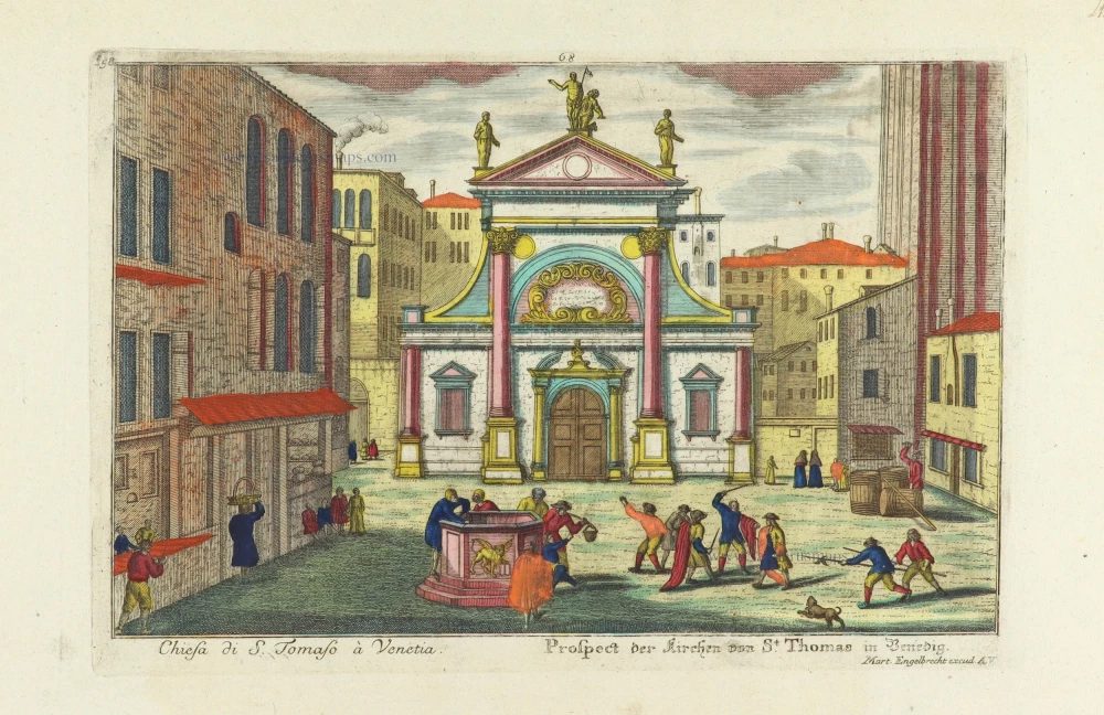
Chiesa di S. Tomaso à Venetia. - Prospect der Kirchen von St. Thomas in Venedig. c. 1750
Church of S. Tomaso in Venice (Venezia), by Martin Engelbrecht.
[Item number: 32012]

Palazzo Vendramino alla Giudecea à Venetia. - Vendraminischer Pallast auf der Insel Guidecca in Venedig. c. 1750
Venice (Venezia) - Palazzo Vendramin, by Martin Engelbrecht.
[Item number: 32017]

Palazzo Mocenigi a S. Samuele à Venetia. - Mocenigischer Pallast beij S. Samuel in Venedig. c. 1750
Venice (Venezia) - Palazzo Mocenigo, by Martin Engelbrecht.
[Item number: 32018]

Palazzo Fini sopra il Canal Grande à Venetia. - Finischer Pallast auf dem grossen Canal in Venedig. c. 1750
Venice (Venezia) - Palazzo Fini, by Martin Engelbrecht.
[Item number: 32044]

Facciata della Chiese del Ospitaletto à Venetia. - Prospect der Hospital Kirche in Venedig. c. 1750
Venice (Venezia) - Chiese del Ospitaletto, by Martin Engelbrecht.
[Item number: 32045]
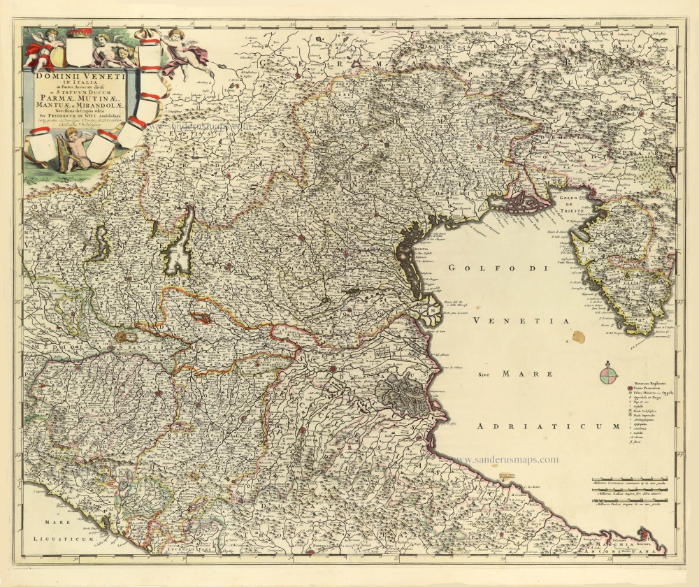
Dominii Veneti in Italia in Partes Accurate divisi ac Statuum Ducum Parmae, Mutinae, Mantuae et Mirandolae. 1691-96
Republic of Venice by Frederik de Wit.
[Item number: 32603]