
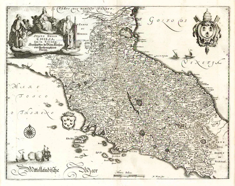
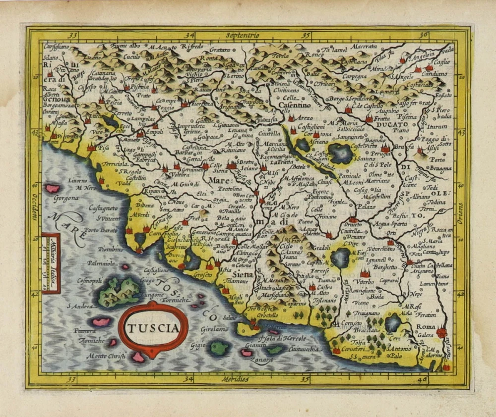
Papal State - Tuscany (Toscana) by Janssonius J. - Hondius H. 1644-58

The Janssonius Family
Joannes Janssonius (Arnhem, 1588-1664), son of the Arnhem publisher Jan Janssen, married Elisabeth Hondius, daughter of Jodocus Hondius, in Amsterdam in 1612. After his marriage, he settled down in this town as a bookseller and publisher of cartographic material. In 1618, he established himself in Amsterdam next door to Blaeu’s bookshop. He entered into serious competition with Willem Jansz. Blaeu when copying Blaeu’s Licht der Zeevaert after the expiration of the privilege in 1620. His activities concerned the publication of atlases, books, single maps, and an extensive book trade with branches in Frankfurt, Danzig, Stockholm, Copenhagen, Berlin, Koningsbergen, Geneva, and Lyon. In 1631, he began publishing atlases together with Henricus Hondius.
In the early 1640s, Henricus Hondius left the atlas publishing business to Janssonius. Competition with Joan Blaeu, Willem’s son and successor, in atlas production, prompted Janssonius to enlarge his Atlas Novus finally into a work of six volumes, into which a sea atlas and an atlas of the Old World were inserted. Other atlases published by Janssonius are Mercator’s Atlas Minor, Hornius’s historical atlas (1652), the townbooks in eight volumes (1657), Cellarius’s Atlas Coelestis and several sea atlases and pilot guides.
After the death of Joannes Janssonius, the shop and publishing firm were continued by the heirs under the direction of Johannes van Waesbergen (c. 1616-1681), son-in-law of Joannes Janssonius. Van Waesbergen added Janssonius's name to his own.
In 1676, Joannes Janssonius’s heirs sold by auction “all the remaining Atlases in Latin, French, High and Low German, as well as the Stedeboecken in Latin, in 8 volumes, bound and unbound, maps, plates belonging to the Atlas and Stedeboecken.” The copperplates from Janssonius’s atlases were afterwards sold to Schenk and Valck.
Stato della Chiesa con la Toscana
Item Number: 19236 Authenticity Guarantee
Category: Antique maps > Europe > Italy
Old, antique map of Papal State - Tuscany (Toscana) by Janssonius J. - Hondius H.
Title: Stato della Chiesa con la Toscana
Date: 1644-58.
Copper engraving, printed on paper.
Size (not including margins): 420 x 525mm (16.54 x 20.67 inches).
Verso: German text.
Condition: Old coloured, paper slightly age-toned.
Condition Rating: A.
From: Novus Atlas, das ist Welt-beschreibung mit schönen newen aussführlichen Taffeln inthaltende die Königreiche und Länder des gantzen Erdreichs. Amsterdam, J. Janssonius, 1644-58. (Van der Krogt 1, 424)
The Janssonius Family
Joannes Janssonius (Arnhem, 1588-1664), son of the Arnhem publisher Jan Janssen, married Elisabeth Hondius, daughter of Jodocus Hondius, in Amsterdam in 1612. After his marriage, he settled down in this town as a bookseller and publisher of cartographic material. In 1618, he established himself in Amsterdam next door to Blaeu’s bookshop. He entered into serious competition with Willem Jansz. Blaeu when copying Blaeu’s Licht der Zeevaert after the expiration of the privilege in 1620. His activities concerned the publication of atlases, books, single maps, and an extensive book trade with branches in Frankfurt, Danzig, Stockholm, Copenhagen, Berlin, Koningsbergen, Geneva, and Lyon. In 1631, he began publishing atlases together with Henricus Hondius.
In the early 1640s, Henricus Hondius left the atlas publishing business to Janssonius. Competition with Joan Blaeu, Willem’s son and successor, in atlas production, prompted Janssonius to enlarge his Atlas Novus finally into a work of six volumes, into which a sea atlas and an atlas of the Old World were inserted. Other atlases published by Janssonius are Mercator’s Atlas Minor, Hornius’s historical atlas (1652), the townbooks in eight volumes (1657), Cellarius’s Atlas Coelestis and several sea atlases and pilot guides.
After the death of Joannes Janssonius, the shop and publishing firm were continued by the heirs under the direction of Johannes van Waesbergen (c. 1616-1681), son-in-law of Joannes Janssonius. Van Waesbergen added Janssonius's name to his own.
In 1676, Joannes Janssonius’s heirs sold by auction “all the remaining Atlases in Latin, French, High and Low German, as well as the Stedeboecken in Latin, in 8 volumes, bound and unbound, maps, plates belonging to the Atlas and Stedeboecken.” The copperplates from Janssonius’s atlases were afterwards sold to Schenk and Valck.
Related items
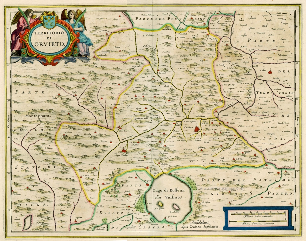
Territorio di Orvieto. 1644-58
Orvieto, by Janssonius J.
[Item number: 15378]

Territorio di Pavia, Lodi, Noavarra, Tortona, Allessandria et altri vicini dello Stato di Milano. 1644-58
Milano (South), by Janssonius J. - Hondius H.
[Item number: 19238]

Montisferrati Ducatus. 1630
Monferrato, by H. Hondius.
[Item number: 21522]
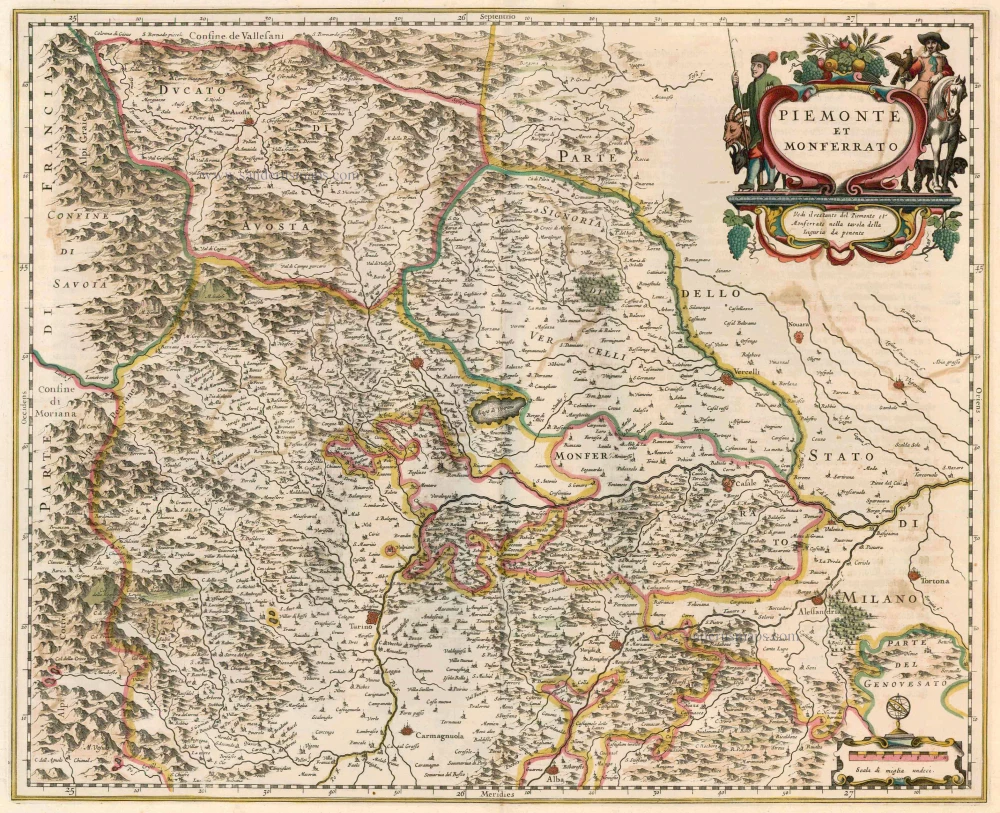
Piemonte et Monferrato 1644-58
Piemonte - Monferrato, by Janssonius J. - Hondius H.
[Item number: 22847]

Status Ecclesiasticus et Magnus Ducatus Thoscanae. c. 1680
Papal States & Toscana by Frederik De Wit.
[Item number: 24382]

Status Ecclesiasticus, Magnus Ducatus Florentiae, et Resp. Lucae ... c. 1700
Central Italy, by G. & L. Valck, published by R. & I. Ottens.
[Item number: 26005]
Stato della Chiesa con la Toscana ... 1638
Central Italy, by M. Merian.
[Item number: 26031]

Le Grand Duché de Toscane. 1713
Tuscany (Toscana) by P. Van der Aa.
[Item number: 26079]
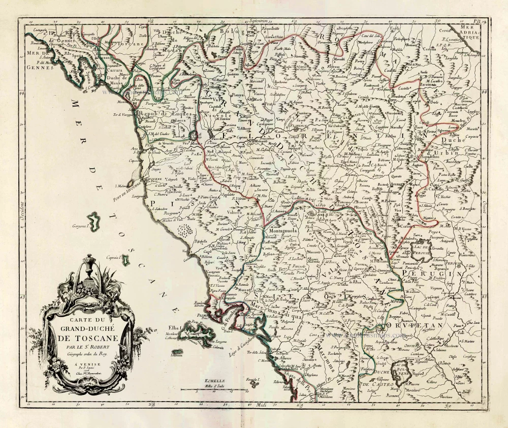
Carte du Grand-Duché de Toscane. 1776-79
Tuscany (Toscana) by Francesco & Paolo Santini
[Item number: 27724]

Parergon map
Tusciae Antiquae Typus. 1595
Ancient Tuscany (Toscana), by Abraham Ortelius.
[Item number: 30672]

Tuscia. c. 1610-1650
Tuscany (Toscana), by Gerard Mercator.
[Item number: 30924]
Tuscia. 1607
Toscana by Gerard Mercator, published by Jodocus Hondius.
[Item number: 31461]

Thuscia. 1618
Toscana by Petrus Bertius, published by Jodocus Hondius II.
[Item number: 31634]

Stato della Chiesa, con la Toscana. 1647
Papal State - Tuscany (Toscana), by Willem Blaeu.
[Item number: 31840]

Scarce
Status Ecclesiasticus et Magnus Ducatus Thoscanae. c. 1696
Tuscany - Papal States by Cornelis Danckerts.
[Item number: 32509]

Rare
Toscana Inferiore, Detta Anticamente Tuscia Suburbicaria. 1675
Toscana (Tuscany) by Joannes Janssonius.
[Item number: 32601]

Descrittione dello Stato della Chiesa e della Toscana 1687
Papal States - Tuscany (Toscana), by Michel Antoine Baudrand, published by Giovanni de Rossi.
[Item number: 32919]
Stato della Chiesa. - Dominium Ecclesiasticum in Italia. c. 1633-1650
Papal State & central Italy by Henricus Hondius
[Item number: 33030]